The Petersburg Project
  • Home
    • About Us
  • Blog and Updates
  • The Crater
  • Petersburg in Pencil and Ink
    • Alfred R. Waud, Special Artist at Petersburg >
      • In Front of Petersburg
      • Waud Drawing of 5th Corps Fortifications
      • Rives Salient ("Fort Mahone")
      • Soldiers' Wells
      • The Mine Explosion
    • William Waud, Special Artist
    • Charles H. Chapin, Special Artist
    • Edwin Forbes, Special Artist at Petersburg
    • Joseph Becker, Special Artist at Petersburg
    • Edward Mullen, Special Artist at Petersburg
    • Andrew W. Warren, Special Artist
    • Winslow Homer, Special Artist
    • Enlisted Artists >
      • Charles Wellington Reed
      • Andrew McCallum
      • Francis Knowles
      • James William Pattison
      • Herbert Valentine
  • Petersburg Photographs --So Many!
    • Working with Photographs
    • Steeples of Petersburg
    • Petersburg Panorama 1865
    • City Point
    • City Point Wharf Explosion, Aug. 9, 1864
    • Fort Rice?? We don't think so!
    • Federal Picket Line, Jerusalem Plank Road
    • Timothy O'Sullivan, Photographer at Petersburg >
      • O'Sullivan and Vest Man
      • Fort Morton and Baxter Road Group
      • Fort Haskell Panorama
      • Fort Stedman Group
      • Gracie's Salient Group
      • Bombproofs behind Fort Haskell
      • Camp of the 50th N. Y. Engineers
    • John Reekie, Photographer for the Quartermaster Corps
    • Thomas C. Roche, Photographer at Petersburg
    • David Knox, Photographer at Petersburg
    • Andrew J. Russell, Photographer at Petersburg >
      • "Fort Mahone" CS Batteries 25 & 27
  • U. S. Military Railroad
    • Terminus of Military R. R. at City Point
    • City Point to Clark's Station
    • Pitkin's Station to Shooting Hill
    • Hancock's Junction/Jerusalem Plank Road
    • Parke's Station
    • Warren's Station
    • Patrick's Station
  • Maps and Topogs
    • Grand Medicine Pow-wow
    • Michler's Reports from Topographical Department
    • John E. Weyss, Cartographer
    • William H. Paine, Cartographer
    • Gilbert Thompson
  • Confederate Maps
    • Confederate Defenses 1862
    • Gilmer-Campbell Maps, 1864
    • Stevens Map July 1864
    • Fields of Fire
    • Coit's map of the Crater Battlefield
  • Federal Maps
    • June 18, 1864-Federal Engineers Map
    • June 21, 1864, Federal Engineers Map
    • June 22, 1864. Second Corps at Jerusalem Plank Road
    • June 30, 1864 -- XVIII Corps Map
    • Undated Federal Engineers Map--June-July, 1864
    • July 1864 Map of XVIII Corps Lines
    • 18th Corps, June 18, 1864
    • Native American Perspective of the Crater
    • August 28, 1864, Michler Map
    • IX Corps, Peebles and Pegrams Farms Oct. 1864
    • Army of the Potomac, Nov. 2, 1864
    • 1864, Coast Survey Map of Petersburg
    • Army of the Potomac, Routes of the Corps to Petersburg
    • Manuscript Survey, 1865
    • Michler-Weyss, Siege of Petersburg
    • Michler Map Series 1865-1867
    • 1871, Map of Recapture of Ft. Stedman
    • 1881, Boydton Plank Road
  • Confederate Forts and Batteries
    • Dimmock Line >
      • Priest Cap
      • French Rifle Pits
    • Fort Clifton
    • Confederate Leadworks
  • Federal Forts and Batteries
    • Battery X
    • Fort Alexander Hayes
    • Fort Avery
    • Fort Conahey
    • Fort Davis & Battery XXII
    • Fort Fisher
    • Fort Meikel --Photographic Views
    • Fort Morton
    • Fort Patrick Kelly
    • Fort Sedgwick, better known as Fort Hell,
    • Fort Wadsworth -- the Evolution
    • Fort Willcox or Battery XVI
    • Hare House Hill
  • Battlefield Features
    • Aiken House
    • Avery House
    • Bailey/Johnston Farm
    • Blandford Church
    • Broadway Landing, Appomattox River
    • The Crater
    • Cummings House
    • Dams and Inundations
    • Dunn House
    • Friend House >
      • View from Friend House toward Gibben complex and Petersburg
    • Globe Tavern / Weldon Railroad
    • Gregory House
    • Griffith Farm
    • Gurley House
    • Hare House
    • The "Horseshoe"
    • Jones House
    • Jordan House
    • Pegram's Farm
    • Peebles Farm, Pegrams Farm, Poplar Springs Church
    • Shand House
    • Taylor Farm >
      • The Ice House
      • Surviving Taylor Barn
    • U. S. Engineers at the Williams House
    • Williams House
  • Signal Towers and Trees
    • Some Operations of the Signal Corps at Petersburg
  • Archeology
    • Geology of the Crater
    • Fieldwork -- Petersburg
    • Civil War Sinks
    • Deserted Confederate Camp
    • Gracie's Countermine
    • LIDAR Forts and Batteries
  • Articles, Papers, Presentations
    • Shiman: A Note on Maps
    • The Siege Landscape: Through Fire and Ice at Petersburg
    • "The Rebel in the Road"
    • "A Strange Sort of Warfare Underground"
    • Lost Trenches of Petersburg: June 17
    • Between the Lines
    • Combat Trenching: An Introduction
  • Encyclopedia
    • Glossary
    • The Battlefields
    • Siege Warfare
    • Union Lines
    • Confederate Lines
    • Combat >
      • June 30, 1864, Attack
      • Combat Entrenching
      • Trench Warfare in Civil War History
      • Chamberlain at Petersburg, June 18, 1864
  • Kittens, Puppies & Ponies
  • Executions!
  • Civil War Combat Trenching
  • Pontoon Bridges
  • Depot Hospital at City Point
  • New: Shot tower
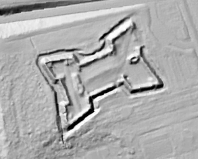
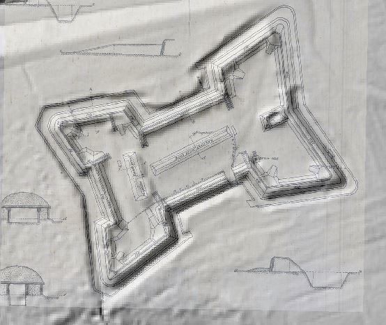
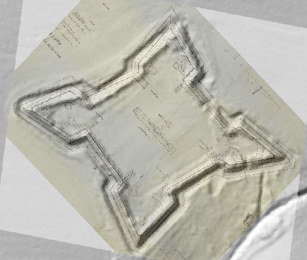
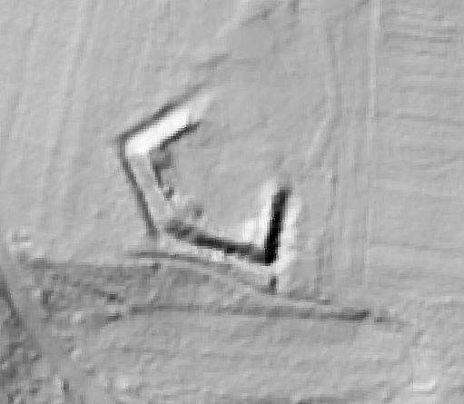
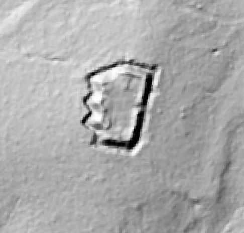
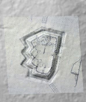
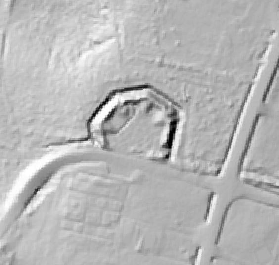
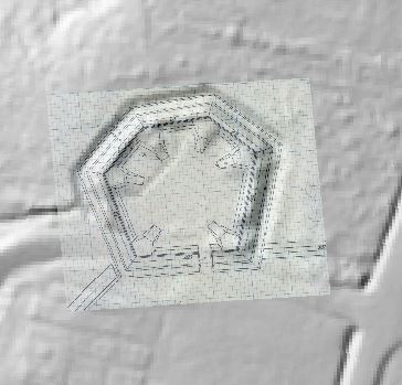
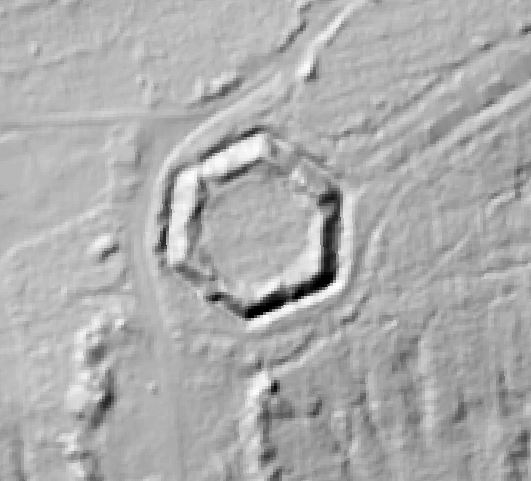
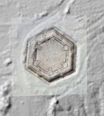
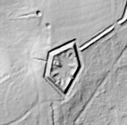
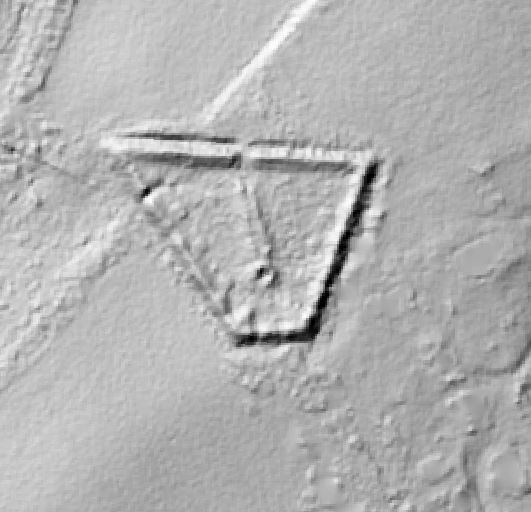
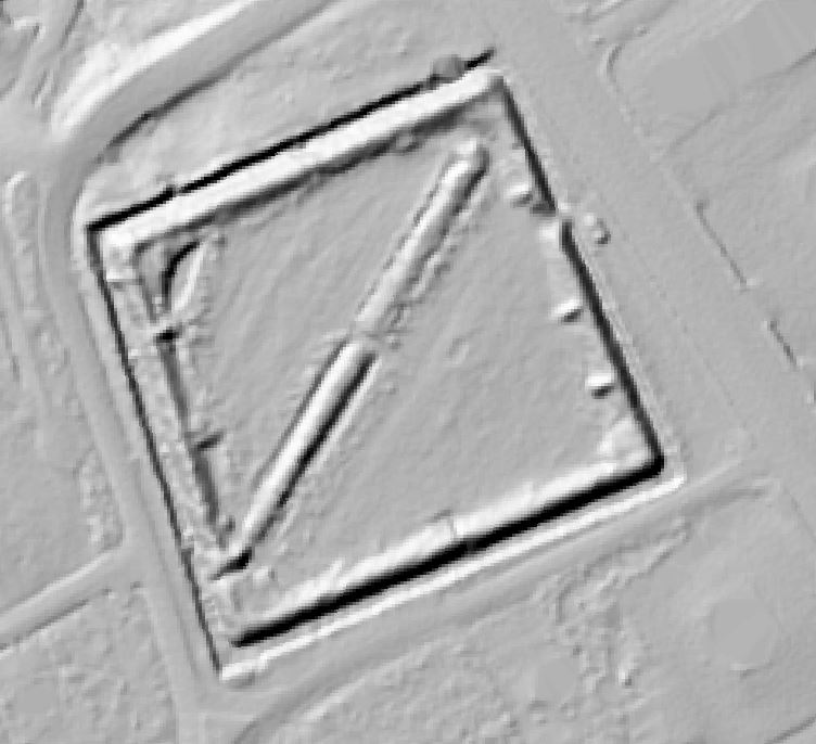
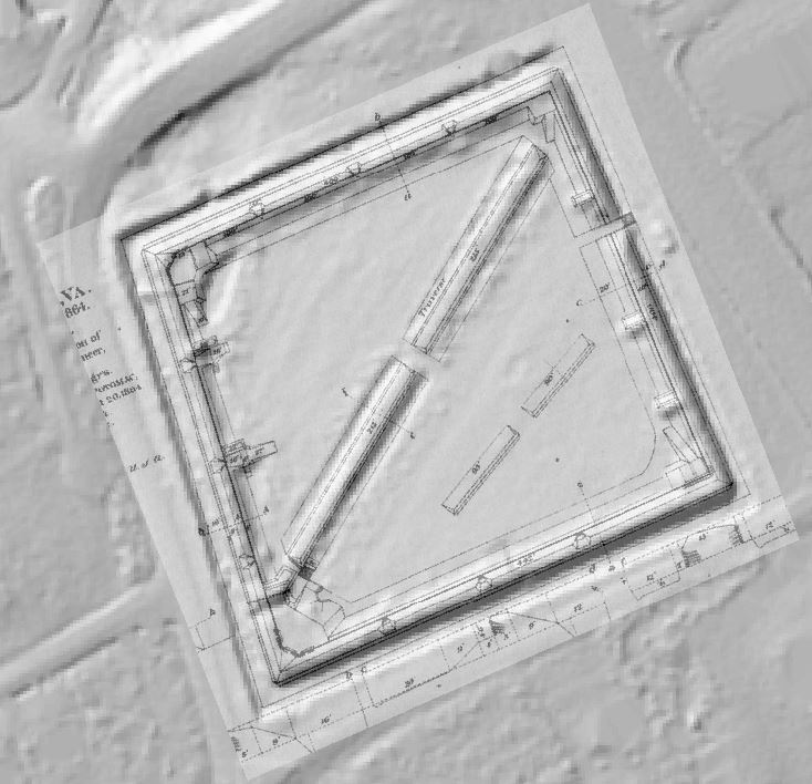
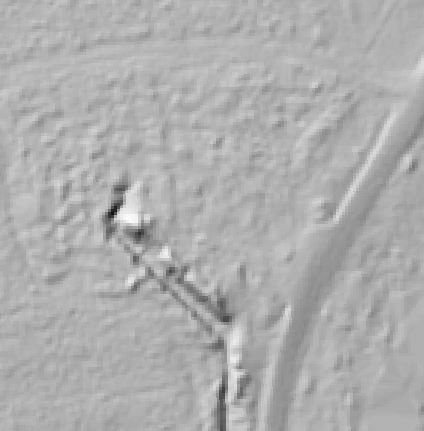
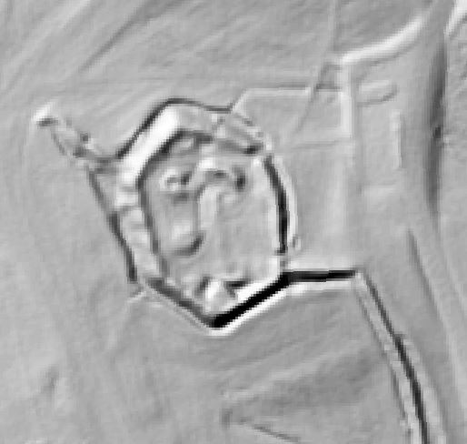
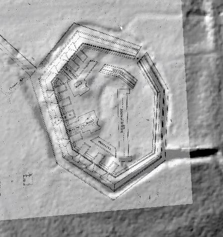
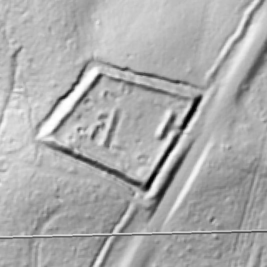
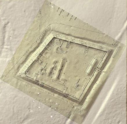
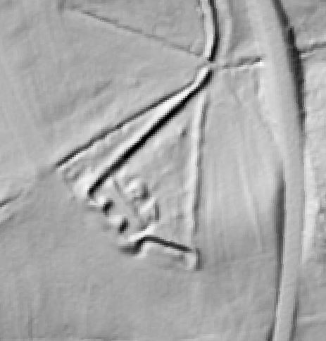
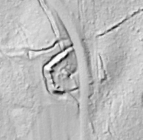
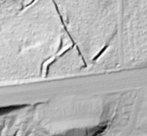
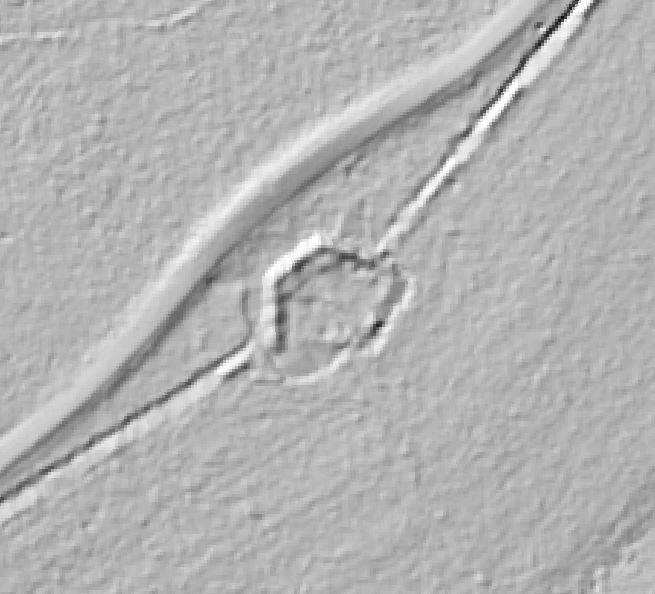
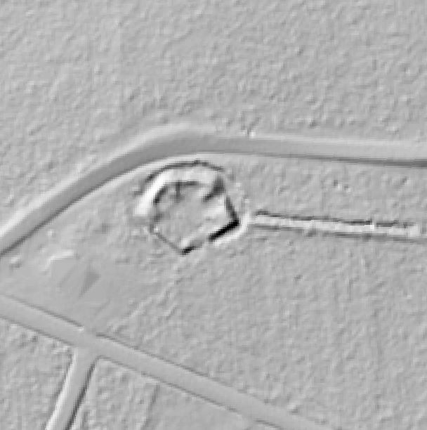
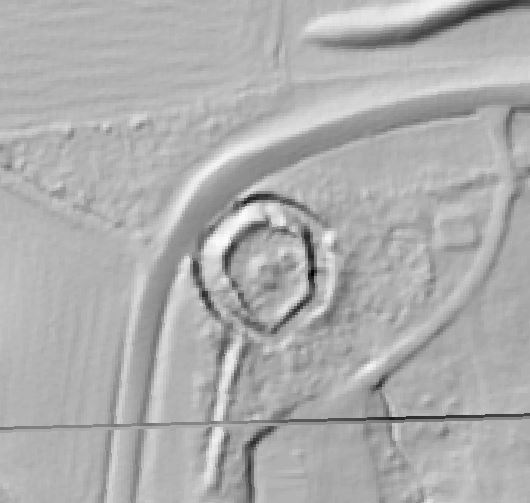
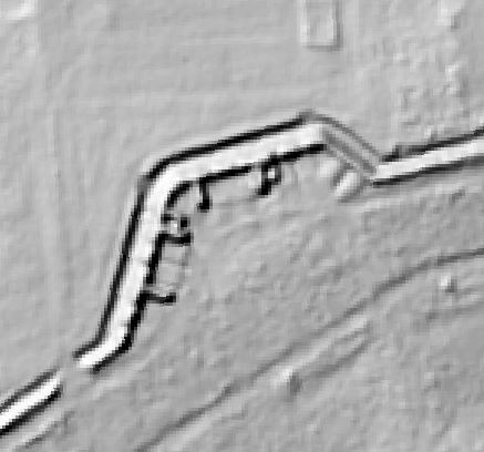
LIDAR, which stands for Light Detection and Ranging, is a remote sensing method that uses light in the form of a pulsed laser to measure ranges (variable distances) to the Earth. These light pulses—combined with other data recorded by the airborne system— generate precise, three-dimensional information about the shape of the Earth and its surface characteristics.
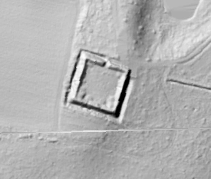
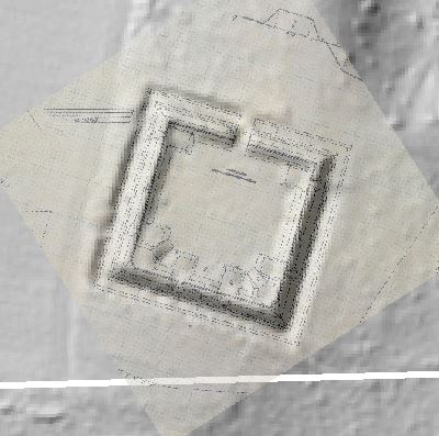
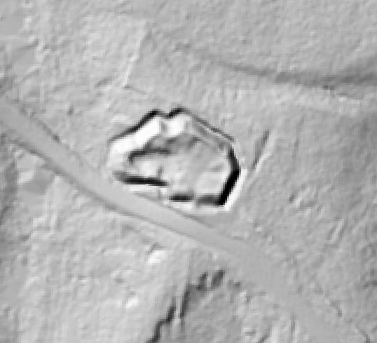
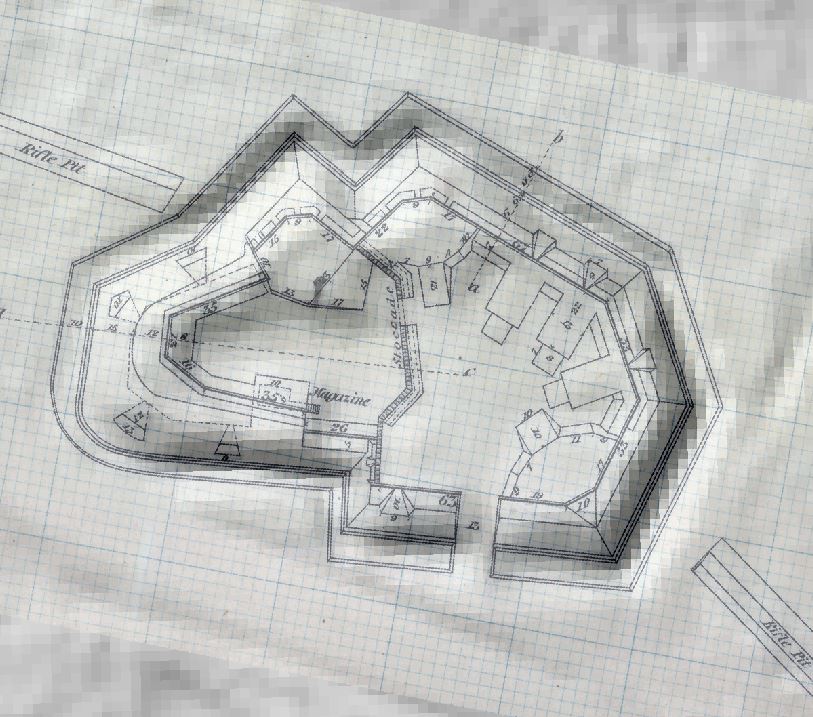
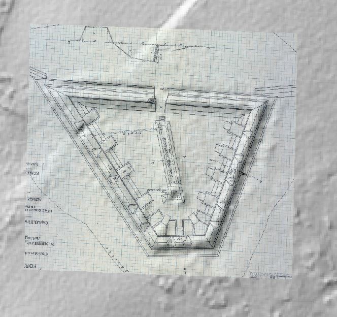
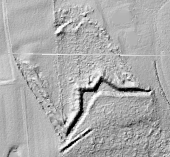
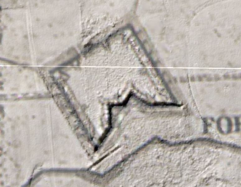
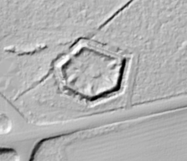
In 2014, Fort Lee shared digital elevation data derived from a LIDAR flyover with Petersburg National Battlefield. LIDAR has the ability to peer beneath forest cover to see minute changes in topography and to throw surviving earthworks in clear relief. The resolution of these images is about 1-meter. The Petersburg Project has seized upon the godsend of LIDAR to locate and document surviving fortifications within and adjacent to the national park. Below are illustrations of the interpretive power of this new technology.

Forts Overlain with Engineering Plans,
​showing full extents and surviving features.

Fort Wadsworth on the Weldon Railroad
Fort Wadsworth Plan Overlaying Lidar
Fort Dushane on the Weldon Railroad
Dushane Plan Overlaying Lidar
Fort Clark
Clark Plan Overlaying Lidar
Fort Emory
Emory Plan Overlaying Lidar
Fort Conahey
Conahey Plan Overlaying Lidar
Fort Fisher
Fisher Plan Overlaying Lidar
Fort Gregg
Gregg Plan Overlaying Lidar
Fort Urmston
Urmston Plan Overlaying Lidar
Federal Fort Wheaton/Confederate Fort Archer
Wheaton Plan Overlaying Lidar
Fort Welch
Welch Plan Overlaying Lidar
Fort McMahon
McMahon Plan Overlaying Lidar
Fort Stevenson
“Capt. Van Brocklin is still at work on Fort Stevenson, and expects to finish this week. It is an enormous work. It is intended to cover the whole rear line with Heavy Artillery.” Folwell Diary, Nov. 14, 1864.
Fort Patrick Kelly
Patrick Kelly Plan Overlaying Lidar
Fort Davis on Jerusalem Plank Road
Davis Plan Overlaying Lidar
Fort Alexander Hays
Alex. Hays Plan Overlaying Lidar
Fort Stedman
Fort Stedman plan overlaying Lidar image.
Fort Haskell
Haskell Plan Overlaying Lidar

Batteries without Engineering Plan Overlays

Battery XI
Battery XIV
Battery XVI
Battery XXIV
Battery XXV
Battery XXVI
Battery XXVII

Federal Fortifications in LIDAR

Picture
Proudly powered by Weebly
Picture