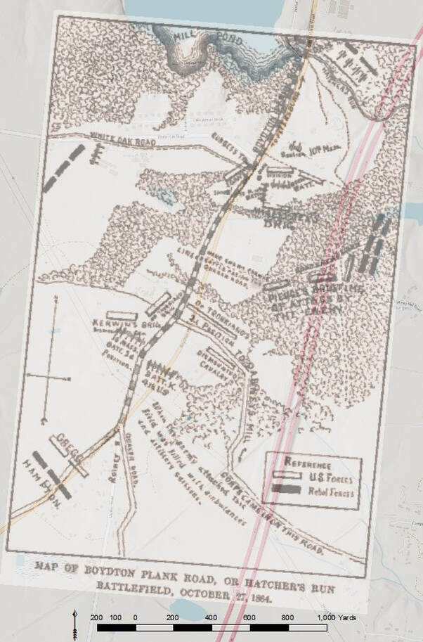
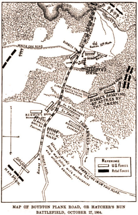
Map of Boydton Plank Road or Hatcher's Run, October 27, 1864
from John Davis Billings, The History of the Tenth Massachusetts Battery of Light Artillery, 1881, pg. 278

Overlay of the above map on modern street data with scale bar. The Burgess Mill Pond, White Oak Road (Rte. 613 west), Boydton Plank Road (US Rte. 1), Quaker Road (Rte. 660), and Dabney's Mill Road (Rte. 613 east), all line up tolerably well. Interstate I-85 cuts through the eastern half of the battlefield.


