
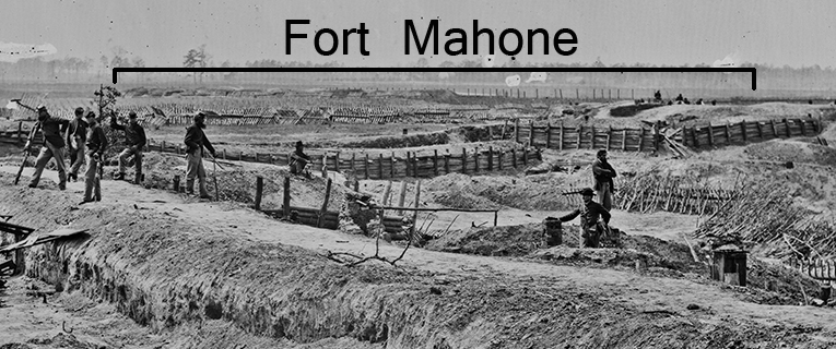
"Fort Mahone"
"Fort Mahone" was shorthand for images taken at Rives Salient on April 3, 1865. These photographs were taken in and around Confederate Batteries 25 and 27 near the Jerusalem Plank Road. Fort Mahone makes a cameo appearance in the background of image LC 02629 taken from the right flank of Battery 25 looking southeast.
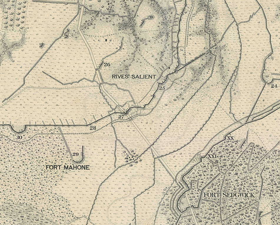
Michler 8-inch = 1 mile series (NARA RG 77 G204-38 detail). Vicinity of Rives' Salient, Fort Mahone, and Fort Sedgwick.
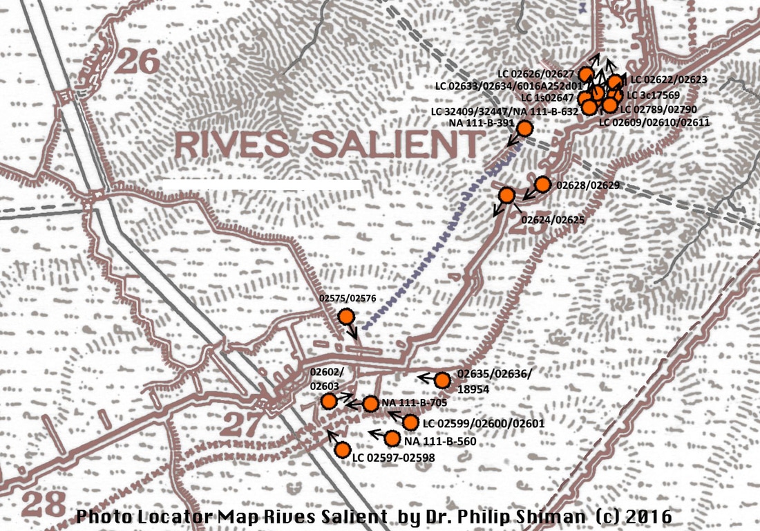
Dr. Phil Shiman compiled this map a few years back and has revised it since (principally correcting NARA photos that have more recently been posted on LOC). We will post a new version soon. The basics here, though, are correct. None of these photographs were literally taken at "Fort Mahone," as shown on the above map detail. All of the famous close-up photos of chevaux-de frise were taken in front of Confederate Battery 27 on the Jerusalem Plank Road. The photos of soldiers (and civilians) posed atop log traverses and mugging for the camera were taken at Battery 25. Details in the background of these photos (whoa there is Fort Morton!!) are definitive. We will post those as soon as we can get to it.
Many of these photos were taken by or under the auspices of Captain Andrew J. Russell, since he appears in several. The view is from inside Battery 25 looking to the northeast. The Baxter Road overpass (behind the man with the artillery ramrod) and Fort Morton are visible in the distance. Can you find Captain Russell seated with folded arms?
Confederate Battery 25, April 3, 1865
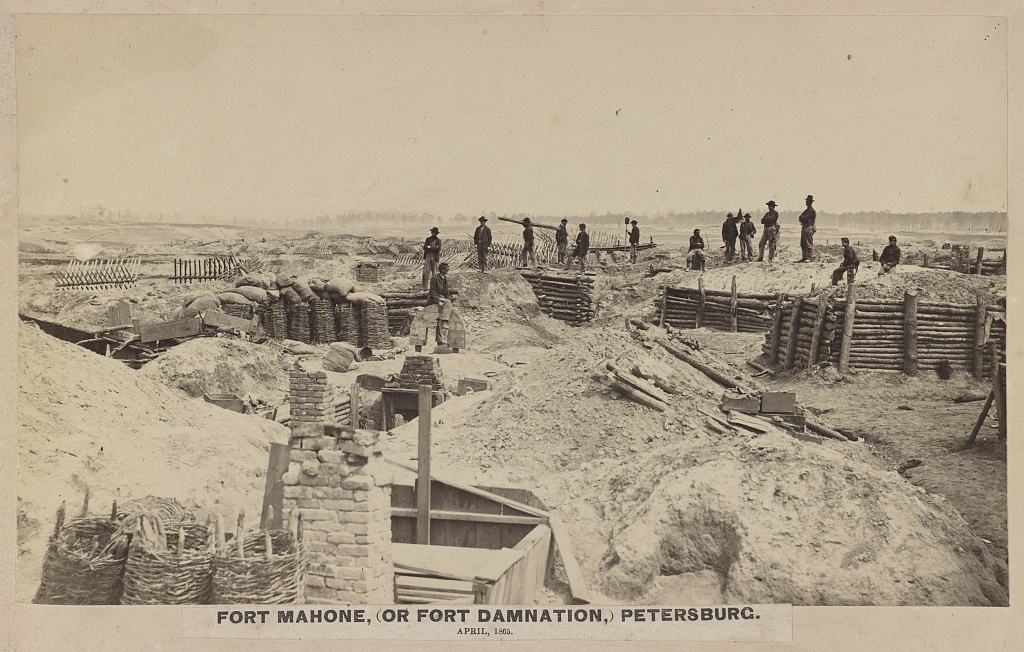
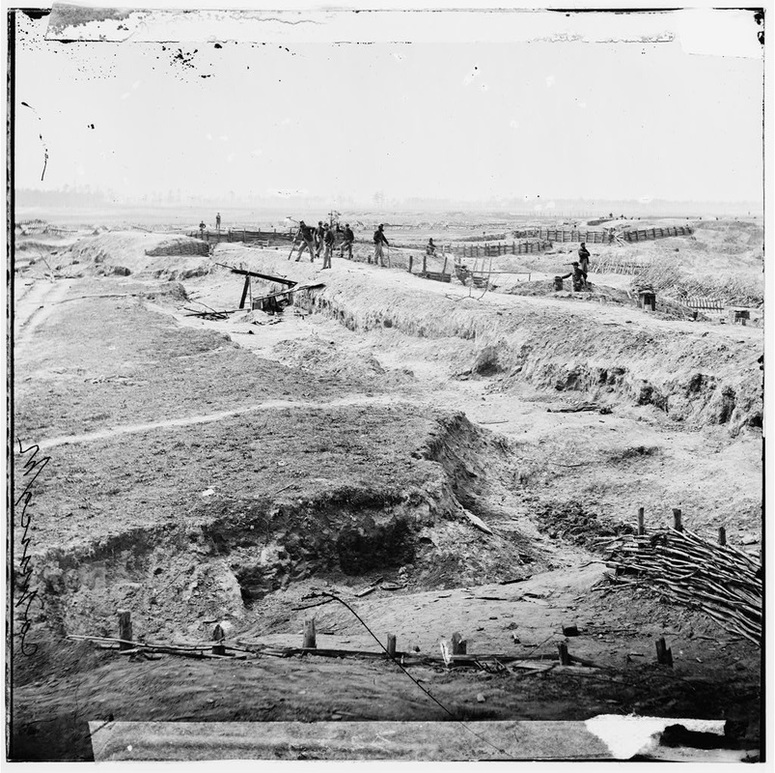
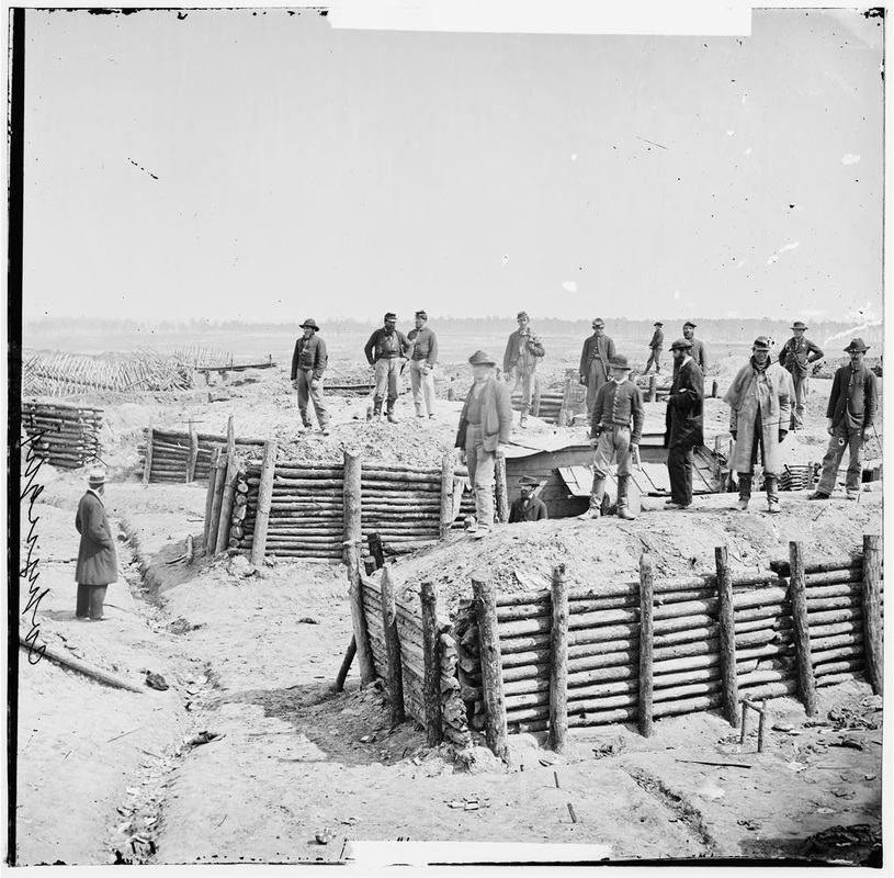
LC 32447. "Fort Mahone, (or Fort Damnation,) Petersburg. April, 1865," large-format image by Andrew J. Russell (seated, 7th from the right) LOT 4166-E, no. 54. This image was taken from inside Confederate Battery 25 looking to the north. Front of CS battery is to the right lined with traverses. Also visible are many signs of capture on April 2. Federal soldiers carried and piled the chevaux-de-frise, once neatly deployed in front of the battery, in a chaotic heap to the rear to deter counterattacks.
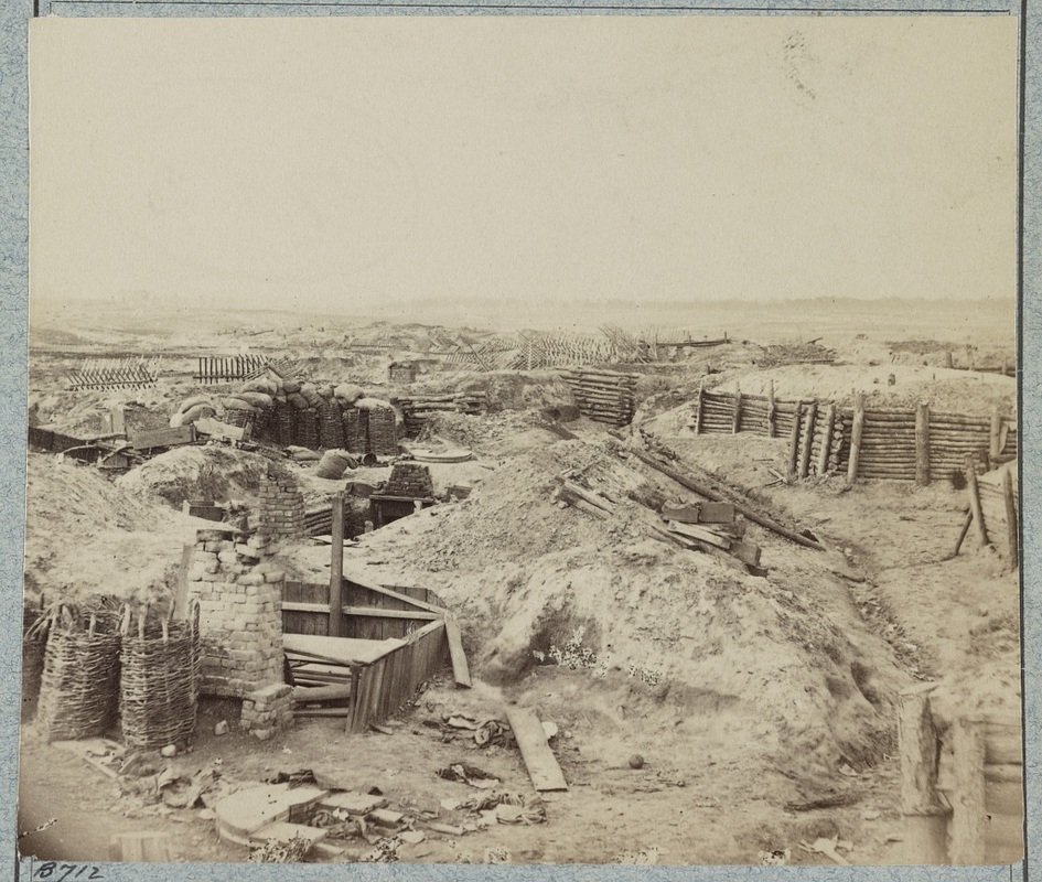
LC32409. "Fort Mahone (Confederate)," likely photographed by A. J. Russell. Camera location is nearly identical to the above photo.
Detail from the above photo (LC32409) showing a chaotic pile of chevaux-de-frise deposited by Federal soldiers to fend off Confederate counterattacks on April 2.
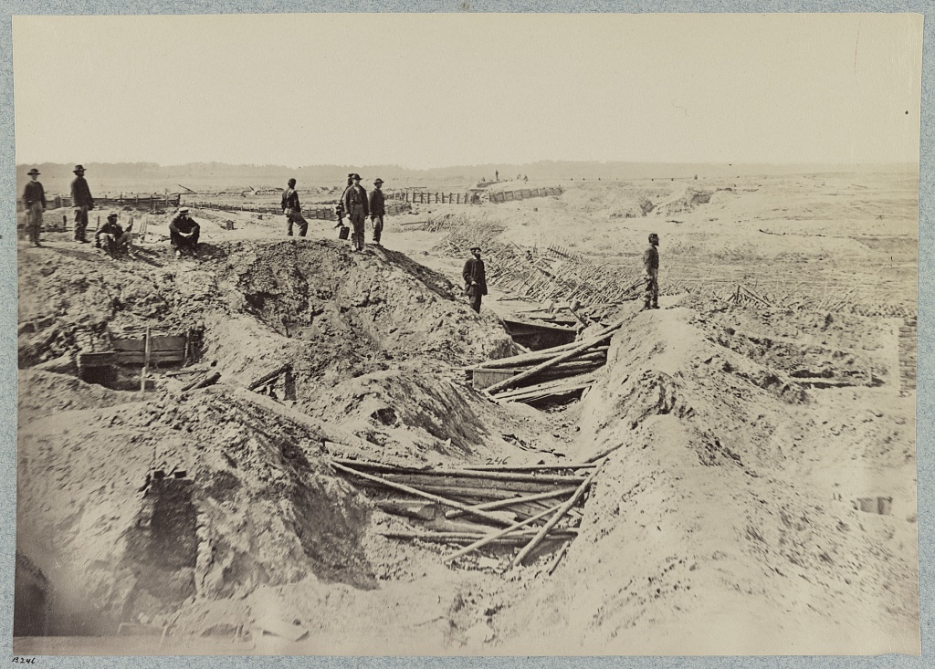
LC 02634. "Petersburg, Virginia. Interior view of Confederate works near Elliott's salient," unatttributed stereograph (Russell?) taken inside Confederate Battery 25. Note battle debris from the fighting April 2, 1865.
LC 32431. "Fort Mahone (Confederate) in front of Petersburg, Va., image by Andrew J. Russell [LOT 4166-E, no. 31], taken inside Battery 25, looking south along the Confederate lines. Battery 27 in the distance.
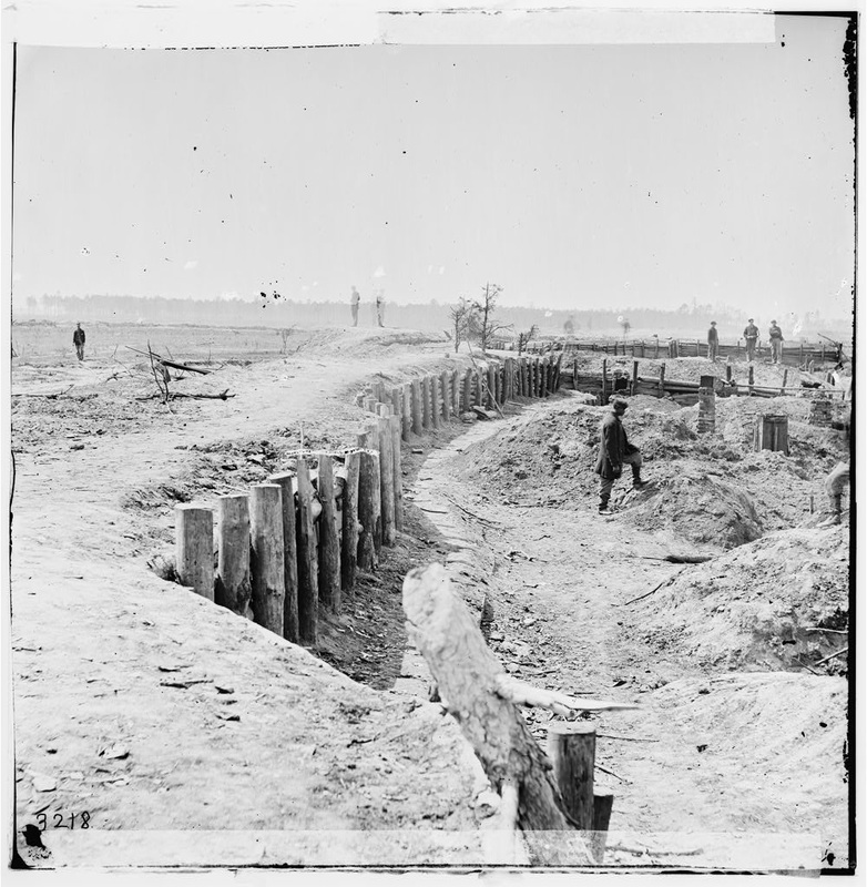
LC 02625. "Petersburg, Virginia. Confederate breastworks in front of Petersburg," stereograph by Andrew J. Russell [LC-B811- 3218 [P&P] LOT 4166-E] taken from inside Confederate Battery 25, looking southwest along the main line.
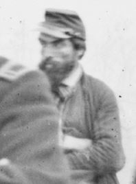
LC 02629. "Petersburg, Virginia. Confederate breastworks in front of Petersburg," stereograph by Andrew J. Russell [LC-B811- 3220 [P&P] LOT 4166-E], taken from Confederate Battery 25. The actual Fort Mahone is in the right distance. Russell is posed on the right in the distance with his arms crossed.
Detail from the above photo highlighting Fort Mahone in the distance. A. J. Russell standing right rear with arms crossed.


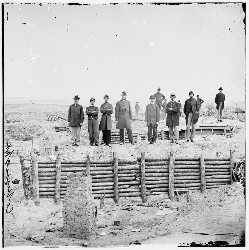
LC 02623. " On the parapet of Ft. Mahone, Petersburg, Va., April 1865. Standing in the middle is Lt. J. B. Krepps, 2nd Pa. Heavy Art.," stereograph by Andrew J. Russell (seated at right rear). Photo taken inside Confederate Battery 25, probably on April 5, 1864, based on Frassanito's reasoning.
LC 02610. "[Petersburg, Va. Breastworks of the Confederate Fort Mahone ("Fort Damnation")], photograph by Andrew J. Russell, taken inside of Confederate Battery 25. Russell is posed mid ground 2nd from left atop the traverse.
Confederate Battery 27 on the Jerusalem Plank Road, April 3, 1865
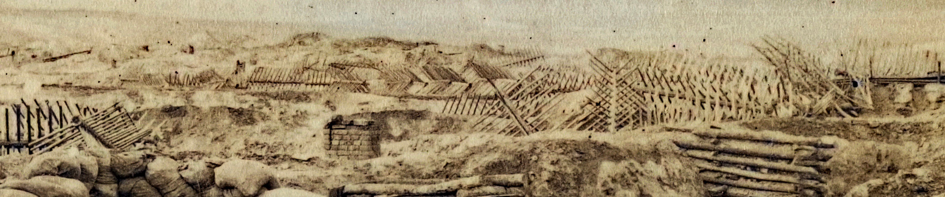
LC 32433. "Chevaux de frise in front of Confederate fortifications, Petersburg, Va." positive by Andrew Russell. [LOT 4166-E, no. 33], taken in front of Confederate Battery 27. Capt. Russell poses atop the fort wall.
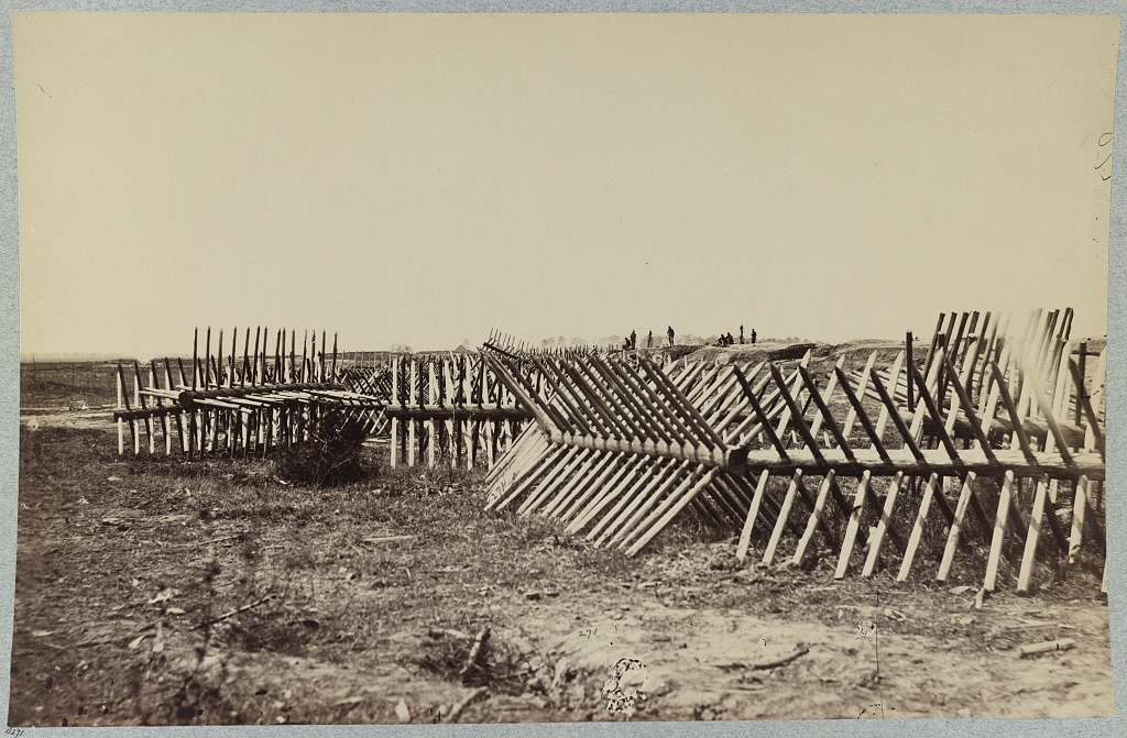
LC 02602. "Petersburg, Virginia. Chevaux-de-frise in front of Confederate works," stereograph by Andrew Russell? [LC-B811- 3208], taken in front of Battery 27.
|
LC 02599. "Petersburg, Virginia. Chevaux-de-frise in front of Confederate works," stereograph by Andrew Russell? [LC-B811- 3207], taken in front of Battery 27.
|
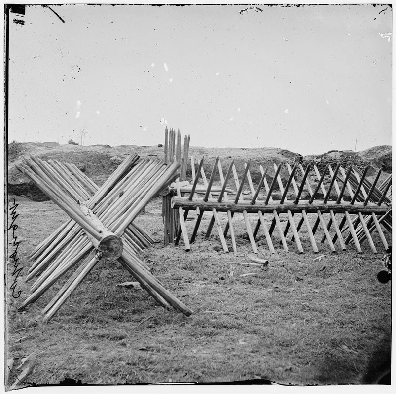
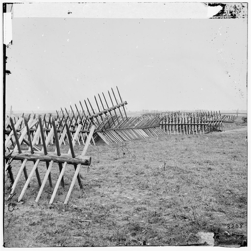
LC 02597. "Petersburg, Va. Sections of chevaux-de-frise before Confederate main works," stereograph by Andrew Russell? [LC-B811- 3206] in front of Confederate Battery 27.
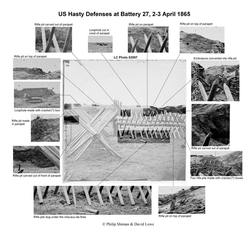
Magnification reveals evidence of the fighting on April 2, 1865.
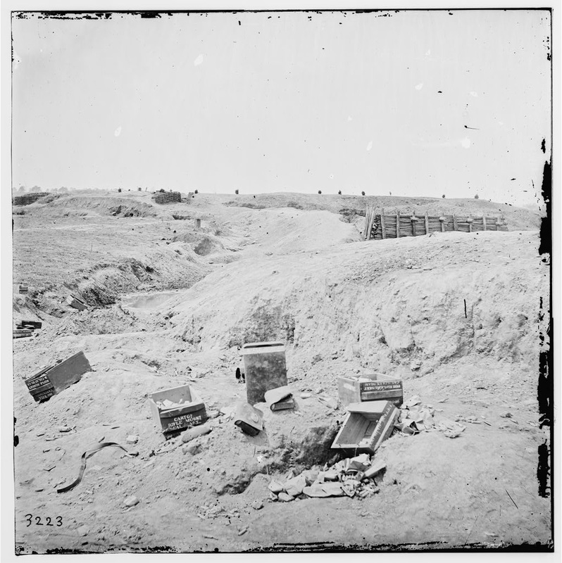
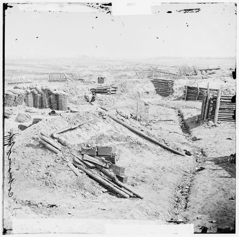
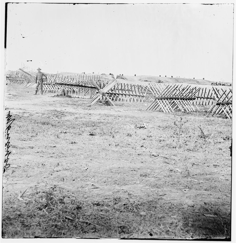
LC 02636. "Petersburg, Virginia. Interior view of Confederate works," stereograph, likely by Andrew J. Russell {LC-B811- 3223 [P&P] LOT 4166-E] taken outside Battery 27. Ammo boxes (CAL .577), scattered cartridges, evidence of fighting April 2, 1865.
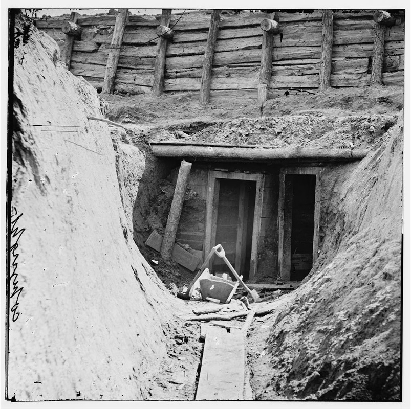
LC 02576. "[Petersburg, Va. Entrance to mine in Fort Mahone, intended to undermine Fort Sedgwick]," unattributed photograph, likely by A. J. Russell or his associate, taken inside Battery 27.
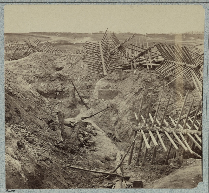
LC 32918. "Dead Confederates in the trenches of Fort Mahone, April 3, 1865," image by Thomas C. Roche [LOT 4168, no. 16], likely taken in the covered ways of Confederate Battery 27. Note the chevaux-de-frise carried from the front and piled here by Federal soldiers to stem off Confederate counterattacks on April 2. 1865.
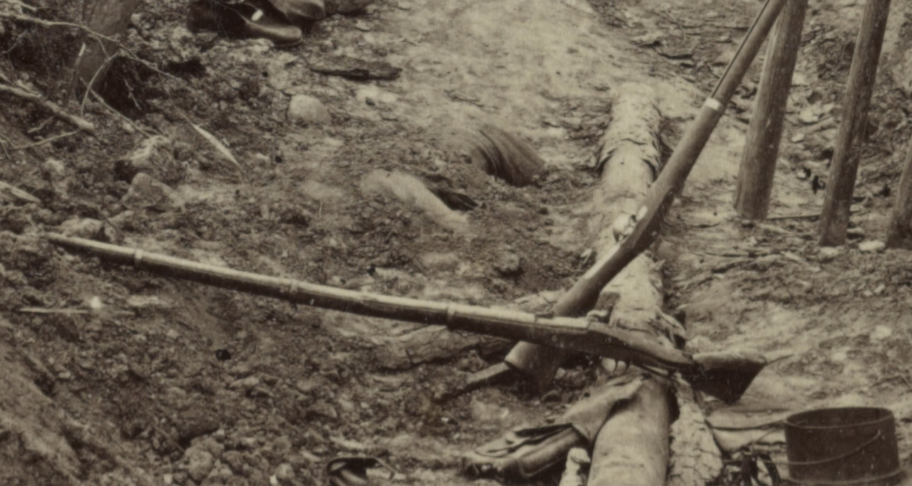
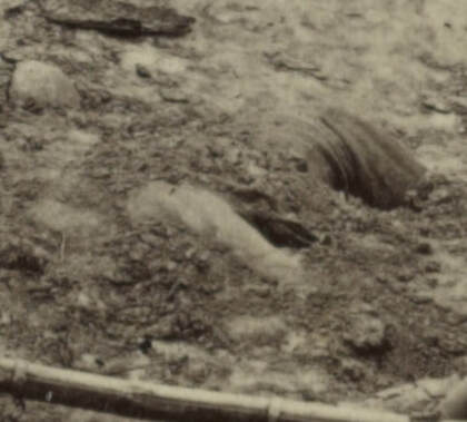
Detail from the above photograph showing a half-buried corpse in the foreground. Under magnification, individual shovelfuls of dirt can be distinguished, as well as footprints on the corpse, likely from the photographer's assistant when he placed the prop rifle-muskets in the scene.
|
Photographer Roche was only a few steps ahead of the burial party on April 3, 1865. The Federal dead had likely already been buried.
|
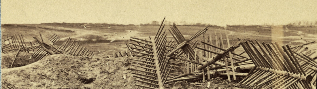
Detail of the background of the above photograph.
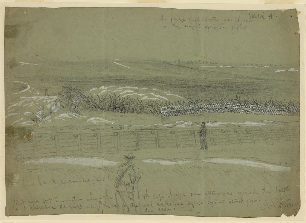
Sketch by A.R. Waud. "Spot near fort Damnation where the 9th Corps charged and afterwords carried the abattis and Cheveaux de frize [sic] across to the rear of the rebel works as a defense against attack from the second line." This sketch appears to capture some of the same area as the background of the above photograph.
