The Petersburg Project
  • Home
    • About Us
  • Blog and Updates
  • Postwar Visit to the Battlefields 1866
  • Civil War Combat Trenching
  • Views of the City of Petersburg
    • Petersburg Panorama 1865
    • Steeples of Petersburg
    • Petersburg Mill Photographs
  • The Mine Explosion and its Crater
  • Petersburg in Pencil and Ink
    • Alfred R. Waud, Special Artist at Petersburg >
      • Waud Drawing of 5th Corps Fortifications
    • William Waud, Special Artist
    • Charles H. Chapin, Special Artist
    • Joseph Becker, Special Artist at Petersburg
    • Edwin Forbes, Special Artist at Petersburg
    • Winslow Homer, Special Artist
    • Edward Mullen, Special Artist at Petersburg
    • Andrew W. Warren, Special Artist
    • Enlisted Artists >
      • Charles Wellington Reed
      • Andrew McCallum
      • Francis Knowles
      • James William Pattison
      • Herbert Valentine
      • Howard A. Camp
  • Petersburg Photographs --So Many!
    • Dimmock Battery 5 Photographs >
      • Working with Photographs
    • City Point
    • City Point Wharf Explosion, Aug. 9, 1864
    • Fort Rice?? We don't think so!
    • Federal Picket Line, Jerusalem Plank Road
    • Egbert Guy Fowx, Photographer at Petersburg
    • Timothy O'Sullivan, Photographer at Petersburg >
      • Harrison's Creek USCT Camps
      • Fort Morton and Baxter Road Group
      • Fort Haskell Panorama and Bomb Proofs
      • Fort Stedman Group
      • Gracie's Salient Group
      • Camp of the 50th N. Y. Engineers
    • David Knox, Photographer at Petersburg
    • William Redish Pywell, Photographer at Petersburg
    • John Reekie, Photographer at Petersburg
    • Thomas C. Roche, Photographer at Petersburg
    • Andrew J. Russell, Photographer at Petersburg >
      • "Fort Mahone" CS Batteries 25 & 27
  • U. S. Military Railroad
    • Terminus of Military R. R. at City Point
    • City Point to Clark's Station
    • Pitkin's Station to Shooting Hill
    • Hancock's Junction/Jerusalem Plank Road
    • Parke's Station
    • Warren's Station
    • Patrick's Station
  • Topographical Engineers -- Our Heroes
    • Grand Medicine Pow-wow
    • Michler's Reports from Topographical Department
    • John E. Weyss, Cartographer
    • William H. Paine, Cartographer
    • Gilbert Thompson
    • Albert Hanry Campbell, C.S.A. Cartographer
  • Confederate Maps
    • Confederate Defenses 1862
    • Gilmer-Campbell Maps, 1864
    • Stevens Map July 1864
    • Fields of Fire
    • Campbell Dinwiddie County 1864
    • Coit's map of the Crater Battlefield
  • Federal Maps
    • Army of the Potomac, Routes of the Corps to Petersburg
    • June 9 1864, Kautz Attack
    • June 18, 1864-Federal Engineers Maps
    • June 18, 1864, 18th Corps
    • June 19, 1864, Engineers Map
    • June 21, 1864, Federal Engineers Maps
    • June 22, 1864. Second Corps at Jerusalem Plank Road
    • June 29, 1864. Dept of VA and NC
    • June 30, 1864 -- XVIII Corps Map
    • June-July, Undated Federal Engineers Map-
    • July 29, 1864, Engineers Map, Annotated
    • July 1864 Map of XVIII Corps Lines
    • Crater, Native American Perspective of the Crater
    • August 1864, Michie Map - Bermuda 100
    • August 28, 1864, Michler Map
    • Aug.-Nov. 1864 Two Base Maps
    • September 13, 1864, Recon Map
    • Sept. 13-Oct.25 versions. Redoubts and Batteries
    • September 30, 1864, Warren Map
    • October 1864, Two IX Corps Maps
    • October 20, 1864. Benham's map of defenses of City Point
    • Nov. 2, 1864, Army of the Potomac
    • 1864, Coast Survey Map of Petersburg
    • Michler Map Series 1865-1867
    • 1864-1867, Michler-Weyss, Siege of Petersburg
    • 1865-1867, Manuscript Survey Maps
    • 1871, Map of Recapture of Ft. Stedman
    • 1881, Boydton Plank Road
  • Confederate Forts and Batteries
    • Dimmock Line >
      • Priest Cap
      • French Rifle Pits
    • Fort Clifton
    • "Fort Mahone" CS Batteries 25 & 27
    • Confederate 8-inch Columbiad
    • Leadworks
  • Federal Forts and Batteries
    • Union Battery Ten (X)
    • Fort Alexander Hayes
    • Fort Avery
    • Fort Conahey
    • Fort Davis & Battery XXII
    • Fort Fisher
    • Fort Meikel --Photographic Views
    • Fort Morton
    • Fort Patrick Kelly
    • Fort Sedgwick, better known as Fort Hell,
    • Fort Wadsworth -- the Evolution
    • Fort Willcox or Battery XVI
  • Battlefield Features
    • Aiken House
    • Armstrong's Mill
    • Avery House
    • Bailey/Johnston Farm
    • Blandford Church
    • Broadway Landing, Appomattox River
    • The Crater
    • Cummings House
    • Dams and Inundations
    • WW Davis Farm
    • Dunn House
    • Friend House >
      • View from Friend House toward Gibben complex and Petersburg
    • Gibbons Properties
    • Globe Tavern / Weldon Railroad
    • Gregory House
    • Griffith Farm
    • Gurley House
    • Hare House Hill
    • The "Horseshoe"
    • Jerusalem Plank Road
    • Jones House
    • Jordan House
    • Newmarket Racecourse
    • Pegram's Farm
    • Peebles Farm, Pegrams Farm, Poplar Springs Church
    • Shands House
    • Taylor Farm >
      • The Ice House
      • Surviving Taylor Barn
    • Williams House
  • Signal Towers and Trees
    • Some Operations of the Signal Corps at Petersburg
  • Archeology
    • Geology of the Crater
    • Fieldwork -- Petersburg
    • Civil War Sinks
    • Deserted Confederate Camp
    • Gracie's Countermine
    • LIDAR Forts and Batteries
  • Articles, Papers, Presentations
    • Shiman: A Note on Maps
    • The Siege Landscape: Through Fire and Ice at Petersburg
    • "The Rebel in the Road"
    • "A Strange Sort of Warfare Underground"
    • Lost Trenches of Petersburg: June 17
    • Between the Lines
    • Combat Trenching: An Introduction
    • Lowe -- Post-War Topographical Survey
    • Civil War Maps and Landscapes -- Observations
  • Kittens, Puppies & Ponies
  • Executions!
  • Notes on Leveled Earthworks
  • Depot Hospital at City Point
  • Pontoon Bridges
  • The Great Pontoon Bridge Across James River
  • Captain Robert Davis CSA

Yellow House, Yellow Tavern, Globe Tavern, Blick House, Blick Junction, Warren Station on the Weldon Railroad

Picture
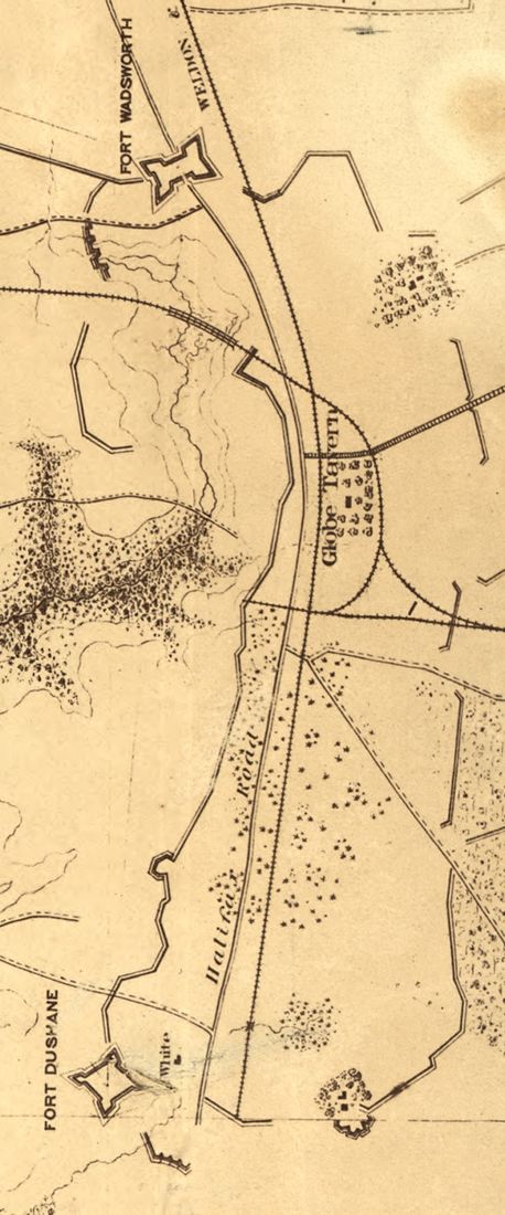
Detail from Federal engineers map in the National Archives, dated January 1865, showing the vicinity of Globe Tavern. Two bastioned forts -- Wadsworth and Dushane -- protected the Weldon Railroad. North is to the right of the map.
Picture
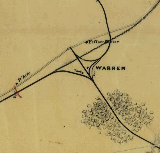
Detail of the 'Y' junction at the Yellow House, Globe Tavern, or Warren Station, from Map of the City Point and Army Line. NARA RG77 Rds. 196. This map shows "Yellow House" opposite the railroad from "Globe Tavern" on the right.
Picture
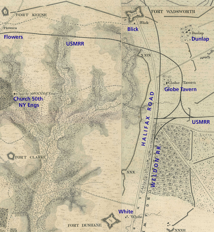
Detail of the Vicinity of Globe Tavern from the Michler map series, G204- 8" = 1 mile. Blick house drops off of many late-war Union maps.
Picture
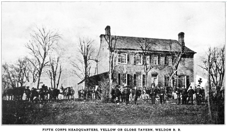
Illustration from Under the Maltese Cross: Antietam to Appomattox, Campaigns 155th Pennsylvania Regiment (Pittsburg, PA, 1910), 318. This, however, does not appear to be the same house shown in the images below.
Picture
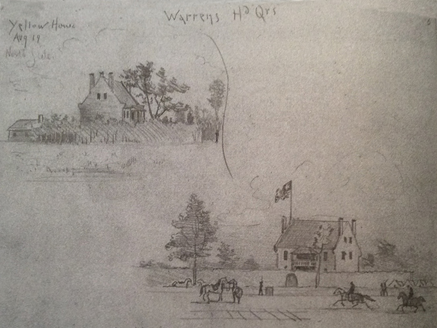
Two sketches of "Yellow House, Aug 19, Warrens HdQrs," by Charles Wellington Reed. From "A Grand and Terrible Dramma," edited by Eric Campbell.
Picture
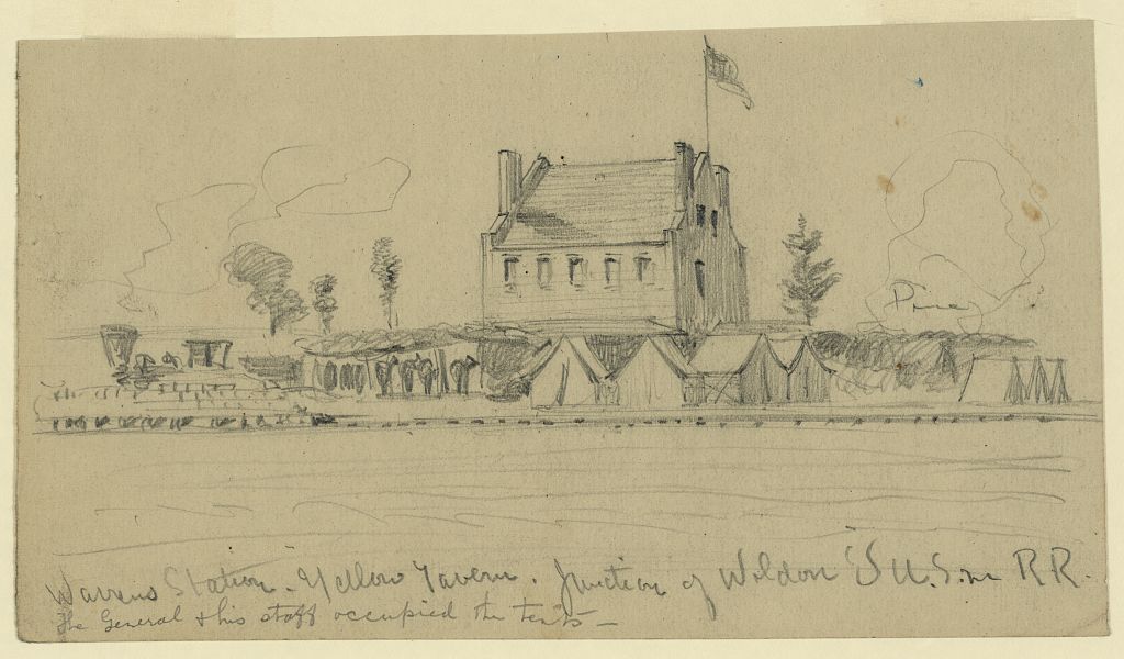
"Warrens Station. Yellow Tavern. Junction of Weldon's U.S. R.R.," drawing by A. W. Warren.
Picture
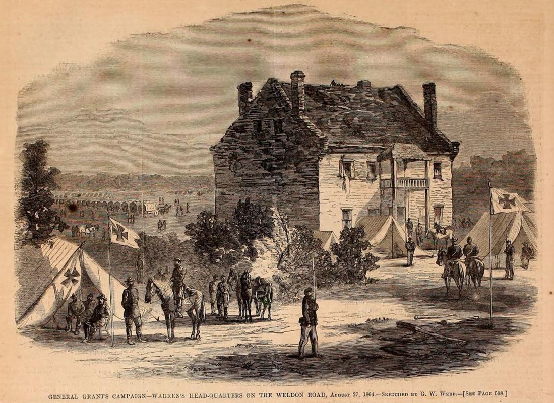
"Warren's Headquarters on the Weldon Road, August 27, 1864" sketched by G. W. Webb, "a soldier in the Fifth Corps." Woodcut published in Harper's Weekly, September 17, 1864.
Picture
Picture
Picture
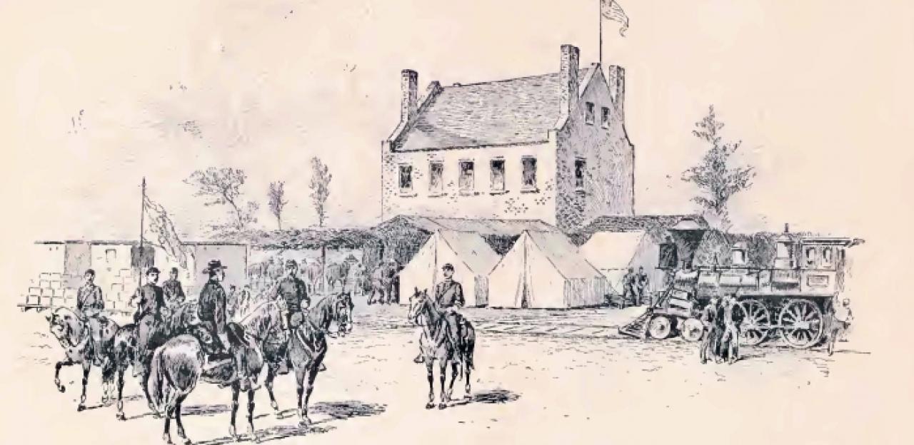
"Junction with Weldon Railroad at Blick House," woodcut in Frank Leslie's Illustrated, Oct. 1, 1864, from a sketch by Andrew McCallum. The building depicted is Globe Tavern.
Picture
Picture
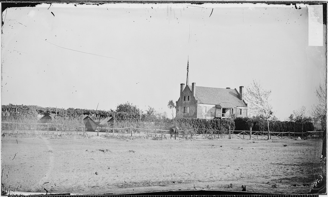
LC 33026. Original caption reads: "Globe Tavern - Meade's hdq. at the battle of Malvern Hill," which is erroneous.
Picture
LC 35108. Caption reads "[Headquarters, 6th Army Corps, Warren Station, in front of Petersburg, Va.]"
Picture
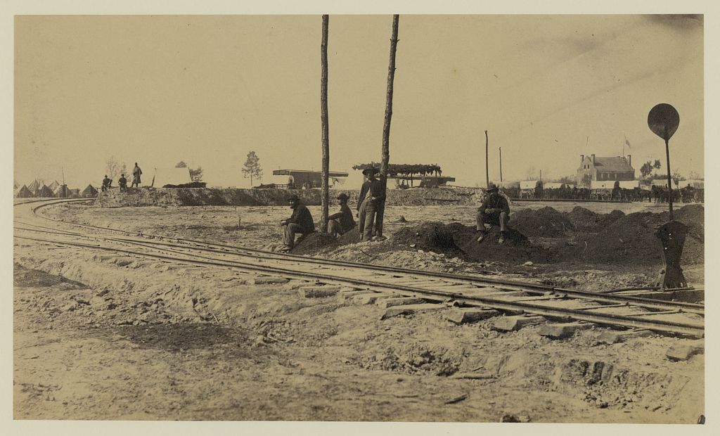
LC 08263. "View of "Y" on the City Point & Army line, near yellow house." Are those freshly dug graves on the right?
Picture
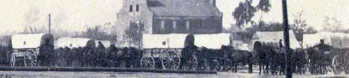
This detail from LC 08263 above shows the distinctive 9th Corps shield-shaped emblem on the wagons, which should help us date the photograph.
Picture
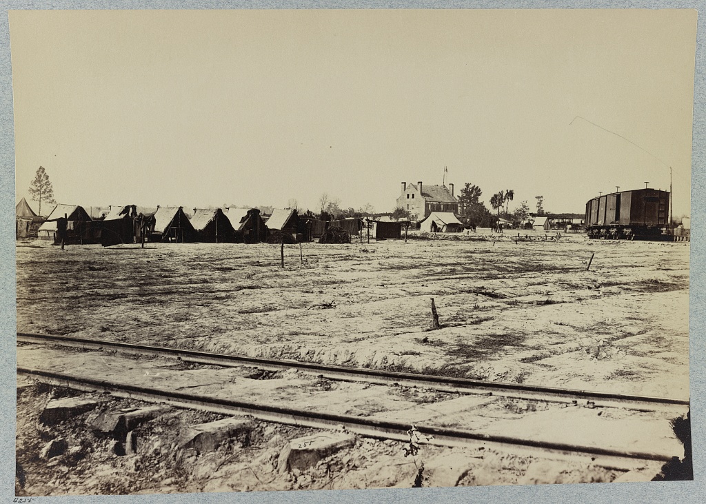
LC 33015. "Headquarters 6th Army Corps. Warren Station, in front of Petersburg, Va." At the 'Y' junction.
Picture
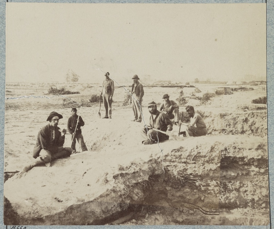
LC 32928. "Lone graves at Warren Station in front of Petersburg, Va.," photographer unknown. The covered wagon in rear is stenciled HEAD QUARTERS over a Maltese cross. To the right of the wagon is the same battery that appears behind the soldiers below.
Picture
LC 32410. Caption reads. "Confederate fortifications at Warren Station."

Blick House

Picture
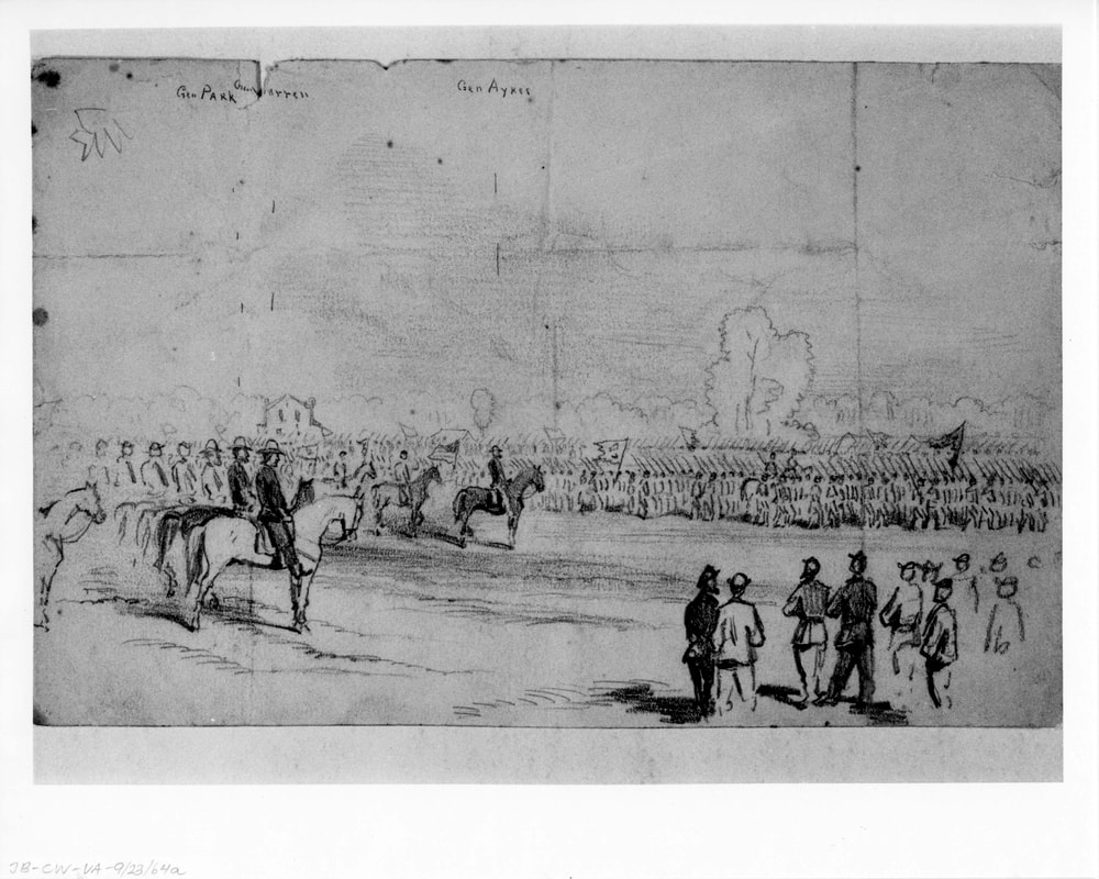
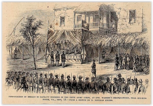
" "Generals Warren, Park & Ayres reviewing Ayres 2nd Div 5th Corps on Friday Afternoon Sept 23 on the plain opposite the Blick house," sketch by Joseph Becker, Sept. 23, 1864. Image courtesy of the Becker Collection.
Picture
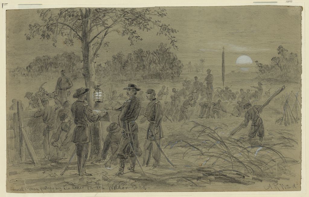
LC21009. "General Warren fortifying his lines on the Weldon road," drawing by Alfred R. Waud.
Picture
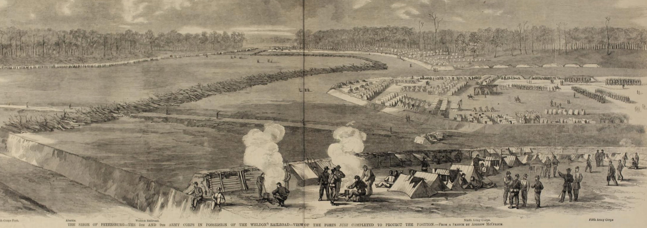
"The 5th and 9th Army Corps in Possession of the Weldon Railroad," woodcut published in Frank Leslie's Illustrated, Sept. 24, 1864, from a sketch by Andrew McCallum.
Picture
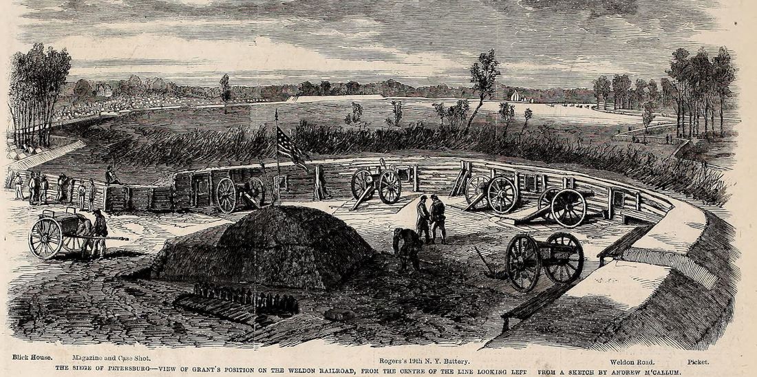
"View of Grant's Position on the Weldon Railroad," woodcut from Frank Leslie's Illustrated, Oct. 1, 1864, from a sketch by Andrew McCallum. Note the Blick house on the
Picture
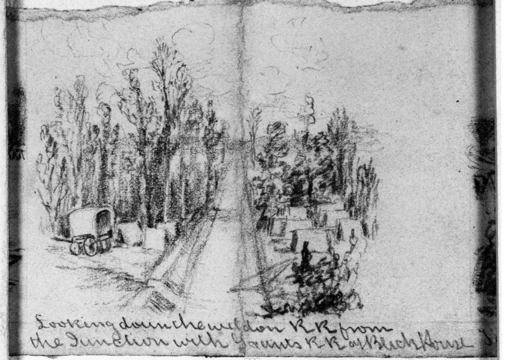
"Looking down the Weldon RR from the Junction with Grant's RR at Blick House," sketch by Andrew McCallum from the Becker Collection, Boston College.

Picture
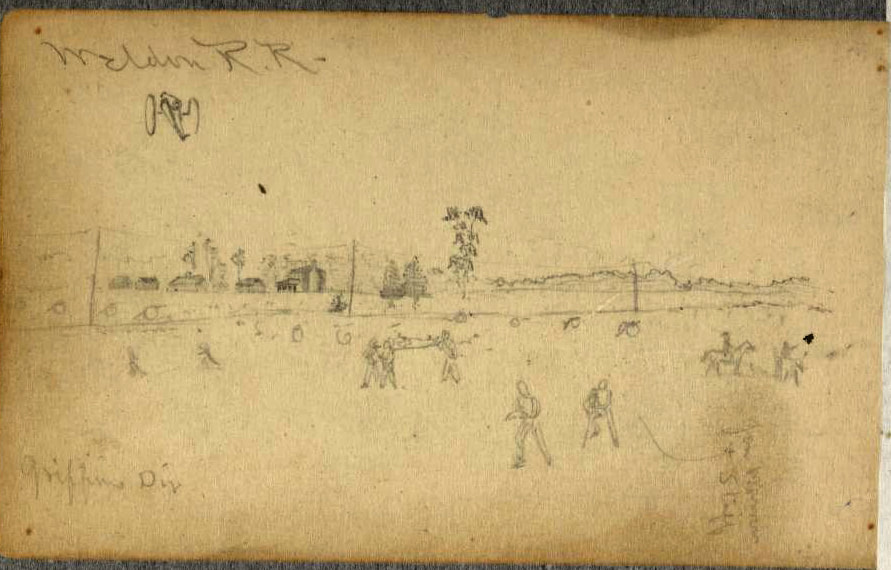
"Weldon RR," sketch by Charles Wellington Reed. LC Collection. Railroad is marked by line of telegraph poles. Blick House compound is depicted left mid-ground.
Picture
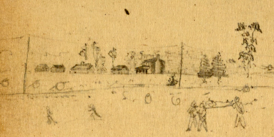
Detail of Blick farm from C.W. Reed sketch above.
Picture
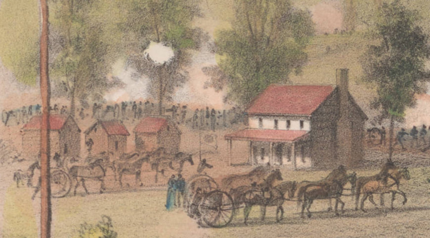
Blick house, as depicted by Holland in the lithograph "Battle of the Weldon Railroad."
Picture
"Mrs. Kane's House on Picket Lint front of 3d Div 9th Corps near Weldon RR, painted red." Drawing by Charles Wellington Reed. LC
Last Update: 04/06/2021
Picture
Proudly powered by Weebly