
Michler Map, August 28, 1864
Work on this map began shortly after the fiasco of The Crater. It shows how disconnected the Union siege lines were at this stage of the conflict. Army leadership and the engineers were then involved in discussions on how to rationalize and shorten the lines, to make defense more efficient. Particular emphasis we placed on combining batteries and siting them to create interlocking fields of fire. At this point, the only large, enclosed fort appears to have been Fort Davis on the Jerusalem Plank Road. Fort Sedgwick was only beginning to grow into the formidable fortress that it would become later in the siege. Fort Morton on the Taylor Farm was known as the "Fourteen-Gun Battery." Fort Stedman consisted of four separate batteries on Hare House Hill that had yet to be consolidated. Poor Creek appears as "Poo River."
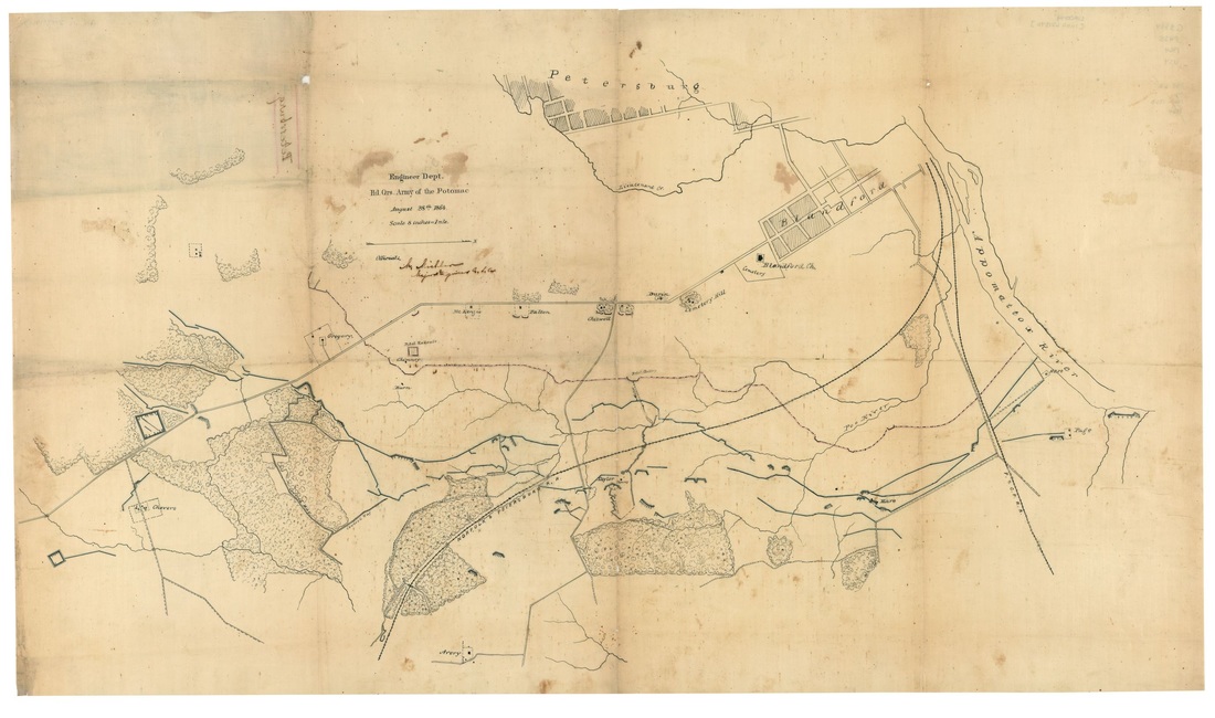
LC lva00194. "Vicinity of Petersburg, Army of the Potomac. Engineer Dept., Army of the Potomac, N. Michler, August 28, 1864."
