
The Great Pontoon Bridge Across James River by which Grant Opened the Petersburg Front
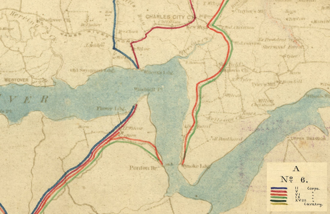
LC cw050100 detail from "[Map of the lines of march of the Army of the Potomac from Culpeper to Petersburg, Virginia," Army of the Potomac, Engineer Department, showing area where the Great Pontoon was laid at "Wynoke Ldg." Second and part of Fifth Army Corps converged on Wilcox's Landing and crossed the river on steamers to Windmill Point. Sixth and Ninth Corps and the army trains crossed the pontoons. The bridge was dismantled entirely on June 18.
Reaching the James
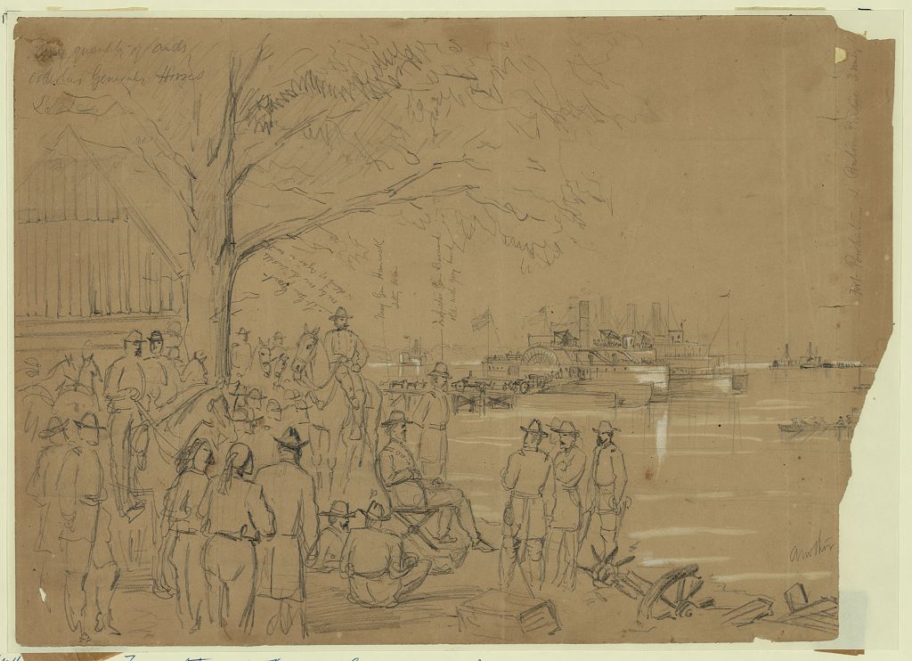
LC 21747. Gen Grant, Hancock & Staff watching the transportation of the Second Corps from Wilcox Landing to Windmill Point across the James River." Sketch by William Waud, June 14, 1864. Inscribed upper left: Any quantity of aids[sic], orderlies Generals Horses &c. &c.
Inscribed lower right: another [image cropped]
Inscribed within image, vertically, with arrow indicators: Lt Gen Grant one leg over the saddle & stump of cigar in mouth; Maj Gen Hancock sitting down; Inspector Gen Barnard old with grey beard; Fort Powhatan & Pontoon bridge 3 miles to.
Published in: Harper's Weekly, July 9, 1864, p. 436.
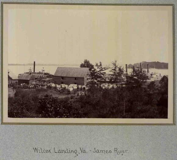
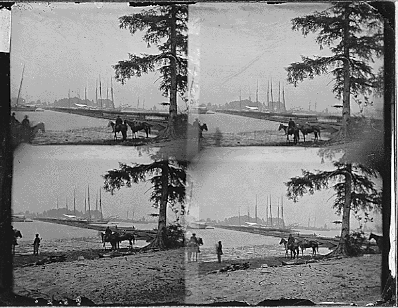
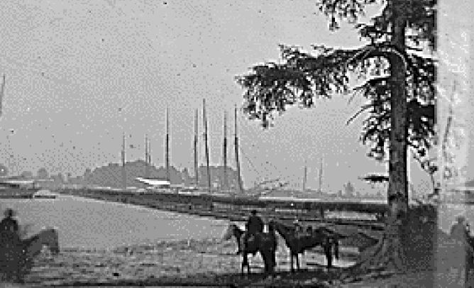
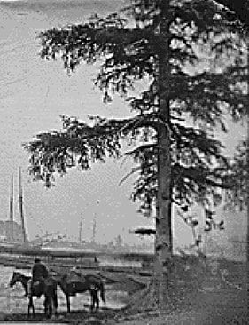
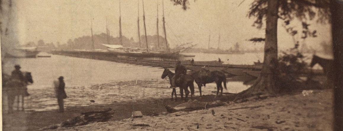
Image of Wilcox Landing on James River from where the Second Army Corps and portions of the Fifth were ferried across to the Southside. Unattributed photograph from the MOLLUS Collection, Vol. 19, 939. The pontoon bridge crossed the river about at the far tree line above the cluster of trees center.
Two Very Competent Looking Engineers--Weitzel and Duane
LC 07632. Brig. Gen. Godfrey Weitzel was chief engineer of the Army of the James. As early a June 12, Weitzel directed Lt. Peter Michie to finalize the crossing site at Douthard's and to cut timber for the approaches.
|
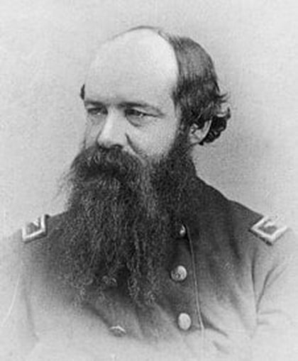
Major James Chatham Duane, Chief Engineer, Army of the Potomac, oversaw the engineer troops that assembled the bridge and directed its construction. Gen. Henry Benham arrived some time later from Fortress Monroe, took charge and "carried off all the credit," according to a staff officer.
|
Duane literally wrote the manual on pontoon bridge construction.
Duane, J.C., Manual for Engineer Troops, New York: Van Nostrand, 1862.
Duane, J.C., Manual for Engineer Troops, New York: Van Nostrand, 1862.
|
"The battalion was engaged in and did a great part of the work of throwing the bridge over the James, containing 101 wooden pontoons. In the channel the depth of water was twelve to fifteen fathoms, the tidal current strong, rising and falling about four feet. In the channel pontoons were anchored to vessels above and below moored for that purpose. The bridge was commenced from each end, and built by successive pontoons and by rafts. It was commenced about 4 p.m. on 15th of June, two companies at each end, under the direction of Major Duane, chief engineer. Later in the afternoon and after considerable progress had been made, General Benham took command. The bridge was completed except a passage-way of 100 feet left for vessels, and the raft constructed to fill this gap by 11 p.m. The greater part of the infantry and artillery, all the wagon trains, and droves of beef-cattle of the army passed this bridge safely and without interruption, except such as resulted from a vessel moored above slipping her anchor, thereby carrying away a part of the bridge, which, however, was promptly restored."
--Report of George H. Mendell, US Engineer Battalion |
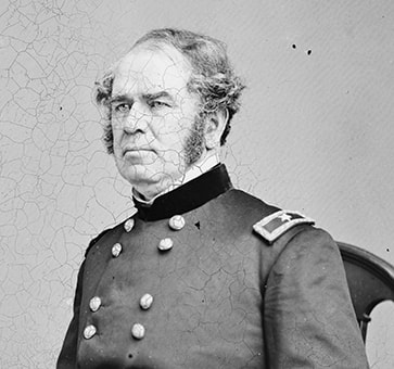
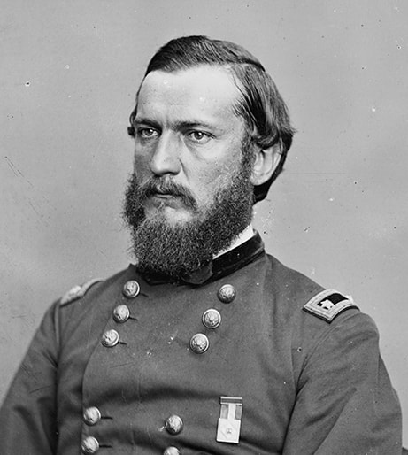
LC 06247. Detail. Henry W. Benham commanded the Engineers Brigade in the Army of the Potomac. He was stationed at Fort Monroe. Benham was responsible for gathering 155 wooden pontoons at Point Comfort and forwarding them to the bridge site. The pontoons, accompanied by elements of the 15th New Engineers, were towed in strings by steamers. Additional equipage was loaded onto barges and forwarded to Ft. Powhatan. Among the commanders of the Army of the Potomac, Ambrose Burnside was the only one to refer to it as "Benham's Bridge." In all fairness, Benham outranked the others upon his arrival.
|

On June 13, at Weitzel's direction, Lt. Peter Smith Michie's detail cut and trimmed 1,200 feet of timber to build the northern approach to the bridge over 200 feet of marsh. He directed another detachment to fell 3,400 feet of timber from near Ft. Powhatan and float it in rafts to the bridge site.
|
"DOUTHAT'S LANDING, June 16, 1864.---2.30 p.m. I have come down here from Petersburg to see how the crossing advances. I find the rear of Warren's corps just being ferried across. The great wagon train will all be over the bridge by daylight to-morrow morning. The cavalry (Wilson's division) will also pass over in the night, leaving Wright's corps to hold the rear. ...The last of the army will no doubt be south of the James River by noon to-morrow. I must here say that the unprecedented pontoon bridge, nearly 700 yards long, constructed by Major Duane, is of the most admirable solidity. After Duane had nearly finished it Benham came up and took charge."
Charles A. Dana in a dispatch to the Secretary of War. |
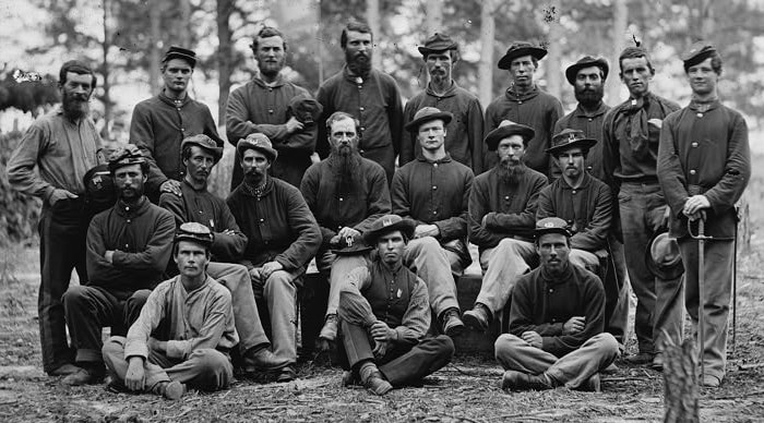
LC 03893. Detail. Group of the US Engineer Battalion, Company B, taken a few weeks after working on the Great Bridge. From the looks of it, these men were all about getting the job done; they did not stand on ceremony.
|
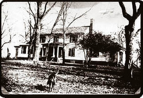
The bridge was built from Weyanoke Plantation, Charles City County, on the north bank to Flowerdew Hundred Plantation, Prince George County, on the southside. Extensive archeological examination has been conducted at Flowerdew Plantation over the years.
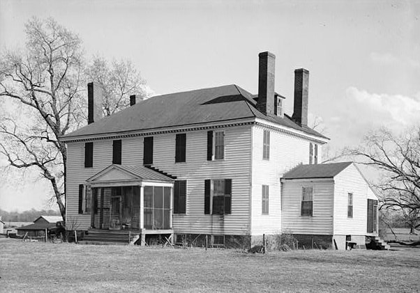
Weyanoke Plantation Main House. Photo from HABS/HAER documentation. At the time of the Civil War the property was owned by Robert Douthat (spelled Douthart on some maps).
|
The plantation house at Flowerdew Hundred was built in 1804 and demolished in 1955. At the time of the bridge building, the property was owned by John Wilcox.
|
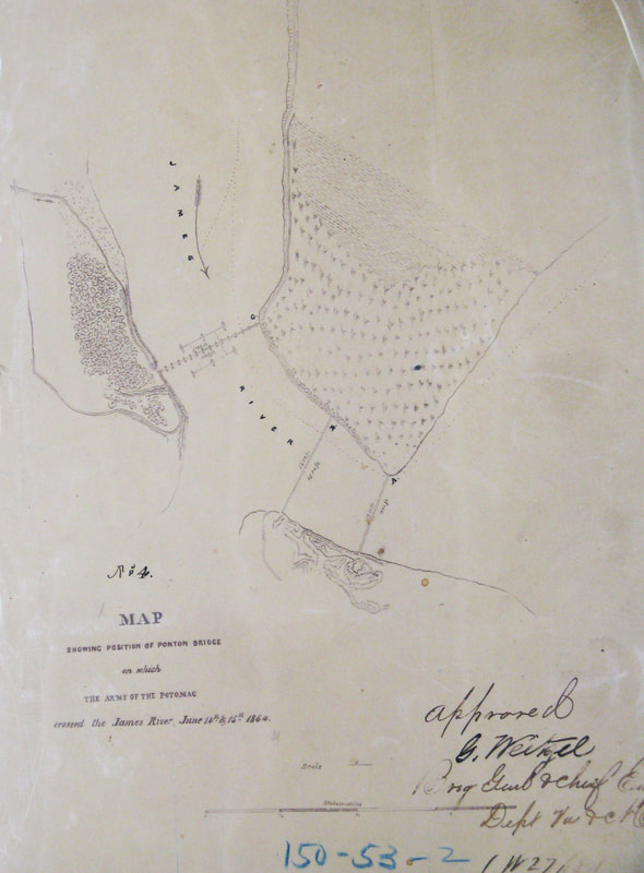
Weitzel's "Map Showing Position of Ponton Bridge on which The Army of the Potomac crossed the James River, June 14th, 15th, 1864," from the National Archives. RG 77, drawer 150, sheet 53. Photo scan by Phil Shiman. The map shows the three possible bridge locations that were scouted, A, B, and C. C was selected--the river was wider but the approaches were easier.
The Bridge
The site was examined by two of Grant's staff, Cyrus Comstock and Horace Porter, selected and confirmed by Gen. Godfrey Weitzel, Chief Engineer Army of the James. Steamers, directed by Brig. Gen. Henry Benham, Engineers Brigade, towed strings of pontoons and equipage-laden barges up from Fort Monroe to the bridge site. The bridge was anchored near Weyanoke Landing (Douthat's) and connected to the Flowerdew Hundred plantation at base of Windmill Point upstream from Fort Powhatan, a masonry fort, War of 1812 vintage. The river was 80-90 feet deep in the ship channel, tide ran 3-4 feet, current was strong and swift and reversed twice a day. The approaches were prepared by Weitzel and Lt. Peter Michie, Army of the James. A wagon road had to be built up the bluff on the Flowerdew side. The completed bridge was 2,170 feet long, requiring 101 wooden pontoon boats. Crews built it in sections of rafts and completed it from both banks working toward the center. A 100-foot section of pontoons in the shIpping channel could be shunted aside to allow ships to pass up and down the river. The bridge was supported upstream and down by cables attached to six schooners anchored on either side of the structure as shown on Weitzel's map above. About 450 engineers and pioneers of the U.S. Engineers Battalion and the 15th and 50th New York Engineers worked on the bridge, directed by Major James Chatham Duane, Army of the Potomac.
The site was examined by two of Grant's staff, Cyrus Comstock and Horace Porter, selected and confirmed by Gen. Godfrey Weitzel, Chief Engineer Army of the James. Steamers, directed by Brig. Gen. Henry Benham, Engineers Brigade, towed strings of pontoons and equipage-laden barges up from Fort Monroe to the bridge site. The bridge was anchored near Weyanoke Landing (Douthat's) and connected to the Flowerdew Hundred plantation at base of Windmill Point upstream from Fort Powhatan, a masonry fort, War of 1812 vintage. The river was 80-90 feet deep in the ship channel, tide ran 3-4 feet, current was strong and swift and reversed twice a day. The approaches were prepared by Weitzel and Lt. Peter Michie, Army of the James. A wagon road had to be built up the bluff on the Flowerdew side. The completed bridge was 2,170 feet long, requiring 101 wooden pontoon boats. Crews built it in sections of rafts and completed it from both banks working toward the center. A 100-foot section of pontoons in the shIpping channel could be shunted aside to allow ships to pass up and down the river. The bridge was supported upstream and down by cables attached to six schooners anchored on either side of the structure as shown on Weitzel's map above. About 450 engineers and pioneers of the U.S. Engineers Battalion and the 15th and 50th New York Engineers worked on the bridge, directed by Major James Chatham Duane, Army of the Potomac.
The Photographers
According to William Frassanito's research, two different camera crews recorded thirteen images of the newly completed pontoon bridge on June 15, 1864. James Gardner and Timothy O'Sullivan worked together on behalf of the Alexander Gardner firm. Brady had a crew of cameramen there, their identities less certain, but they are attributed with ten of the 13 photos. (Frassanito, Grant and Lee, 1983, pp. 207-211). The north bank south of Douthard's House was marshy, a fact that is shown nicely in the photos. Sullivan and Gardner were credited with only four photos. A recently re-captioned image (LC 33973 "Army transports in James River, Va. near Deep Bottom") may not have been included in the tally.
Before Crossing
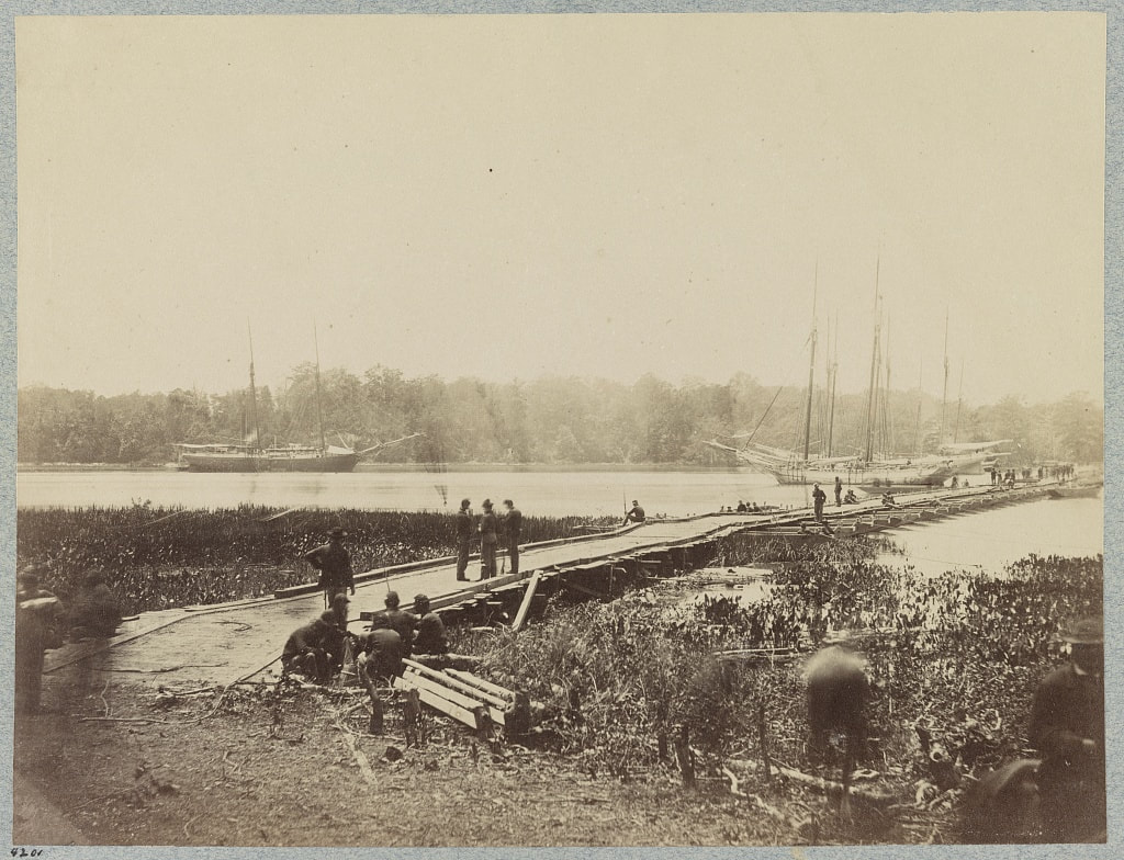
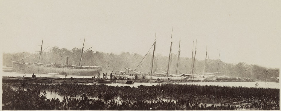
LC 03994. "[James River, Va. Pontoon bridge]," photograph by James Gardner. This is an image of the Great Pontoon Bridge at Weyanoke Neck, 2,100 feet long, by which much of the Army of the Potomac crossed James River, June 14-18, 1864. Taken from the north bank of the river. The bridge was anchored to three schooners upstream of the bridge and three downstream. Engineers appear to be working on completing the bridge.
LC 33360. "Pontoon bridge across James River at Powhatan Point on which Army of Potomac crossed, June, 1864," image by James Gardner. In the foreground is a 200-foot causeway constructed of felled trees, floored with extra chesses.
LC 33300. "Pontoon bridge across James River at Powhatan Point on which Army of Potomac crossed," image by Timothy O'Sullivan and James Gardner, June 15, 1864. Taken from the north bank of the river, current flowing from right to left. Anticipation is evident in the posture and poise of the riders and horses.
LC 00381. "Charles City Court House, Virginia (vicinity). Pontoon Bridge on the James River," right half of stereograph by Timothy O'Sullivan and James Gardner.
The Crossing
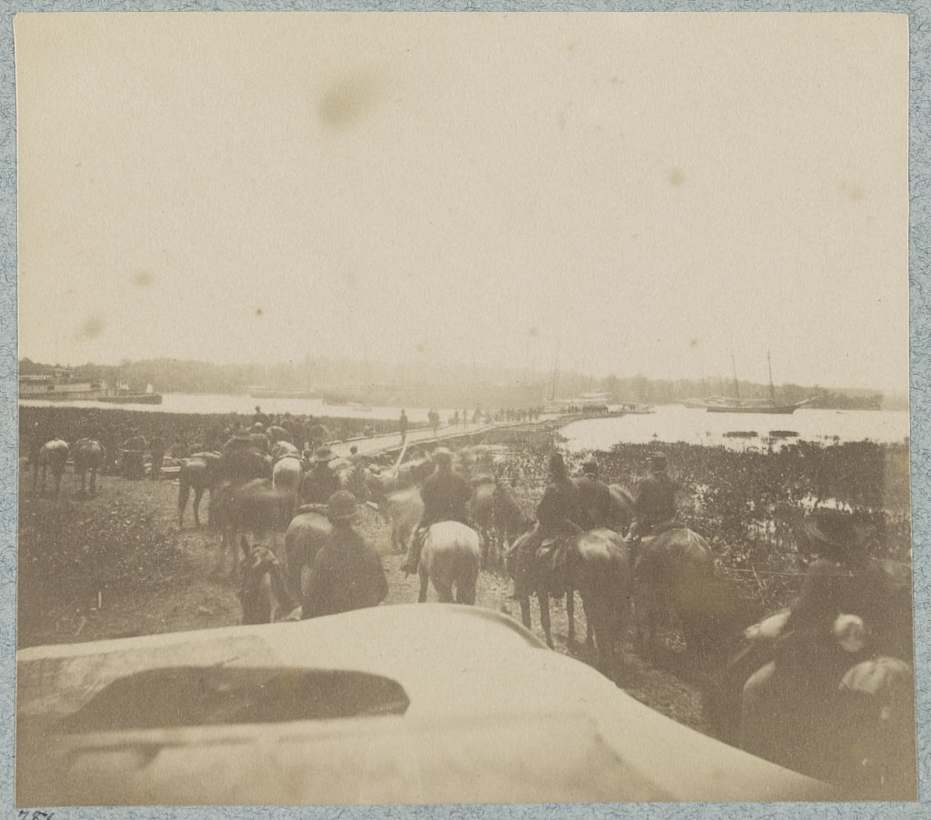
LC33380 detail. "Pontoon bridge across James River at Powhatan Point on which Army of Potomac crossed, June, 1864," Brady & Co. photograph taken from north (marshy) bank. A line of wagons is crossing at the far end of the bridge.
LC 01764 detail. "James River, Virginia. Pontoon bridge on which the Army of the Potomac crossed, June 1864," photograph by Brady & Co., taken from near the same location as previous photo. A column of cavalry is crossing, paused on the left, still moving accordion-style on right.

NARA 529083a. Miscaptioned "Ships at Wharf." This is another exposure of the pontoon bridge from near the same location.
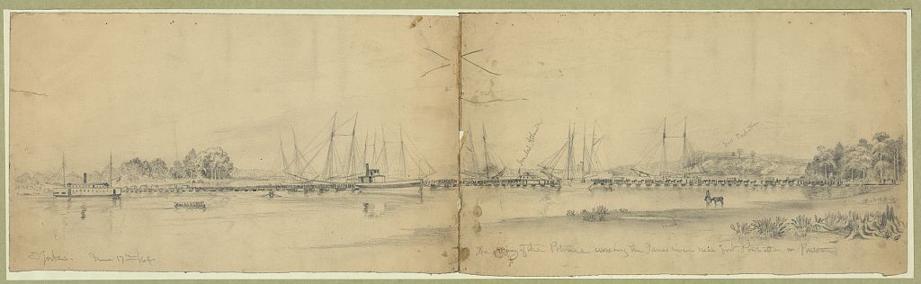
LC 22560. "The Army of the Potomac crossing the James River near Fort Powhattan on pontoons, June 17th, 1864." drawing by Edwin Forbes. View looking downstream. "Fort Powhatan" is labeled on the bluff next to the masts on the right. "Ironclad Atlanta" labeled at center, far side of the bridge. 74 visible pontoons were painstakingly drawn in.
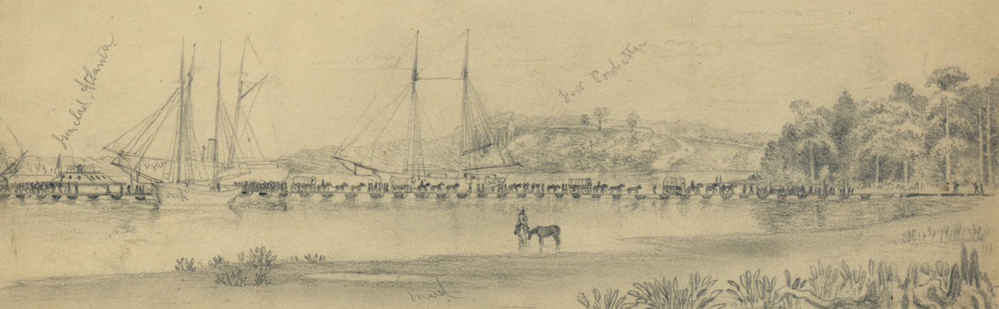
Detail from the Forbes drawing above showing the "Atlanta" and Fort Powhatan.
After Crossing
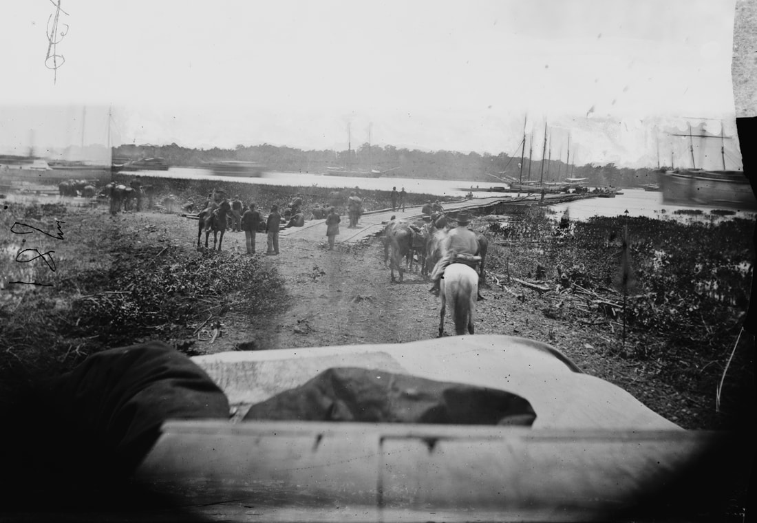
LC 33374. "Pontoon bridge across James River at Powhatan Point on which Army of Potomac crossed, June, 1864," Brady & Co. photograph taken from the south bank. Current is flowing from left to right.
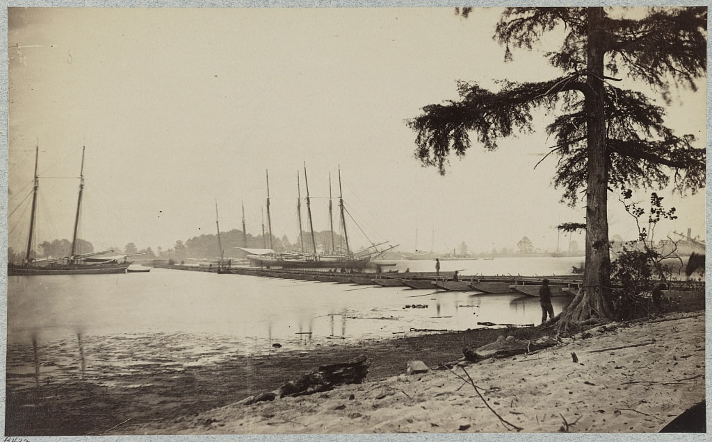
LC 33377. "Pontoon bridge across James River at Powhatan Point, on which Army of Potomac crossed, June, 1864," Brady & Co. photograph taken from the south bank. The camera position is shifted somewhat to the left and rear from the previous photo.
NARA 111-B-5217. Four successive exposures by Brady & Co. taken from near the same location as the previous image.
When animated, the four images appear to show the impatient movement of the horses and a sentry entering from the left and possibly saluting an officer on horseback. Not overly dramatic but interesting.
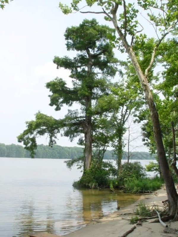
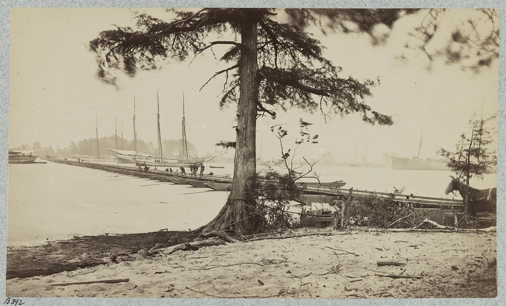
THE TREE THAT WITNESSED HISTORY. A recent photo shared by Bobby Russo shows the ancient cypress at the anchorage. Thanks. This image gave us chills.
|
NARA 111-B-5217. Brady & Co., higher resolution detail from the above composite image.
|
View of the Bridge from Afar
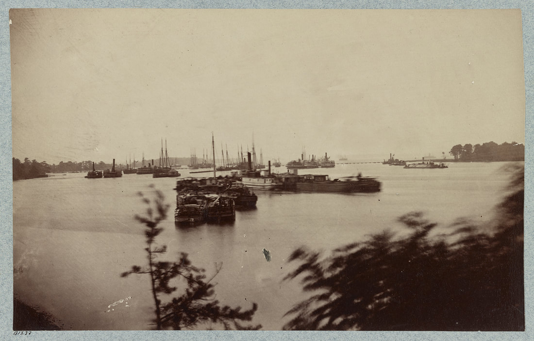
LC 33973. "Army transports in James River, Va. near Deep Bottom." Unattributed photograph. that was not taken near Deep Bottom. The Great Pontoon Bridge can be seen in the distance stretching from tree-lined point to tree-lined cove. The photo was likely taken from Fort Powhatan. As explained in a Center for Civil War Photography post, this image was first identified correctly by Christopher B. Coleman and confirmed by Virginia archeologist Taft Kiser.

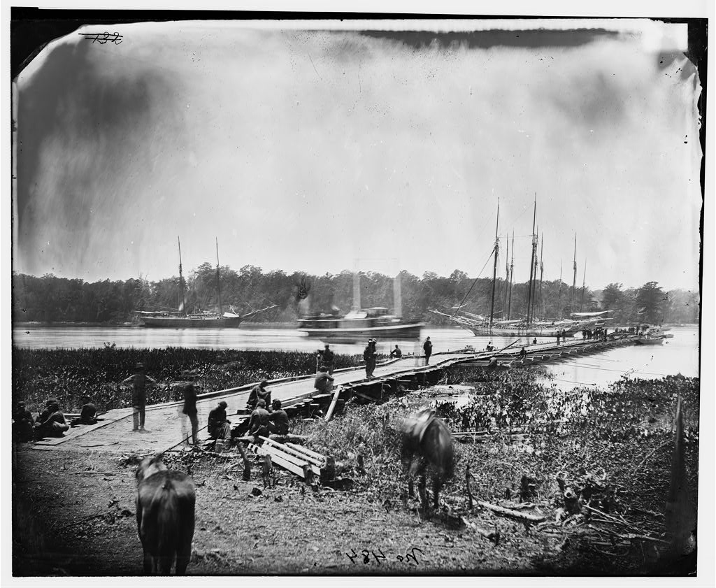
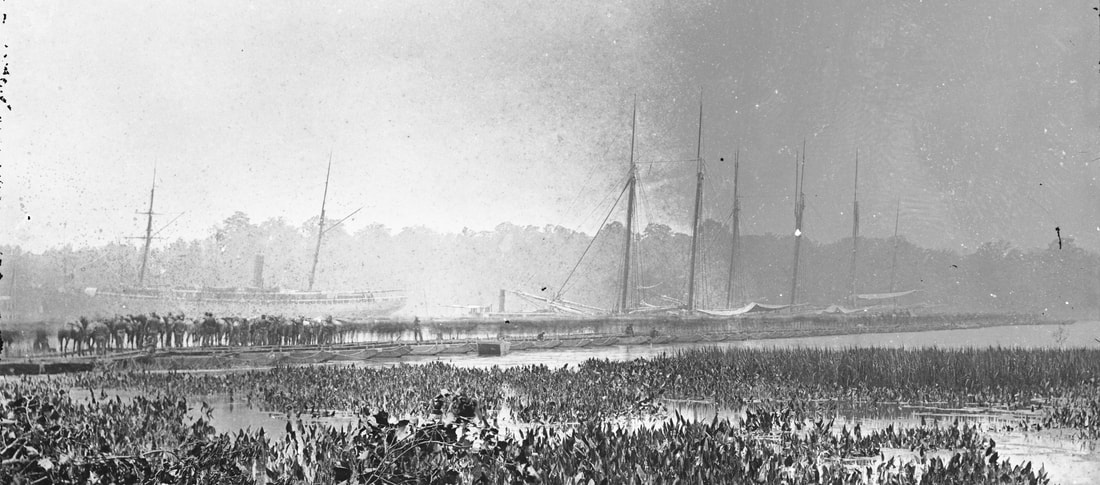
NARA 111-B-5205. "View on James River." Two images from a four-image plate stitched together to form a panorama, showing the bridge from bank to bank. I count more than sixty visible pontoons.
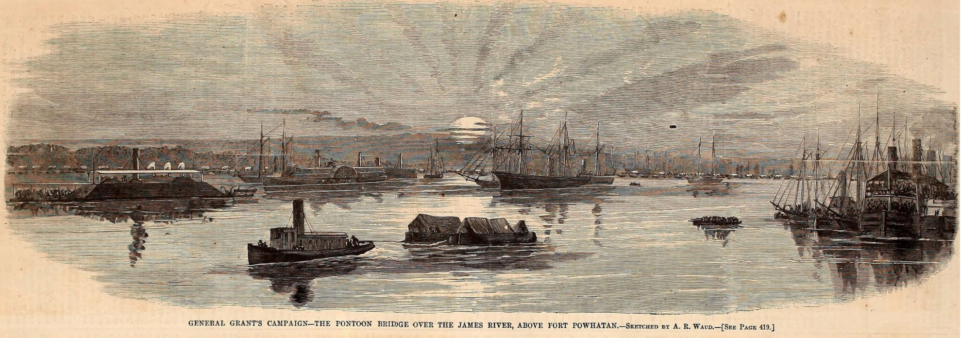
"General Grant' Campaign--The Pontoon Bridge Over the James River, Above Fort Powhatan," woodcut from a sketch by A. R. Waud, published in Harper's Weekly, July 2, 1864. The line of the pontoon bridge in the distance is defined by the white canvas tops of the wagons.
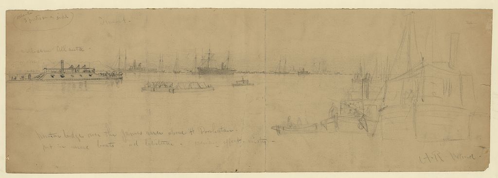
LC 22476. "Pontoon bridge over the James River above Ft. Powhatan," drawing by Alfred R. Waud. Notation: "put in more boats ad libitum; evening effect misty; Inscribed upper left Atlanta 3 ports on a side. Sunset; rebel ram Atlanta." Bridge can be seen in the distance. Detail below.
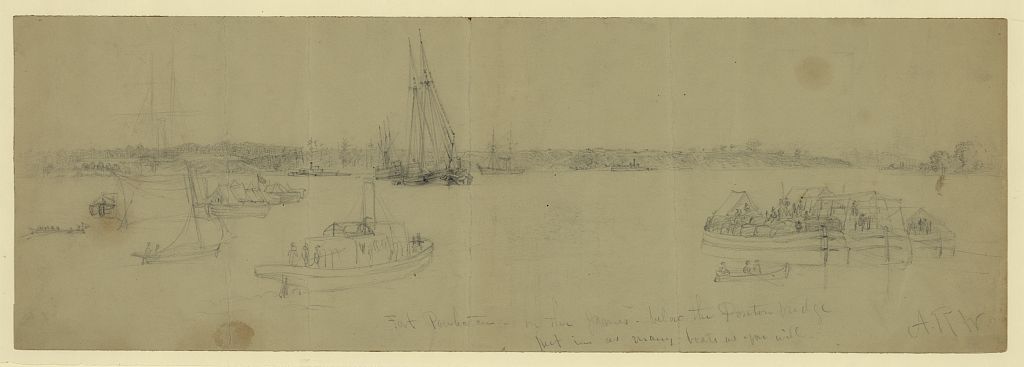
LC 22412. "Fort Powhatan--on the James--below the Pontoon bridge," drawing by Alfred R. Waud. The fort is on the far bluff at the left of the drawing.
Last updated 3/10/2022
