
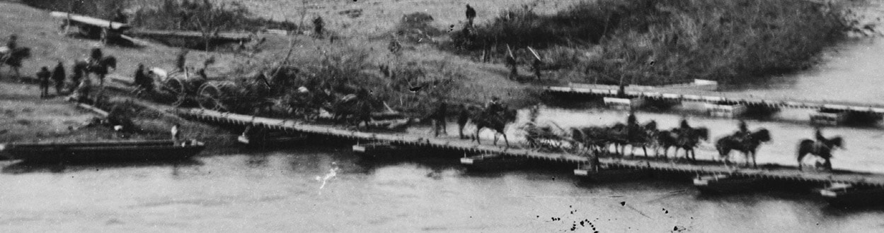
Pontoon Bridges in the Petersburg Campaign
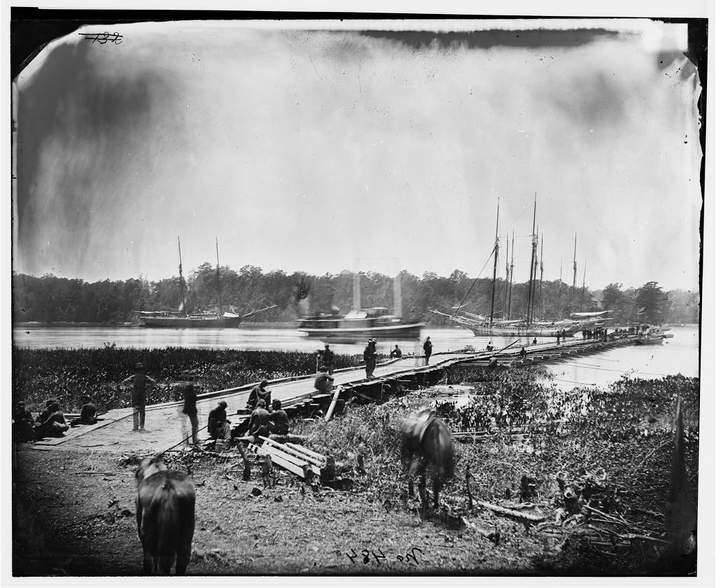
LC 03994. "[James River, Va. Pontoon bridge]," photograph by James Gardner. This is an image of the Great Pontoon Bridge at Weyanoke Neck, 2,100 feet long, by which much of the Army of the Potomac crossed James River, June 14-18, 1864.
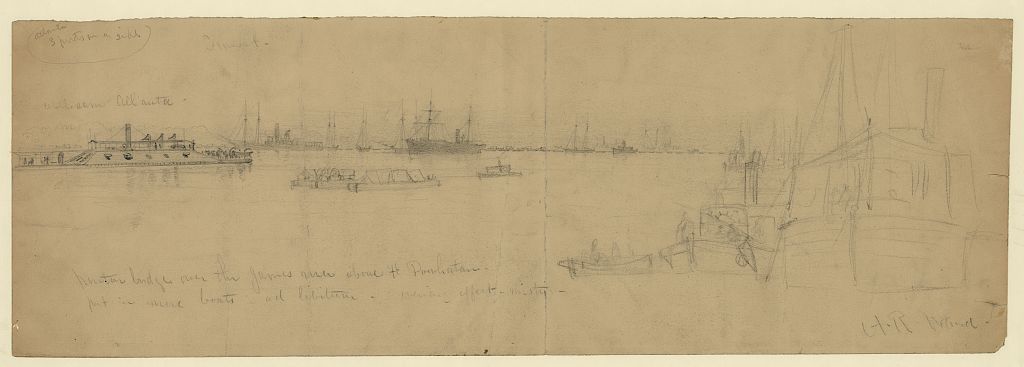
LC 22476. "Pontoon bridge over the James River above Ft. Powhatan," drawing by Alfred R. Waud. Notation: "put in more boats ad libitum; evening effect misty; Inscribed upper left Atlanta 3 ports on a side. Sunset; rebel ram Atlanta."
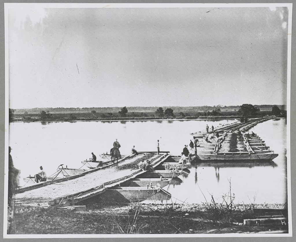
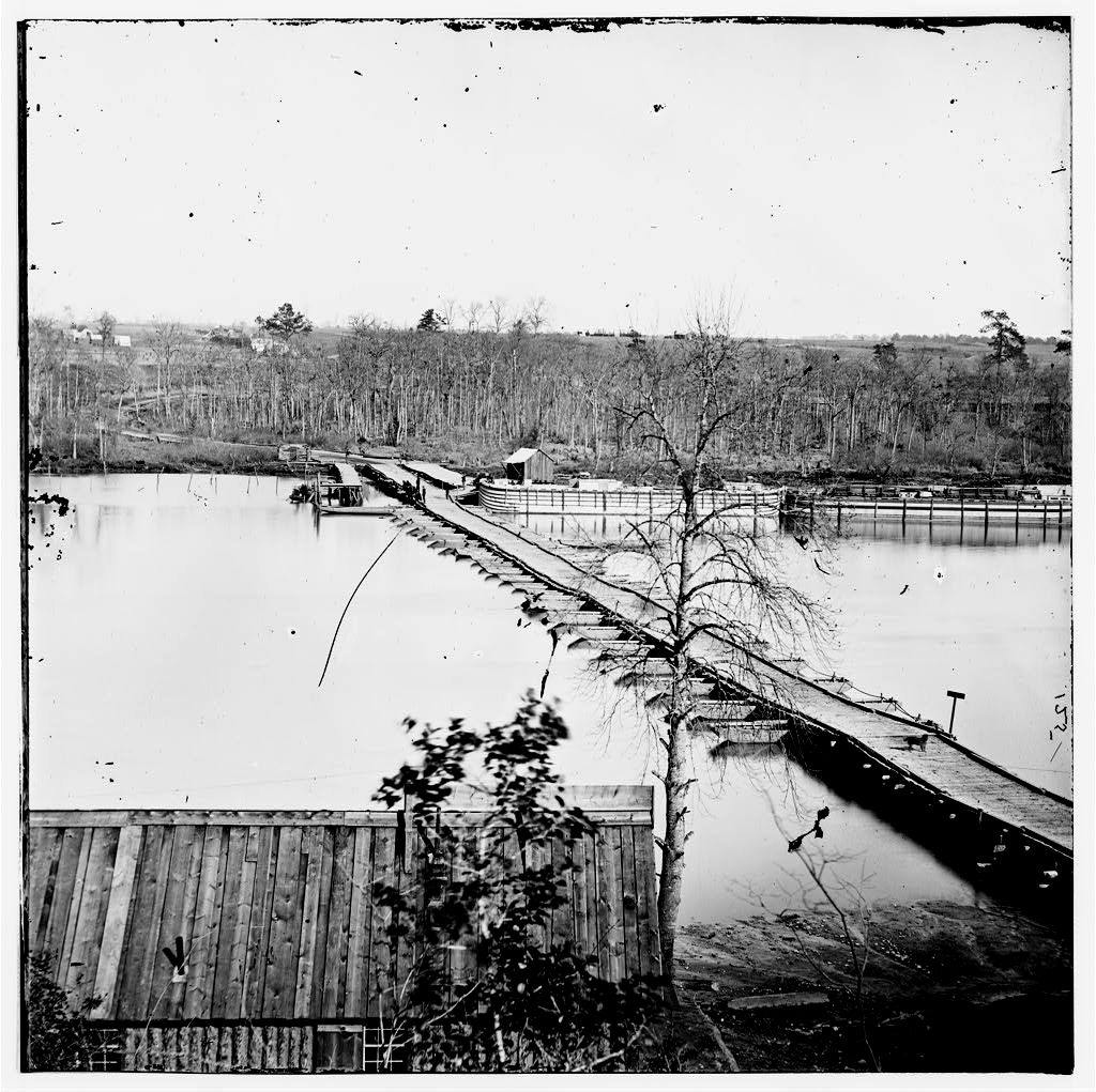
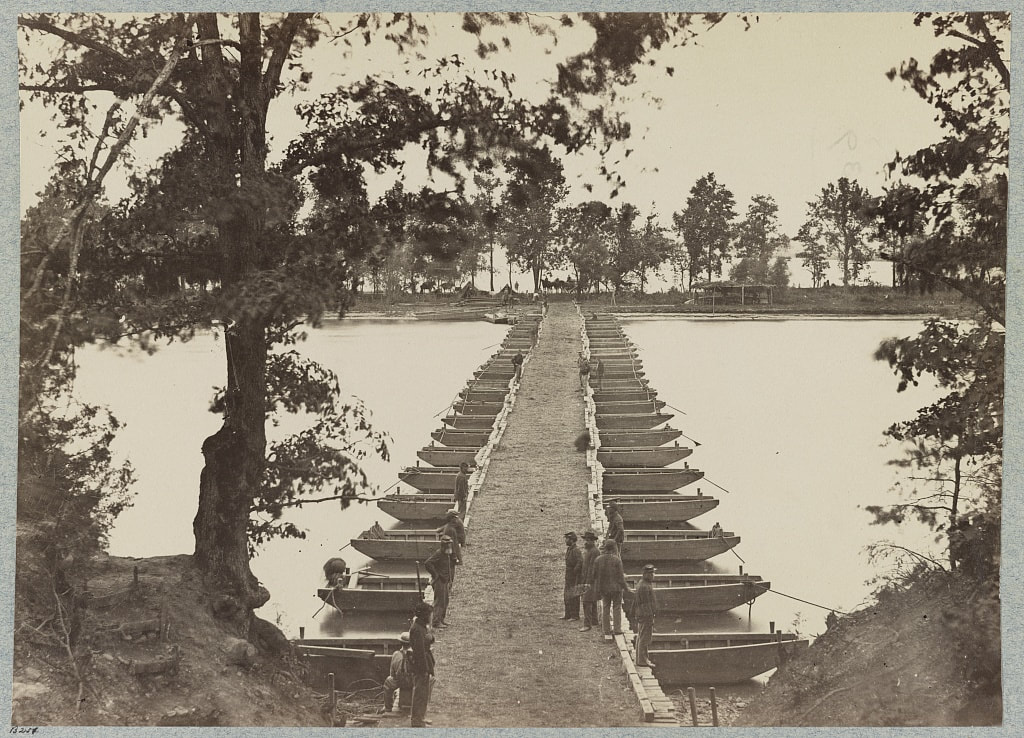
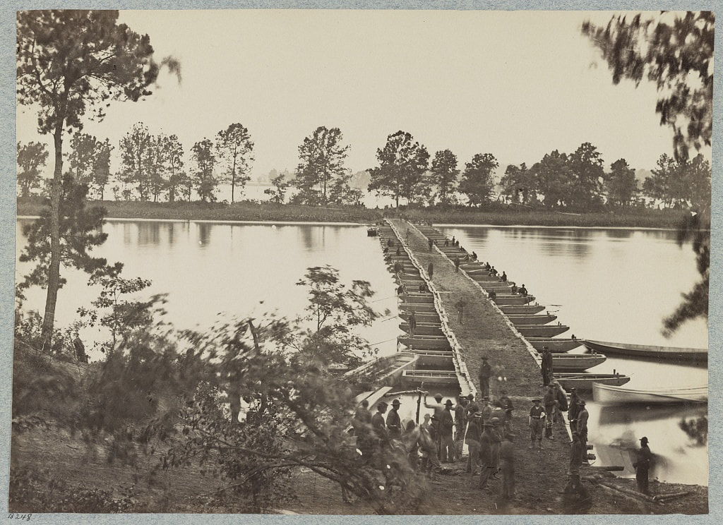
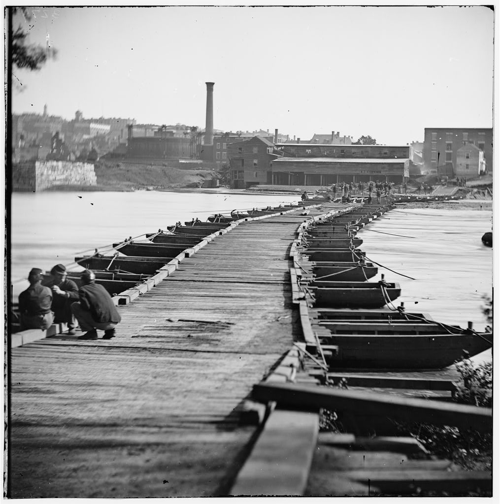
LC 33386. "Pontoon bridge"
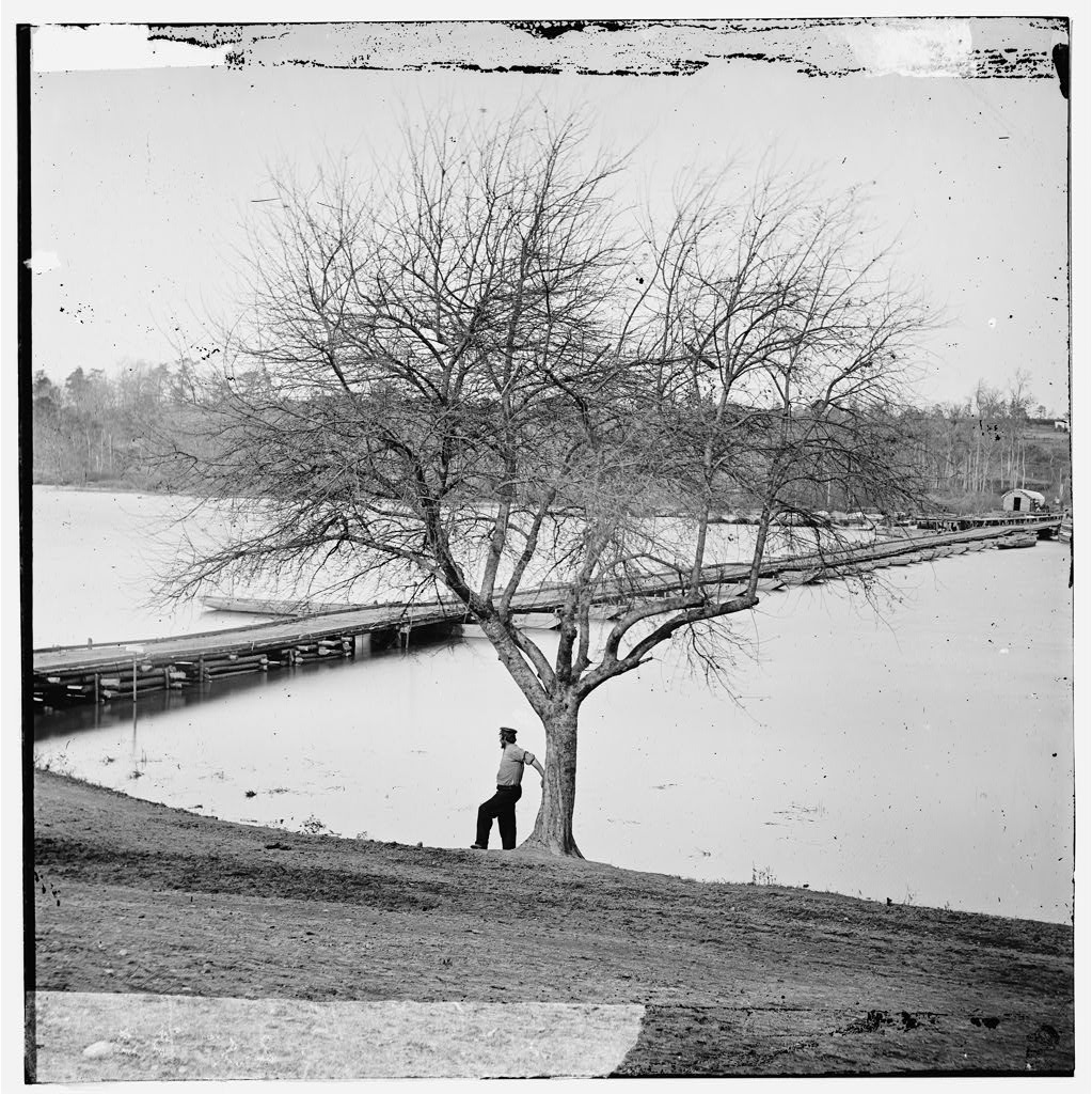
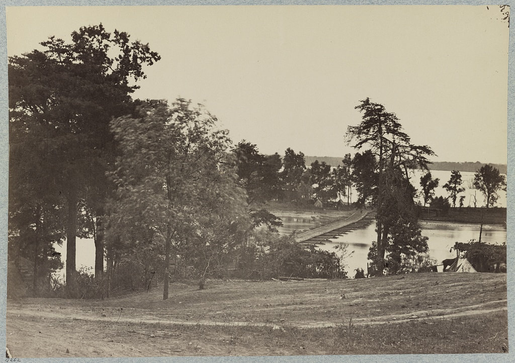
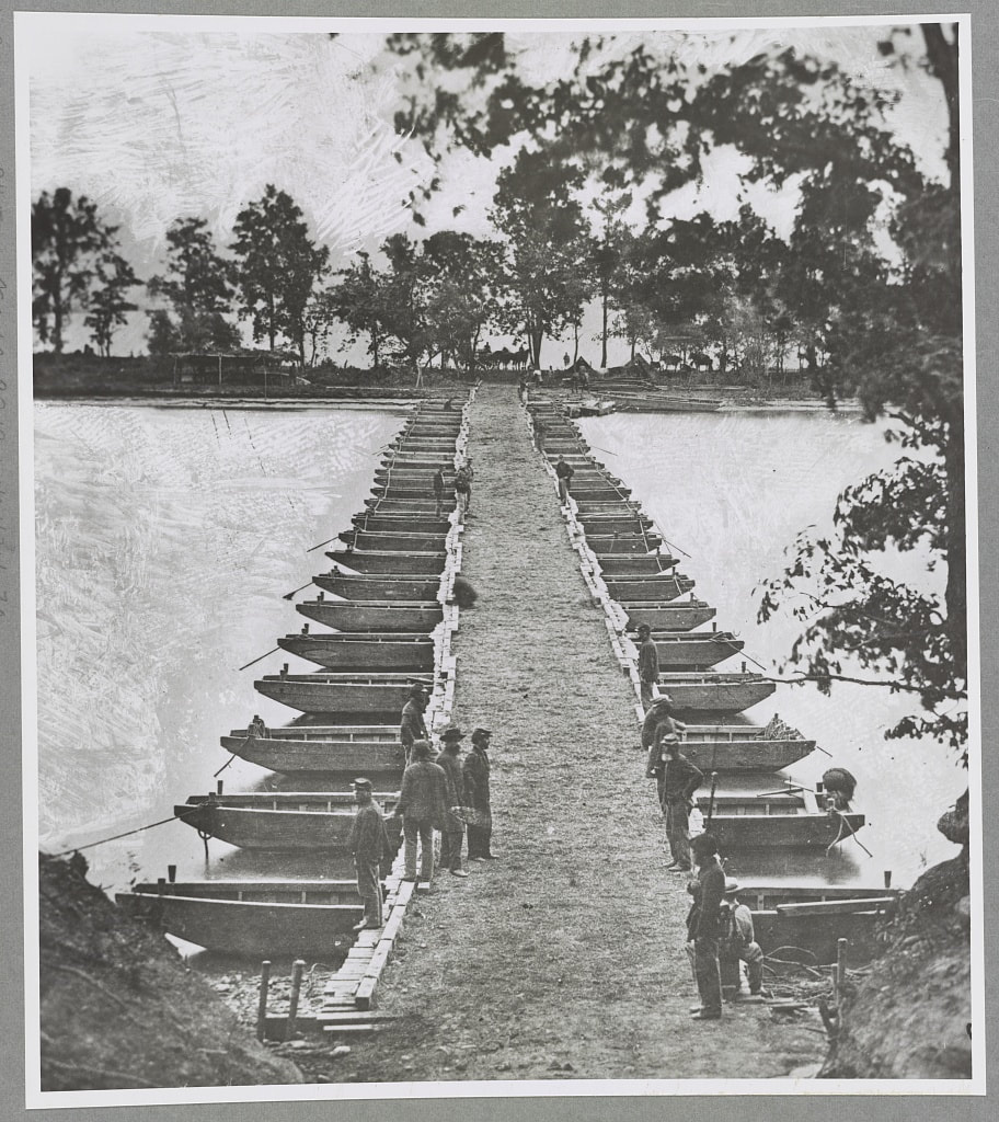
LC 1s02796. "A pontoon bridge on the James River; Stereograph showing a man standing near the middle of a pontoon bridge across the James River near Jones' Landing, Virginia." This is the same bridge shown in the following stereograph with the draft open.
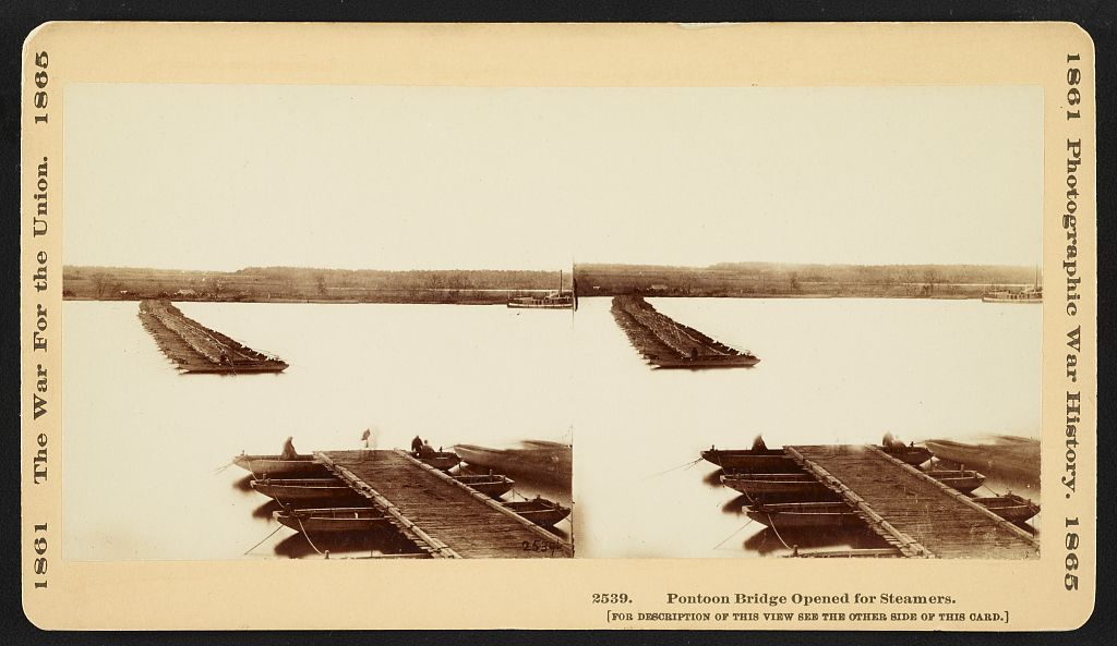
LC 1s02797. "Pontoon bridge opened for steamers; Stereograph showing a pontoon bridge across the James River near Jones' Landing, Virginia. A group of men have moved the pontoon boats holding up the bridge out of the way to create an opening which will allow steamers to pass through."
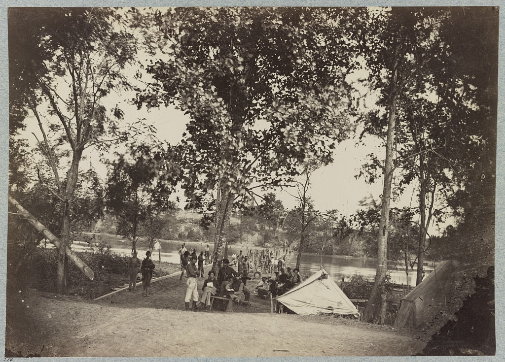
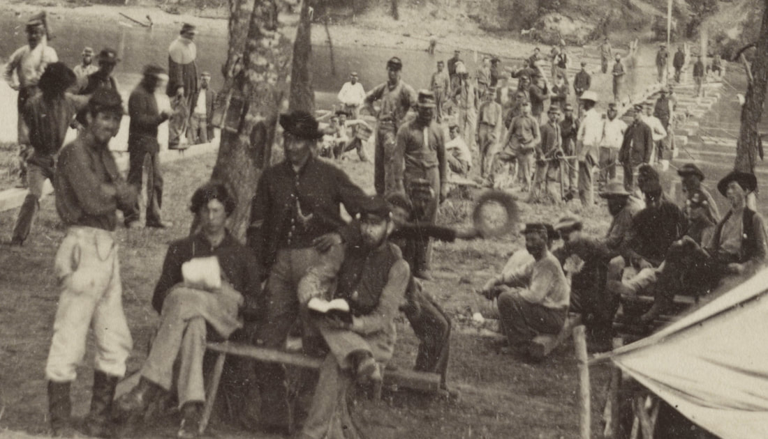
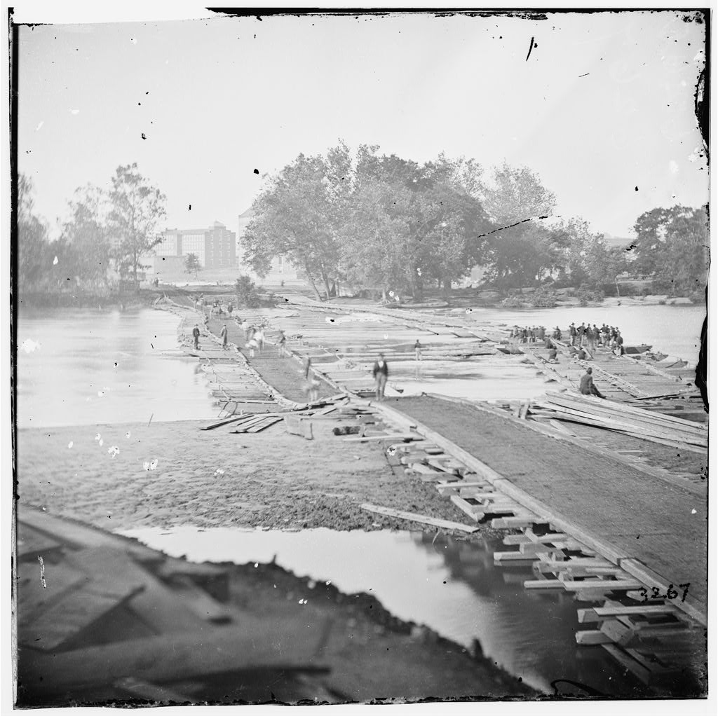
LC 02062. "[Broadway Landing, Va. Pontoon bridge across the Appomattox]," unattributed stereo view, looking north from the right bank. Please notice the dog at this end of the bridge.
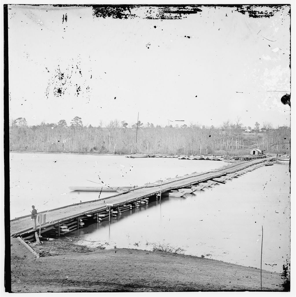
LC 01890. "Pontoon bridge across Appomattox, Va., below Broadway Landing, Va.," unattributed stereograph.
LC 01892. "[Pontoon bridge across the James River]," unattributed stereo view.This is the same bridge shown in the previous picture.
Recto: No text.
Verso: "The Army Under Gen. Baldy.Smith. Crossing the Appomattox River to attack Petersburg." Mullen, E. F., “Siege of Petersburg -The Army Crossing the Appomattox,” The Becker Collection, accessed April 29, 2019, https://beckercollection.bc.edu/items/show/2959.
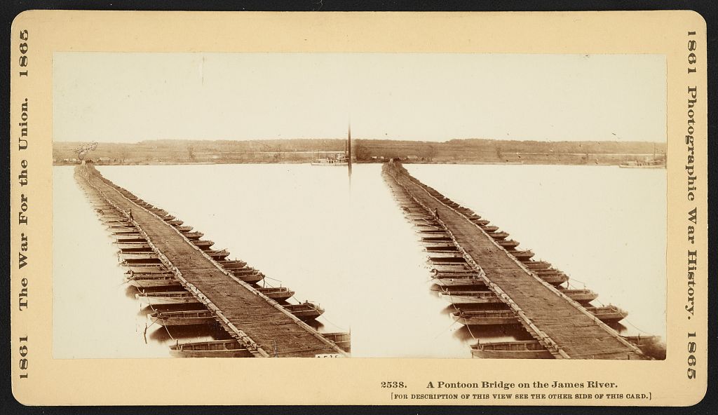
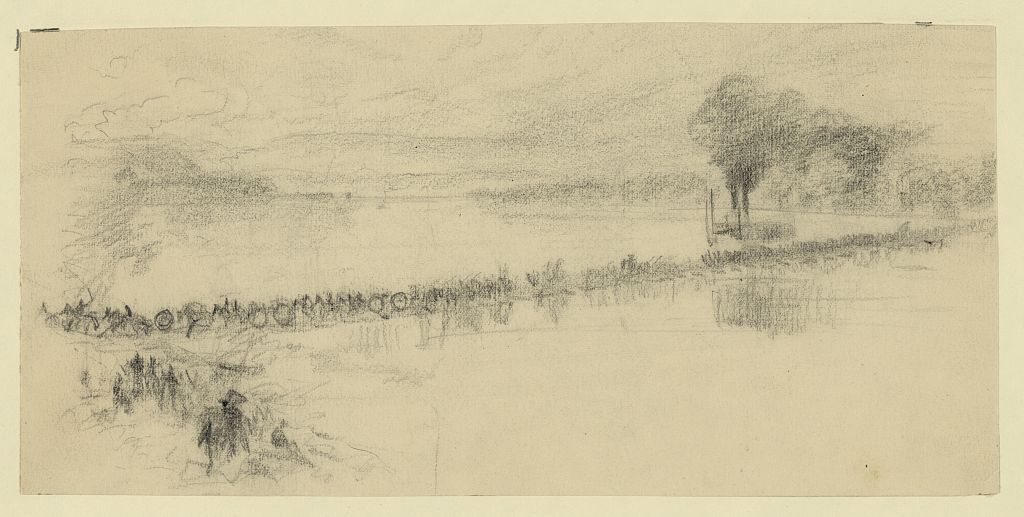
A Pontoon bridge on the James River
The boats and timbers forming this bridge are carried on wheels. When the army needs a bridge the boats are quickly launched, and anchored parallel [perpendicular?] with the current, the timbers are soon laid. A bridge is thus formed, strong enough to permit the army to cross with the cannons and trains. The boats are then taken up, placed on the wheels and are carried with the army.
The boats and timbers forming this bridge are carried on wheels. When the army needs a bridge the boats are quickly launched, and anchored parallel [perpendicular?] with the current, the timbers are soon laid. A bridge is thus formed, strong enough to permit the army to cross with the cannons and trains. The boats are then taken up, placed on the wheels and are carried with the army.
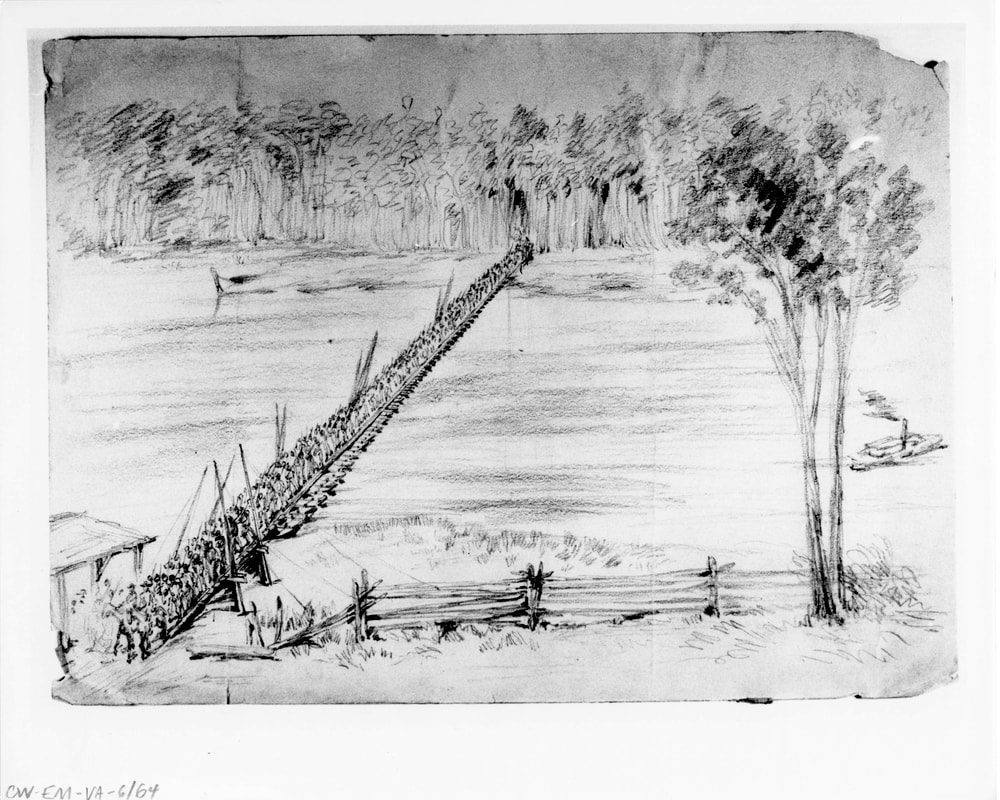
LC 20956. "Rough sketch of cavalry crossing, steamboat beyond bridge," drawing by Alfred R. Waud. It looks to me like a battery crossing followed by infantry. Even many of Waud's "rough sketches" contain accurate details.
Artillery caisson
|
Artillery limber
|
Not cavalry crossing. The end of a battery on the left with (perhaps) a forge wagon and two caissons. A mounted officer leading the column of infantry, middle of the bridge. The regimental flags may be seen at the center of the following column. Is the steamboat upstream or downstream from the bridge. Are there clues? Might that be Point of Rocks on the left?
|
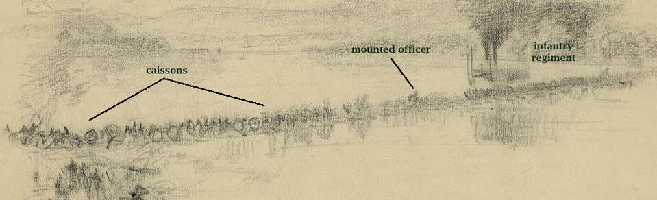
It is not unusual to have a faulty caption on these images. There is no mistaking the artillery caissons. The infantry regiment has its flags at the center of the column, perhaps unfurled for the river crossing occasion. You can see the company breaks in the column. Next question. Where was this pontoon bridge? Not the James River bridge. Deep Bottom? Broadway Landing?
LC 00327. "[Germanna Ford, Rapidan River, Va. Artillery crossing pontoon bridges]," detail of photograph by Timothy O'Sullivan, taken at the onset of the Overland Campaign. For comparing to the above sketch.
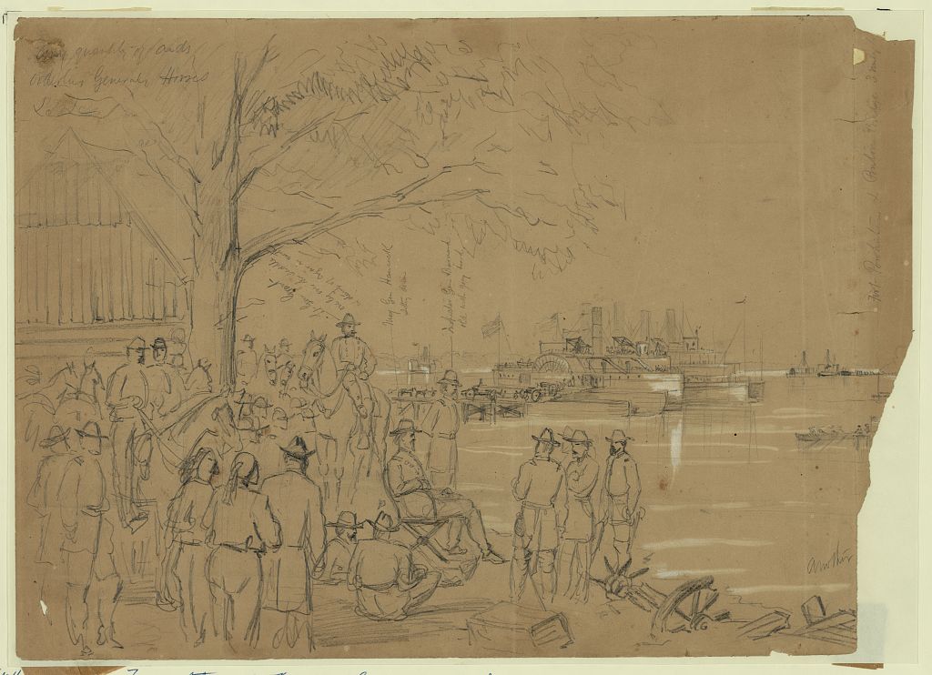
LC 21747. Gen Grant, Hancock & Staff watching the transportation of the Second Corps from Wilcox Landing to Windmill Point across the James River. William Waud, June 14, 1864. Inscribed upper left: Any quantity of aids[sic], orderlies Generals Horses &c. &c.
Inscribed lower right: another [image cropped]
Inscribed within image, vertically, with arrow indicators: Lt Gen Grant one leg over the saddle & stump of cigar in mouth; Maj Gen Hancock sitting down; Inspector Gen Barnard old with grey beard; Fort Powhatan & Pontoon bridge 3 miles to.
Published in: Harper's Weekly, July 9, 1864, p. 436.
Pontoon Bridges at Deep Bottom
July 26-27, First Deep Bottom: "General Hancock and General Sheridan marched in the afternoon of [July} 26th, and about two o'clock in the morning of the 27th, the Second Corps, followed by the cavalry, began crossing the James. There were two ponton bridges at Deep Bottom (the north end of Jones's Neck is so called), one just above the mouth of Bailey's Creek, the other just below it; the creek is about twelve miles from Richmond; it is four or five miles long, running from north to south, crossing the Central or Darby road (at Fussell's mill), the Long Bridge road, and the New Market or river-road. It was impassable near its mouth, and probably from its character there gave rise the the name of Deep Bottom. General Foster of the Tenth Corps held the two ponton Bridges. There was considerable force of the enemy intrenched opposite the upper bridge, but their line appeared to extend only a short distance beyond. General Hancock determined to cross by the lower bridge, and turn the enemy's left flank, while General Foster threatened them in front. The Second Corps and cavalry were over the river before daybreak, and as soon as it was light, moved forward, the cavalry on the right." --A. A. Humphreys, Virginia Campaign of '64 and '65, pg. 248.
Overview map showing general area, highlighting importance of connecting the AoP and AoJ with pontoon bridges across Appomattox River at Point of Rocks and Broadway Landing. Later expanding from Jones Neck to Deep Bottom and Strawberry Plains to create an offensive bridgehead north of James River.....
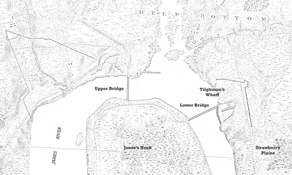
Detail of Michler 8"=1 -mile with addition of pontoon bridge locations from Military Atlas, Plate 67:7. Map annotated by D. Lowe
LC 33355. "Pontoon bridge at Deep Bottom, James River, Va.," unattributed photograph, likely Russell. Taken from the right bank, view from Jones Neck to Strawberry Plains. This is suggested to be the Upper Bridge at Deep Bottom, but details link it to the series of photos below. Assembled in August 1864.
LC 33355 detail. This is the engineer crew that built this bridge for the Second Deep Bottom operation in August 1864. They look hot and tired, but proud of their achievement.
LC 33369. "Lower Pontoon bridge at Deep Bottom, James River, Va.," unattributed photograph, likely Russell. View is from north (left) bank of the river, Curles Neck or "Strawberry Plains," to Jones Neck and upriver.
LC33368. "[Lower] Pontoon bridge at Deep Bottom, James River, Va.," attributed to Capt. Andrew J. Russell. The sentry at this end of the bridge is holding his weapon properly at support arms.
LC 33385. "Pontoon bridge across the James River," photograph by Andrew J. Russell. This appears to be a reverse print of the above photo.
LC 33367. "Pontoon bridge at Deep Bottom, James River, Va.," unattributed photograph, but possibly Andrew Russell, see previous photo.
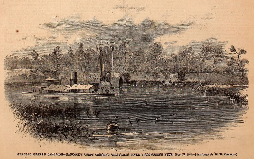
Hancock's Second Corps Crossing from Jones's Neck to Deep Bottom Landing, dated July 28, 1864. A view of the Upper Pontoon bridge from a sketch by W.W. Charles, published in Harper's Weekly, August 20, 1864.
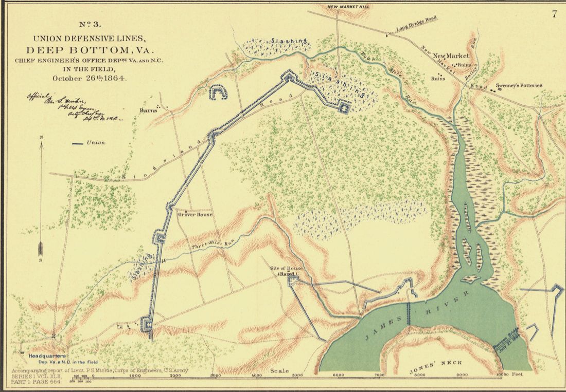
Official Military Atlas Plate 67:7, showing placement of pontoon bridges across James River during the Deep Bottom operations. The upper bridge anchored at Deep Bottom Landing, the lower at Strawberry Plains Landing.
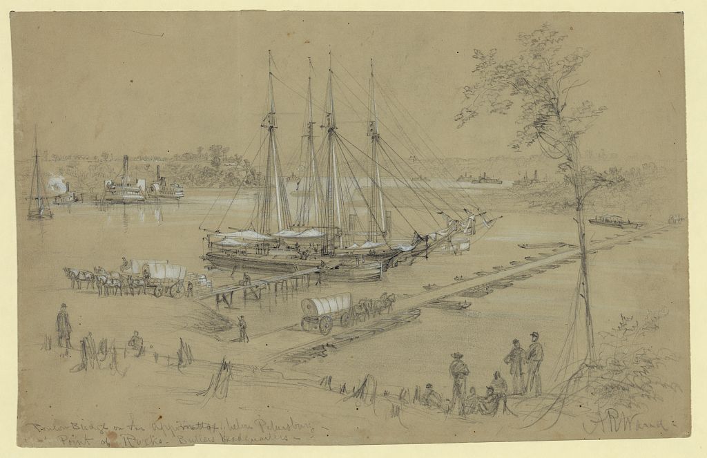
LC 21426. Ponton [sic] Bridge on the Appomattox below Petersburg--Point of Rocks--Butlers headquarters. Signed lower right: AR Waud.
Title inscribed lower left.
Published in: Harper's Weekly, July 23, 1864, p. 472 The drawing was erroneously credited to William Waud when it appeared in Harper's.
LC 21701. Jones Neck from Gen R.S. Fosters Head Quarters at Deep Bottom. William Waud, June-July, 1864.
Inscribed on verso with title: between 3 & 4 miles from Malvern Hills and on the same side of the James River showing the Pontoon bridge & the double end gun boats protecting one of his flanks. Gen Foster has an entrenched position here which is likely to become the base of operations for movements of importance. When the object of this position is more fully developed I will send other sketches of it. W.W.
Published in: Harper's Weekly, July 23, 1864, p. 468.
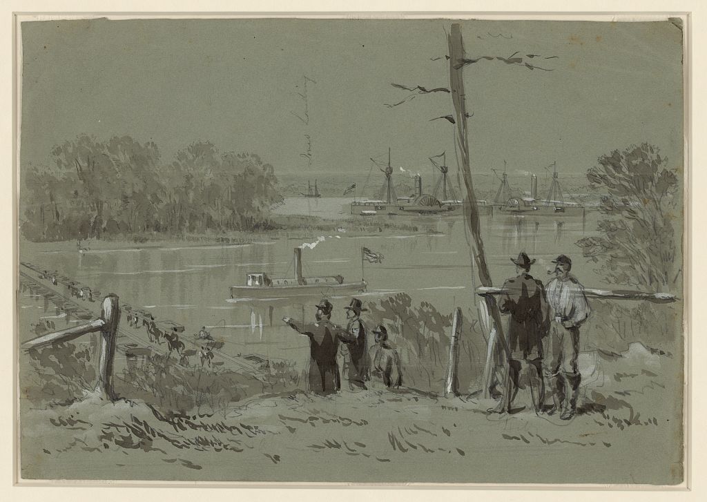
LC 22507. View from Weitzels lookout & sig[nal] tower; Bermuda hundred looking south. William Waud, 1864. Inscribed after title: shewing [sic] the Pontoon Bridge, Spring Hill Fort, the course of the Appomattox River & position of Gun Boats, Fort Clifton (rebel), Petersburg in the distance being shelled from out lines.
Inscribed above image from left to right: City Point; B- Point of Rocks landing; Point of Rocks; C The Chamberlain. Gen Graham's Flag Boat; D The Putnam; Woods on Fire; Broadway Landing; Woods on Fire; Troops moving; Dust - Troops moving; Spring Hill Fort; obstructions in the river made of piles of sunken boats &c to prevent the union boats ascending; The Clifton Rebel Battery; Troops moving; Petersburg, shelling along the lines; A - The Commodore Perry Gun Boat picketing the river.
Published in: Harper's Weekly, July 23, 1864, pp. 472-473.
An Often Misidentified Photograph (Even Here!)
It was pointed out by astute observer Aaron Rowland that the photograph on the left from the Library of Congress (LC 02736), labelled "Petersburg, Virginia. Pontoon bridge," is likely an image of a pontoon bridge over James River looking from Manchester towards Richmond. The image on the right (LC 02724) is labelled "Richmond, Va. Pontoon bridges across the James, looking toward Manchester." The right-hand bridge in this photo appears to be the same as that in the photograph on the left, the same bridge viewed from opposite banks.
|
|
