
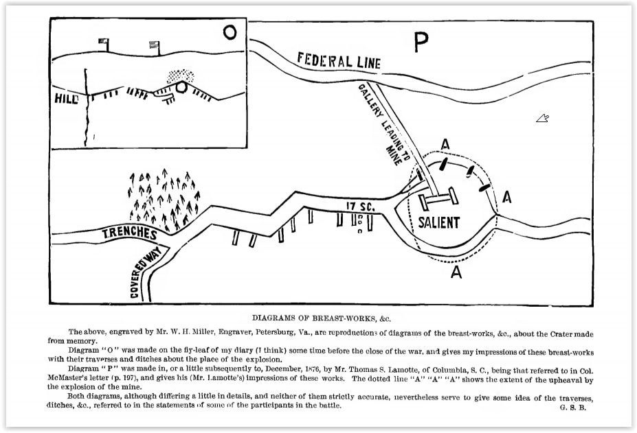
"The Mine"
Barnard's Sketch of the Crater --National Archives
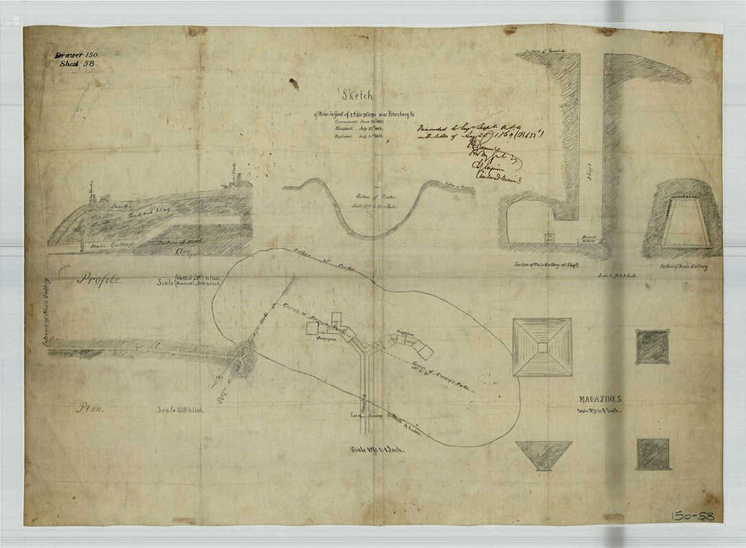
J. G. Barnard. "Sketch of the Mine in Front of the 2d Div. 9 Corps near Petersburg, VA" [NARA RG 77: Dr. 150-58 Entry 2.245]
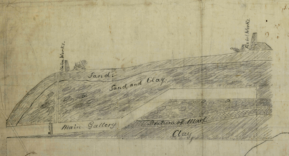
Detail from Barnard's "Sketch of the Mine," above.
|
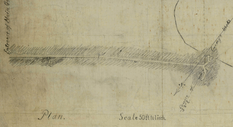
Detail from Barnard's "Sketch of the Mine," above.
|
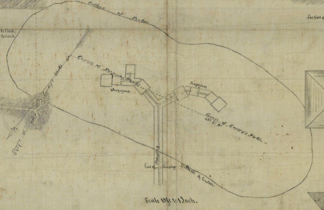
Detail from Barnard's "Sketch of the Mine," above.
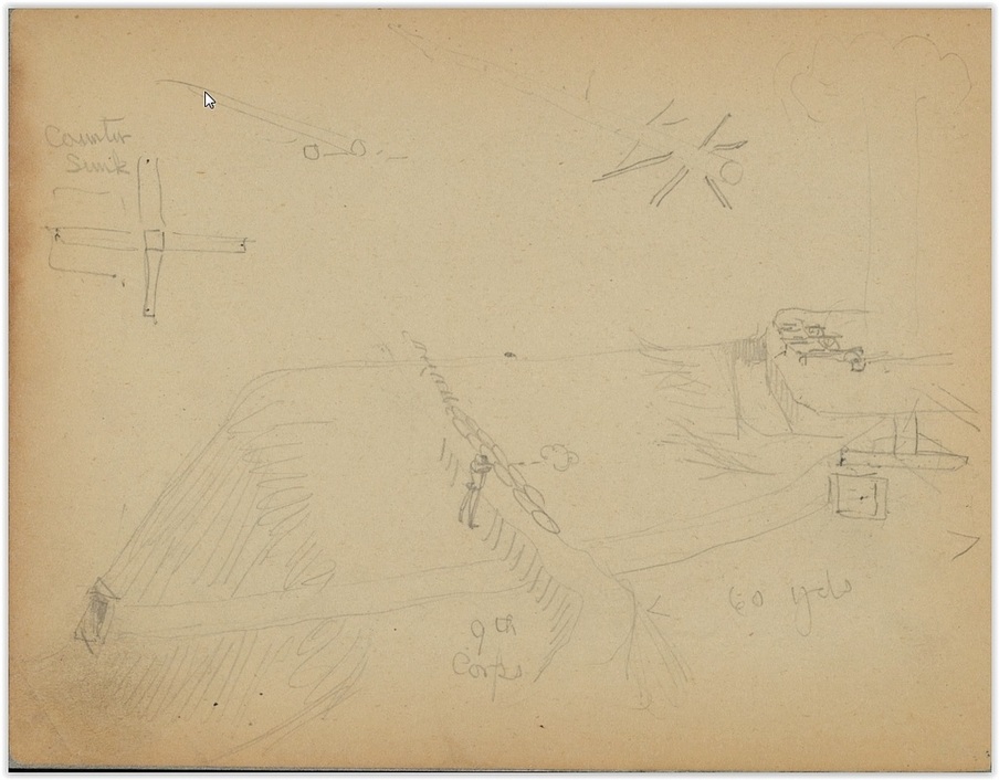
Charles Wellington Reed's depiction of the Federal mine. Library of Congress, Manuscript division, Reed papers.
July 30th, 1864. Artists' Depictions of The Crater.
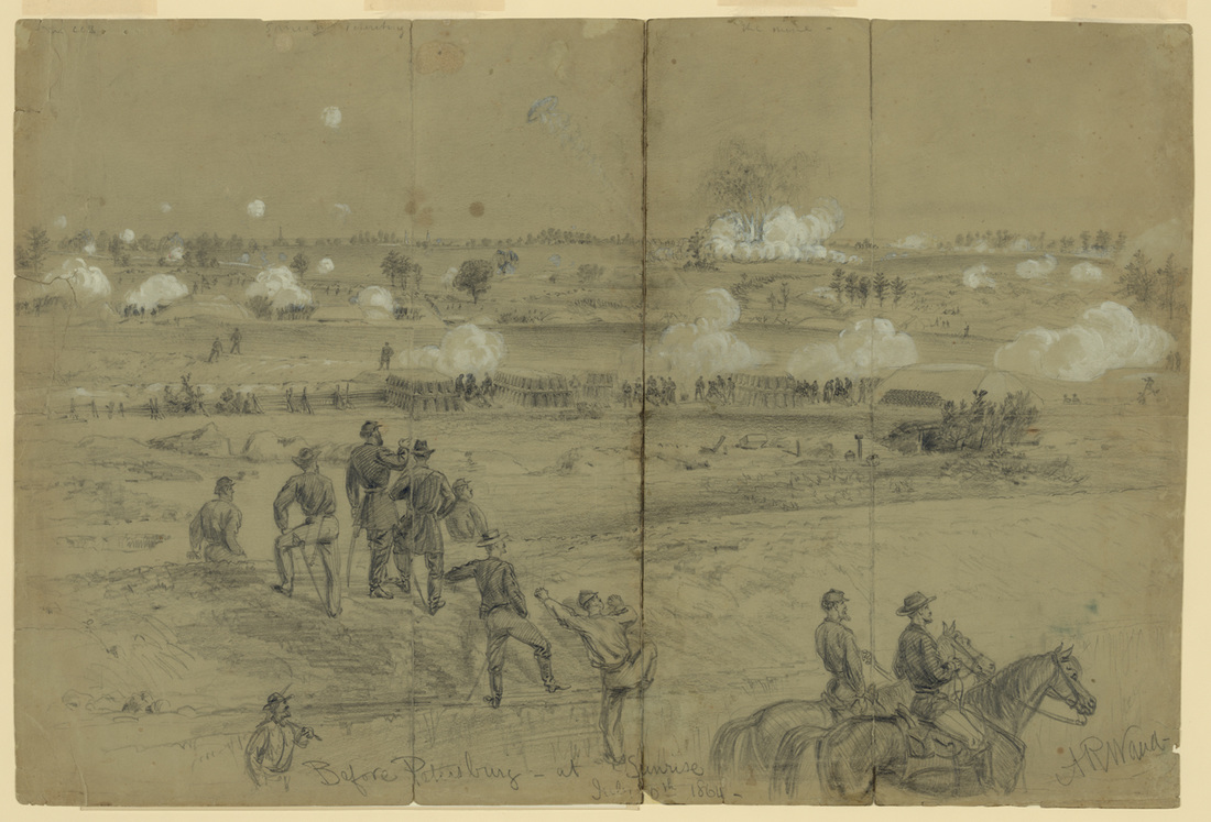
"Before Petersburg at Sunrise, July 30th 1864," sketched by Alfred R. Waud, LC Waud, no. 727 B size (22452).
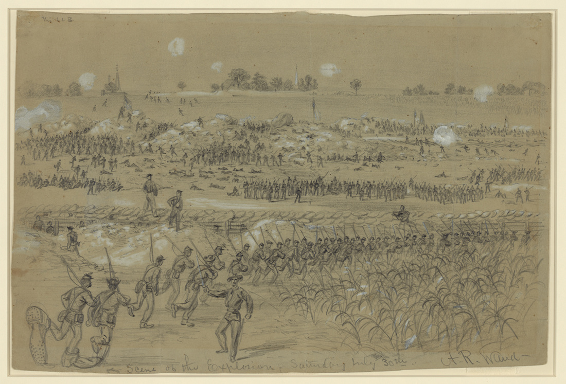
"Scene of the explosion Saturday July 30th," sketched by Alfred R. Waud, LC Waud, no. 156 A size (20996).
|
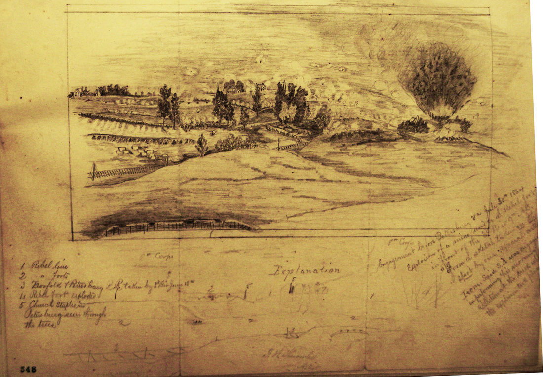
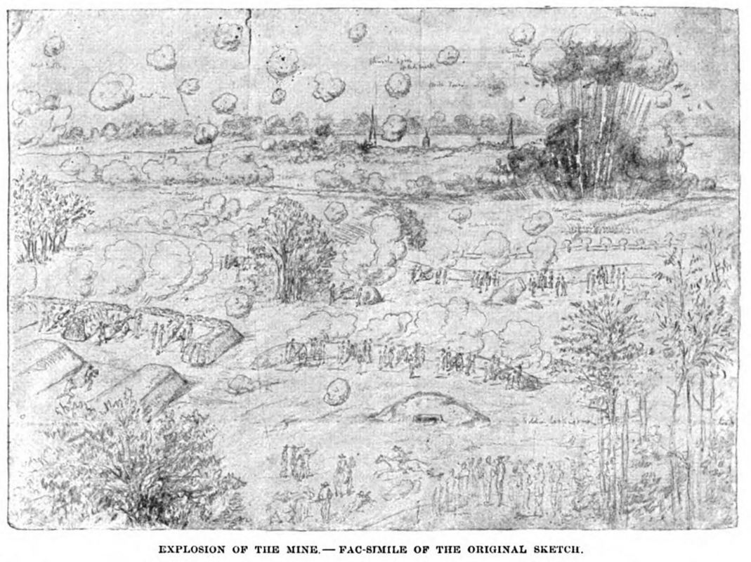
"Mine Explosion, July 30th, 1864," sketch by Charles Wellington Reed, LC Reed Papers, image photographed by Philip Shiman. Reed drew from the perspective of the 5th Corps front.
|
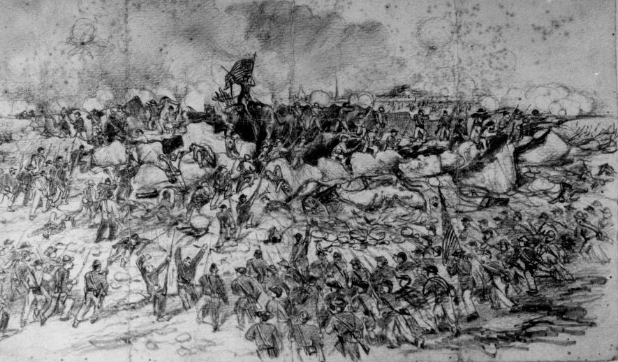
Becker Collection 22484 detail. "Siege of Petersburg -- Charge into the Crater." Andrew McCallum, artist.
Sketch by Joseph Becker, published in the American Magazine, vol. 37 (1894): 749.
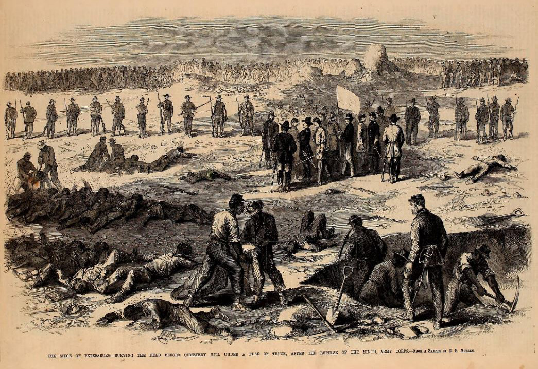
"Burying the Dead Before "Cemetery Hill Under a Flag of Truce After the Repulse of the Ninth Army Corps," woodcut after a sketch by E. F. Mullen, Leslie's Illustrated Newspaper, September 3, 1864.
"After the repulse on the 30th, Gen. Burnside sent a flag of truce to ask leave to remove our wounded and bury our dead. On the 1st of August a reply was given and working parties, white and colored, sent out. Our Artist sketches the terrible scene. The bodies, after lying in a midsummer sun for two days were terribly altered; swarms of flies gathered around those remains of the gallant fellows who fell. The rebel works swarmed with men, and in front was a line of guards. In the intervening space, between this and our line, the men were busily at work, committing to earth the remains of their comrades. Near the guards our officers met rebel officers at the flag. Among the latter were Gen. Cooper and Gen. Mahone, among the former Gen. Ferrero. Our dead amounted to 300 in all, less than had been supposed. The time given for the truce was from five A.M. to nine, after which hostilities commenced, but in reality only random musketry firing was heard." -- Frank Leslie's Illustrated Newspaper, September 3, 1864.
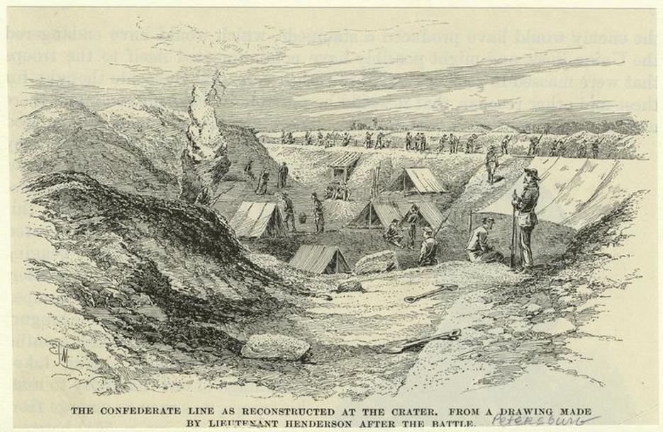 New York Public Library . The Confederates reestablished their line after the explosion.
Postwar Photographs of the Crater
"Fortifications on the Petersburg lines," a view of the Crater taken at the end of the war [LOT 4166-E, no. 29]. Photographer unidentified.
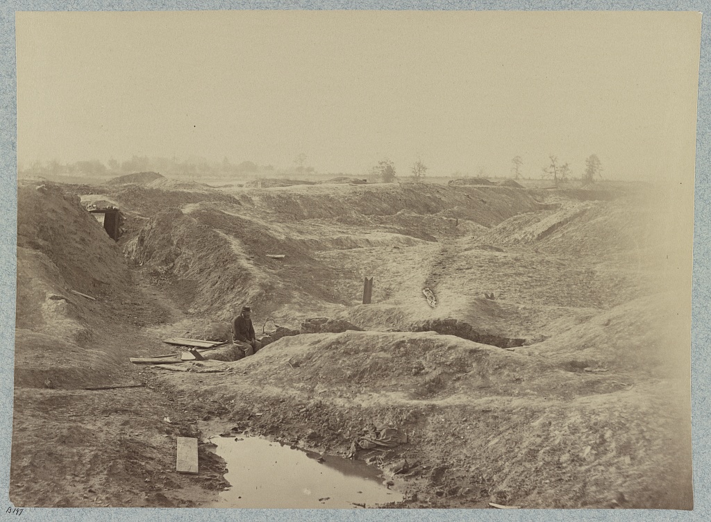
"Interior of the Crater," postwar photograph (c. 1870), photographer unknown, collections of the USAMHI.

"No. 878. Crater, Petersburg, VA," postwar photograph, photographer unknown, New York Public Library. Note the encroaching vegetation.
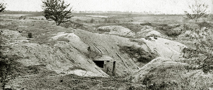
The Crater, circa 1870. NPS files.
|
The Crater, circa 1870. NPS files. The rebuilt Taylor farm can be seen in the distance. Note the rampant erosion in the foreground.
|
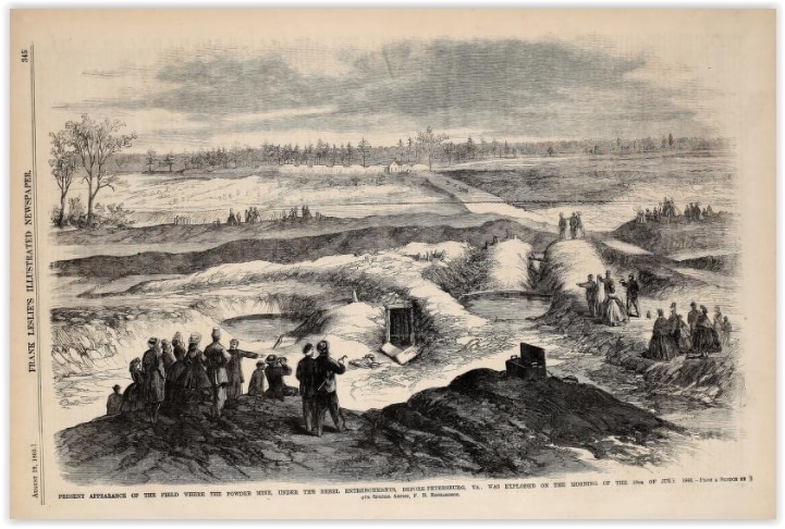
Frank Leslie's Illustrated Newspaper published this view from the Crater on August 19, 1865, approximately a year after the mine explosion and four months after the end of the war.
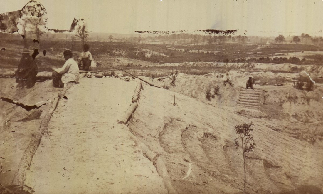
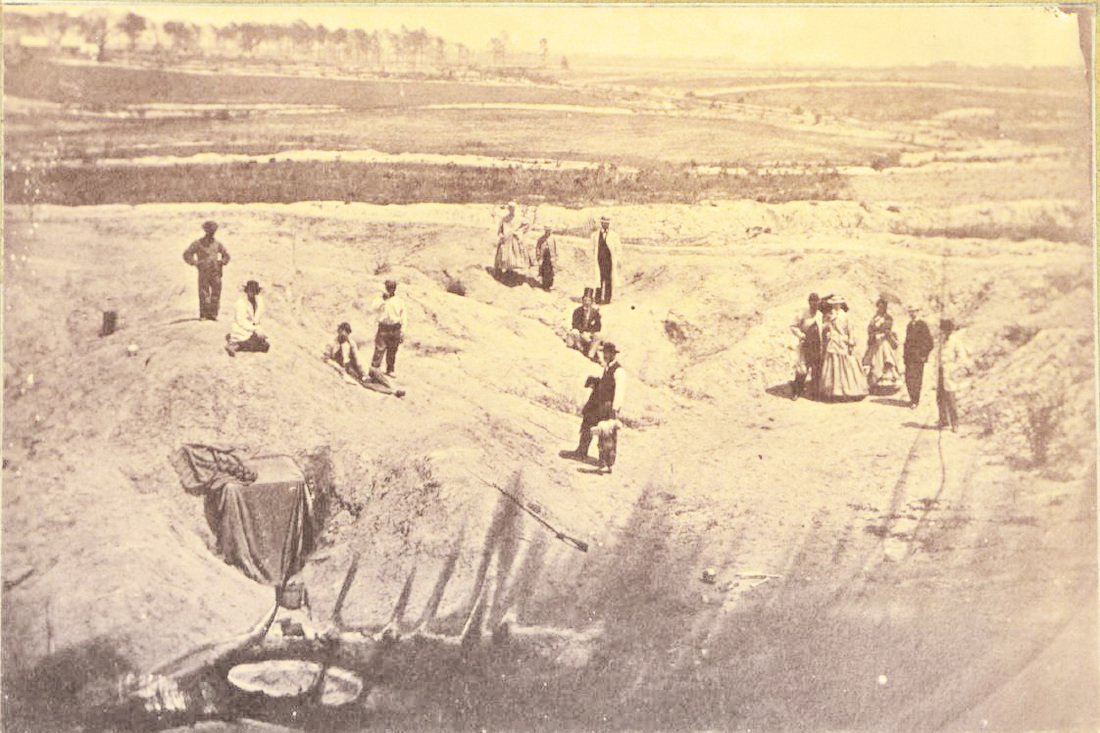
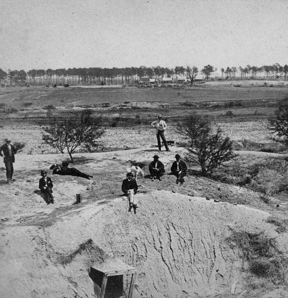
The Crater, circa 1870. NPS files. Notice the stairs and terraced seating for tour groups.
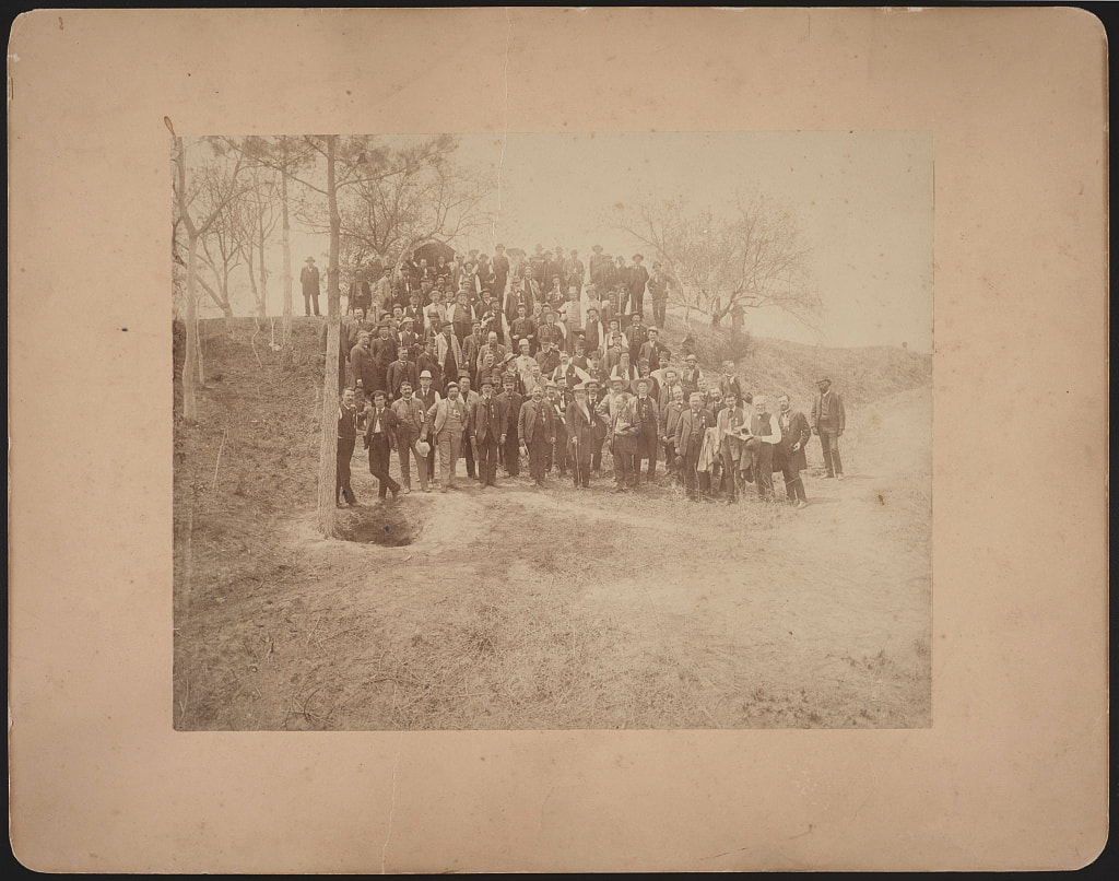
LC 56346. "[Civil War veterans of the 57th Massachusetts Infantry Regiment with Confederate General William Mahone at the crater caused by Union soldiers exploding a mine at Petersburg, Virginia]", May 1887.
A More Modern Comparison ....
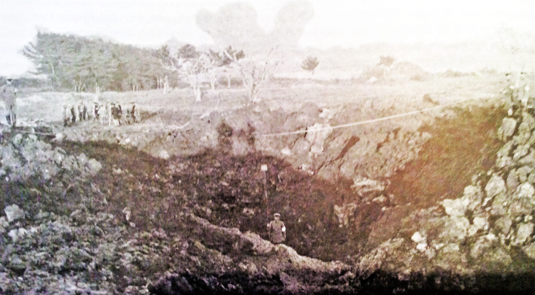
Kokura, Japan, 1890s. Practice mine in clayey ground. This is how the Petersburg crater may have appeared just after the explosion of July 30, 1864. Barton and Doyle, Beneath Flanders Fields (2007), pg. 38.
