Manuscript Maps Used to Compile the 8" = 1 mi. Engineers Series Immediately after War's End
These four manuscript maps of the eastern and western fronts of the Petersburg defenses were produced by Federal topographical engineers and surveyors of the Army of the Potomac shortly after the end of the war (1865-1867). Recently identified by the Petersburg Project, these maps are shown here together for the first time. The insets allow you to zoom in fairly closely.
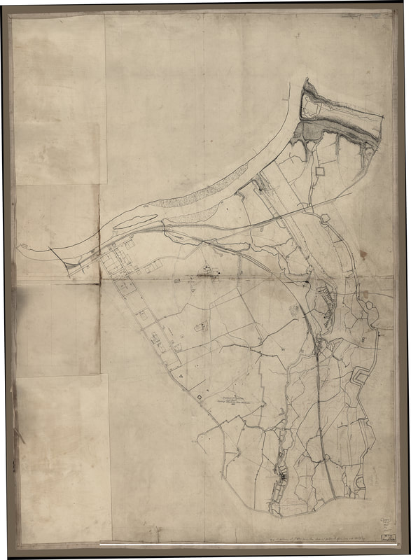
The first map from the Library of Congress, entitled "Map of defenses of Petersburg, Virginia, showing the position of General Lee and his staff during the attack on Fort Stedman, March 25, 1865", depicts the area south of the Appomattox River to Baxter Road near the Crater, east of Jerusalem Plank Road, and west of the main Federal line of siegeworks. The X marking the location of "General Lee and his staff" (lower left center) was secondary to the purpose of the map, which was to capture in detail the Confederate defenses. Many detailed maps of Federal defenses were produced during the war. Confederate defenses, on the other hand, could not be mapped until evacuated for obvious reasons. This map was finished in India Ink with contour intervals drawn in in red ink. Many pencil lines indicate the locations of survey stations and sight lines, as well as obscure details such as mines and countermines.
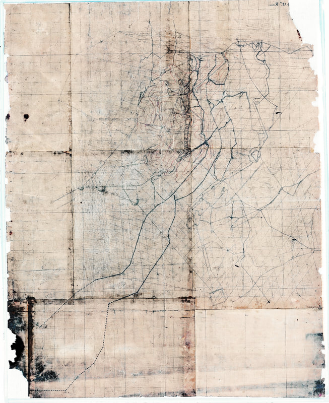
The second manuscript map shown here from the National Archives was filed with another manuscript and labeled "Untitled Virginia County - Norfolk Stage Road, Norfolk Rail Road, and Virginia Main Line." This map continues coverage from the Baxter or Norfolk Stage Road south to Fort Davis on the Jerusalem Plank Road. Of special interest is the area around Union Fort Sedgwick and Confederate Fort Mahone, "Forts Hell and Damnation," toward the center of the page. This map represents an intermediate step in transferring raw data from the surveyors' notebooks onto a larger, coherent map. Features are measured and drawn in on graph paper. The map includes the draftsman's scale bar and annotations, each small square on the page being 33 feet and each larger square being 330 feet. Earthworks are shown in detail. Contours are drawn in with red ink in the same hand as that of the first map.
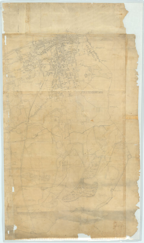
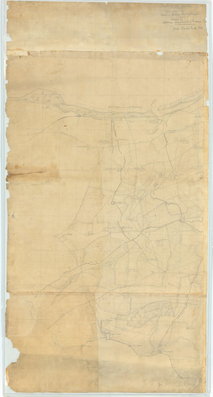
The third and fourth manuscript maps show here from the National Archives were entitled simply "Petersburg and Vicinity." Number three continues the coverage west of Jerusalem Plank Road, including the city of Petersburg in meticulous detail and extends south past Fort Davis, curiously leaving out the area around Federal Fort Sedgwick that is shown on the above map. Number four abuts the city sheet on the west and continues coverage down Boydton Plank Road. These maps are drawn in pencil. All of the Union and Confederate lines are shown in great detail.
These are four of a number of preliminary maps that were incorporated into an 8 inch = 1 mile map series that covered the areas of Petersburg and Richmond in 28 sheets. This series, compiled under the direction of Nathaniel Michler, is found at NARA RG77: G 204-33 through G204-60. We are pleased to have these maps as they show details that are not found elsewhere. These documents represent simply the finest surveying of the war at Petersburg. As the maps are in various stages of completion, the series provides a record of the process used by the military topographers to go from the ground survey to the finished product.
LC Map Collection G3884.P4S5 1865 .P3 Vault : CW 607.2; Digital ID 3884p cw0607200
Recently Identified Manuscript Map
The National Archives is in the process of scanning high-resolution images of its extensive Civil War holdings in Record Group 77 Records of the Office of the Chief Engineer. The map below joins the map above at the Baxter or Norfolk Stage Road, the companion piece of the same survey, apparently by the same team. There are similarities in style, lettering, and inks, such as using red lines to represent contour intervals on both maps. Also both maps are works in progress, crisscrossed with surveyed lines connecting stations. The map above is the more finished work, having been transferred from graph paper to plain paper for the sake of clarity. Unfortunately, the map below suffered from the lesser quality paper and some type of exposure. The original is barely legible in places. This version was rotated 90 degrees counterclockwise and tweaked in PhotoShop to bring out the ink and pencil lines showing the main features of earthworks, roads, and terrain. It was necessary to reduce the size of the image to reproduce it here. Please consult the links to view the original image.
Two More Identified Manuscript Maps from the Michler Post War Series in the National Archives

[Mss Map 3]. "Petersburg and Vicinity, Virginia." This manuscript map from RG77 covers the area from the Jerusalem Plank Road west, including the city of Petersburg, and south along Weldon Railroad to the Union siegeworks at Fort Wadsworth. The next map abuts this one on the left (west). Both maps are contained in the same link at NARA.
Last Updated 10/14/2021 DWL


