
Evolution of the Federal line east of Fort Wadsworth: Batteries XXVII and XXVI
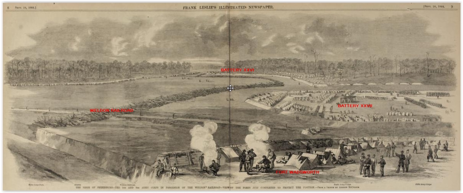
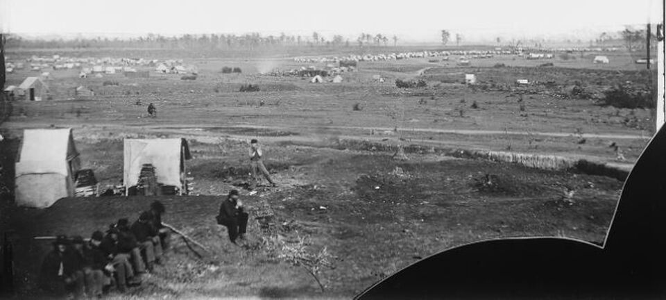
THE SIEGE OF PETERSBURG--THE 5TH AND 9TH ARMY CORPS IN POSSESSION OF THE WELDON RAILROAD- VIEW OF THE FORTS JUST COMPLETED TO PROTECT THE POSITION. This sketch by Andrew McCallum is taken from the location of the future Fort Wadsworth looking east along the U. S. line of fortifications sometime before the publication date of September 24, 1864, in Frank Leslie's Illustrated Newspaper.
This view of the Federal line of fortifications looking east across the Weldon Railroad did not look like the end of the war Michler maps of the vicinity that we generally look at for guidance on the layout of the works. The battery labeled 27 with five guns just to the east of the railroad did not exist at the end of the war. Was artist McCallum relying on his imagination, or does he accurately depict the lines and camps behind them? The discrepancy between the early siege and end of siege maps and images are actually not surprising- both sides reconfigured their lines to make them more efficient as the military situation evolved. See our discussion of the Grand Medicine Pow-Wow, when the lines east of the Jerusalem Plank Road were shortened, for a discussion of changes on a broader scale. In this case, in September 1864, Fort Wadsworth anchored the western-most extension of Union earthworks and blocked the Weldon Railroad and Halifax Road, important transportation links to the city. Many troops are bivouacked behind the lines as they work on pushing the Union presence to the west. McCallum was accurate as of September 1864. By April 1865, Battery XXVII was leveled and the line straightened.
Subject: Grand Medicine Pow-wow
Subject: Grand Medicine Pow-wow
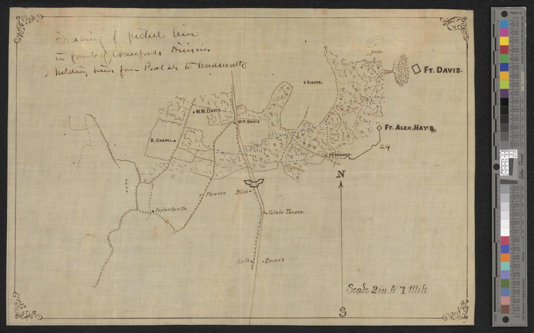
This undated map is captioned "Tracing of picket line in front of Crawford'sDivision, Including lines from Bat 24 to Wadsworth". Clements Library< University of Michigan.
 Title of a map in RG 77, NARA- not shown. Details from the full map are below
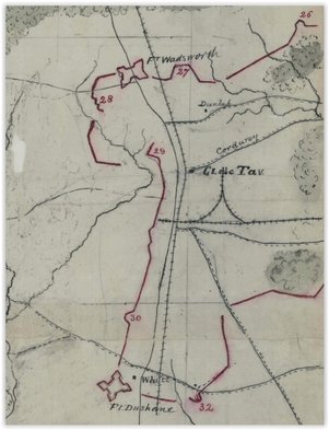
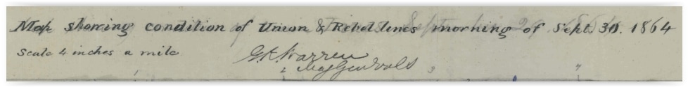
Detail of the map above, showing the westernmost Federal fortifications as of September 30, 1864, This is the day the Federals launched an attack further west at Peebles Farm.
|
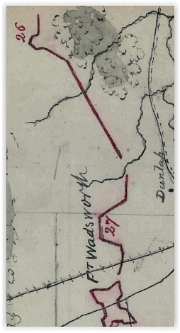
The section of the above map depicted in McCallum's sketch, reoriented, with east at the top of the detail, in order to show how accurate McCallum's depiction was, as of September 1864.
|
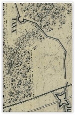
Detail of end of the war Michler Sheet 11. Battery XXVII is no longer extant. although Battery XXVI remains the same.
|
Gilbert Thomas of the U. S. Engineers describes construction of this sector of the U. S. line:
September 6. Company C left camp, in marching order, and joined Company D, in camp at the Williams house. Details from Company D laid out six batteries and a long line of rifle pits. This included the rear line selected September 1, and Batteries 26, 27, and 28.
Gilbert Thompson, “The Engineer Battalion in the Civil War: A Contribution to the History of the United States Engineers”. Number 44, Occasional Papers, Engineer School, U.S. Army. Press of the Engineer School, 1910: p 84.
Gilbert Thompson
New: U. S. Engineers at the Williams House
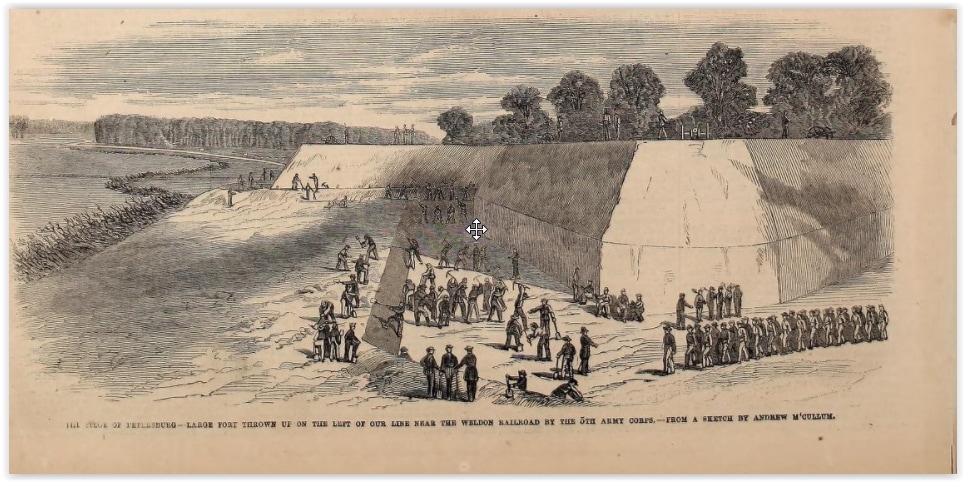 The SIEGE OF PETERSBURG--LARGE FORT THROWN UP ON THE LEFT OF OUR LINE NEAR THE WELDON RAILROAD BY THE 5TH ARMY CORPS--FROM A SKETCH BY ANDREW M'CULLUM [McCallum]. This sketch, also in Frank Leslie's Illustrated Newspaper on September 24th, shows Fort Wadsworth near completion. The McCallum sketch at the top of the page seems to shows the ditch on the north of Fort Wadsworth and the infantry trench north of the fort, while this sketch illustrates the still extant west wall of the fort.
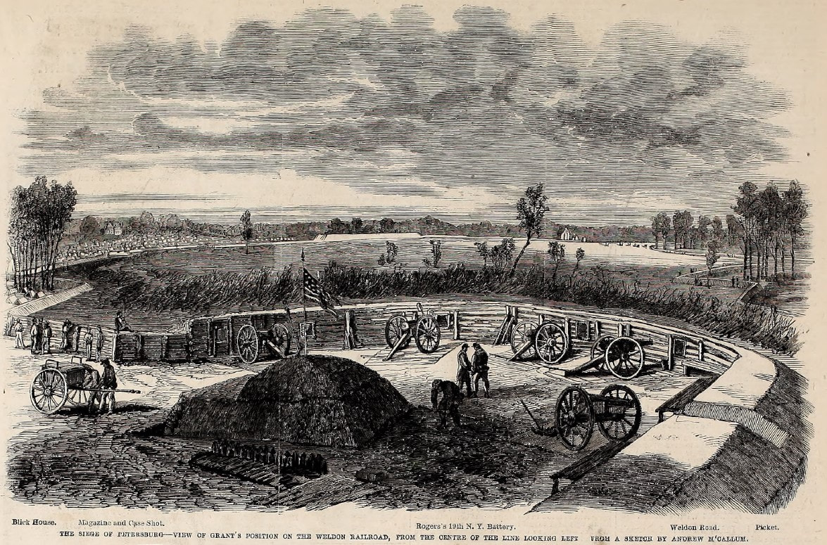
"The Siege of Petersburg -- View of Grant's Position on the Weldon Railroad, From the Center of the Line Looking Left, From a Sketch by Andrew McCallum. Blick House, Magazine and Case Shot, Rogers' 19th NY Battery, Weldon Road, Picket." Woodcut published in Frank Leslie's Illustrated Newspaper, October 10, 1864.
