The Petersburg Project
  • Home
    • About Us
  • Blog and Updates
  • Postwar Visit to the Battlefields 1866
  • Civil War Combat Trenching
  • Views of the City of Petersburg
    • Petersburg Panorama 1865
    • Steeples of Petersburg
    • Petersburg Mill Photographs
  • The Mine Explosion and its Crater
  • Petersburg in Pencil and Ink
    • Alfred R. Waud, Special Artist at Petersburg >
      • Waud Drawing of 5th Corps Fortifications
    • William Waud, Special Artist
    • Charles H. Chapin, Special Artist
    • Joseph Becker, Special Artist at Petersburg
    • Edwin Forbes, Special Artist at Petersburg
    • Winslow Homer, Special Artist
    • Edward Mullen, Special Artist at Petersburg
    • Andrew W. Warren, Special Artist
    • Enlisted Artists >
      • Charles Wellington Reed
      • Andrew McCallum
      • Francis Knowles
      • James William Pattison
      • Herbert Valentine
      • Howard A. Camp
  • Petersburg Photographs --So Many!
    • Dimmock Battery 5 Photographs >
      • Working with Photographs
    • City Point
    • City Point Wharf Explosion, Aug. 9, 1864
    • Fort Rice?? We don't think so!
    • Federal Picket Line, Jerusalem Plank Road
    • Egbert Guy Fowx, Photographer at Petersburg
    • Timothy O'Sullivan, Photographer at Petersburg >
      • Harrison's Creek USCT Camps
      • Fort Morton and Baxter Road Group
      • Fort Haskell Panorama and Bomb Proofs
      • Fort Stedman Group
      • Gracie's Salient Group
      • Camp of the 50th N. Y. Engineers
    • David Knox, Photographer at Petersburg
    • William Redish Pywell, Photographer at Petersburg
    • John Reekie, Photographer at Petersburg
    • Thomas C. Roche, Photographer at Petersburg
    • Andrew J. Russell, Photographer at Petersburg >
      • "Fort Mahone" CS Batteries 25 & 27
  • U. S. Military Railroad
    • Terminus of Military R. R. at City Point
    • City Point to Clark's Station
    • Pitkin's Station to Shooting Hill
    • Hancock's Junction/Jerusalem Plank Road
    • Parke's Station
    • Warren's Station
    • Patrick's Station
  • Topographical Engineers -- Our Heroes
    • Grand Medicine Pow-wow
    • Michler's Reports from Topographical Department
    • John E. Weyss, Cartographer
    • William H. Paine, Cartographer
    • Gilbert Thompson
    • Albert Hanry Campbell, C.S.A. Cartographer
  • Confederate Maps
    • Confederate Defenses 1862
    • Gilmer-Campbell Maps, 1864
    • Stevens Map July 1864
    • Fields of Fire
    • Campbell Dinwiddie County 1864
    • Coit's map of the Crater Battlefield
  • Federal Maps
    • Army of the Potomac, Routes of the Corps to Petersburg
    • June 9 1864, Kautz Attack
    • June 18, 1864-Federal Engineers Maps
    • June 18, 1864, 18th Corps
    • June 19, 1864, Engineers Map
    • June 21, 1864, Federal Engineers Maps
    • June 22, 1864. Second Corps at Jerusalem Plank Road
    • June 29, 1864. Dept of VA and NC
    • June 30, 1864 -- XVIII Corps Map
    • June-July, Undated Federal Engineers Map-
    • July 29, 1864, Engineers Map, Annotated
    • July 1864 Map of XVIII Corps Lines
    • Crater, Native American Perspective of the Crater
    • August 1864, Michie Map - Bermuda 100
    • August 28, 1864, Michler Map
    • Aug.-Nov. 1864 Two Base Maps
    • September 13, 1864, Recon Map
    • Sept. 13-Oct.25 versions. Redoubts and Batteries
    • September 30, 1864, Warren Map
    • October 1864, Two IX Corps Maps
    • October 20, 1864. Benham's map of defenses of City Point
    • Nov. 2, 1864, Army of the Potomac
    • 1864, Coast Survey Map of Petersburg
    • Michler Map Series 1865-1867
    • 1864-1867, Michler-Weyss, Siege of Petersburg
    • 1865-1867, Manuscript Survey Maps
    • 1871, Map of Recapture of Ft. Stedman
    • 1881, Boydton Plank Road
  • Confederate Forts and Batteries
    • Dimmock Line >
      • Priest Cap
      • French Rifle Pits
    • Fort Clifton
    • "Fort Mahone" CS Batteries 25 & 27
    • Confederate 8-inch Columbiad
    • Leadworks
  • Federal Forts and Batteries
    • Union Battery Ten (X)
    • Fort Alexander Hayes
    • Fort Avery
    • Fort Conahey
    • Fort Davis & Battery XXII
    • Fort Fisher
    • Fort Meikel --Photographic Views
    • Fort Morton
    • Fort Patrick Kelly
    • Fort Sedgwick, better known as Fort Hell,
    • Fort Wadsworth -- the Evolution
    • Fort Willcox or Battery XVI
  • Battlefield Features
    • Aiken House
    • Armstrong's Mill
    • Avery House
    • Bailey/Johnston Farm
    • Blandford Church
    • Broadway Landing, Appomattox River
    • The Crater
    • Cummings House
    • Dams and Inundations
    • WW Davis Farm
    • Dunn House
    • Friend House >
      • View from Friend House toward Gibben complex and Petersburg
    • Gibbons Properties
    • Globe Tavern / Weldon Railroad
    • Gregory House
    • Griffith Farm
    • Gurley House
    • Hare House Hill
    • The "Horseshoe"
    • Jerusalem Plank Road
    • Jones House
    • Jordan House
    • Newmarket Racecourse
    • Pegram's Farm
    • Peebles Farm, Pegrams Farm, Poplar Springs Church
    • Shands House
    • Taylor Farm >
      • The Ice House
      • Surviving Taylor Barn
    • Williams House
  • Signal Towers and Trees
    • Some Operations of the Signal Corps at Petersburg
  • Archeology
    • Geology of the Crater
    • Fieldwork -- Petersburg
    • Civil War Sinks
    • Deserted Confederate Camp
    • Gracie's Countermine
    • LIDAR Forts and Batteries
  • Articles, Papers, Presentations
    • Shiman: A Note on Maps
    • The Siege Landscape: Through Fire and Ice at Petersburg
    • "The Rebel in the Road"
    • "A Strange Sort of Warfare Underground"
    • Lost Trenches of Petersburg: June 17
    • Between the Lines
    • Combat Trenching: An Introduction
    • Lowe -- Post-War Topographical Survey
    • Civil War Maps and Landscapes -- Observations
  • Kittens, Puppies & Ponies
  • Executions!
  • Notes on Leveled Earthworks
  • Depot Hospital at City Point
  • Pontoon Bridges
  • The Great Pontoon Bridge Across James River
  • Captain Robert Davis CSA

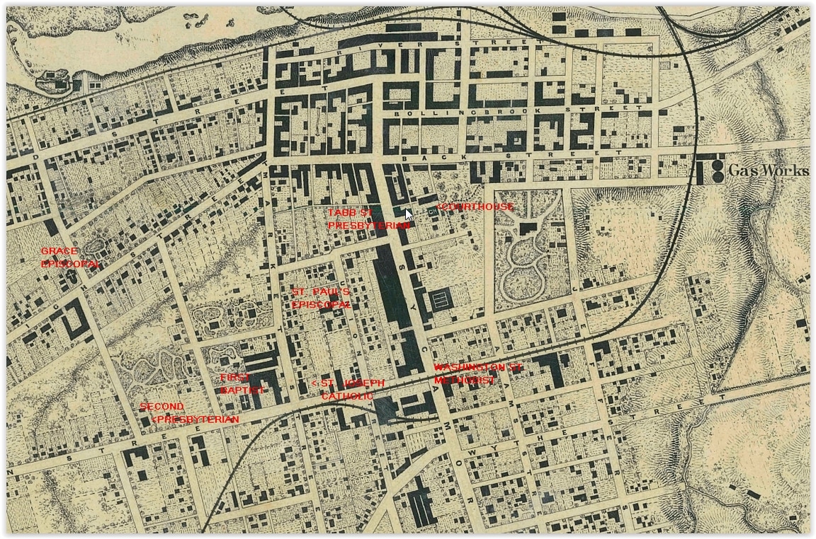
STEEPLES of Petersburg

Picture
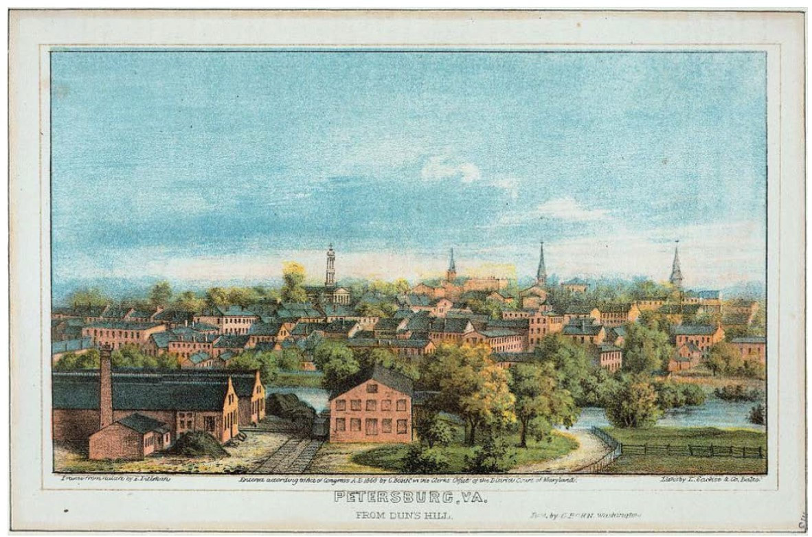
"Petersburg, Va., from Dun's Hill," lithograph artist E. Dielman, printer E. Sachse & Co. Balto, publisher C. Bohn, 1866.
Picture
Picture
Picture
St. Joseph's Catholic Church (left), Market Street Methodist Episcopal (center), First Baptist (right). Clarification submitted by Mark Jacob 07/2024.
Picture
Market Street Methodist Episcopal Church from historic photo.
Picture
More recent image of Market Street M. E. Church. Mark Jacob points out that the tower's finials are visible in the historic photograph.
Picture
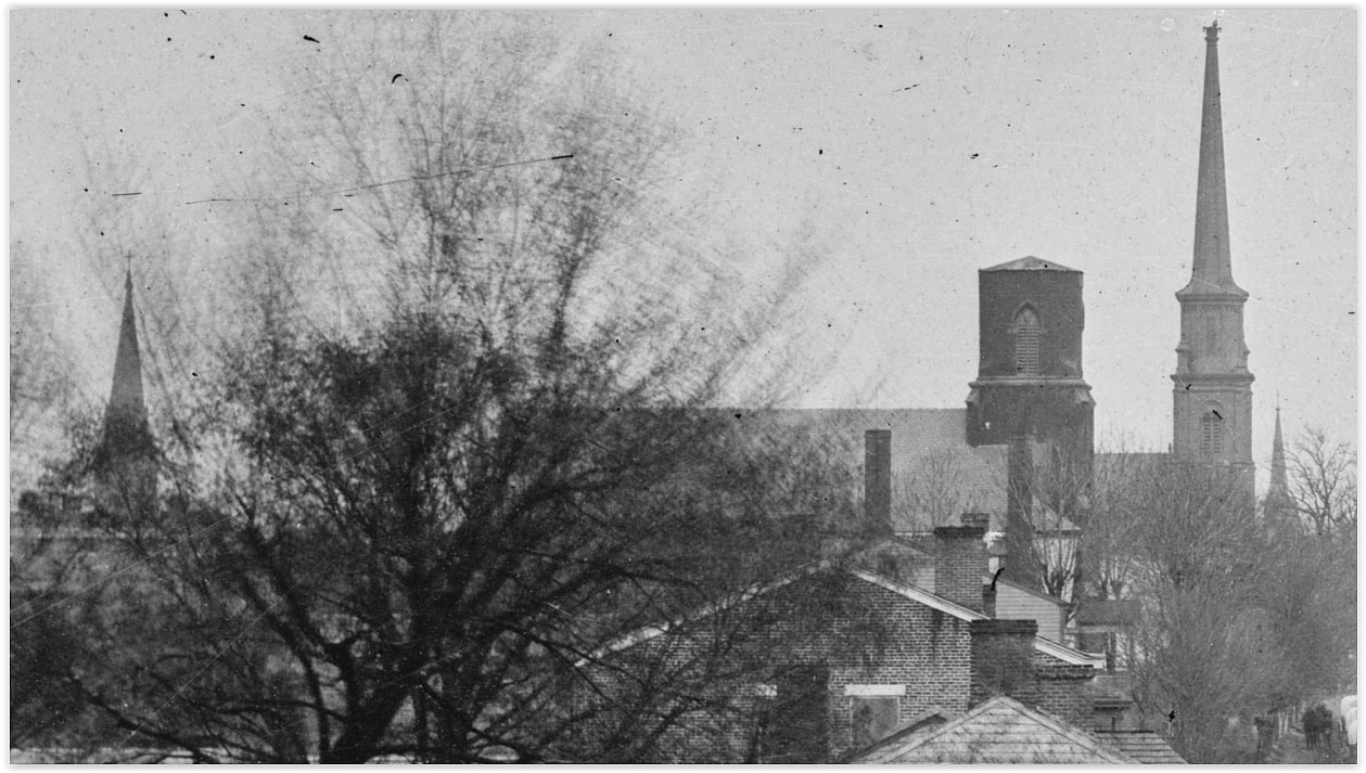
St. Joseph's Catholic Church from historic photo.
Picture
St. Joseph's Catholic Church from later source.
Picture
St. Joseph's Catholic Church from a drawing by A. R. Waud, LC 21324. Images submitted by Mark Jacob 07/2024
Picture
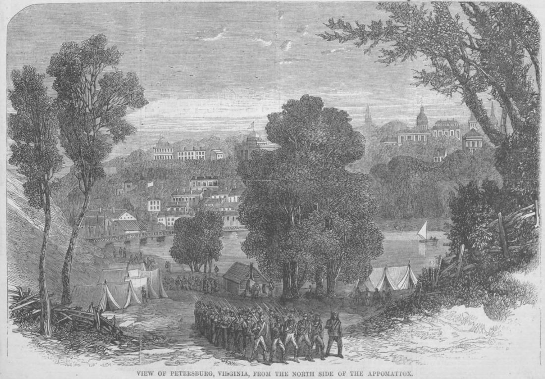
View of Petersburg, unattributed woodcut published in Harper's Weekly Magazine, Sept. 17, 1864.
Picture
Picture
Library of Congress 21324. A. R. Waud. The churches in the background are identified as Baptist on the left and Catholic on the right. Both were on Washington Street.
Picture
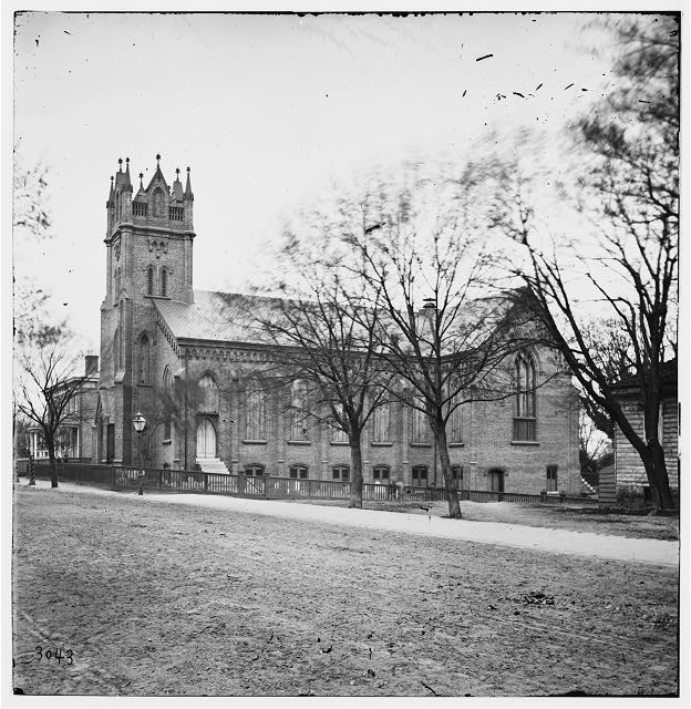
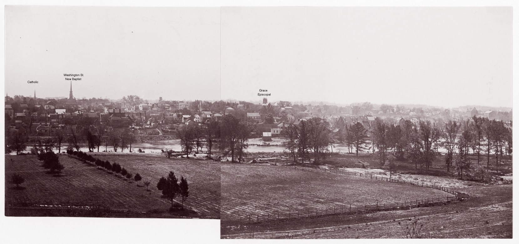
"Petersburg, Virginia. Grace Episcopal Church," photographer unidentified. LC-B811- 3043
Picture
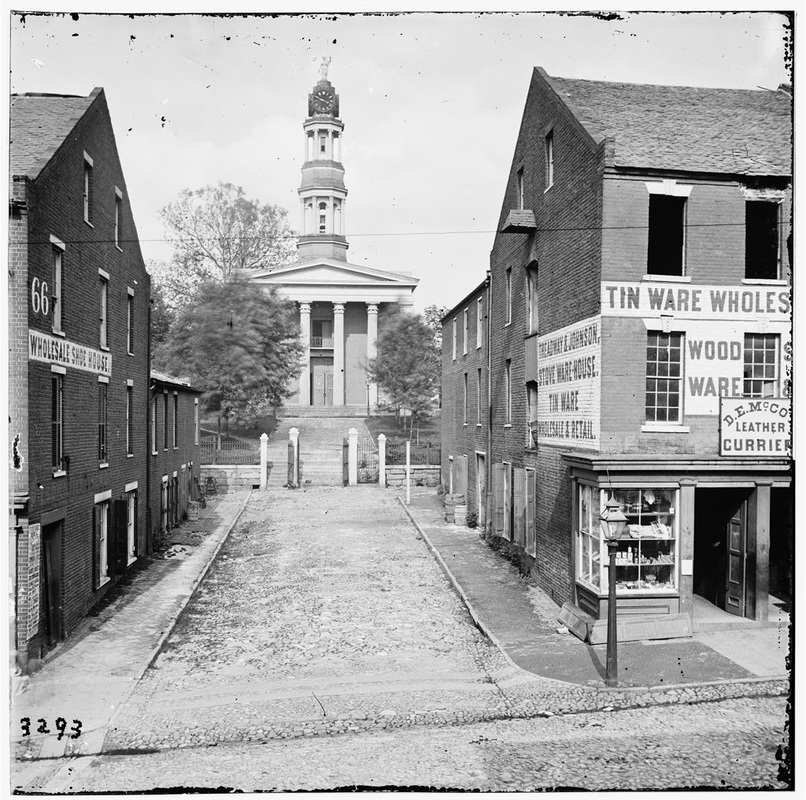
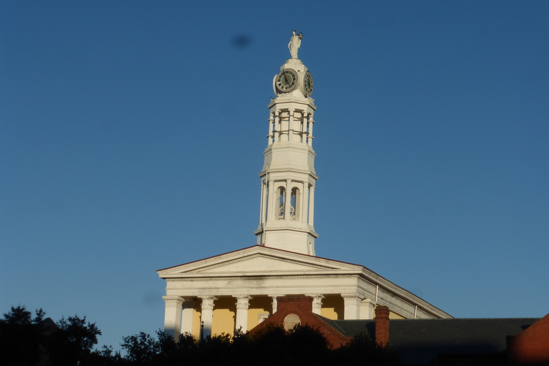
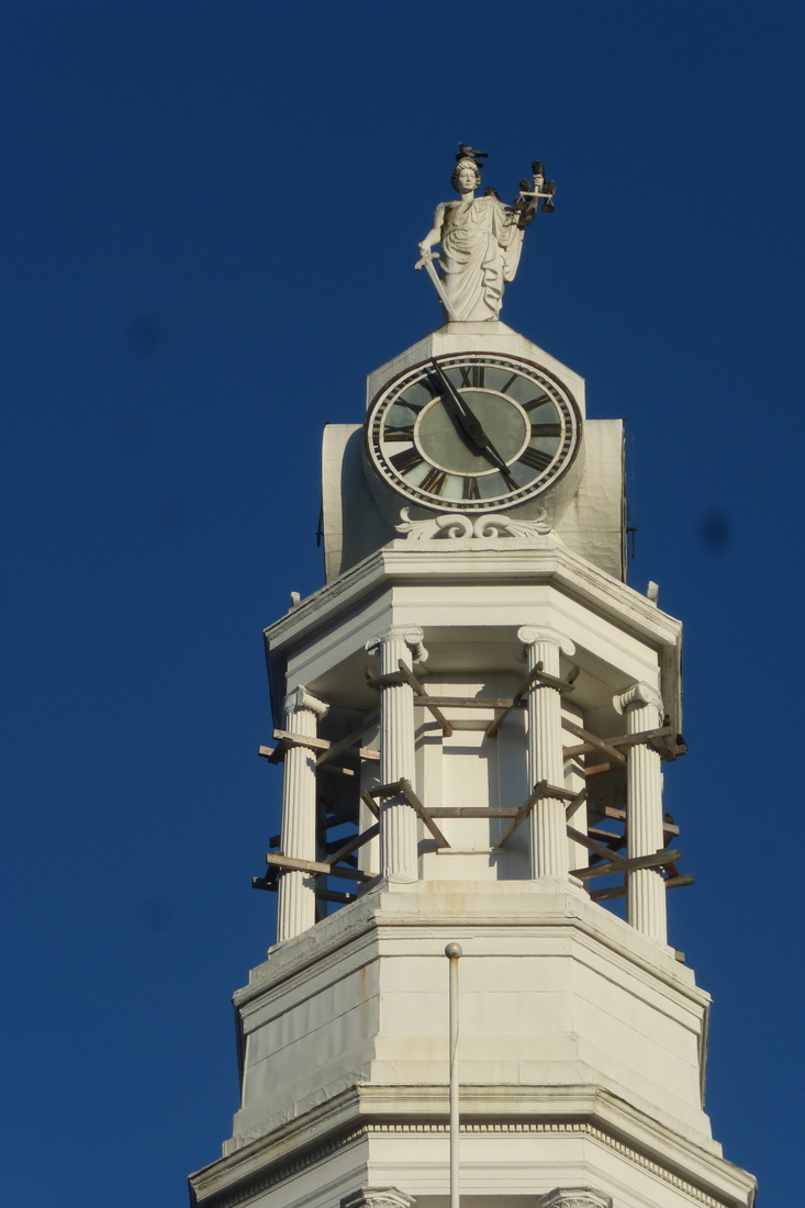
"Petersburg, Virginia, Courthouse," photographer unidentified. LC-B811- 3293
Picture
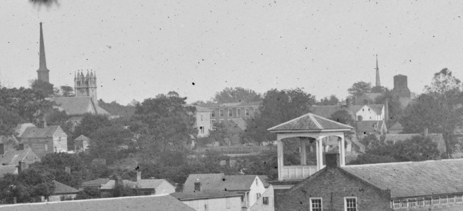
LC 00609 detail. Grace Episcopal Church second from left. The church stood at the intersection of High and Cross Streets. Shot tower on the right.
Picture
Four steeples-detail from LC 01286a, view down Washington Street looking east. L to R: St. Paul's Episcopal; Second Presbyterian; First Baptist; St. Joseph's Catholic.
Picture
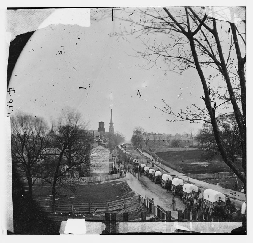
LC 01286. "[Petersburg, Va. The first Federal wagon train entering the town]." The caption is a tad misleading. The head of the train has passed through town on Washington Street and is leaving to follow the army.
Picture
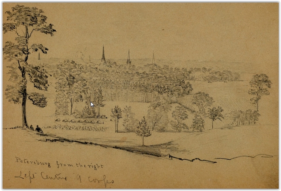
Library of Congress, Manuscript Division, Charles Wellington Reed collection. Labeled "Petersburg from the right. Left centre 9 Corps". 
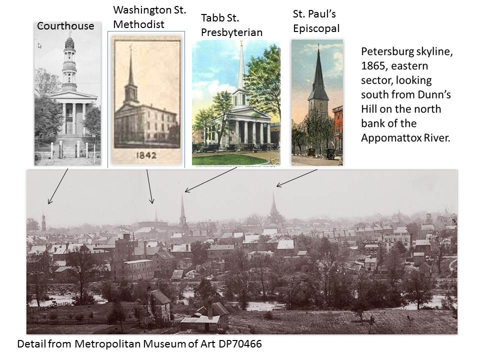
Detail from drawing with St. Paul's Episcopal Church steeple in center and the Tabb Street Presbyterian Church steeple to the right of that.
Picture
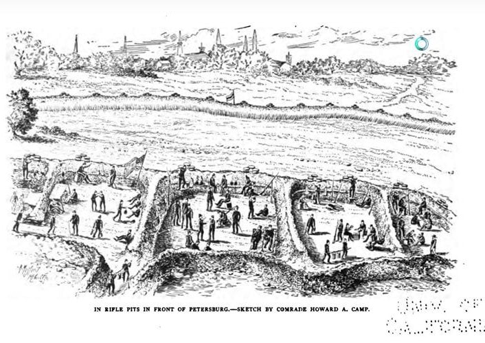
The city of Petersburg from U.S. lines east of the city. So many great details in this drawing! The story of the Twenty-first Regiment, Connecticut Volunteer Infantry, during the Civil War, 1861-1865. P 313. This earthwork was adjacent to the City Point & Petersburg Railroad. The inverted "Y" on the right would have been the junction of this railroad and the Norfolk & Petersburg R R.
Picture
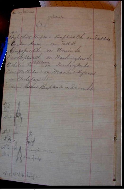
NARA RG 77. Topographical Engineers notebooks. Federal mappers noted visible towers and steeples.
War of the Rebellion: a compilation of the official ... ser.1:v.40:pt.1:Reports. p292...On learning the plan adopted I directed my principal assistant, Maj. John E. Weyss, to commence on the 9th an exact triangulation of the front of Petersburg, locating our own line of work as well as that of the enemy, and to take the immediate charge of the surveying party. My assistants, Messrs. Theilkuhl, Schumann, and Jacobsen aided him. The work was extended from the south of the Jerusalem plank road as far north as City Point. By this triangulation, performed under the fire of the enemy’s batteries and sharpshooters, the different spires and certain prominent buildings in Petersburg were accurately located, and having been kindly furnished by Professor Bache, Superintendent of the United States Coast Survey, with a copy of the beautiful map of that city and the Appomattox River prepared a few years ago in his department, I was able to combine the two [emphasis added], and thereby obtain an exact and connected map of the locality of our siege operations, covering the whole ground occupied by both armies....
N. MICHLER,
Major of Engineers, U. S. Army.


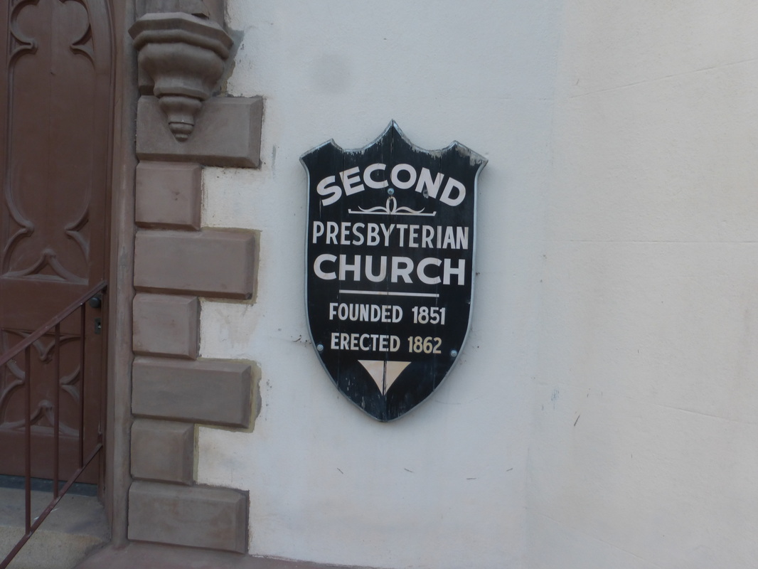
​STEEPLE BECOMES A SHOT TOWER  Richmond Whig, 26 November 1862

SHOT WORKS in Petersburg
Mr. Joseph Doherty has commenced manufacture of shot in Petersburg, Va., and his works are now in successful operation.  The steeple of the old Presbyterian Church has been converted into a shot tower, and the proprietor is prepared to drop from two to four thousand pounds per week.
Picture
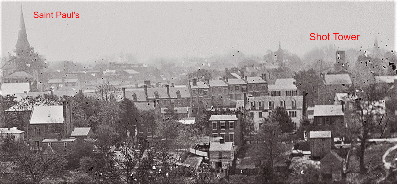
New York Public Library, DP70466, detail of Petersburg from Dunn's Hill in Colonial Heights looking south.

A shot tower is used for the production of lead balls, primarily for use in shotguns (modern) or muskets (historical).  Melted lead is run through a copper sieve of specified dimension and the extruded lead is dropped from the tower.  Surface tension forms a ball as the lead drops and the balls are caught in water at the base of the tower.  They were checked for roundness by rolling them on a slightly inclined plane, and imperfect examples were remelted.  Nineteenth century shot towers still stand in Philadelphia and Baltimore as well as other places in the U.S. and around the world. 

We don't know if this shot tower/truncated steeple was used in the Confederate war effort, or if it supplied civilian needs.  The bullets used by both armies were formed by molding, but round balls are found in the military context along with the more common molded bullets. 

Picture
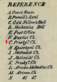
The red X marks the location of the "old Presbyterian Church" where the shot tower was located near the southwest corner of High Street and Market Street..
Picture
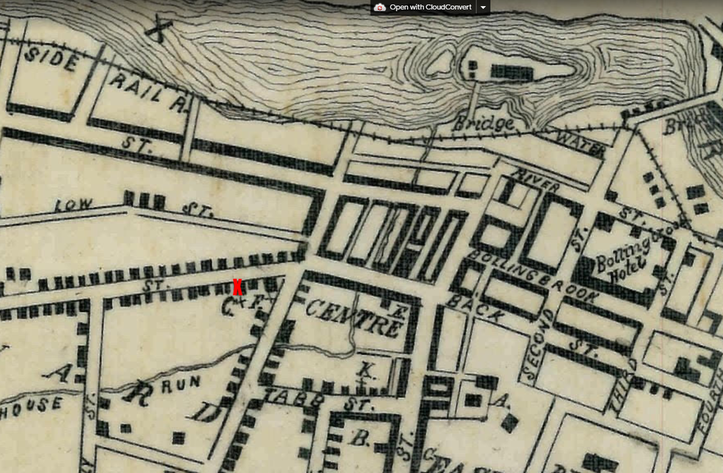
Detail of copy of an 1856 map by Keily, NARA RG 76.
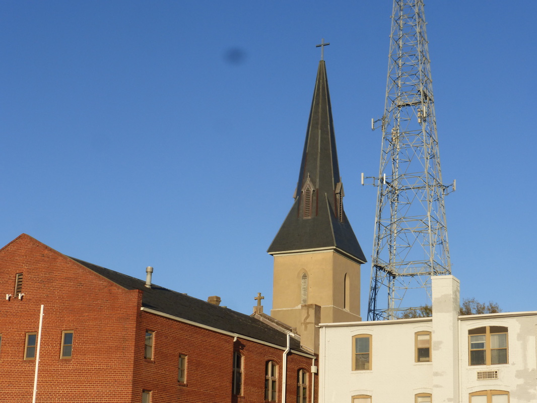
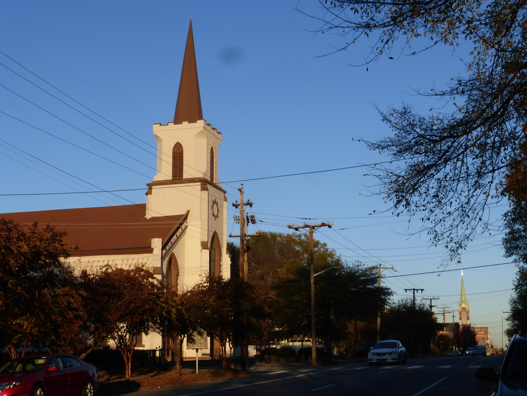
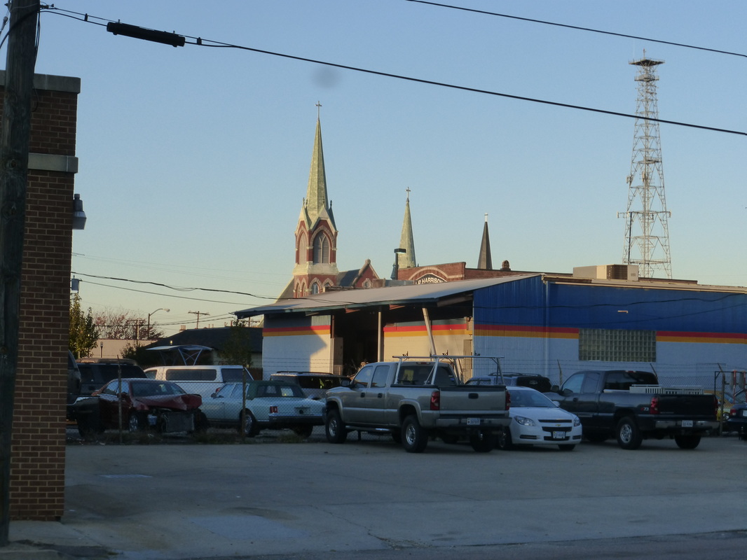
A few modern photos

Last Update 06/16/2021
Picture
Proudly powered by Weebly