The Petersburg Project
  • Home
    • About Us
  • Blog and Updates
  • The Crater
  • Petersburg in Pencil and Ink
    • Alfred R. Waud, Special Artist at Petersburg >
      • In Front of Petersburg
      • Waud Drawing of 5th Corps Fortifications
      • Rives Salient ("Fort Mahone")
      • Soldiers' Wells
      • The Mine Explosion
    • William Waud, Special Artist
    • Charles H. Chapin, Special Artist
    • Edwin Forbes, Special Artist at Petersburg
    • Joseph Becker, Special Artist at Petersburg
    • Edward Mullen, Special Artist at Petersburg
    • Andrew W. Warren, Special Artist
    • Winslow Homer, Special Artist
    • Enlisted Artists >
      • Charles Wellington Reed
      • Andrew McCallum
      • Francis Knowles
      • James William Pattison
      • Herbert Valentine
  • Steeples of Petersburg
  • Petersburg Photographs --So Many!
    • Working with Photographs
    • Petersburg Panorama 1865
    • City Point
    • City Point Wharf Explosion, Aug. 9, 1864
    • Fort Rice?? We don't think so!
    • Federal Picket Line, Jerusalem Plank Road
    • Timothy O'Sullivan, Photographer at Petersburg >
      • O'Sullivan and Vest Man
      • Fort Morton and Baxter Road Group
      • Fort Haskell Panorama
      • Fort Stedman Group
      • Gracie's Salient Group
      • Bombproofs behind Fort Haskell
      • Camp of the 50th N. Y. Engineers
    • John Reekie, Photographer for the Quartermaster Corps
    • Thomas C. Roche, Photographer at Petersburg
    • David Knox, Photographer at Petersburg
    • Andrew J. Russell, Photographer at Petersburg >
      • "Fort Mahone" CS Batteries 25 & 27
  • U. S. Military Railroad
    • Terminus of Military R. R. at City Point
    • City Point to Clark's Station
    • Pitkin's Station to Shooting Hill
    • Hancock's Junction/Jerusalem Plank Road
    • Parke's Station
    • Warren's Station
    • Patrick's Station
  • Maps and Topogs
    • Grand Medicine Pow-wow
    • Michler's Reports from Topographical Department
    • John E. Weyss, Cartographer
    • William H. Paine, Cartographer
    • Gilbert Thompson
  • Confederate Maps
    • Confederate Defenses 1862
    • Gilmer-Campbell Maps, 1864
    • Stevens Map July 1864
    • Fields of Fire
    • Coit's map of the Crater Battlefield
  • Federal Maps
    • June 18, 1864-Federal Engineers Map
    • June 21, 1864, Federal Engineers Map
    • June 22, 1864. Second Corps at Jerusalem Plank Road
    • June 30, 1864 -- XVIII Corps Map
    • Undated Federal Engineers Map--June-July, 1864
    • July 1864 Map of XVIII Corps Lines
    • 18th Corps, June 18, 1864
    • Native American Perspective of the Crater
    • August 28, 1864, Michler Map
    • IX Corps, Peebles and Pegrams Farms Oct. 1864
    • Army of the Potomac, Nov. 2, 1864
    • 1864, Coast Survey Map of Petersburg
    • Army of the Potomac, Routes of the Corps to Petersburg
    • Manuscript Survey, 1865
    • Michler-Weyss, Siege of Petersburg
    • Michler Map Series 1865-1867
    • 1871, Map of Recapture of Ft. Stedman
    • 1881, Boydton Plank Road
  • Confederate Forts and Batteries
    • Dimmock Line >
      • Priest Cap
      • French Rifle Pits
    • Fort Clifton
    • Confederate Leadworks
  • Federal Forts and Batteries
    • Battery X
    • Fort Alexander Hayes
    • Fort Avery
    • Fort Conahey
    • Fort Davis & Battery XXII
    • Fort Fisher
    • Fort Meikel --Photographic Views
    • Fort Morton
    • Fort Patrick Kelly
    • Fort Sedgwick, better known as Fort Hell,
    • Fort Wadsworth -- the Evolution
    • Fort Willcox or Battery XVI
  • Battlefield Features
    • Aiken House
    • Avery House
    • Bailey/Johnston Farm
    • Blandford Church
    • Broadway Landing, Appomattox River
    • The Crater
    • Cummings House
    • Dams and Inundations
    • Dunn House
    • Friend House >
      • View from Friend House toward Gibben complex and Petersburg
    • Globe Tavern / Weldon Railroad
    • Gregory House
    • Griffith Farm
    • Gurley House
    • Hare House
    • Hare House Hill
    • The "Horseshoe"
    • Jones House
    • Jordan House
    • Pegram's Farm
    • Peebles Farm, Pegrams Farm, Poplar Springs Church
    • Shands House
    • Taylor Farm >
      • The Ice House
      • Surviving Taylor Barn
    • U. S. Engineers at the Williams House
    • Williams House
  • Signal Towers and Trees
    • Some Operations of the Signal Corps at Petersburg
  • Archeology
    • Geology of the Crater
    • Fieldwork -- Petersburg
    • Civil War Sinks
    • Deserted Confederate Camp
    • Gracie's Countermine
    • LIDAR Forts and Batteries
  • Articles, Papers, Presentations
    • Shiman: A Note on Maps
    • The Siege Landscape: Through Fire and Ice at Petersburg
    • "The Rebel in the Road"
    • "A Strange Sort of Warfare Underground"
    • Lost Trenches of Petersburg: June 17
    • Between the Lines
    • Combat Trenching: An Introduction
  • Encyclopedia
    • Glossary
    • The Battlefields
    • Siege Warfare
    • Union Lines
    • Confederate Lines
    • Combat >
      • X Corps, June 30, 1864, Attack
      • Combat Entrenching
      • Trench Warfare in Civil War History
      • Chamberlain at Petersburg, June 18, 1864
  • Kittens, Puppies & Ponies
  • Executions!
  • Civil War Combat Trenching
  • Pontoon Bridges
  • Depot Hospital at City Point
  • New: Shot tower
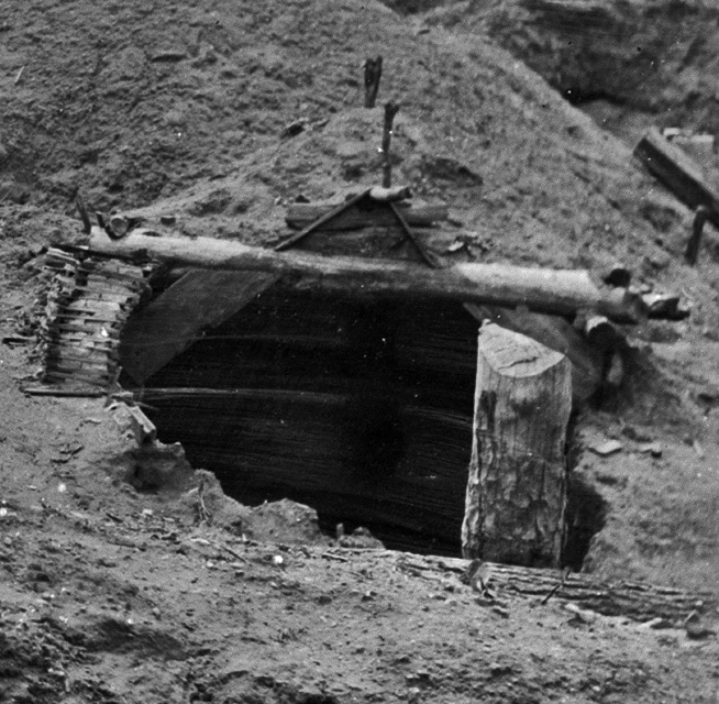
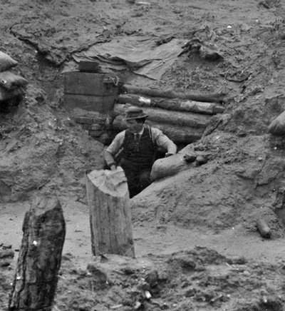
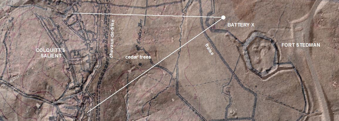
This stereo image has been identified as earthworks at Fort "Steadman." Dr. Shiman has convincingly matched image details with the Army engineers' plan of Battery Ten (X) and cross-referenced these details with other photographs taken in the vicinity. It is clear that the image was taken from the rear of Battery Ten, looking toward the Confederate lines at Colquitt's Salient. When Confederates assaulted this portion of the Union lines before dawn of March 25, they first penetrated Union lines here at Battery Ten and then entered adjacent Fort Stedman. With careful scrutiny, damage from the March 25th fighting can be discovered in this photograph, along with Union efforts to repair the damage in the weeks before the image was taken. In addition, the appearance of Timothy O'Sullivan's assistant "Vest Man" (Wm. Pywell) posed in the doorway of a bombproof is sufficient (by our way of thinking) to attribute this photograph to O'Sullivan. This stereograph was taken roughly at the same time as others in the Fort Stedman series.
Picture
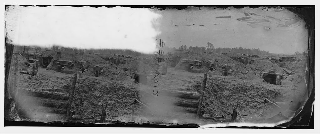
LC 00515. "Petersburg, Virginia. Earthworks [Fort Stedman] in front of Petersburg." Battery X adjacent to Fort Stedman. Image by Timothy O'Sullivan (unattributed).
Picture
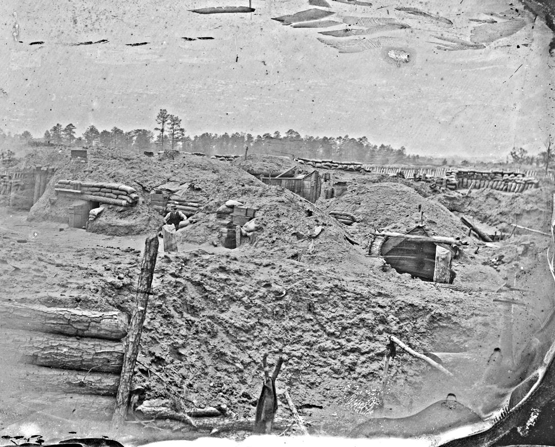
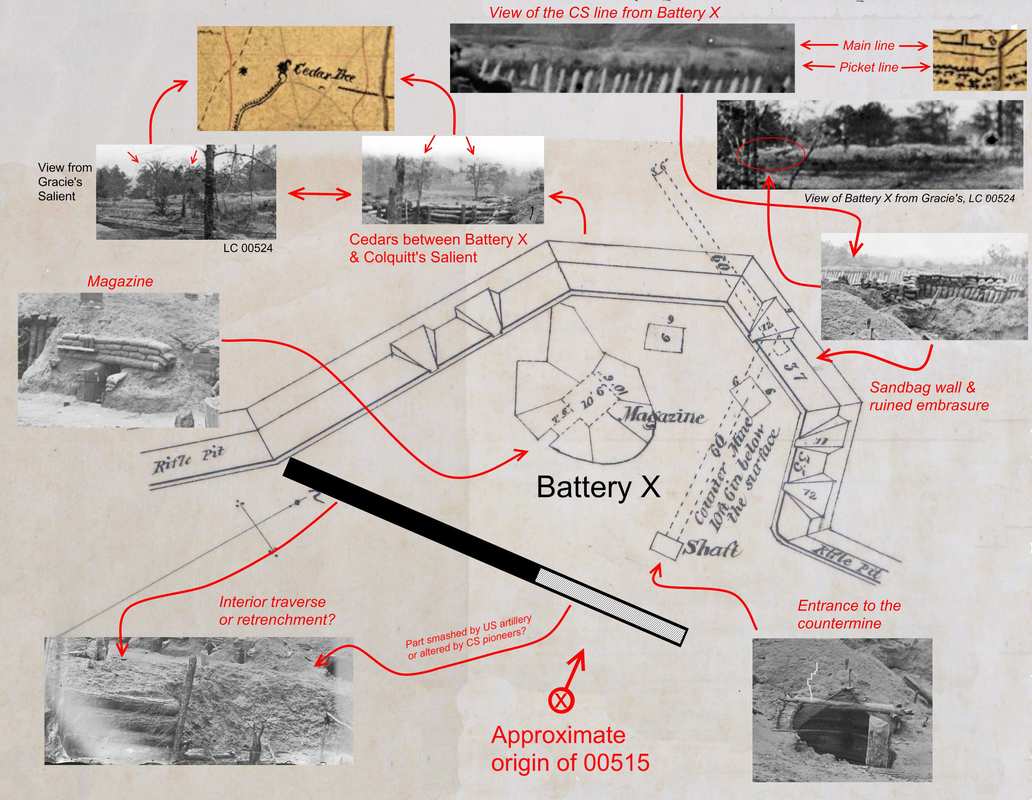
LC 00515 right half of stereo. Dr. Shiman delineates the details found in this photo in the page below.
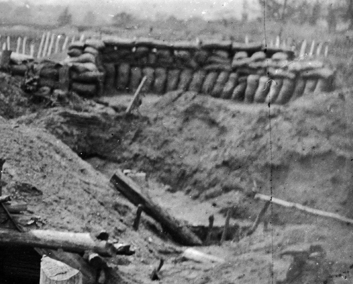
Picture
Picture
Picture
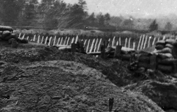
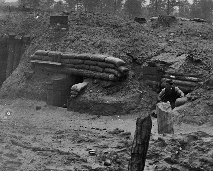
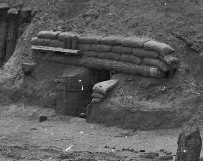
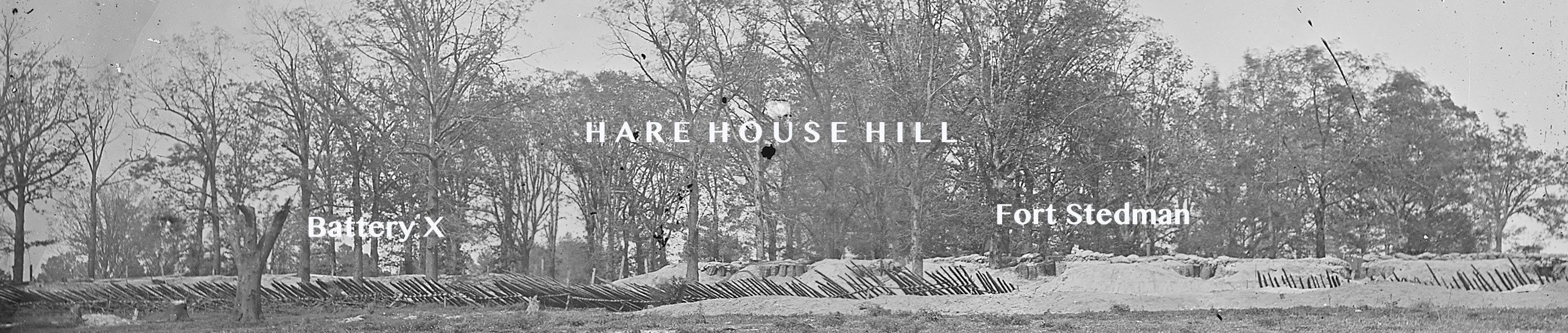
NARA photograph, unattributed (likely O'Sullivan), 1865. Beneath the label "Fort Stedman," the fraise was cut away in the March 25th assault.
updated March 2021
Proudly powered by Weebly
Picture