
This was the first identified historic photograph of Fort Davis, initially called "Fort Warren," but as you can see here that it was the subject for numerous pen-and-ink artists who captured all of its angles. The fort was the brainchild of G.K. Warren, who personally shepherded it through every phase of construction. This square redoubt with a massive diagonal traverse was large enough to hold a brigade of 2,000 infantry, or something on the order of a Roman legion. Chief Engineer of the Army of the Potomac, James Duane, envisioned a series of 4-6 forts of about this size holding the entire line from Jerusalem Plank Road back to the Appomattox River. After the "Grand Medicine Pow-wow," a new concept was adopted -- smaller, enclosed forts, redoubts, and batteries with garrisons of 100 or 200 men, connected by infantry trenches. Later on, it was decided that the infantry trenches could pretty much be manned by a picket line if backed by a strong reserve. The engineers decided that the ground could be held mostly by artillery, supported properly by a few hundred infantrymen. This was a giant step in the continuing development of trench warfare at Petersburg. The driving force on the Federal side -- hold more ground with fewer soldiers. Confederate engineers had the same problem but continued to build the same redan-redoubt lines that dated back to earlier in the war.
Fort Davis is owned by the City of Petersburg. G.K. Warren's statue on Little Round Top might as easily be recreated in Fort Davis. It may be his largest visible structural contribution to the American Civil War.
Fort Davis is owned by the City of Petersburg. G.K. Warren's statue on Little Round Top might as easily be recreated in Fort Davis. It may be his largest visible structural contribution to the American Civil War.
July 14, 1864 Thursday.
General Warren is now in his element: so far as I can learn, he is his own officer of the trenches, and commander of the working parties. There is nothing that he likes so much as overseeing work, and is consequently in a most agreeable humor. I spent some hours with him yesterday in the large redoubt, which one might easily believe he had undertaken to build by contract, and certainly has pushed forward with most wonderful rapidity. It is an immense work, five hundred feet front I believe, and perfectly square (p 436).
--Col. Charles S. Wainwright, A Diary of Battle, edited by Allan Nevins, DaCapo Press, New York,1998.
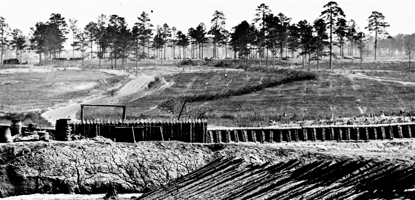
LC 02607, detail. This photograph of Fort Sedgwick looks south and captures the front of Fort Davis in the background. A tif version downloaded from the Library of Congress website is clearer than the jpeg version we can post here. Nonetheless, interesting details emerge, such as the signal tree identified by the ladders leaning against its base. Phil Shiman made this identification. The Jerusalem Plank Road at left connects the two forts.
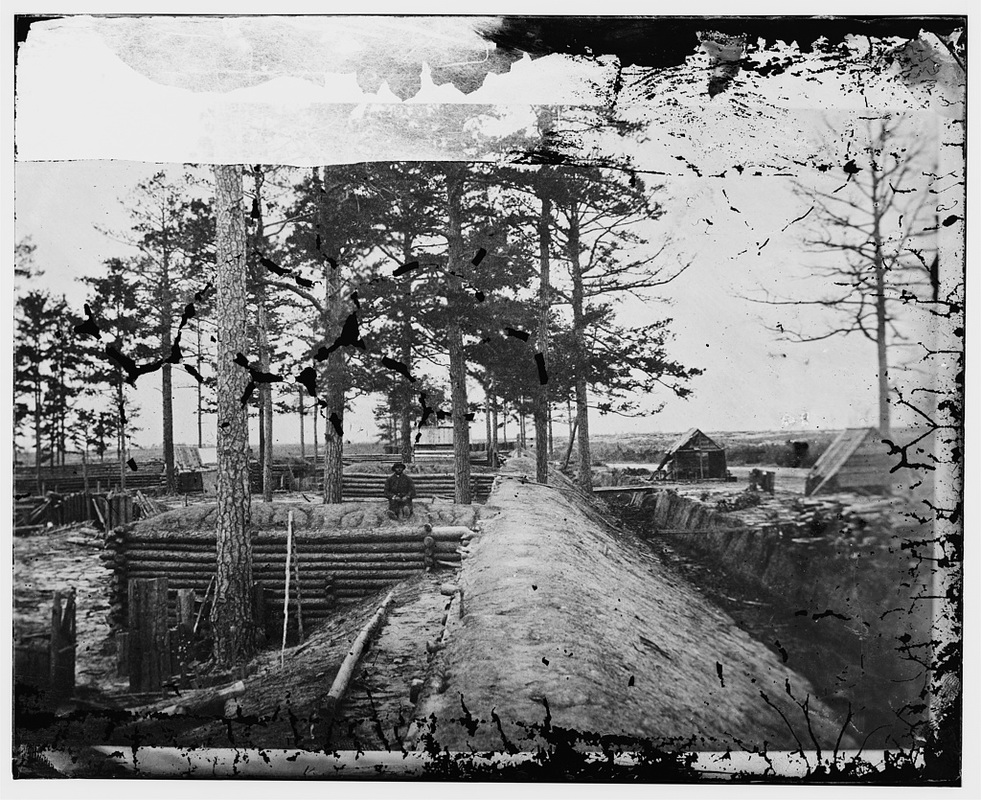
LC 03344. This unattributed image (LC-BH84- 60), captioned "Fortification - Petersburg?," is of Fort Davis, taken from the southeast angle of the fort looking north. Jerusalem Plank Road passes by the two structures at the right. The bridge spans the ditch at the sally port. Identity confirmed by Chris Calkins.
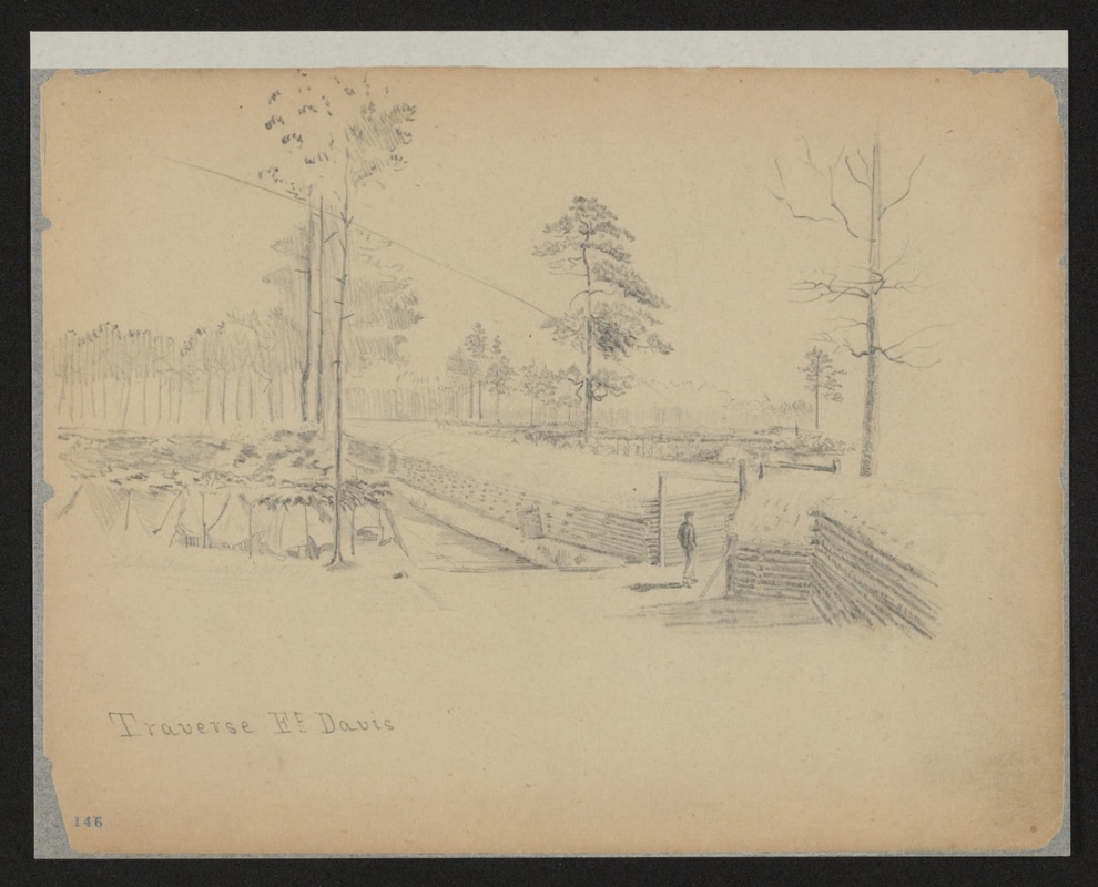
Traverse Ft. Davis. Drawing by Charles Wellington Reed. Charles Wellington Reed Papers, Library of Congress Mss. Division.
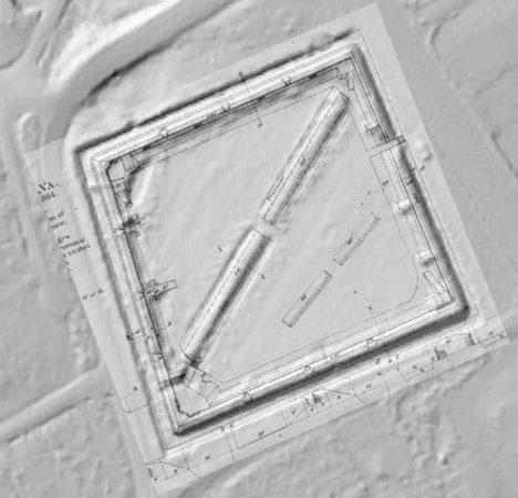
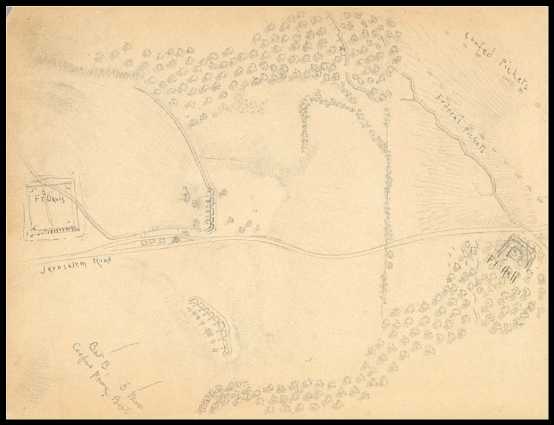
An Engineers' plan for Fort Davis is combined with modern LIDAR data, revealing current conditions. The square fort is about 450 feet on a side; ditch is 10-12 feet deep. In the overlay on left, the upper section of the internal traverse appears chewed up from heavy equipment crossing over it during logging. Located at the intersection of Flank Road and S. Crater Road (the old Jerusalem Plank Road).

Civil War Trails Marker at Fort Davis pull-off, photographed by Bill Coughlin 2007. The sign reads"
Fort Davis - Union Stronghold image.
Photographed By Bill Coughlin, April 22, 2007
1. Fort Davis - Union Stronghold
Inscription. Click to hear the inscription. After four days of unsuccessful trying to capture Petersburg by direct assault on June 15-18, 1864, Gen. U.S. Grant’s Union army began siege operations against the city. Grant’s immediate objective was to cut one of Gen. Robert E. Lee’s supply routes, the Petersburg and Weldon Railroad. Moving westward against the rail line in this area June 21-23, Union forces were stopped short of reaching their goal. They were able, though, to extend their trench lines across the Jerusalem Plank Road, now known as Crater Road. To protect this position, construction began on a large earthen structure initially called Fort Warren, Named for Fifth Corps commander, Gen. Gouverneur K. Warren."
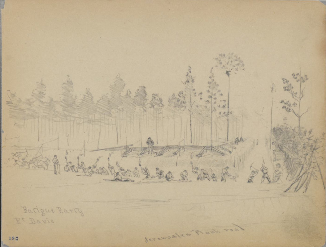 "Fatigue party building Fort Davis." Jerusalem Plank Road is labeled in the foreground. Drawing by Charles Wellington Reed. Charles Wellington Reed Papers, Library of Congress Mss. Division. Note the observer in the signal tree.
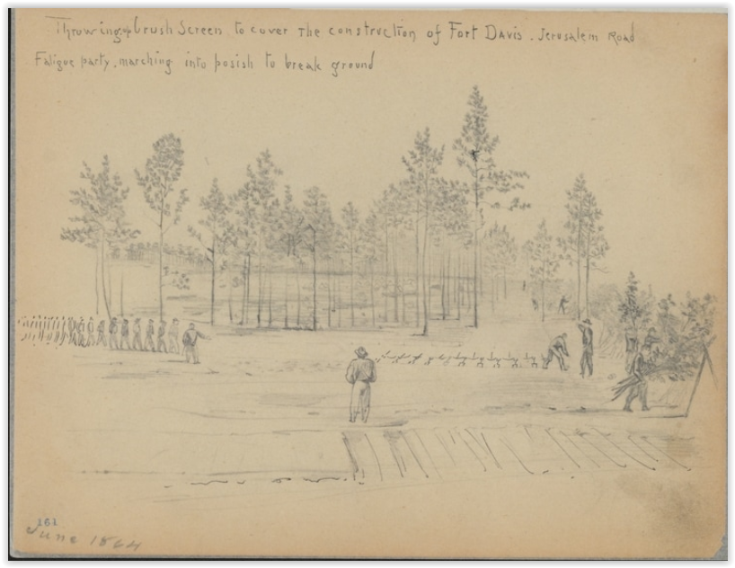
Throwing brush screen to cover the construction of Fort Davis. Jerusalem Road. Fatigue party, marching into posish to break ground. Drawing by Charles Wellington Reed. Charles Wellington Reed Papers, Library of Congress Mss. Division. Note the observer in the signal tree.
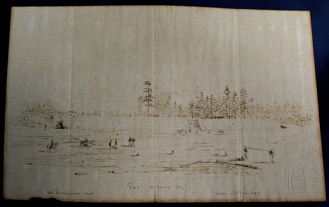
"Fort Warren Va, on Jerusalem Road near Petersburg," drawing of Fort Warren (renamed Fort Davis) by George Dean, 39th Massachusetts Infantry, Petersburg National Battlefield. File contributed by Emmanuel Dabney.
Drawing by Charles Wellington Reed. Charles Wellington Reed Papers, Library of Congress Mss. Division. Ft. Davis on the left; "Ft. Hell" on the right.
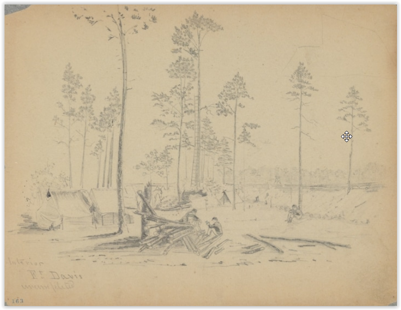
Interior, Ft. Davis. Uncompleted. Drawing by Charles Wellington Reed. Charles Wellington Reed Papers, Library of Congress Mss. Division. Note the observer in the signal tree.
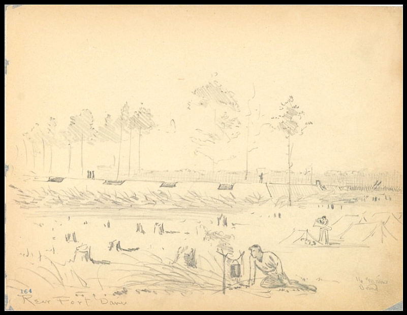
Rear. Fort Davis. Drawing by Charles Wellington Reed. Charles Wellington Reed Papers, Library of Congress Mss. Division.
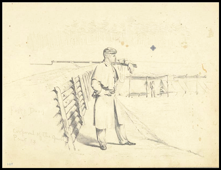
Fort Davis. Corporal of the Guards.
Drawing by Charles Wellington Reed. Charles Wellington Reed Papers, Library of Congress Mss. Division.
