
FORT FISHER 1864 until today...
The fort begins its existence as works are thrown up in the vicinity during the Battle of Peebles Farm (September 30-October 2, 1864).
 NARA, College Park, RG 77. NARA, College Park, RG 77.
|
NARA, College Park, RG 77.
|
NARA, College Park. RG 77.
|
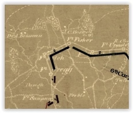
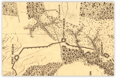
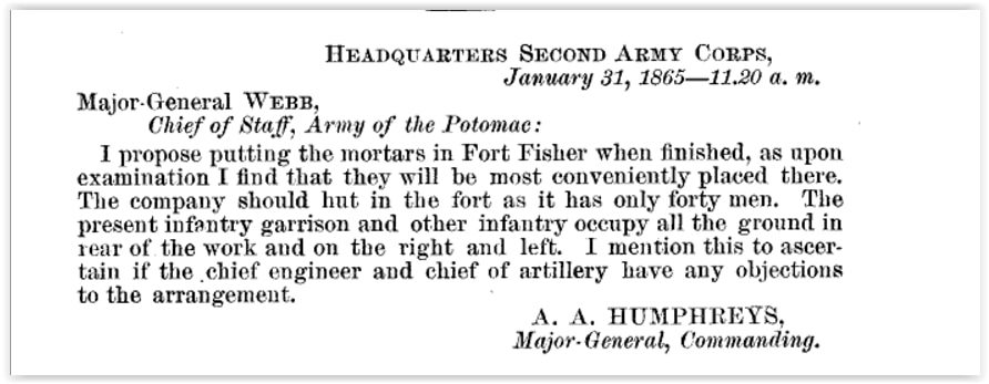
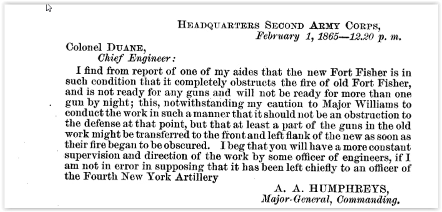
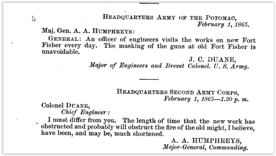
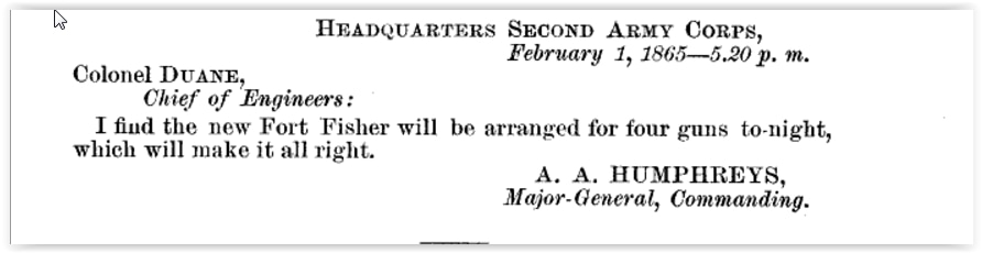
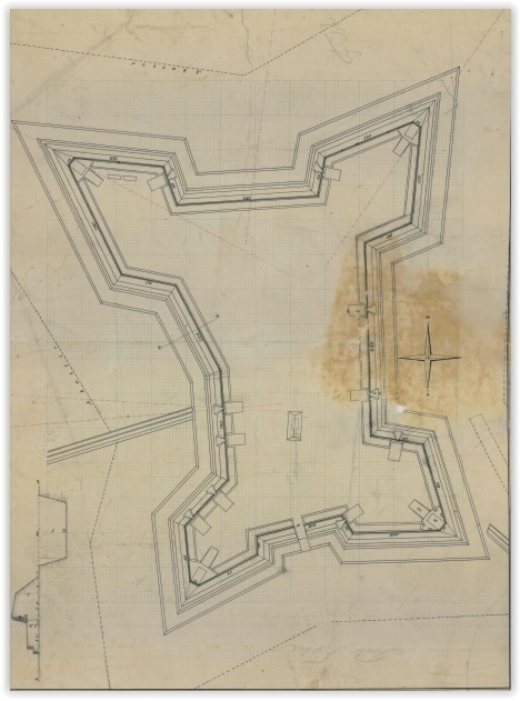
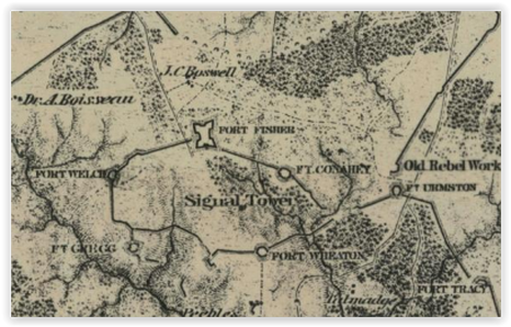
The fort was originally a simple "squarish" redoubt with a low profile, seven gun platforms in a tight configuration and four embrasures. Two barbette guns were mounted in the forward angles. Fort Fisher was connected to Fort Welch by a straight segment of parapet as shown in the map (above left). At a later date the parapet was pushed to the front and an angle added, likely to bring fire into the low ground. A siege battery was built into the angle. The map (above right) shows the original configuration as a dashed line. In winter, Federal engineers began a major overhaul of the fort, eventually expanding it into a large bastioned fort, capable of mounting fourteen guns.
|
Mid-winter 1864-65
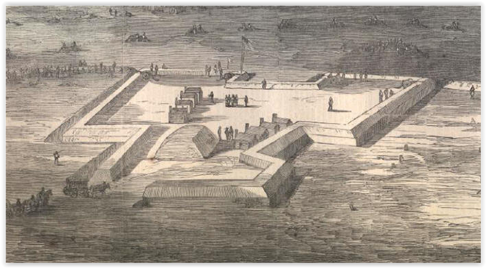
Harper's Weekly, March 11, 1865, sketch by Horace Heath.
Harper's Weekly, March 11, 1865, sketch by Horace Heath.
Late winter 1865
|
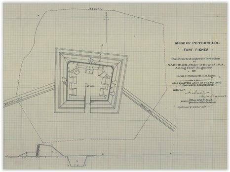
Fort Fisher in its final configuration, left and above.
Michler, Sheet 11, NARA College Park, RG 79.
|
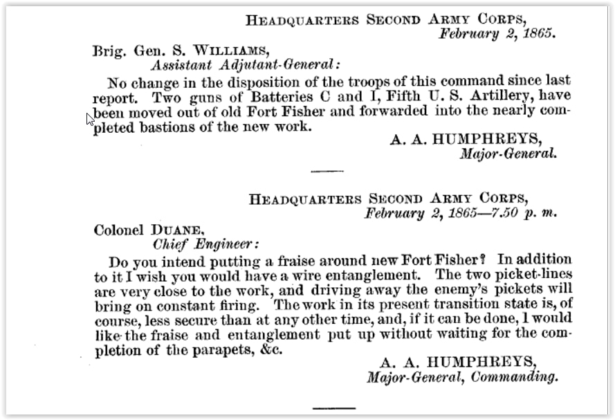
Major General J. G. BARNARD,
Chief Engineer, Armies in the Field.
HEADQUARTERS ARMY OF THE POTOMAC, OFFICE OF THE CHIEF ENGINEER,
February 20, 1865.
SIR: I have the honor to submit the following report of the engineering operations in this army for the week ending February 18, 1865:
...The following extracts are made from the report of Brevet Colonel Spaulding, commanding Fiftieth New York Volunteer Engineers:
The signal tower is so nearly completed that it will be probably finished to-morrow. In the next weekly report drawings of the tower will be furnished, with a detailed description of the work. The work upon Fort Fisher has progressed as rapidly as the state of the weather would permit. Brevet Captain Van Rensselaer reports three-fourths of the parapets completed, and the remainder one-half complete. Platforms are laid for three barbette and three embrasures guns, and two additional embrasure guns will be added to-morrow. This fort can be finished, except the inner works, in four or five days. No bomb-proofs, magazines, or traverses have yet been commenced in this fort....
Captain Dexter has been engaged with his company in getting our platform timber. During the week he has hewn and delivered at Fort Fisher and the battery on its left 3,523 superficial feet of timber, equal to fourteen platforms.
During the week 204 fascines have been made and delivered at Fort Fisher and the eleven-gun battery; 639 gabions have also been made and brought into camp; of these, 417 have been issued for Fort Fisher and for repairing the works on the Ninth Corps front.
Very respectfully, your obedient servant,
J. C. DUANE,
Major of Engineers and Brevet Colonel, U. S. Army.
Major General J. G. BARNARD,
Chief Engineer, Armies in the Field.
HEADQUARTERS ARMY OF THE POTOMAC, OFFICE OF THE CHIEF ENGINEER,
February 27, 1865.
SIR: I have the honor to submit the following report of the engineering operations in this army for the week ending February 25, 1865:
...The following extracts from the weekly report of Brevet Colonel Spaulding, commanding Fiftieth New York Engineers, will show the nature and extent of the engineering duties upon which the officers and men of his command have been engaged:
Lieutenant Van Rensselaer reports the parapets of Fort Fisher nearly finished. The work is ready for fifteen guns and is inclosed with abatis. The whole fort will probably be completed to-morrow, except the interior works, and these have not yet been commenced.
Very respectfully, your obedient servant,
J. C. DUANE,
Major of Engineers and Brevet Colonel, U. S. Army.
Chief Engineer, Armies in the Field.
HEADQUARTERS ARMY OF THE POTOMAC, OFFICE OF THE CHIEF ENGINEER,
February 20, 1865.
SIR: I have the honor to submit the following report of the engineering operations in this army for the week ending February 18, 1865:
...The following extracts are made from the report of Brevet Colonel Spaulding, commanding Fiftieth New York Volunteer Engineers:
The signal tower is so nearly completed that it will be probably finished to-morrow. In the next weekly report drawings of the tower will be furnished, with a detailed description of the work. The work upon Fort Fisher has progressed as rapidly as the state of the weather would permit. Brevet Captain Van Rensselaer reports three-fourths of the parapets completed, and the remainder one-half complete. Platforms are laid for three barbette and three embrasures guns, and two additional embrasure guns will be added to-morrow. This fort can be finished, except the inner works, in four or five days. No bomb-proofs, magazines, or traverses have yet been commenced in this fort....
Captain Dexter has been engaged with his company in getting our platform timber. During the week he has hewn and delivered at Fort Fisher and the battery on its left 3,523 superficial feet of timber, equal to fourteen platforms.
During the week 204 fascines have been made and delivered at Fort Fisher and the eleven-gun battery; 639 gabions have also been made and brought into camp; of these, 417 have been issued for Fort Fisher and for repairing the works on the Ninth Corps front.
Very respectfully, your obedient servant,
J. C. DUANE,
Major of Engineers and Brevet Colonel, U. S. Army.
Major General J. G. BARNARD,
Chief Engineer, Armies in the Field.
HEADQUARTERS ARMY OF THE POTOMAC, OFFICE OF THE CHIEF ENGINEER,
February 27, 1865.
SIR: I have the honor to submit the following report of the engineering operations in this army for the week ending February 25, 1865:
...The following extracts from the weekly report of Brevet Colonel Spaulding, commanding Fiftieth New York Engineers, will show the nature and extent of the engineering duties upon which the officers and men of his command have been engaged:
Lieutenant Van Rensselaer reports the parapets of Fort Fisher nearly finished. The work is ready for fifteen guns and is inclosed with abatis. The whole fort will probably be completed to-morrow, except the interior works, and these have not yet been commenced.
Very respectfully, your obedient servant,
J. C. DUANE,
Major of Engineers and Brevet Colonel, U. S. Army.
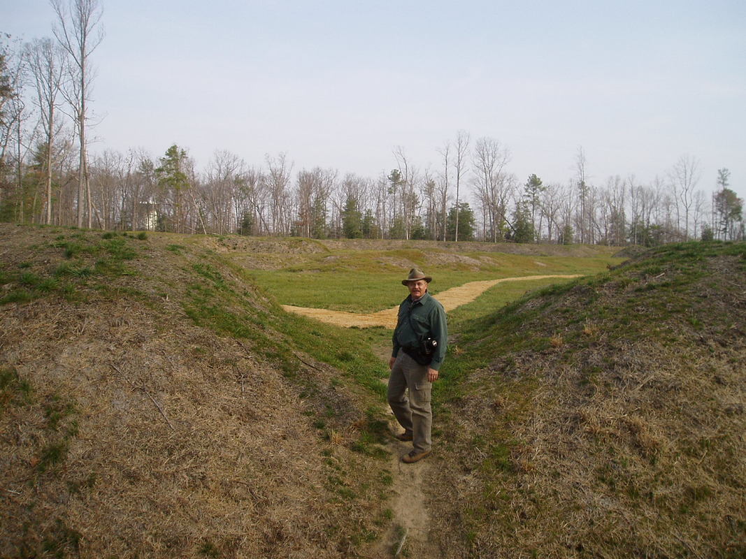
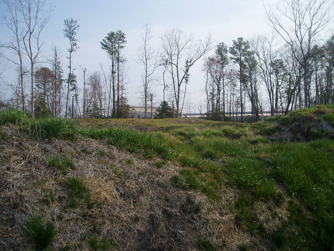

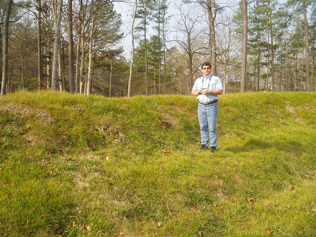
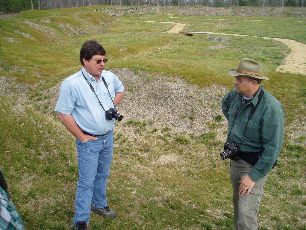
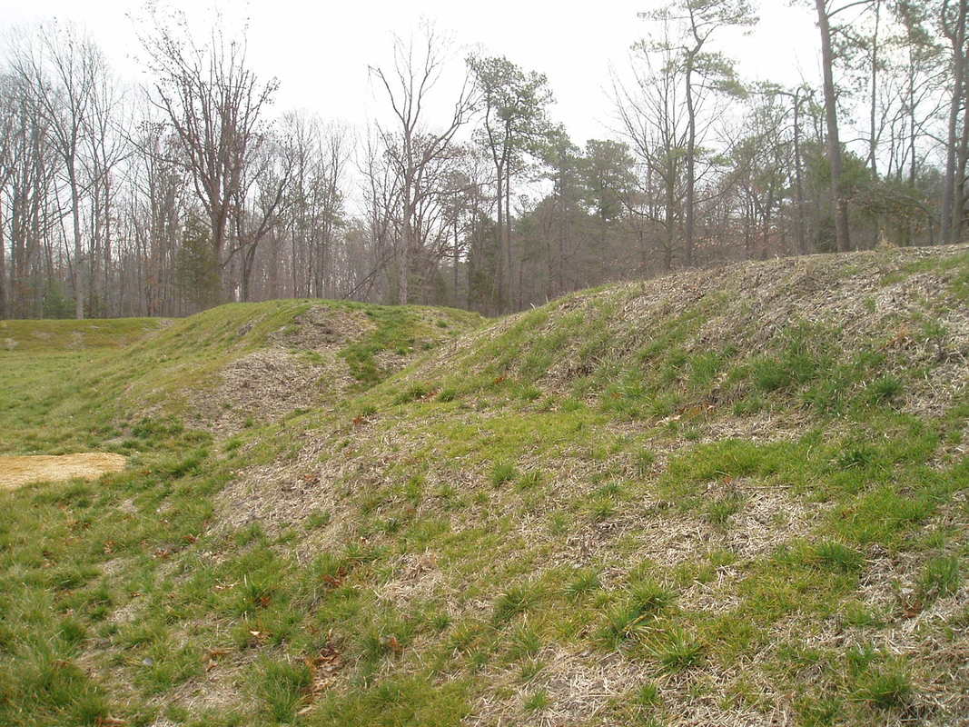
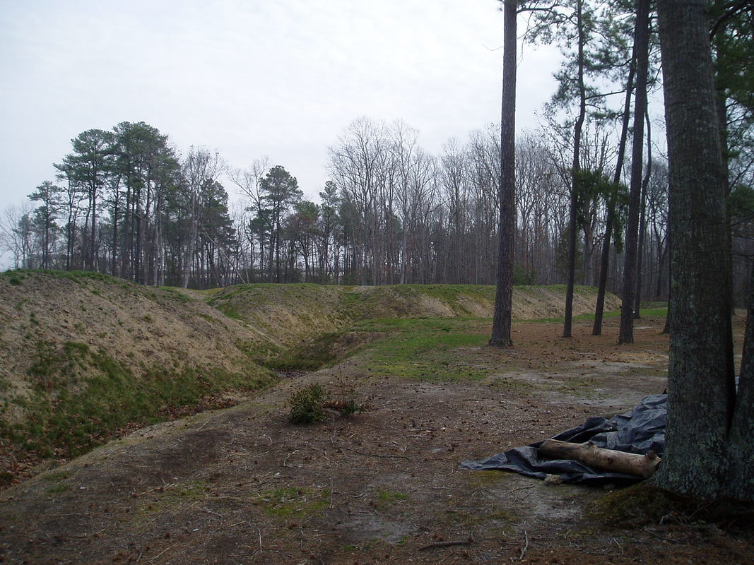


Photographs of Fort Fisher 2006, shortly after site was denuded of trees by the National Park Service
