The Petersburg Project
  • Home
    • About Us
  • Blog and Updates
  • The Crater
  • Petersburg in Pencil and Ink
    • Alfred R. Waud, Special Artist at Petersburg >
      • In Front of Petersburg
      • Waud Drawing of 5th Corps Fortifications
      • Rives Salient ("Fort Mahone")
      • Soldiers' Wells
      • The Mine Explosion
    • William Waud, Special Artist
    • Charles H. Chapin, Special Artist
    • Edwin Forbes, Special Artist at Petersburg
    • Joseph Becker, Special Artist at Petersburg
    • Edward Mullen, Special Artist at Petersburg
    • Andrew W. Warren, Special Artist
    • Winslow Homer, Special Artist
    • Enlisted Artists >
      • Charles Wellington Reed
      • Andrew McCallum
      • Francis Knowles
      • James William Pattison
      • Herbert Valentine
  • Petersburg Photographs --So Many!
    • Working with Photographs
    • Steeples of Petersburg
    • Petersburg Panorama 1865
    • City Point
    • City Point Wharf Explosion, Aug. 9, 1864
    • Fort Rice?? We don't think so!
    • Federal Picket Line, Jerusalem Plank Road
    • Timothy O'Sullivan, Photographer at Petersburg >
      • O'Sullivan and Vest Man
      • Fort Morton and Baxter Road Group
      • Fort Haskell Panorama
      • Fort Stedman Group
      • Gracie's Salient Group
      • Bombproofs behind Fort Haskell
      • Camp of the 50th N. Y. Engineers
    • John Reekie, Photographer for the Quartermaster Corps
    • Thomas C. Roche, Photographer at Petersburg
    • David Knox, Photographer at Petersburg
    • Andrew J. Russell, Photographer at Petersburg >
      • "Fort Mahone" CS Batteries 25 & 27
  • U. S. Military Railroad
    • Terminus of Military R. R. at City Point
    • City Point to Clark's Station
    • Pitkin's Station to Shooting Hill
    • Hancock's Junction/Jerusalem Plank Road
    • Parke's Station
    • Warren's Station
    • Patrick's Station
  • Maps and Topogs
    • Grand Medicine Pow-wow
    • Michler's Reports from Topographical Department
    • John E. Weyss, Cartographer
    • William H. Paine, Cartographer
    • Gilbert Thompson
  • Confederate Maps
    • Confederate Defenses 1862
    • Gilmer-Campbell Maps, 1864
    • Stevens Map July 1864
    • Fields of Fire
    • Coit's map of the Crater Battlefield
  • Federal Maps
    • June 18, 1864-Federal Engineers Map
    • June 21, 1864, Federal Engineers Map
    • June 22, 1864. Second Corps at Jerusalem Plank Road
    • June 30, 1864 -- XVIII Corps Map
    • Undated Federal Engineers Map--June-July, 1864
    • July 1864 Map of XVIII Corps Lines
    • 18th Corps, June 18, 1864
    • Native American Perspective of the Crater
    • August 28, 1864, Michler Map
    • IX Corps, Peebles and Pegrams Farms Oct. 1864
    • Army of the Potomac, Nov. 2, 1864
    • 1864, Coast Survey Map of Petersburg
    • Army of the Potomac, Routes of the Corps to Petersburg
    • Manuscript Survey, 1865
    • Michler-Weyss, Siege of Petersburg
    • Michler Map Series 1865-1867
    • 1871, Map of Recapture of Ft. Stedman
    • 1881, Boydton Plank Road
  • Confederate Forts and Batteries
    • Dimmock Line >
      • Priest Cap
      • French Rifle Pits
    • Fort Clifton
    • Confederate Leadworks
  • Federal Forts and Batteries
    • Battery X
    • Fort Alexander Hayes
    • Fort Avery
    • Fort Conahey
    • Fort Davis & Battery XXII
    • Fort Fisher
    • Fort Meikel --Photographic Views
    • Fort Morton
    • Fort Patrick Kelly
    • Fort Sedgwick, better known as Fort Hell,
    • Fort Wadsworth -- the Evolution
    • Fort Willcox or Battery XVI
    • Hare House Hill
  • Battlefield Features
    • Aiken House
    • Avery House
    • Bailey/Johnston Farm
    • Blandford Church
    • Broadway Landing, Appomattox River
    • The Crater
    • Cummings House
    • Dams and Inundations
    • Dunn House
    • Friend House >
      • View from Friend House toward Gibben complex and Petersburg
    • Globe Tavern / Weldon Railroad
    • Gregory House
    • Griffith Farm
    • Gurley House
    • Hare House
    • The "Horseshoe"
    • Jones House
    • Jordan House
    • Pegram's Farm
    • Peebles Farm, Pegrams Farm, Poplar Springs Church
    • Shand House
    • Taylor Farm >
      • The Ice House
      • Surviving Taylor Barn
    • U. S. Engineers at the Williams House
    • Williams House
  • Signal Towers and Trees
    • Some Operations of the Signal Corps at Petersburg
  • Archeology
    • Geology of the Crater
    • Fieldwork -- Petersburg
    • Civil War Sinks
    • Deserted Confederate Camp
    • Gracie's Countermine
    • LIDAR Forts and Batteries
  • Articles, Papers, Presentations
    • Shiman: A Note on Maps
    • The Siege Landscape: Through Fire and Ice at Petersburg
    • "The Rebel in the Road"
    • "A Strange Sort of Warfare Underground"
    • Lost Trenches of Petersburg: June 17
    • Between the Lines
    • Combat Trenching: An Introduction
  • Encyclopedia
    • Glossary
    • The Battlefields
    • Siege Warfare
    • Union Lines
    • Confederate Lines
    • Combat >
      • June 30, 1864, Attack
      • Combat Entrenching
      • Trench Warfare in Civil War History
      • Chamberlain at Petersburg, June 18, 1864
  • Kittens, Puppies & Ponies
  • Executions!
  • Civil War Combat Trenching
  • Pontoon Bridges
  • Depot Hospital at City Point
  • New: Shot tower

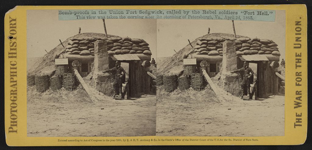
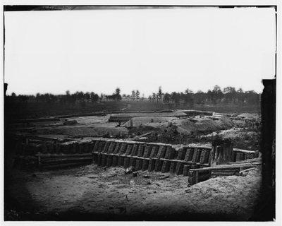
FORT SEDGWICK, better  known  as  FORT HELL... and vicinity, early in the  siege.
Grand Medicine Pow-wow
​"The Rebel in the Road"
Fort Rice?? We don't think so!
Federal Picket Line, Jerusalem Plank Road
Priest Cap

Picture
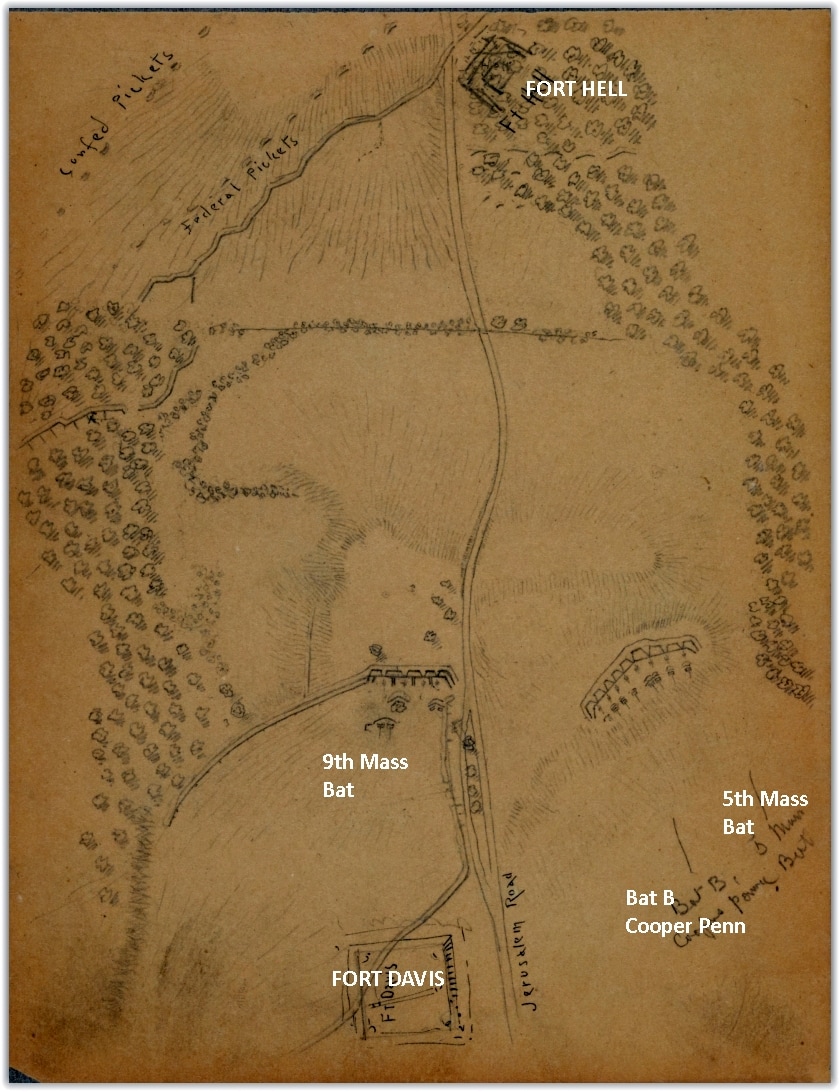
Early version of Fort Hell/Sedgwick as a rectangular redan to the east of Jerusalem Plank Road. Charles Wellington Reed, LC Manuscript Division. Reed's diary and letters make clear that his battery, the 9th Massachusetts, moved into position on the left of the Jerusalem Plank Road on June 24th, "relieving the 6th Maine battery going in to their breastworks" Campbell, "A Grand Terrible Dramma", p233. Reed started his map of the area on June 29 and continued to update it as Fort Warren (eventually named Fort Davis) was not begun until July 6 (Campbell p. 235).
Picture
Detail from OR Atlas, Plate XLIV.
Picture
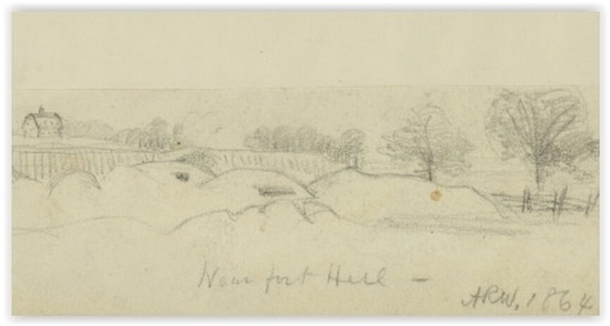
The barn, in the upper left of the Waud drawing detail above, was still standing at the end of July when the farm house was reduced to "Chimneys".
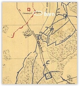
July 19, Tuesday
The engineers have just traced out an irregular work to be enclosed in a corner of the wood close to the plank road:  it  is within one hundred yards of  the rebel pickets at the Gregory chimneys, and having rather an ugly lookout for them is not likely to be  put up with as little disturbance as the others have (p. 438).

July 21,  Thursday
The new work on the plank road gets on slowly.  I was right in my surmise that the rebels would not like it; they make it so hot for the workmen there that it has already been christened Fort Hell by the men (p. 439).

Colonel Charles S. Wainwright, A Diary of Battle, edited by Allan Nevins,  DaCapo Press, New York,1998
Picture
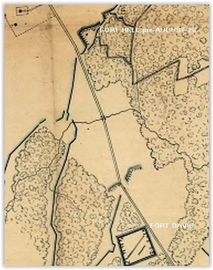
Detail from map signed by N. Michler dated August 28, Library of Virginia. At the end of August, the future Fort Sedgwick remained a simple redan on the east side of the plank road.
Picture
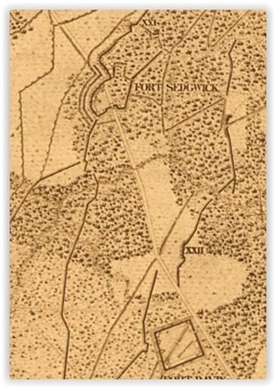
The end of the war Federal maps show the final configuration of the fort- a Priest's Cap design straddling the Jerusalem Plank Road.
Picture
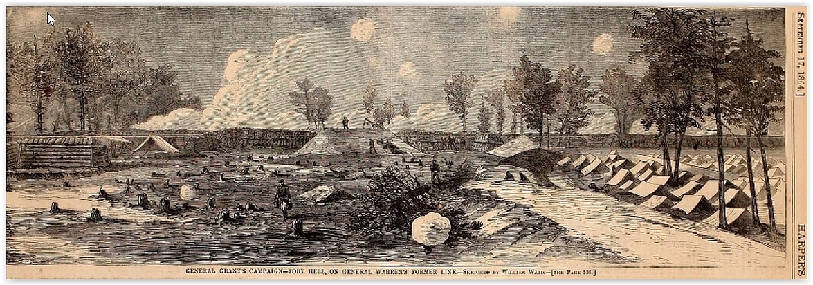
Harper's Weekly, September 17, 1864, William Waud. By mid-September, the fort had been expanded across the road.

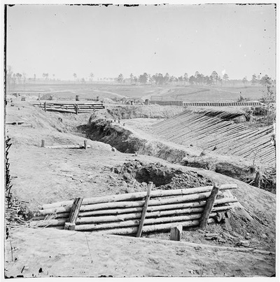
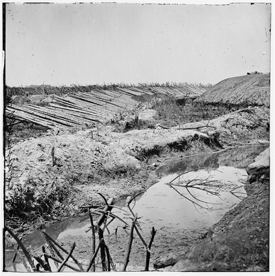
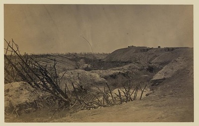
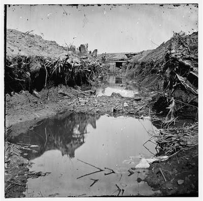
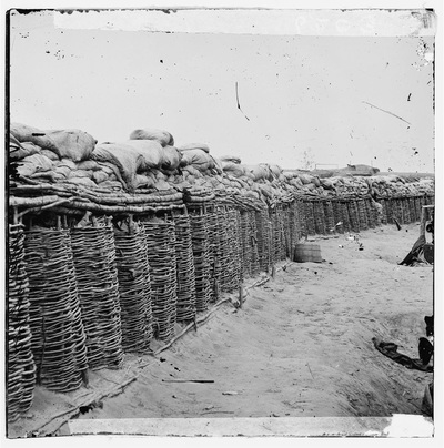
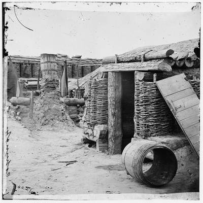
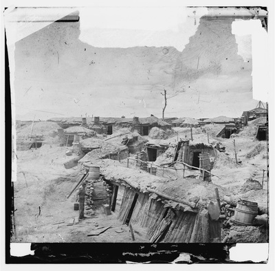
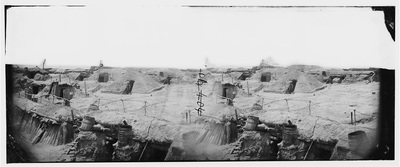
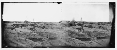
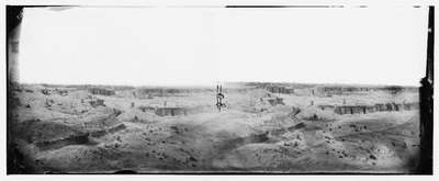
Photographs and Drawings of Fort Sedgwick, known as "Fort Hell"

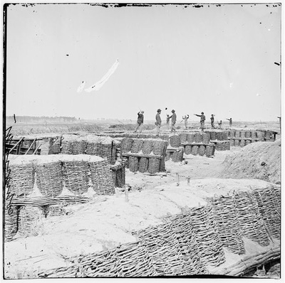
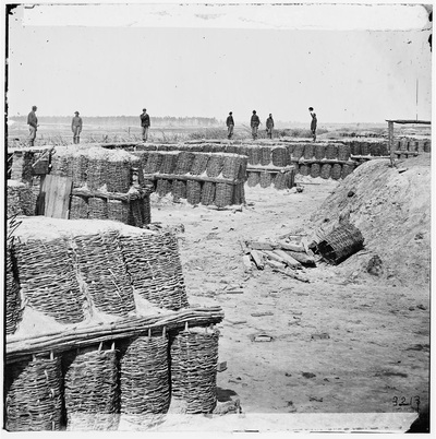
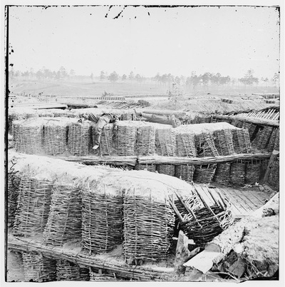
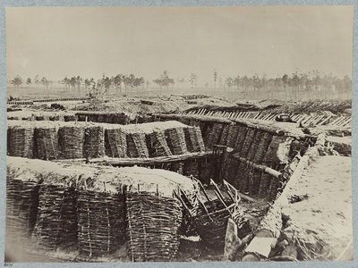
Fort Sedwick "Fort Hell" -- the most photographed and sketched location on the entire Petersburg front.
​
Picture
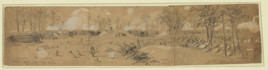
"Fort Hell. On Genl Warrens line," drawing by Alfred R. Waud. (Library of Congress).
Picture
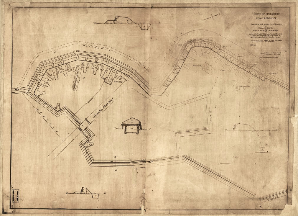
"Siege of Petersburg: Fort Sedgwick, constructed under the direction of Major J. C. Duane and N. Michler, Corps of Eng'rs. July, September & October 1864."
Picture
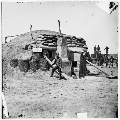
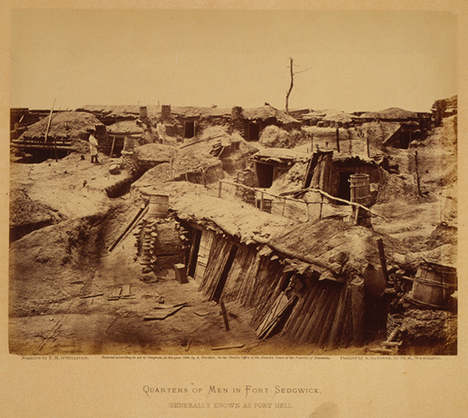
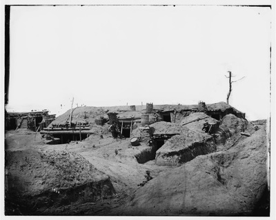
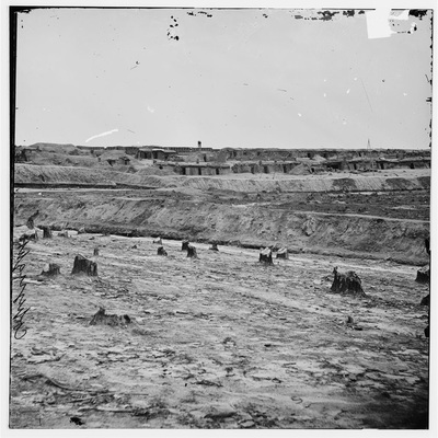
LC 12604. "Quarters of Men in Fort Sedgwick." Negative by T. H. O'Sullivan. Positive by A. Gardner. Dated May 1865.
Picture
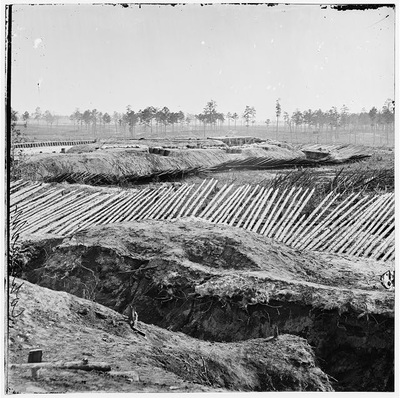
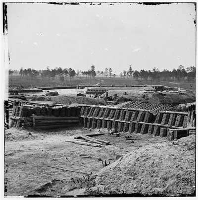
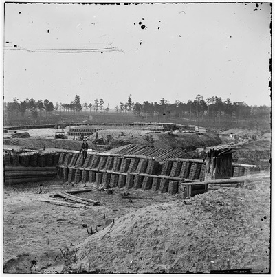
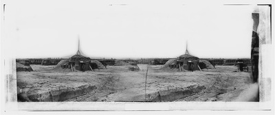
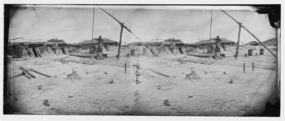
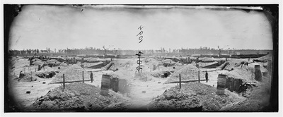
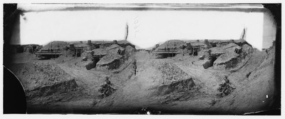
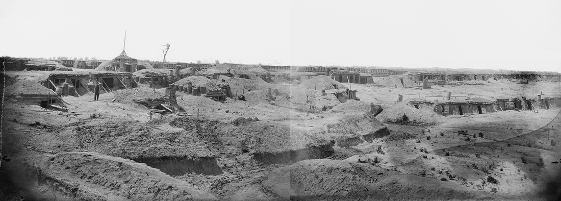
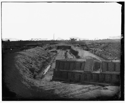
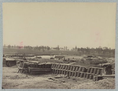
Panorama of the rear of Fort Sedgwick and adjacent batteries formed by merging two stereo images (00605 and 00606). Although not yet attributed, internal evidence leaves little doubt that these images were taken by Timothy O'Sullivan.
Picture
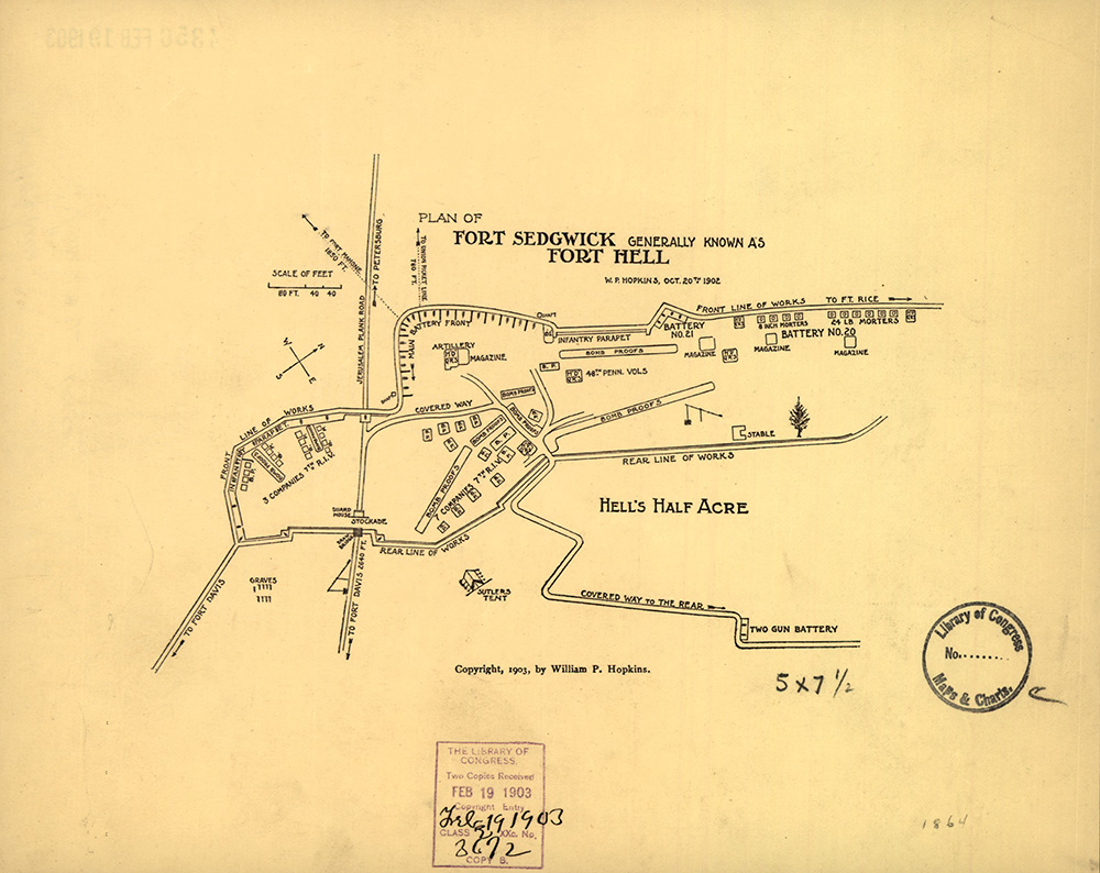
"Plan of Fort Sedgwick Generally Known As Fort Hell, by W. P. Hopkins, Oct. 20th, 1902." From the Seventh Regiment Rhode Island Volunteers (1903), pg. 230.
Picture
Proudly powered by Weebly
Picture