THE PETERSBURG PHOTOGRAPHS
Fort Haskell Rediscovered
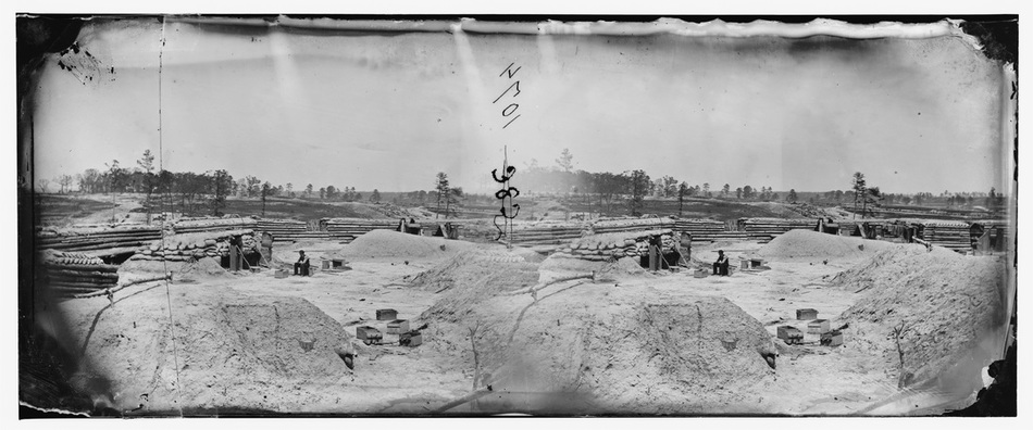
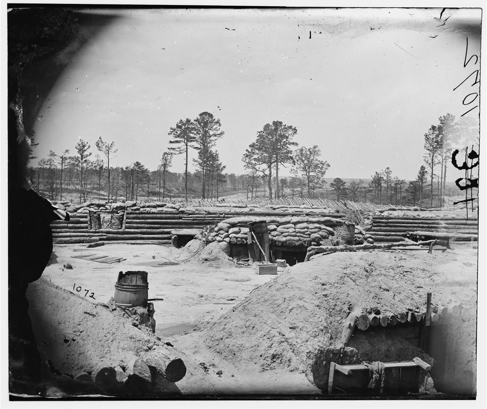
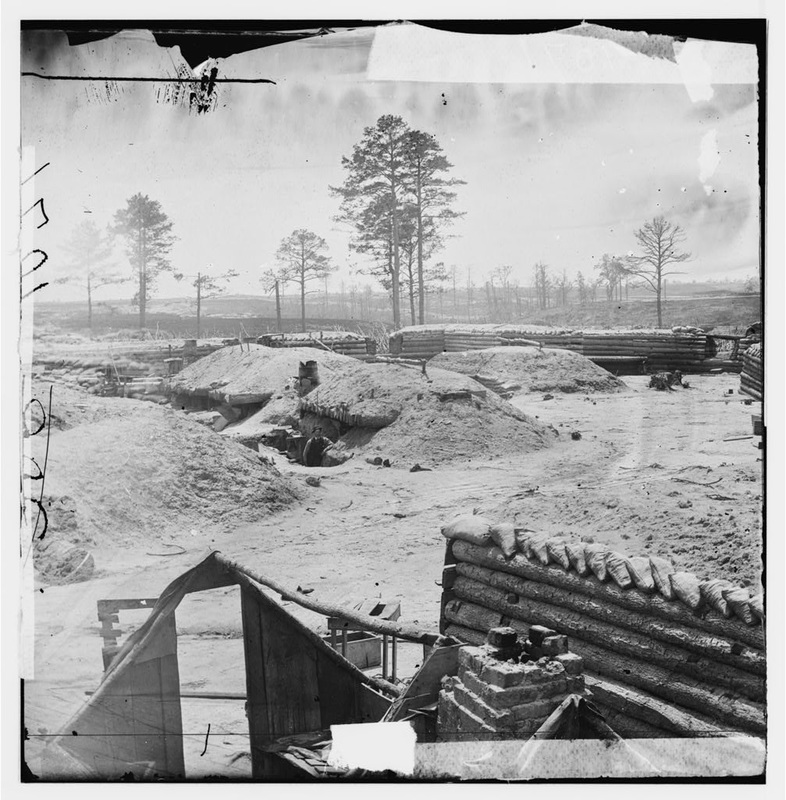
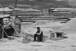 Detail of stereoscope 00532 showing interior of Fort Haskell, misidentified as "Fort Meikle."
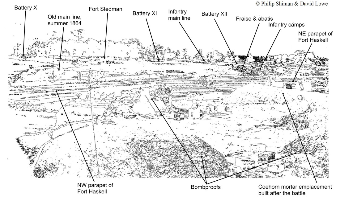
On March 25, 1865, embattled Confederates broke through the cordon of Federal entrenchments east of Petersburg in a dawn assault. Fort Stedman and its adjacent batteries were overrun. Despite this initial success, the operation collapsed under a brutal artillery crossfire and Federal counterattacks. General Lee’s Army of Northern Virginia lost some 3,500 soldiers killed, wounded, and captured, losses it could ill afford. Union soldiers’ stubborn defense of the next fort south of Stedman—Fort Haskell—was key to stalling the attack. Until now, Fort Haskell has been lost—well, photographically, that is. An image showing the interior of Fort Haskell and much of the Fort Stedman battlefield has been misidentified as “Fort Meikle,” since it appeared in Francis Trevelyan Miller’s Photographic History of the Civil War in 1911, a hundred years ago. In fact, at least three stereoscopic images were taken by Timothy O'Sullivan from inside Fort Haskell within a week of the Federal occupation of Petersburg.
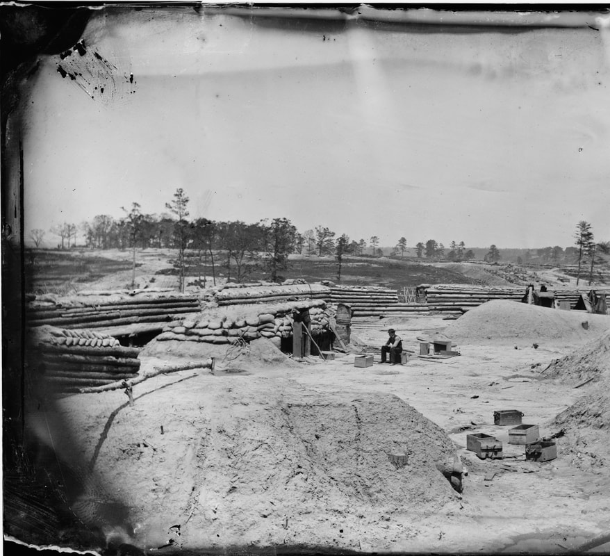
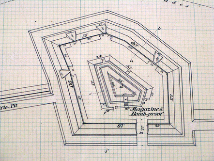
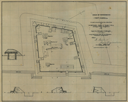
Our work with the Petersburg photographs over the last few years, has led the authors to what we hope is a healthy skepticism. We have discovered a number of faulty or misleading captions. When we first examined the “Fort Meikle” image in detail in the Library of Congress on-line Civil War Photographs Collection and then looked at Fort Meikle on the map, we were suspicious at once. “Meikle” would have been a rather odd fort to photograph. Photographers of the time were encumbered by large cameras and a great deal of heavy (and breakable) equipment and supplies. Federal engineers’ plans of the Petersburg forts, copied from the National Archives, depicted Fort Meikle as a relatively small redoubt designed for four field guns. Access from the east was blocked by the railroad. From the west there was no clear road depicted on the maps, although there must have been a way to get the guns in there. Getting a camera wagon to Fort Meikle, though, would have been risky. And why go to all that trouble, when nearby Forts Morton and Rice were more accessible, larger, more imposing and more photogenic? Look again at the photo. The fort shown in the "Meikle" image was a sprawling structure with differently spaced gun embrasures. Instead of one large internal work, there are at least five smaller ones. Something was clearly amiss with the image's identification. This is not an image of Fort Meikle.
Our work with the Petersburg photographs over the last few years, has led the authors to what we hope is a healthy skepticism. We have discovered a number of faulty or misleading captions. When we first examined the “Fort Meikle” image in detail in the Library of Congress on-line Civil War Photographs Collection and then looked at Fort Meikle on the map, we were suspicious at once. “Meikle” would have been a rather odd fort to photograph. Photographers of the time were encumbered by large cameras and a great deal of heavy (and breakable) equipment and supplies. Federal engineers’ plans of the Petersburg forts, copied from the National Archives, depicted Fort Meikle as a relatively small redoubt designed for four field guns. Access from the east was blocked by the railroad. From the west there was no clear road depicted on the maps, although there must have been a way to get the guns in there. Getting a camera wagon to Fort Meikle, though, would have been risky. And why go to all that trouble, when nearby Forts Morton and Rice were more accessible, larger, more imposing and more photogenic? Look again at the photo. The fort shown in the "Meikle" image was a sprawling structure with differently spaced gun embrasures. Instead of one large internal work, there are at least five smaller ones. Something was clearly amiss with the image's identification. This is not an image of Fort Meikle.
Caption from the sleeve: "Petersburg, Virginia. Fort Meikle (named for Lt. Col. George Meikle, 20th Ind. Inf.) in front of Petersburg." The original image is a stereographic negative, the left half of which is cracked. (LC-DIG-cwpb-00532 ).
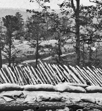
Another telltale discrepancy. The profiles of Fort Meikle as depicted on the engineers plan show the parapets held up by revetments (retaining walls) of fascines and gabions, not logs as shown in the photograph. No gabions. Ergo. No Miekle. The image was definitely not Fort Miekle. We then reexamined the Engineer fort plans, and only one fort was profiled with log revetments--Fort Haskell. Therefore, we were looking at an image taken from inside Fort Haskell. Then the expansive background made sense.
 These three stereographic images were taken inside Fort Haskell. (Left to right: 01324/01325, 01326, and 00532.)
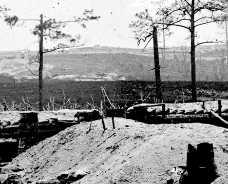
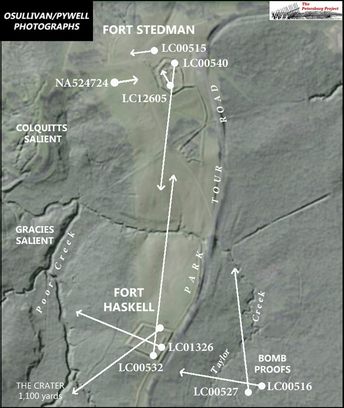
Once establishing that “Meikle” was actually Fort Haskell, the authors searched the Library of Congress collection, looking for the distinctive log revetment and interior works, and found two other stereoscopic images (with additional prints) where internal details can be linked together. These two images were captioned generically as “Fortifications in front of Petersburg.” When examined closely there is no doubt that the three images are from Fort Haskell. the first was taken from atop a bombproof inside the fort looking almost due north toward Fort Stedman. (The park has recently cleared the viewshed between the two forts.) The other two images were taken from inside of the fort, looking southwest and westerly. Suddenly, a vista opened before us. The resulting panorama, published here together for the first time, shows nearly a mile of the Petersburg siege lines from the Crater in the south through Gracie’s and Colquitt’s Salient to Fort Stedman in the north. These images reward minute inspection. In future posts, we will examine close-up many of the interesting details in these photos.
O'Sullivan Photos of Bombproofs Behind Fort Haskell
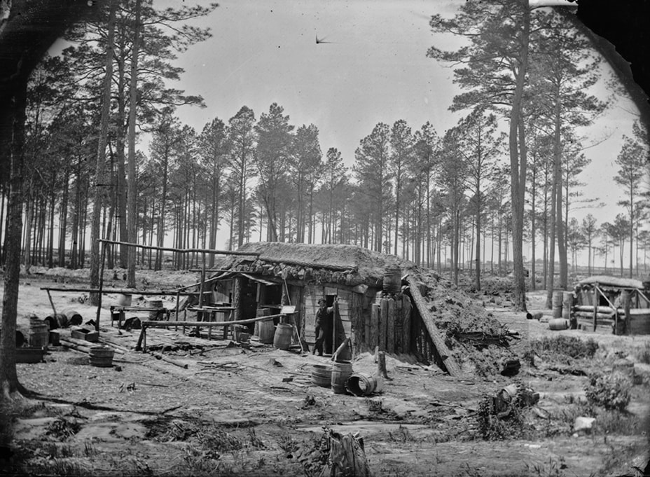
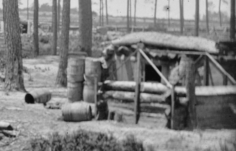
Two notable bombproof stereo views were taken from behind Fort Haskell and east of Taylor Creek. The first shows Fort Stedman and the hardwood grove ion Hare House Hill n the distance. The second shows Fort Haskell in the background. William Redish Pywell is posed in both images. (The left and right stereo plates were stitched together in Photoshop to broaden the field of view.)
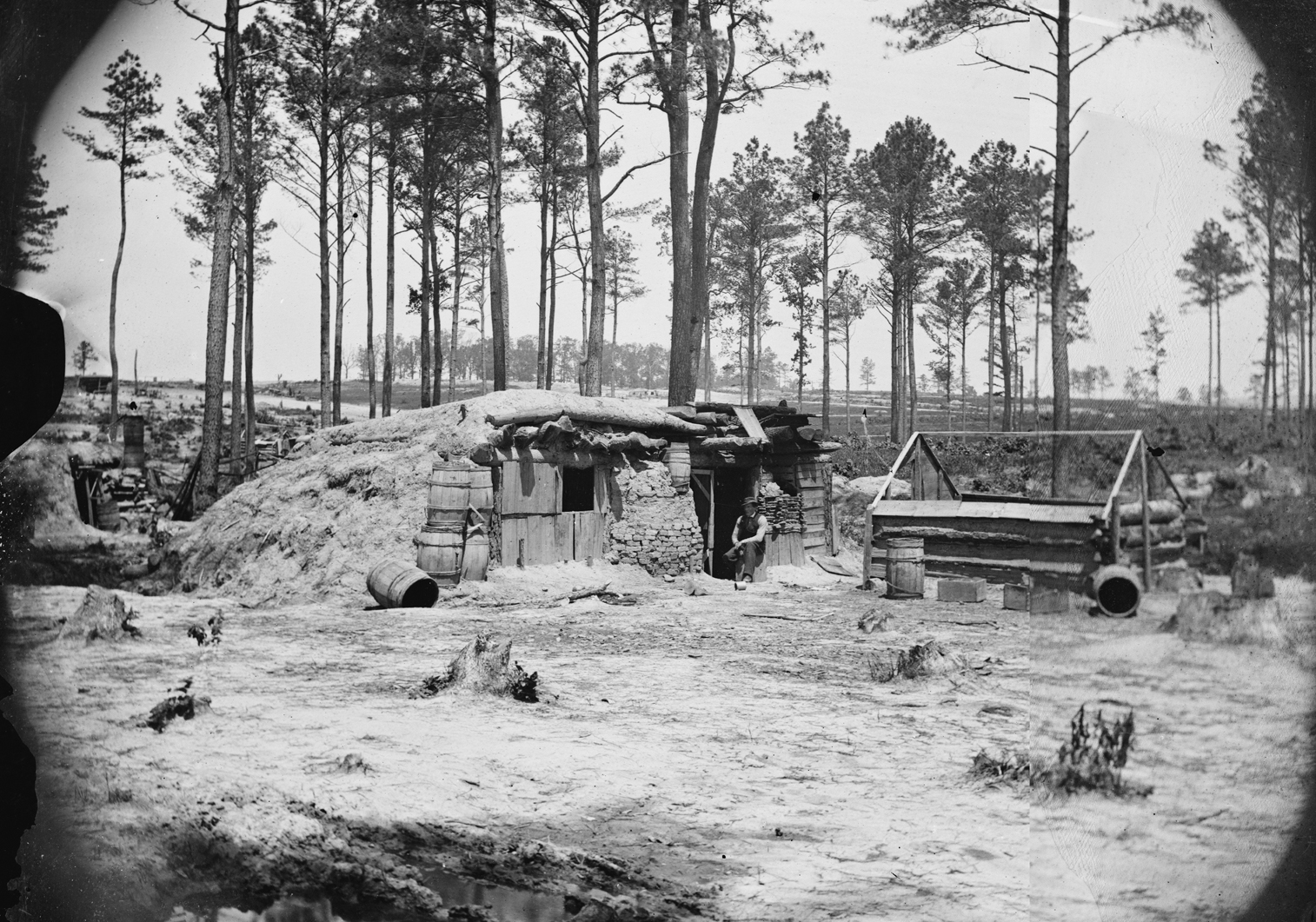
LC 00527. "Bomb-proof in front of Petersburg," stereo view by Timothy O'Sullivan (unattributed), April 1865. View looks north toward Fort Stedman in the distance on Hare House Hill inside the grove of hardwoods. The fort is visible under magnification. O'Sullivan's assistant (and future brother-in-law) is posed seated in the doorway.
Page updated 04/22/2024

