The Dimmock Line
"The order of work on the general defenses ... should be to occupy the favorable points in the circuit around the place (far enough from the town to prevent the enemy coming within bombarding distance) by suitable detached works, closed toward the town, with stockades. The intermediate spaces to be filled up afterward by rifle-pits or lines of infantry cover. The works to be earthworks, with such obstructions in advance as you may find the means and time to construct, such as abatis, pits, felled timber, & c."
-- Chief Engineer Jeremy F. Gilmer
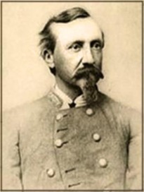
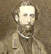 Capt. Charles H. Dimmock Capt. Charles H. Dimmock
In May 1862, as McClellan's Army of the Potomac advanced on Richmond up the Peninsula north of James River, prominent citizens of Petersburg petitioned the Confederate Secretary of War George Randolph to provide for the defense of their city. But little happened until the Federal army had actually retreated and dug in around Harrison's Landing, some twenty miles downstream. Still, there remained the threat of cavalry raids on the Southside or even of a thrust against vulnerable Petersburg, if McClellan had been so inclined. In early July, Maj. Gen. Daniel Harvey Hill took command of the Department of North Carolina, which, at the time, included Southside Virginia and made his headquarters in Petersburg. Almost immediately, Hill dispatched a brigade of his infantry to the Nathaniel Friend farm (White Hill) east of the city to work on a line of entrenchments to cover the fork of the Prince George County and Jordan Point roads. This early work likely consisted of epaulements for artillery and a simple rifle trench for infantry.
When it became clear that McClellan and his army were being withdrawn from the enclave at Harrison's Landing, the Confederate high command at last focused on possible threats south of James River. Two former Regular Army engineers, Col. Jeremy F. Gilmer and Lt. Col. Walter H. Stevens were dispatched to bring their engineering prowess to bear on the defenses at Petersburg. Gilmer, a West Point graduate (Class of 1839), resigned the service in June 1861 and signed on as Gen. Albert Sidney Johnston's chief engineer. After recovering from a wound received at Shiloh, Gilmer was appointed chief engineer of the Department of Northern Virginia and chief of Richmond's Engineering Bureau, a position he would hold until the end of the war. Walter Stevens, a West Point graduate (Class of 1848) and Regular Army engineer, resigned the service in March 1861 when his adopted state of Texas seceded. Stevens was named to the engineers in the Confederate army, where he labored on the defenses of Richmond. Gilmer and Stevens were considered two of the most capable military engineers of the Confederacy. In early August, Gilmer and Stevens (possibly accompanied by a young civil engineer named Charles Dimmock, Jr.) rode out along the high ground outside of Petersburg and traced a ten-mile long semicircle of fifty-five artillery strong points with both flanks anchored on the Appomattox River. Gilmer's philosophy of fortifying had changed little when he offered advice on constructing Atlanta's defenses a year later: "The order of work on the general defenses ... should be to occupy the favorable points in the circuit around the place (far enough from the town to prevent the enemy coming within bombarding distance) by suitable detached works, closed toward the town, with stockades. The intermediate spaces to be filled up afterward by rifle-pits or lines of infantry cover. The works to be earthworks, with such obstructions in advance as you may find the means and time to construct, such as abatis, pits, felled timber, & c." (Gilmer to Grant, O.R. vol. 30, pt. 4:489). Within a week of the engineers' tour, General Hill had assigned three infantry brigades and impressed nearly 1,200 slaves and free blacks to work on the line. This first intense phase of work focused on the lines east of town, from the Appomattox to Jerusalem Plank Road, where Gilmer and Stevens had lavished most of their attention. With construction underway, the senior engineers bowed out and relinquished oversight to Capt. Dimmock. His constant presence and attention throughout 1862 and 1863 ensured that his name would be attached to Petersburg's fortifications -- the Dimmock Line. |
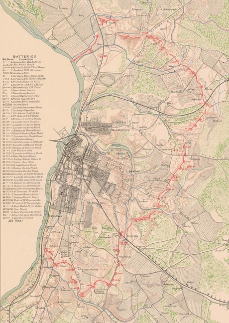
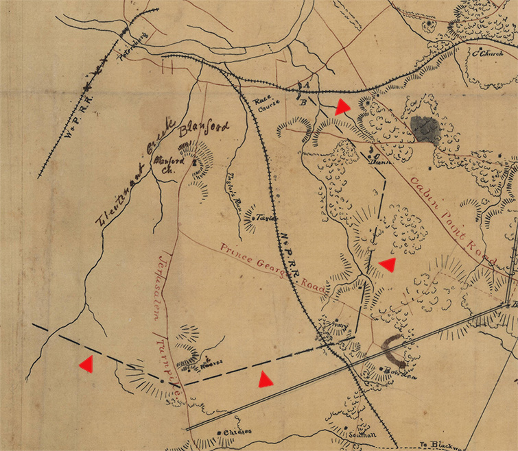
The Dimmock Line (shown in red) extended in a semi-circle around the city of Petersburg with both flanks anchored on the Appomattox River. It consisted of fifty-five numbered batteries of various configurations and armament. Detail from Confederate "Map of the Approaches to Petersburg and their Defenses," Gilmer, 1863. [Official Atlas, plate 40:1]
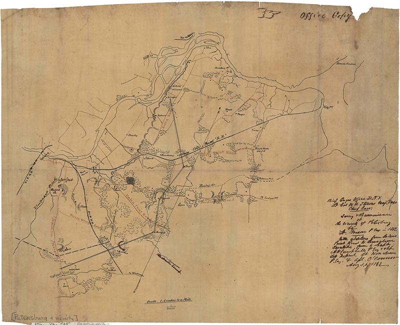
Early Stevens map (1862) of Surveys and Reconnoissances in Vicinity of Petersburg. [University of North Carolina] This appears to show (dashed line) the proposed general location of the Dimmock Line. See detail below.
Detail from Stevens 1862 map. A dashed line is drawn in from the forts on the City Point Railroad to the Dunn house to the Avery house to the Reeves [Rives] house on the Jerusalem Plank Road, and west from what is likely the Gregory House (unnamed) on the Jerusalem Plank Road.
|
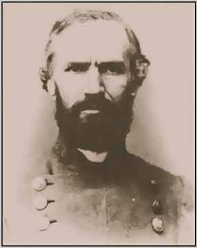
Charles Henry Dimmock was born in Baltimore, on October 18, 1831. His family afterwards settled in Richmond, where his father became the city surveyor. Dimmock studied mathematics and engineering under Claude Crozet, who was Principal Engineer and Surveyor for the Virginia Board of Public Works and a founder of the Virginia Military Institute. Under Crozet's direction, Dimmock worked as engineer on various civil projects in Virginia -- primarily roads and railroads. With the start of the Civil War, Dimmock was commissioned captain of engineers in the Confederate States Army. Undoubtedly, his career was aided by the fact that his father, Col. Charles Dimmock Sr., was by this time Chief of Ordnance for the state of Virginia and Inspector of Richmond's fortifications.
Despite a lack of military experience, one of Dimmock's early war assignments was to oversee construction of fortifications on Roanoke Island, North Carolina. These works were not considered successful. He then returned to Virginia to oversee work on the Yorktown fortifications with others. As McClellan's army moved up the Peninsula toward Richmond, Capt. Dimmock was sent to Petersburg to obstruct the Appomattox River to stymie the approach of Union gunboats. Dimmock then worked on a new military railroad bridge over the Appomattox.
With the departure of Gilmer and Stevens, Capt. Dimmock inherited the formidable task of fortifying the city. Military affairs in North Carolina in November and December drew off most of the soldiers and slave owners demanded the return of their property, leaving him starved for labor. Dimmock solved the problem by establishing a skilled cadre of 200 free black and slave workers who worked from 8 am until 4 pm daily for regular wages. After that, the work proceeded slowly but steadily.
Anticipating attack from the direction of City Point, much labor was lavished on the eastern front from the Appomattox River past the Jerusalem Plank Road. Beyond that the works were more or less sketched in -- artillery batteries were started, connecting infantry lines were left until manpower was available.
Federal Maps of a portion of the Dimoock Line produced during the assaults on Petersburg
Federal engineers made detailed plans and drawings of that portion of the Dimmock Line that was captured during the fighting of June 15-18, 1864. This included the works from Battery 1 on the Appomattox River to Battery 24 near the Norfolk & Petersburg Railroad.
These maps and the original survey drawings that follow are in the National Archives. The images reproduced here are from the collection of Petersburg National Battlefield.
These maps and the original survey drawings that follow are in the National Archives. The images reproduced here are from the collection of Petersburg National Battlefield.
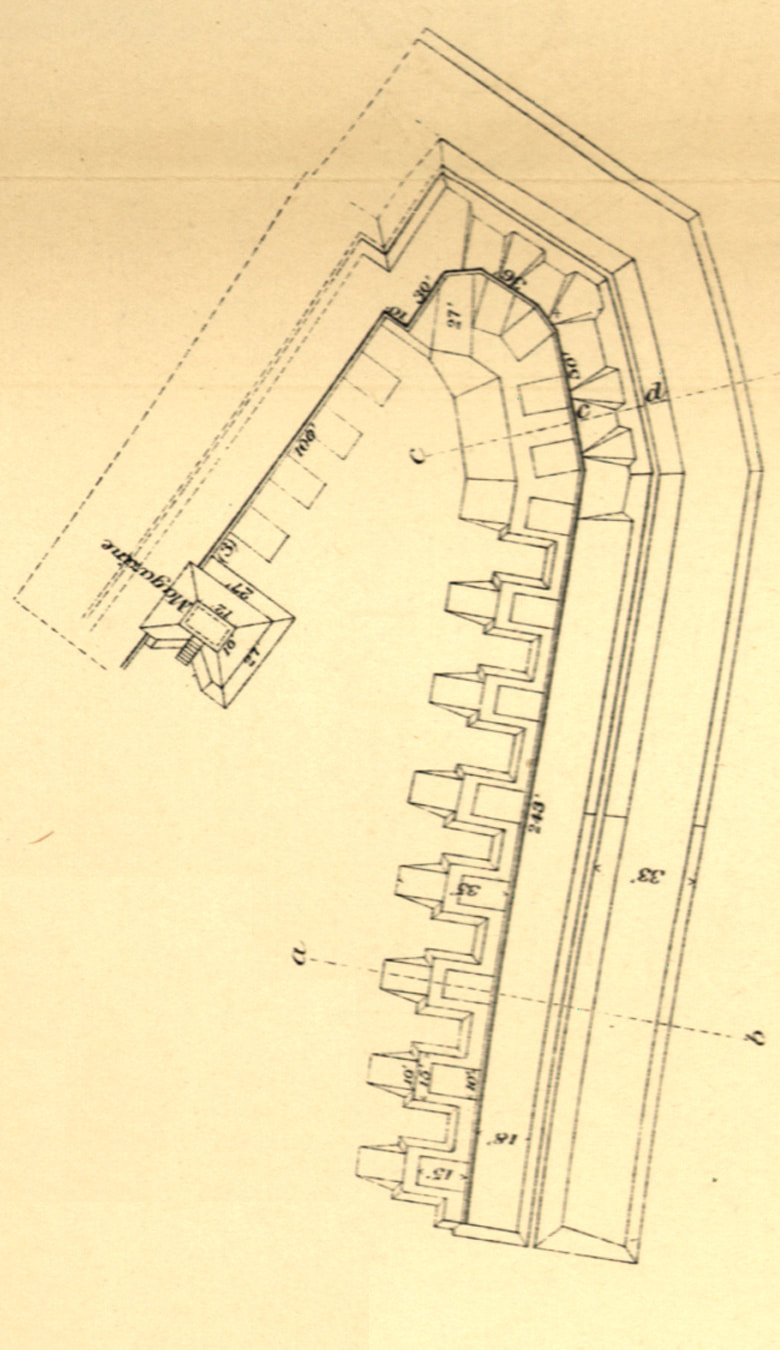
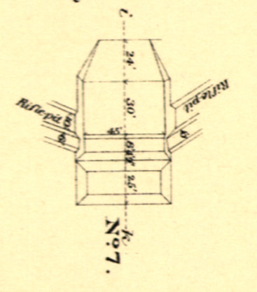
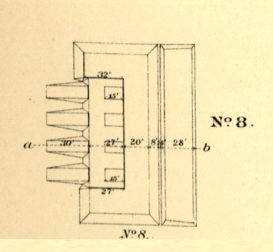
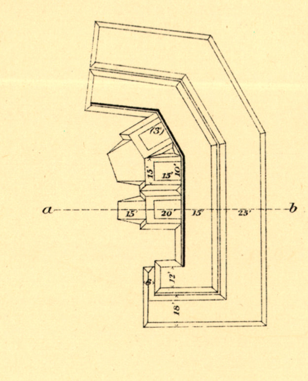
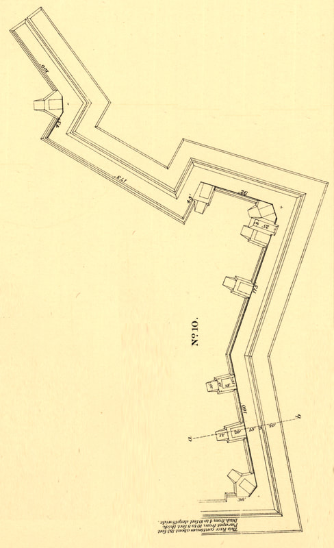
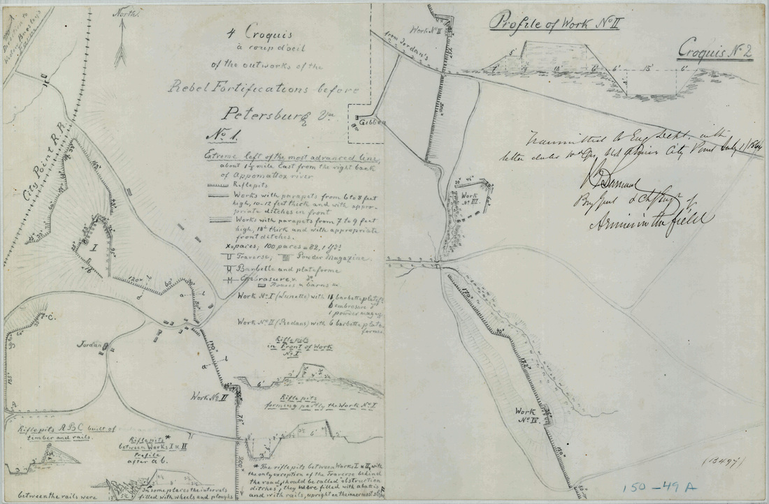
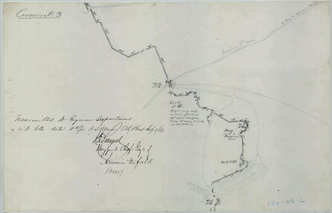
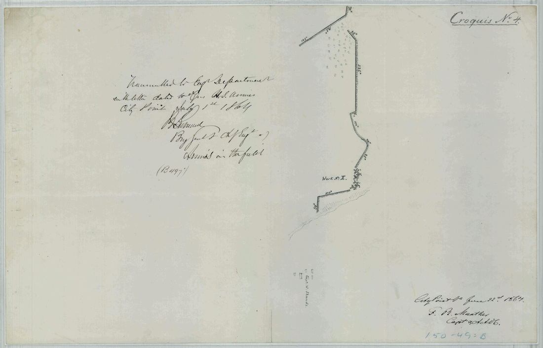
Pages from the surveyors' book, showing individual segments of the Dimmock Line
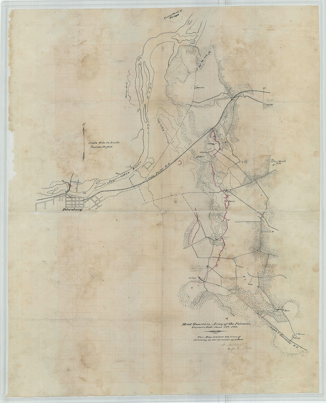
"This map exhibits the lines of the enemy in our possession up to date," Nathanial Michler, Engineer Department, June 18th, 1864. This included Dimmock Batteries 5 - 20. Original map drawn on graph paper.
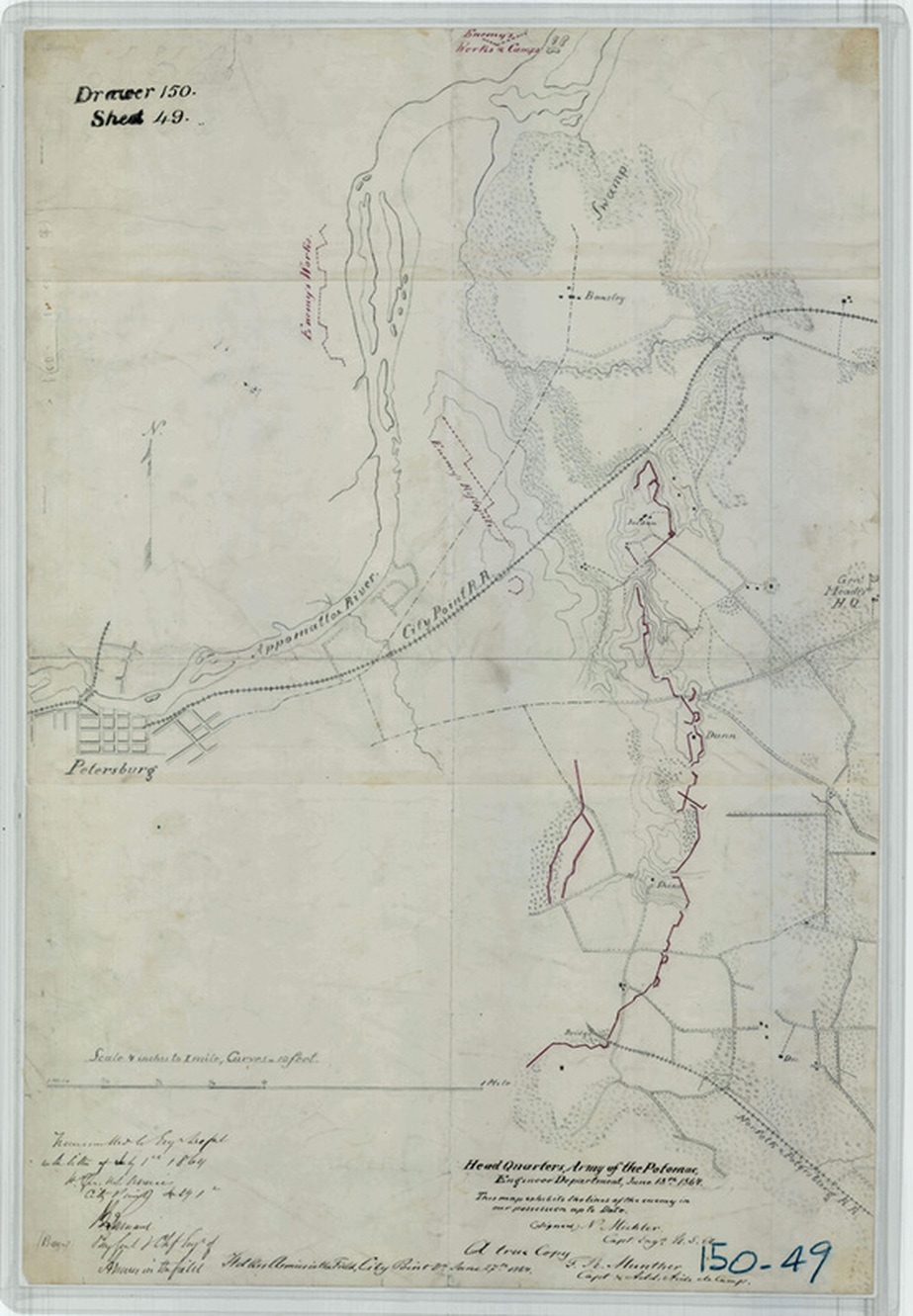
"This map exhibits the lines of the enemy in our possession up to date," Nathanial Michler, Engineer Department, June 18th, 1864." [NARA RG77 Drawer 150 Sheet 49]. A copy of the previous map.
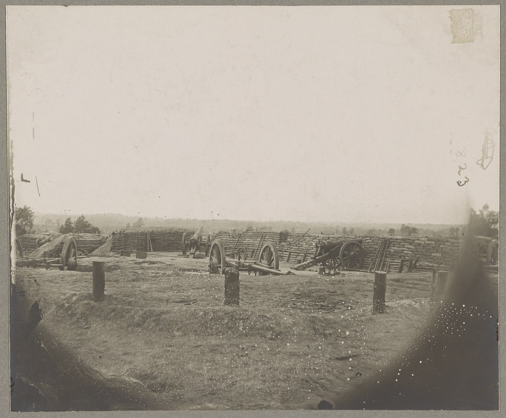
The following images (likely all by Timothy H. O'Sullivan) show the massive scale of the works built on the Dimmock Line. The redoubts were designed to give the artillery a commanding height over the ground to its front, in the style of a rampart topped by a parapet.
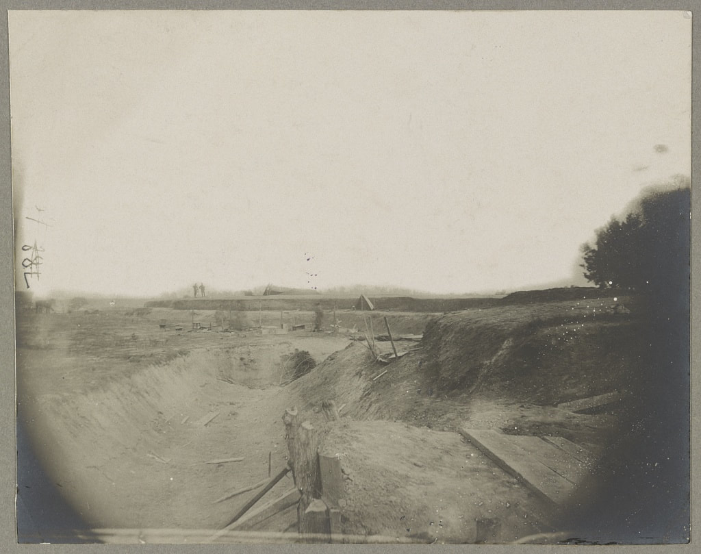
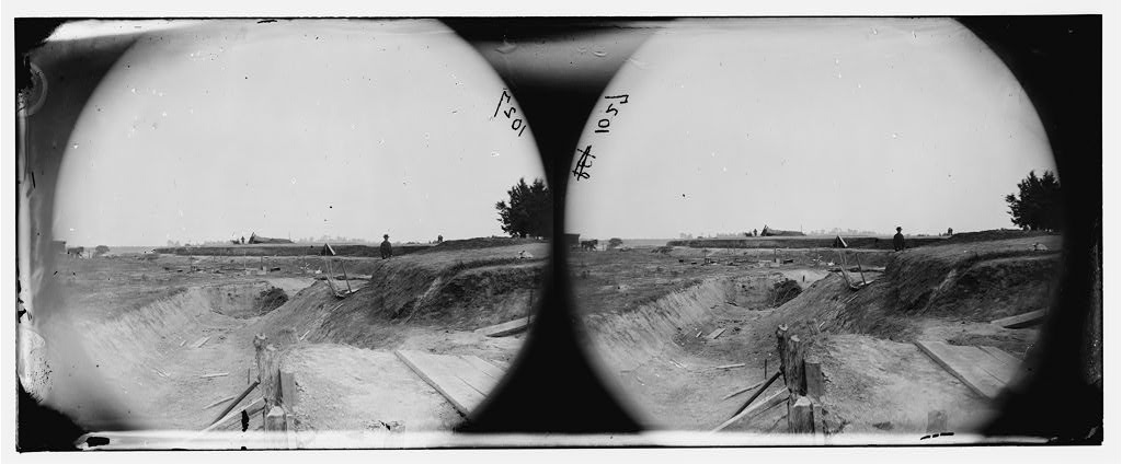
LC 01229. "[Petersburg, Va. Redoubt near Dunn's house in outer line of Confederate fortifications captured June 14 [sic], 1864, by Gen. William F. Smith]," stereograph by Timothy H. O'Sullivan. Looking into the front ditch of Battery 11. Federals dug a firing step into the outer face of the parapet to fire in the opposite direction.
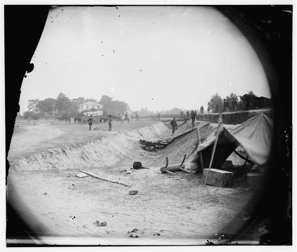
LC 32443. "Outer line of Confederate fortifications, in front of Petersburg, Va., captured by 18th Army Corps, June 15, 1864," Confederate Battery No. 11, Dunn House in the left distance behind the tents.
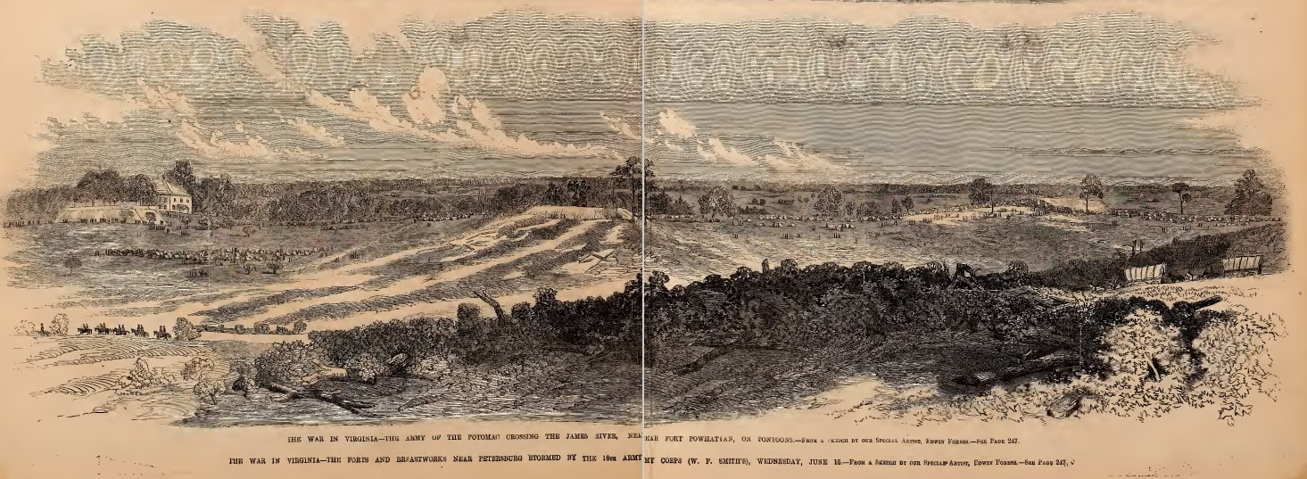
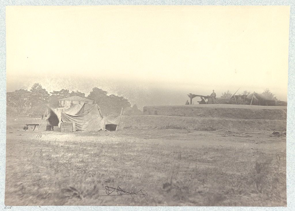
Section of the Dimmock Line from a sketch by Edwin Forbes, woodcut published in Frank Leslie's Illustrated Newspaper, July 9, 1864. Battery 11 and Dunn House on the left. A zoomable image is added below.
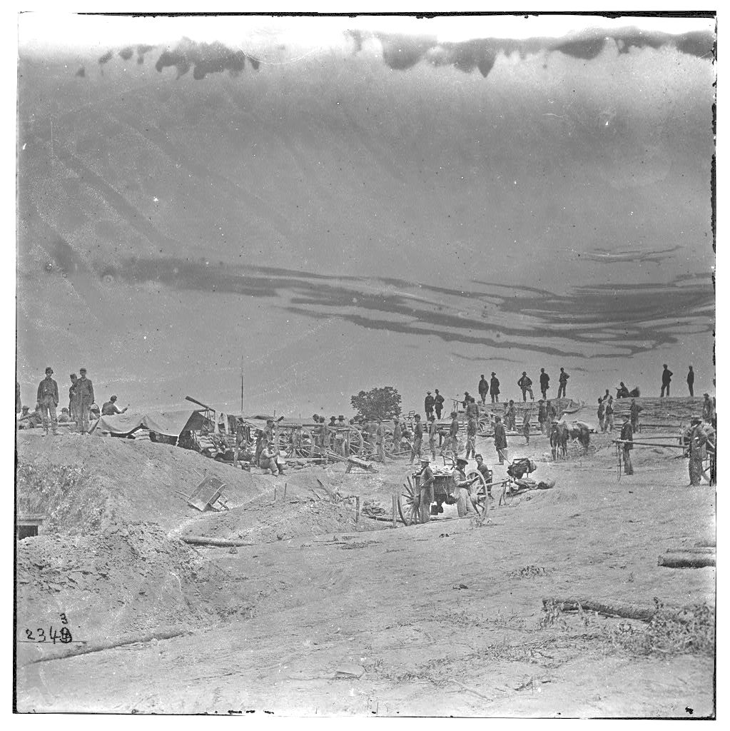
LC 32441. "View of rebel works in front of Petersburg, captured by the 18th Corps, under Gen. Smith, 24th June, 1864," stereograph by Timothy H. O'Sullivan.
LC 00500. "Petersburg, Virginia. Confederate fortifications on the outer line captured by the 18th Corps, June 15, 1864," taken from the same location as the above image, an unattributed O'Sullivan stereograph.
Several of the Dimmock works were reversed by the Federals to fire west instead of east. Some elements of the original Confederate lines can be picked out of the following images, including a magazine, and large, nicely constructed wooden platforms for the guns.
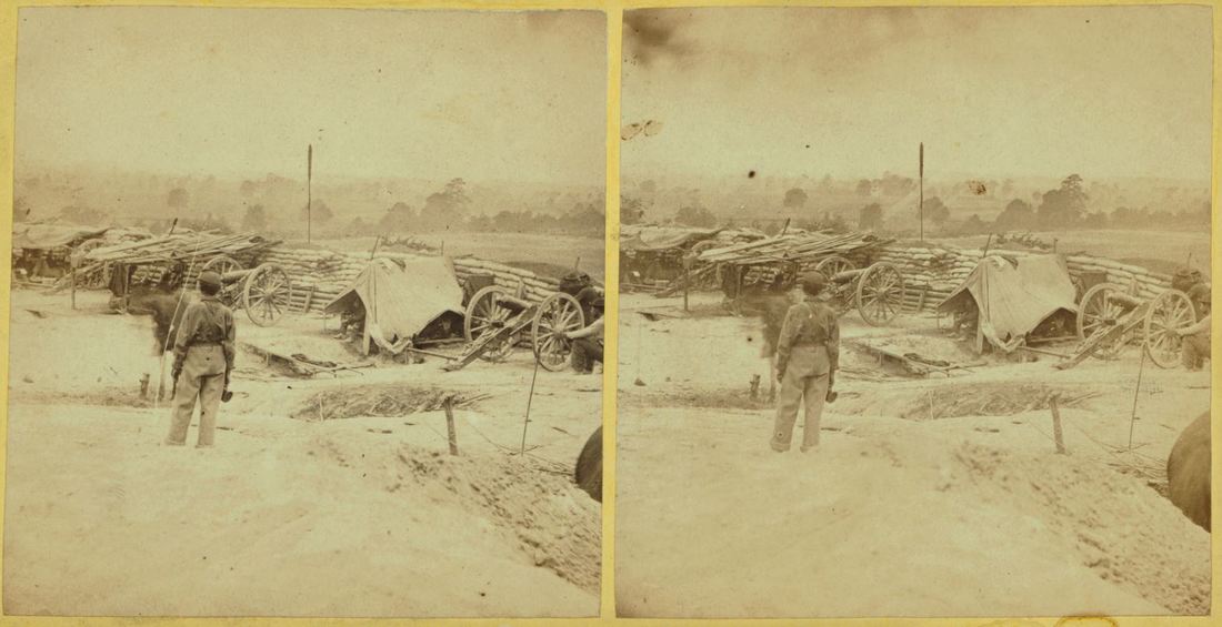
"Cowan's Independent Battery, 1st N.Y., inside one of the rebel forts in front of Petersburg, 24th June, 1864." New-York Historical Society.
LC0 1552. "Captain Andrew Cowan's 1st New York Independent Battery Light Artillery within Confederate works on the Petersburg line."
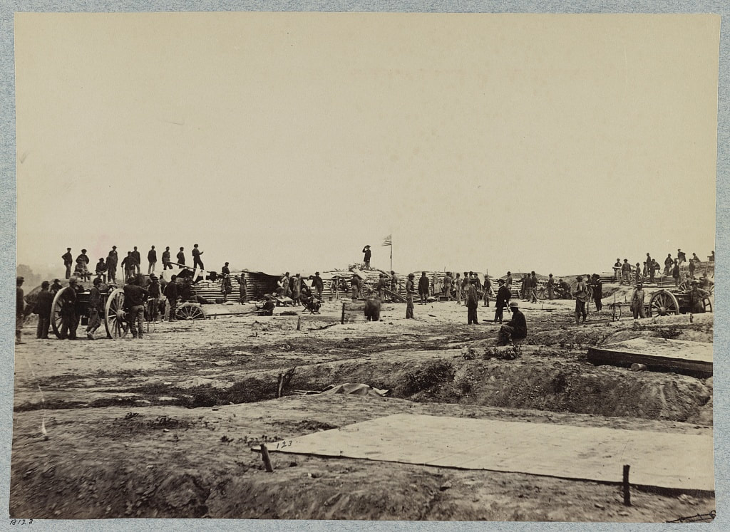
LC 32424. "Outer line of Confederate fortifications, in front of Petersburg, Va., captured by 18th Army Corps, June 15, 1864,"
LC 32444. "Petersburg, Va., battery on outer line Confederate entrenchment capt. June 15, 1865."
LC 00469. "[Petersburg, Virginia (vicinity)]. Fortifications"
updated 03/12/2019