
|
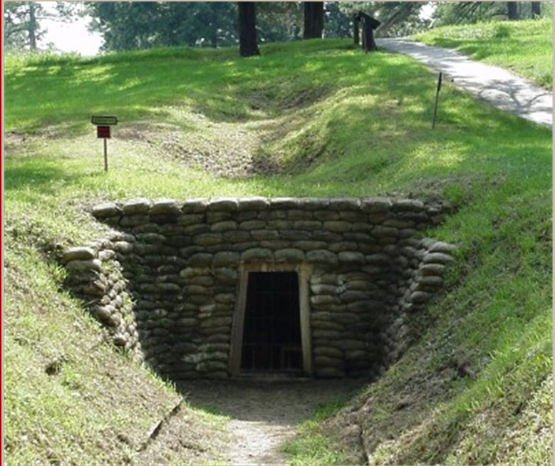
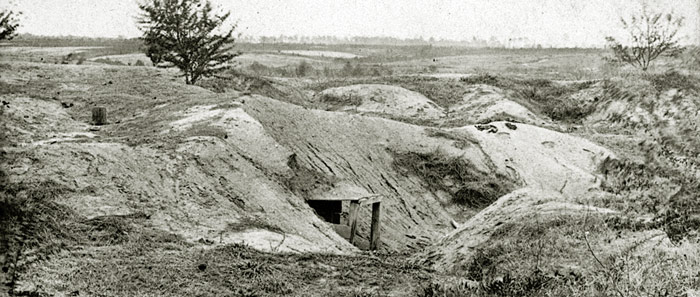
Entrance to the Mine, photo by Philip Shiman. The depressions on the slope mark the collapse of the underlying tunnel.
|
"The Mine and The Crater"
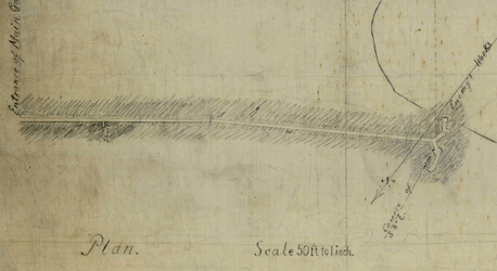
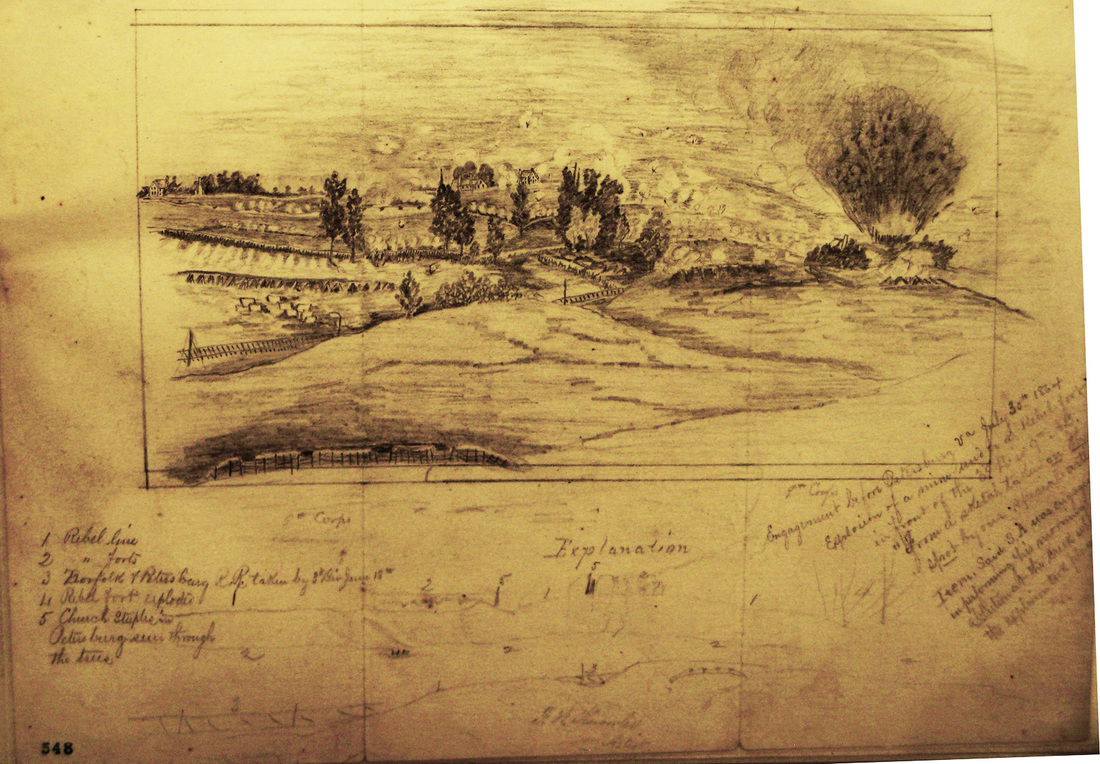
Barnard's Sketch of the Crater --National Archives
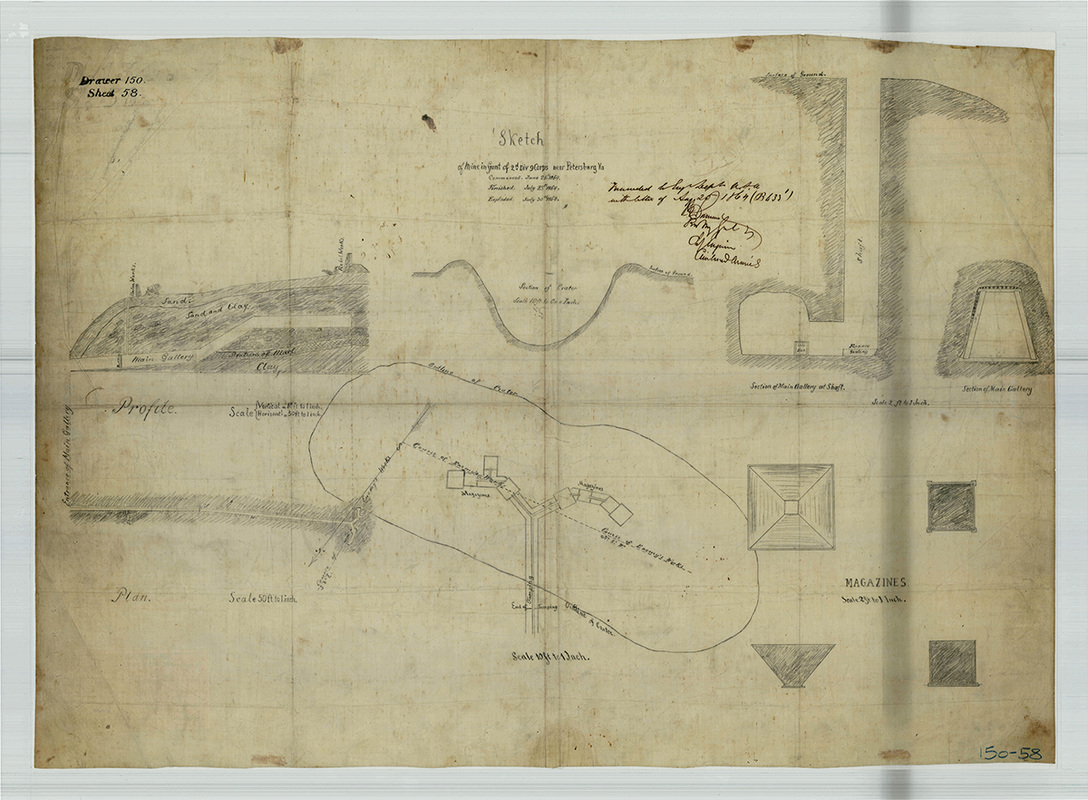
J. G. Barnard. "Sketch of the Mine in Front of the 2d Div. 9 Corps near Petersburg, VA" [NARA RG 77: Dr. 150-58 Entry 2.245]
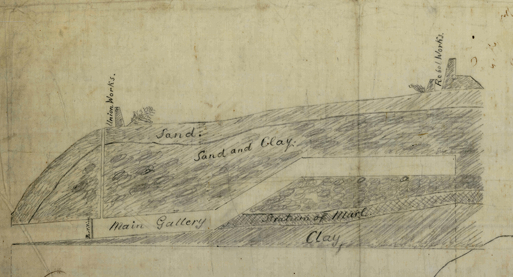
Detail from Barnard's "Sketch of the Mine," above.
|
Detail from Barnard's "Sketch of the Mine," above.
|
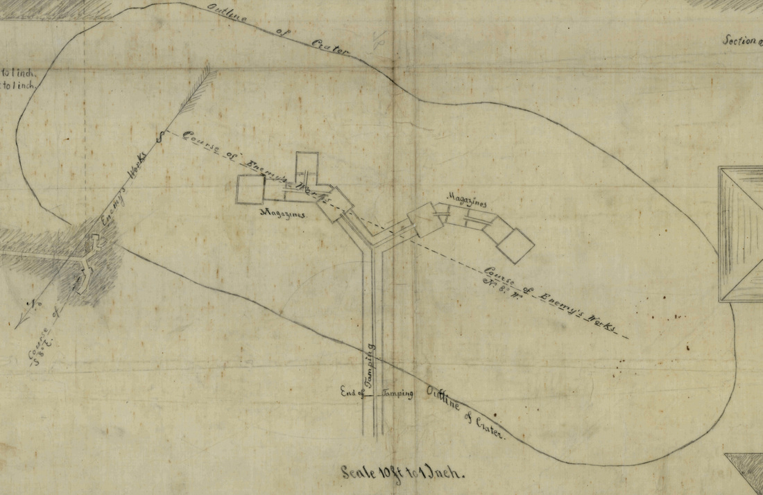
Detail from Barnard's "Sketch of the Mine," above.
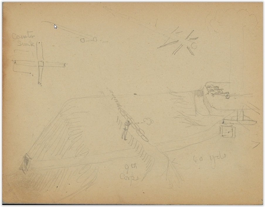
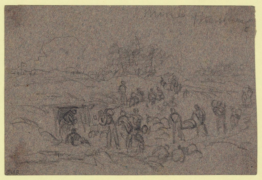
Charles Wellington Reed's depiction of the Federal mine. Library of Congress, Manuscript division, Reed papers.
Charging the Mine with Powder
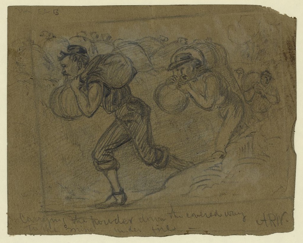
"Carrying the powder down the covered way to the mine under fire" [DRWG/US - Waud, no. 52 (A size)]
Loading Powder in the "Mine, Petersburg" [DRWG/US - Waud, no. 1075 (AA size)]
July 30th, 1864. Artists' Depictions of the Explosion
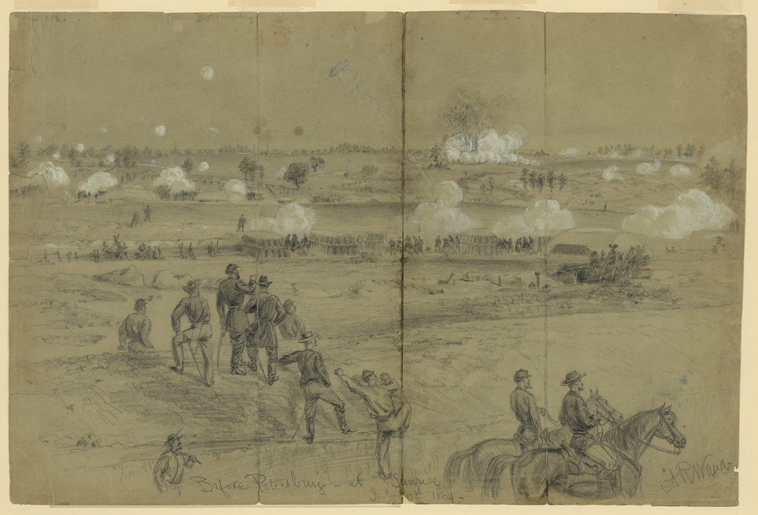
"Before Petersburg at Sunrise, July 30th 1864," sketched by Alfred R. Waud, LC Waud, no. 727 B size (22452).
Inscribed on separate sheet of cream paper: "Explosion of the mine under the Confederate works at Petersburg July 30th 1864. The spires in the distance mark the location of the city; along the crest, in front of them are the defensive works, it was an angle of these that was blown up, with its guns & defenders. The explosion was the signal for the simultaneous opening of the artillery and musketry of the Union lines. The pickets are seen running in from their pits & shelters on the front, to the outer line of attack. In the middle distance, are the magnificent 8 & 10 inch Mortar batteries, built and commanded by Col. Abbott. Nearer is a line of abandoned rifle pits, and in the foreground is the covered way, a sunken road for communication with the siege works and the conveyance of supplies and ammunition to the forts. The chief Engineer of the A. of P. is standing upon the embankment watching progress throw [sic] a field glass."
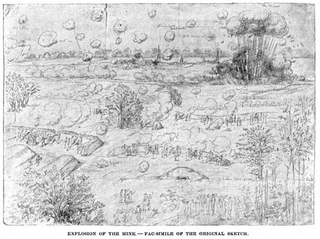
"Mine Explosion, July 30th, 1864," sketch by Charles Wellington Reed, LC Reed Papers, image photographed by Philip Shiman. Reed drew from the perspective of the 5th Corps front.
Sketch by Joseph Becker, published in the American Magazine, vol. 37 (1894): 749.
The Attack and Aftermath
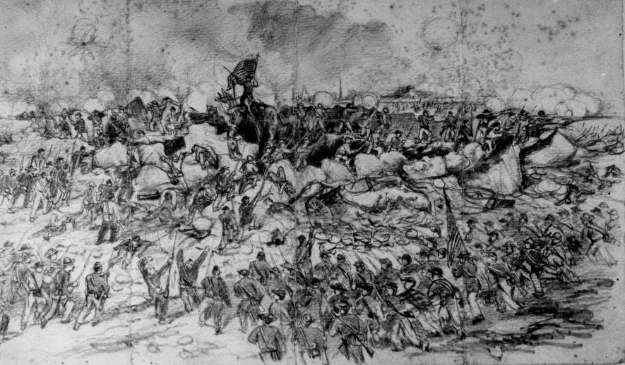
Becker Collection 22484 detail. "Siege of Petersburg -- Charge into the Crater." Andrew McCallum, artist.
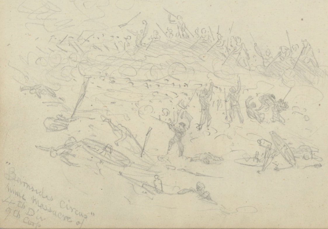
"Burnside's Circus. Mine Massacre of 4th Div. 9th Corps," Charles Wellington Reed Papers: Sketchbooks, Image 165.
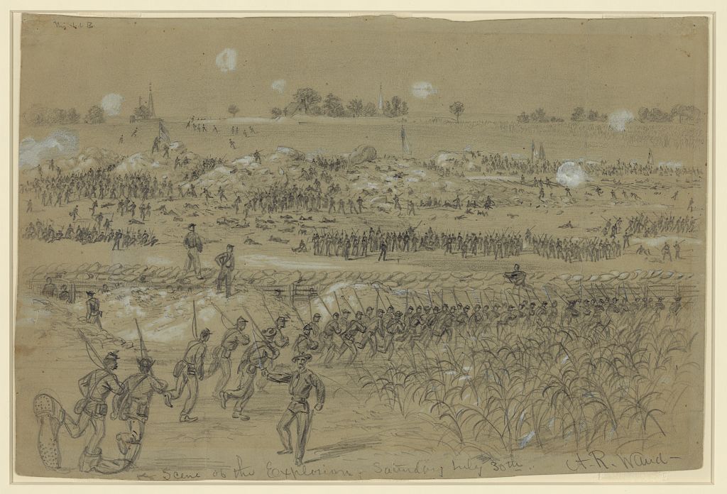
"Scene of the explosion Saturday July 30th" [DRWG/US - Waud, no. 156 (A size)]
Inscribed on an accompanying piece of paper in pencil and black ink: "The advance to the "crater" after the explosion of the mine. In the middle distance are the mounds of earth thrown up by the explosion: beyond upon the high ground cemetery hill the Confederates inner line of works, which if they had carried, would have given the Union Army Petersburg and Richmond. In the foreground troops are seen advancing to and beyond Burnsides outer intrenched line and moving upon the Confederate defences. These were on the left Bartlett's Massachusetts brigade, and on the right, the Negro troops this sketch was made about 8 AM July 30th 1864. / A point in the Rebel works known as Elliots Salient over this part was held by the 18th and 23rd S. Carolina infantry and a battery of artillery blown up in the explosion."
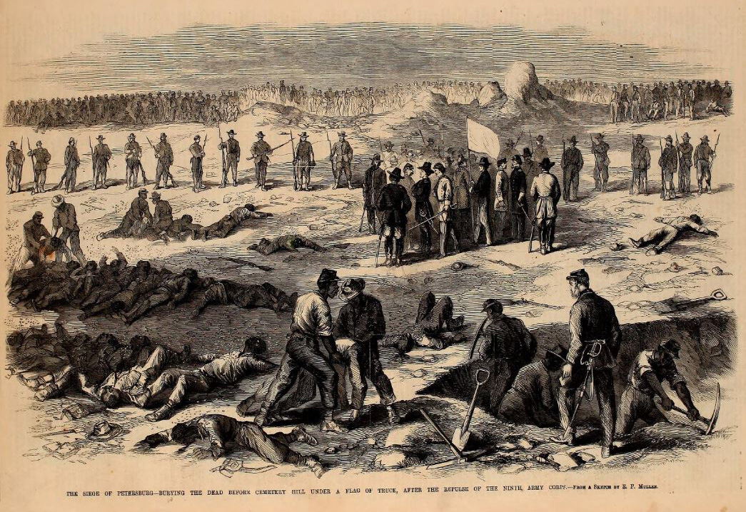
"Burying the Dead Before "Cemetery Hill Under a Flag of Truce After the Repulse of the Ninth Army Corps," woodcut after a sketch by E. F. Mullen, Leslie's Illustrated Newspaper, September 3, 1864.
"After the repulse on the 30th, Gen. Burnside sent a flag of truce to ask leave to remove our wounded and bury our dead. On the 1st of August a reply was given and working parties, white and colored, sent out. Our Artist sketches the terrible scene. The bodies, after lying in a midsummer sun for two days were terribly altered; swarms of flies gathered around those remains of the gallant fellows who fell. The rebel works swarmed with men, and in front was a line of guards. In the intervening space, between this and our line, the men were busily at work, committing to earth the remains of their comrades. Near the guards our officers met rebel officers at the flag. Among the latter were Gen. Cooper and Gen. Mahone, among the former Gen. Ferrero. Our dead amounted to 300 in all, less than had been supposed. The time given for the truce was from five A.M. to nine, after which hostilities commenced, but in reality only random musketry firing was heard." -- Frank Leslie's Illustrated Newspaper, September 3, 1864.
"Those bodies that were recognized and could be lifted on to stretchers without falling to pieces, were carried into our lines and buried. Pits were dug twentv or thirty feet long and about four feet deep for the rest. The poor fellows were then rolled, and in some cases, shovelled onto the stretchers, and dumped or laid in the holes, one on top the other, until within a foot of the top, and then covered with loose earth. In course of time these bodies decayed. Subsequent storms washed the loose covering of earth down through, and for months after, until the end of the war, long rows of bleaching skeletons marked this field of awful slaughter."--Forty-six months with the Fourth R. I. volunteers, in the war of 1861 to 1865 Corp. Geo. H. Allen, of Company B. 1887, 293.
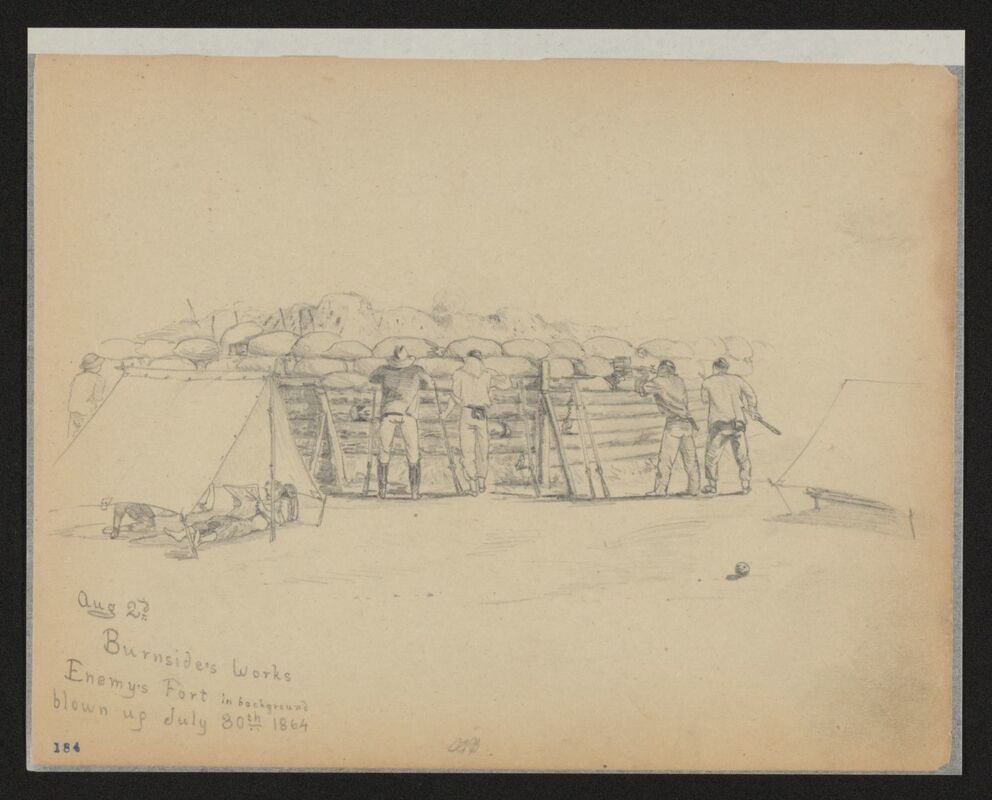
"Burnside's Works, Aug. 27, Enemy's Fort in background blown up July 30th, 1864." Sketch by Charles Wellington Reed, LOC. Sharpshooters with extra loaded muskets leaned against the revetment.
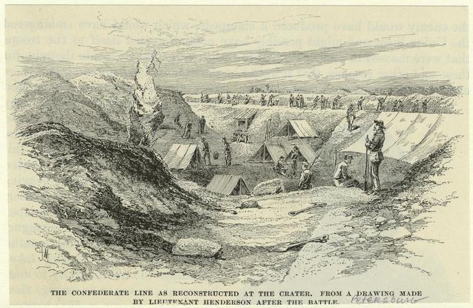 New York Public Library . The Confederates reestablished their line after the explosion.
Postwar Images of the Crater
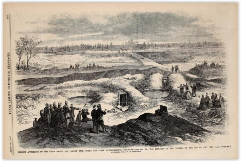
Frank Leslie's Illustrated Newspaper published this view from the Crater on August 19, 1865, a year after the mine explosion and four months after the end of the war.
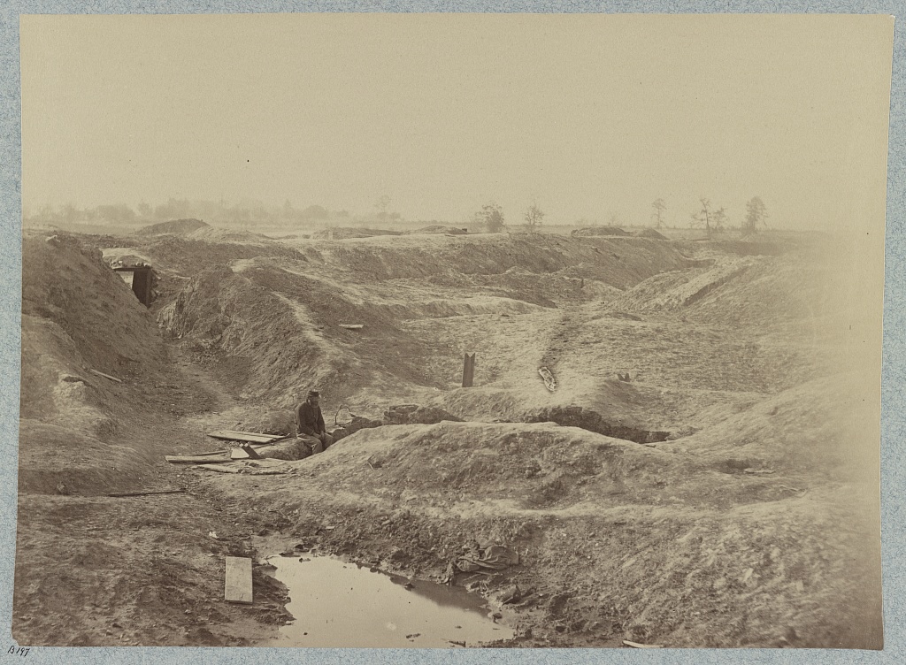
"Fortifications on the Petersburg lines," a view of the Crater taken at the end of the war [LOT 4166-E, no. 29]. Photographer unidentified.
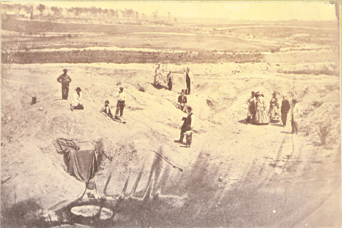
"Interior of the Crater," postwar photograph (c. 1870), photographer unknown, collections of the USAMHI. Note makeshift dark room on left to process photographs of tourists. Also MOLLUS Collection, volume 1, no. 45.

"No. 878. Crater, Petersburg, VA," postwar photograph, photographer unknown, New York Public Library. Note the encroaching vegetation.
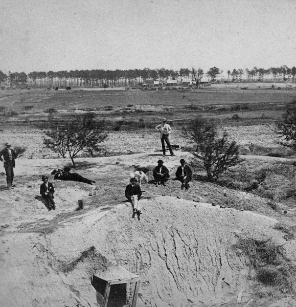
MOLLUS vol. 6, 289. "The Crater, Petersburg, Va., View of Union Lines."
MOLLUS vol. 6, 290. "The Crater, Petersburg, Va., Rebles lines on the left, facing Union rifle works." Taylor Farm in the distance.
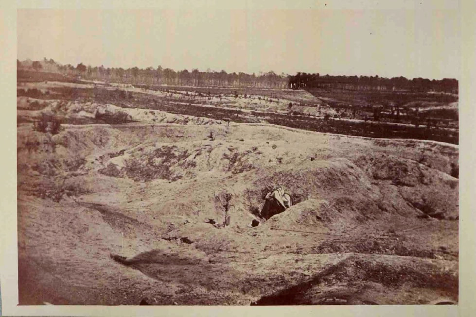
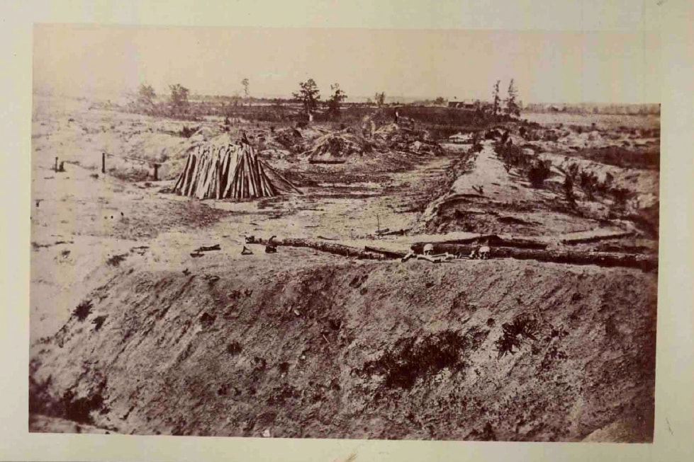
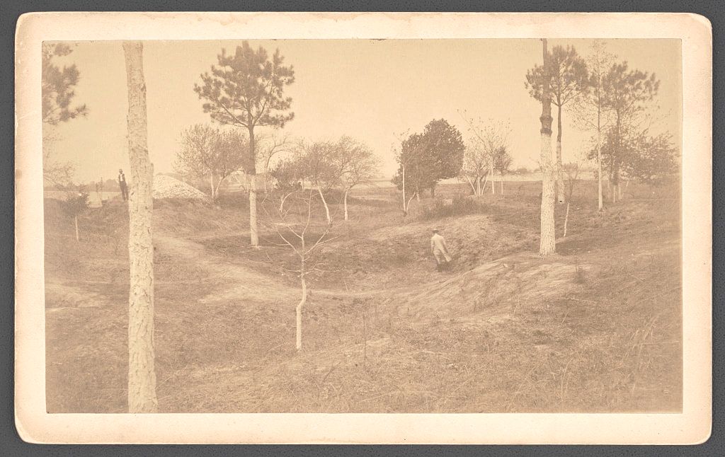
The Crater, circa 1870. NPS files.
The Crater, circa 1870. NPS files. The rebuilt Taylor farm can be seen in the distance. Note the rampant erosion in the foreground.
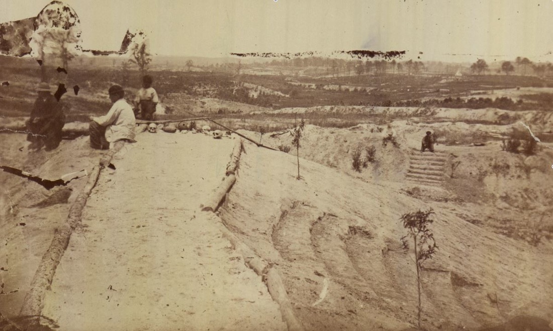
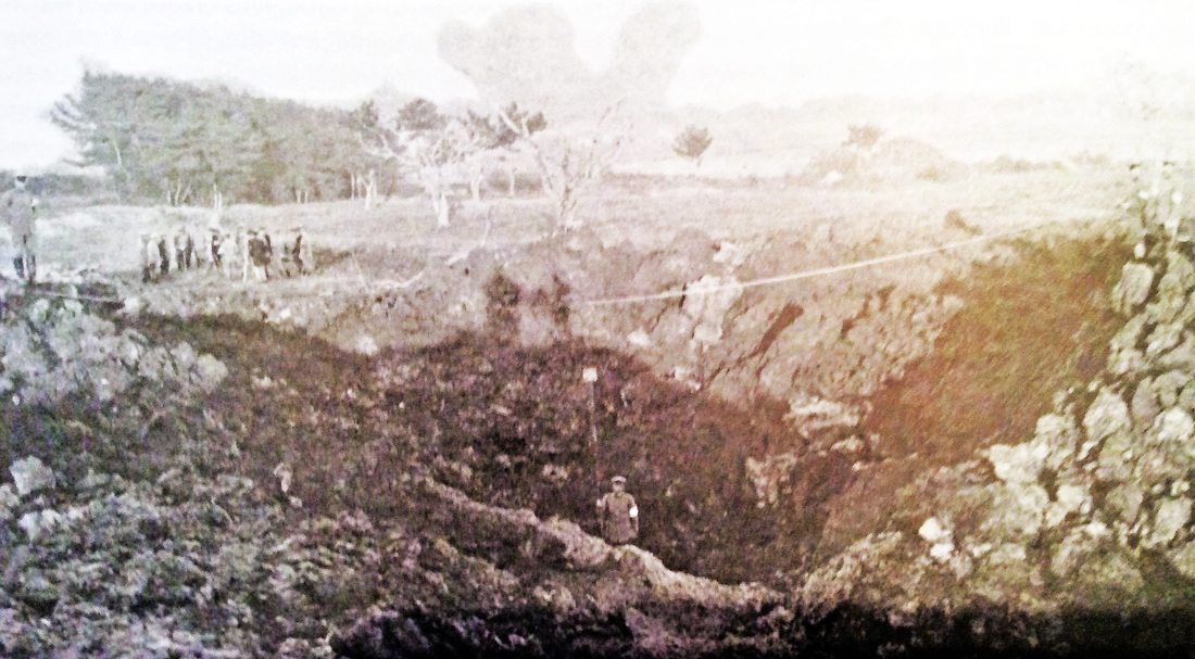
The Crater, circa 1870. NPS files. Notice the skulls, stairs, and terraced seating for tour groups.
LC 56346. "Civil War veterans of the 57th Massachusetts Infantry Regiment with Confederate General William Mahone at the crater caused by Union soldiers exploding a mine at Petersburg, Virginia," photograph by W. H. Tipton, 1887
LC 56185. "The Crater," photograph by Frederick H. Foss, May 1887. View looks east toward the Taylor Farm.
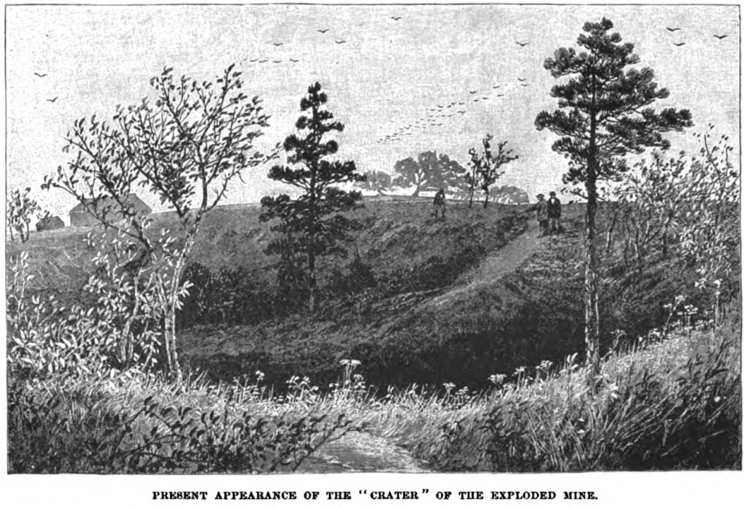
Sketch of the Crater as it appeared to artist Joseph Becker upon revisiting in the 1890s. From "Petersburg," an article in the American Magazine, v. 37, 1894. “Thirty years after, I visited the scene of the explosion. The lines of the “crater” were there still, but softened with grass and shrubs, while tall trees had grown up around the edge of the artificial volcano where so many brave men had thrown their lives away.”
A More Modern Comparison ....
Kokura, Japan, 1890s. Practice mine in clayey ground. This is how the Petersburg crater may have appeared just after the explosion of July 30, 1864. Barton and Doyle, Beneath Flanders Fields (2007), pg. 38.
Last Updated 09/13/2023
