
Fort Patrick Kelly
"Captain Dexter has continued the work on Fort Patrick Kelly, working, besides his own company, a daily detail of about 600 men. The revetment is nearly completed and the parapets about two-thirds done. The platforms for the four guns in embrasure and for one of the guns en barbette are completed, as also the banquette on four of the faces." Report of Nathaniel Michler, September 24, 1864. (O.R. vol. 42, pt. 1: 164.)
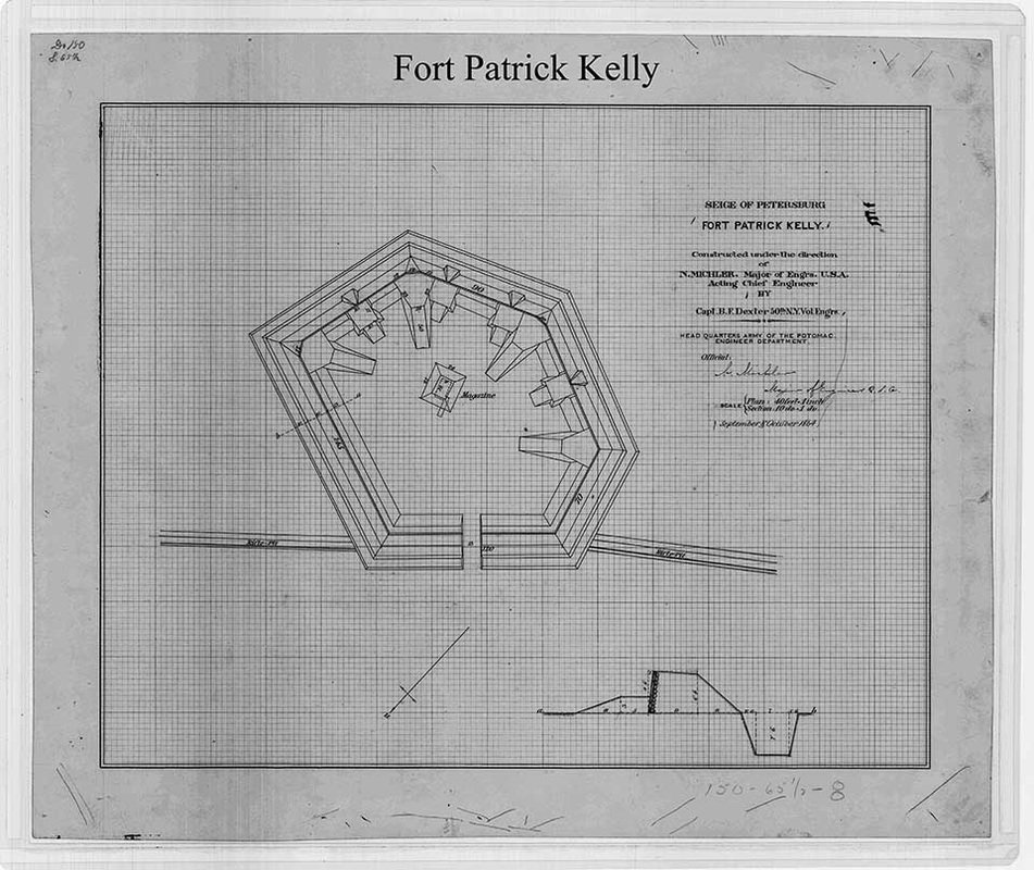
"Siege of Petersburg: Fort Patrick Kelly, Constructed under the direction of N. Michler, Major of Engrs. USA, Acting Chief Engineer by Capt. B. F. Dexter, 50th N.Y. Vol. Engrs., Headquarters Army of the Potomac Engineer Department, September-October 1864." NARA RG77 Dr. 150-44.
October 29, 1864.
Hdqrs. Army of the Potomac, Engineer Department
On Tuesday evening Captain Dexter reported Fort Patrick Kelly completed, except the abatis and some additional slashing in front and on the flanks of the fort. About two days more will be required with one company of engineer troops to complete the abatis and slashing.
I am, colonel, very respectfully, your obedient servant, N. MICHLER, Major Engineers, Acting Chief Engineer.
(O.R. vol. 42, pt. 1: 175)
October 30, 1864.
Major SEPTIMUS CARNCROSS, Assistant Adjutant-General, Second Corps:
MAJOR: I have the honor to report that yesterday two guns of Roder's battery were placed in position in Fort Bross and two in Fort Patrick Kelly; two of Batteries C and I, Fifth U. S. Artillery, in Fort Blaisdell, and four of the Tenth Massachusetts Battery in Fort Stevenson. Nothing of importance has occurred on the line during the past twenty-four hours.
Very respectfully, your obedient servant,
G. HAZARD, Major, Commanding.
(Correspondence O.R. vol. 42, pt. 2: 438)
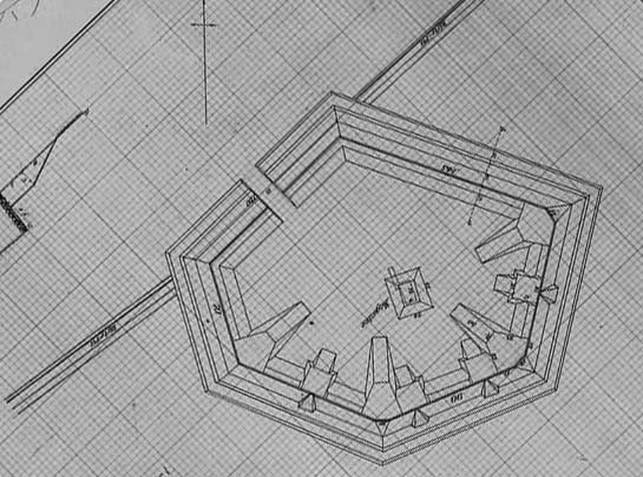
Plan of Fort Patrick Kelly reoriented with north at the top of the page.
|
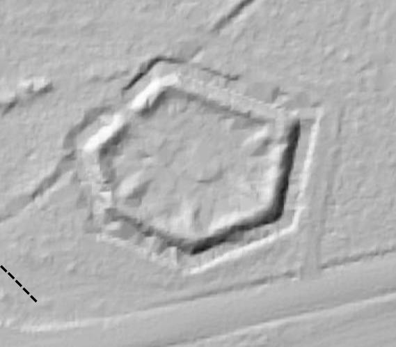
LIDAR image of Fort Patrick Kelly as it survives today. Contributed by Scott Williams.
|
HEADQUARTERS ARMY OF THE POTOMAC, OFFICE OF THE CHIEF ENGINEER, February 27, 1865.
SIR: I have the honor to submit the following report of the engineering operations in this army for the week ending February 25, 1865:
For the past three days Lieutenant De Groot has been engaged with one company of this command, and for two days a detail of 400 men from the Ninth Corps, in completing the repairs of Fort Patrick Kelly. But little progress has been made today on account of infantry detail not reporting. The gun platforms are completed, and the parapets and drains nearly finished.
Very respectfully, your obedient servant,
J. C. DUANE, Major of Engineer and Brevet Colonel, U. S. Army.
(O.R. vol. 46, pt. 1: 162)
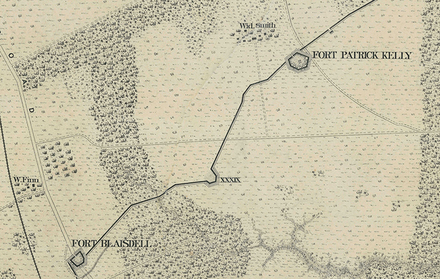
Detail from Michler-Weyss 8 in. = 1 mi. series, Sheet No. 4. NARA RG 77: G 204-34. Fort Blaisdell was built across the Jerusalem Plank Road. Fort Patrick Kelly was built on the Widow Smith farm. These forts were part of the rear-facing Union line.
