
This page is currently under revision 09/15/22
Signal Towers and Trees on the Petersburg and Bermuda Hundred Fronts: Stations of Observation and Communication
Although telegraphy was used extensively during the Petersburg campaign, signal trees, towers and buildings remained vital tools for each army to observe the movements of the enemy from an elevated vantage point. Information gained from such observations could then be relayed through all available means of communication, including signaling by flag or torch.
Military uses of these locations included artillery spotting, mapping, and photography. The fourth estate also climbed these posts as special artists drew the siege lines and battlefields and reported war news.
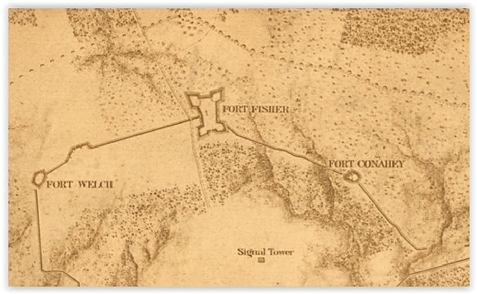
Fort Fisher Signal Complex
The Federal signal tower behind Fort Fisher on the western end of the Union lines at Petersburg is a good study of how signal stations were used in multiple ways.
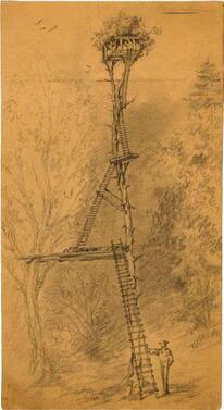
Michler 1867.
The sketch below, done by topographic engineers, illustrates how Federal mappers used the signal tower and signal trees located on the parapets of Fort Welch and Fort Fisher to map the Confederate lines from a safe distance. The penciled lines represent lines of sight to various landmarks from the signal tower.
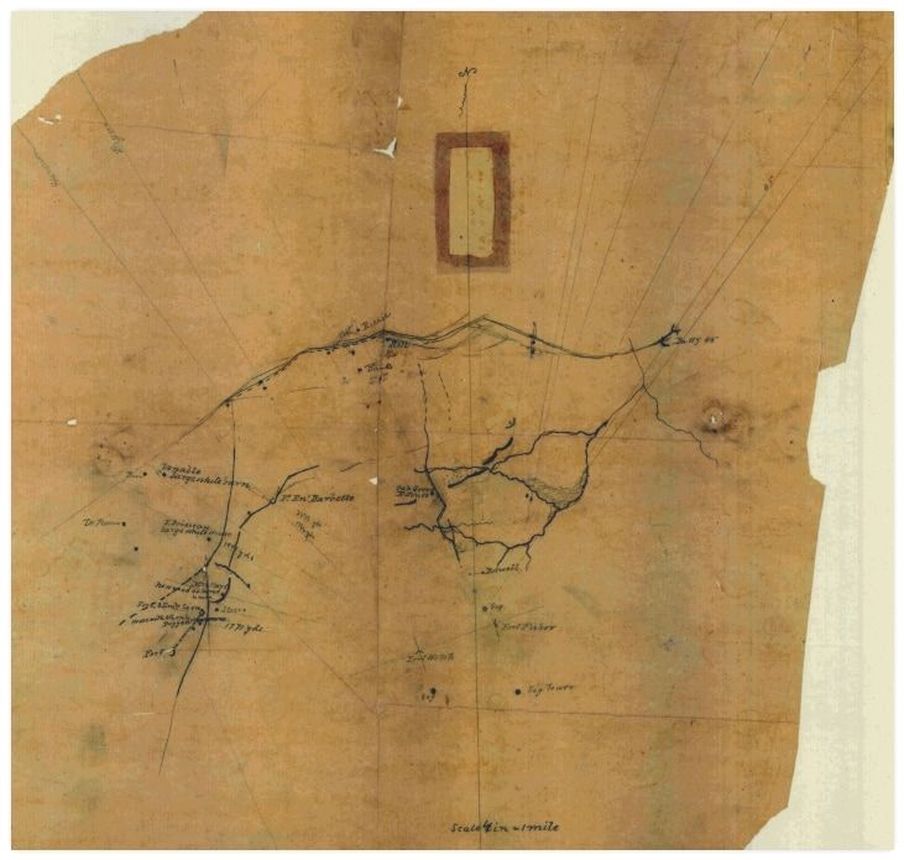
NARA RG 77.
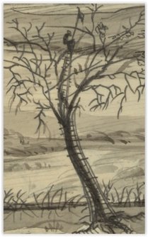
The signal tree on the parapet of Fort Fisher can be seen on the left in the drawing below.
 LC http://hdl.loc.gov/loc.pnp/ppmsca.22822 Appearance of the Union and Rebel lines at the "Front," from the Parapet of Fort Fisher, Mar. 28 showing the territory gained by the 2nd and 6th, Army Corps after the rebel attack on the 25th inst., with Petersburgh [sic] in the distance / 3 miles only / on the right. Inscribed below title on verso: Mem = It will be well to delinate the Pickets of both sides as seen in the middle ground/back/between the Chiver[sic]de frize or abatis[sic]works so close were they that a running conversation was ordinarily kept up between them Nestell. LC http://hdl.loc.gov/loc.pnp/ppmsca.22822 Appearance of the Union and Rebel lines at the "Front," from the Parapet of Fort Fisher, Mar. 28 showing the territory gained by the 2nd and 6th, Army Corps after the rebel attack on the 25th inst., with Petersburgh [sic] in the distance / 3 miles only / on the right. Inscribed below title on verso: Mem = It will be well to delinate the Pickets of both sides as seen in the middle ground/back/between the Chiver[sic]de frize or abatis[sic]works so close were they that a running conversation was ordinarily kept up between them Nestell.
|
Detail from drawing at left.
|
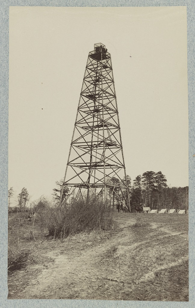
Peebles Farm (Fort Fisher) signal tower.
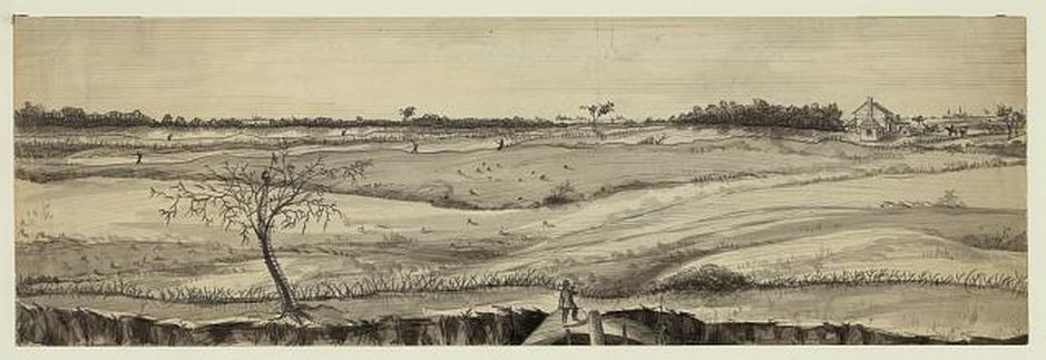
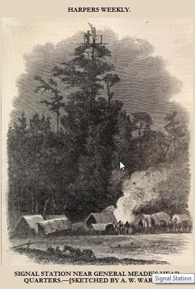
The view was spectacular from the signal tower. The newspaper illustration below shows Fort Fisher, before the southern two bastions were constructed, and the U.S. and Confederate picket lines beyond, with the Confederate line and the city beyond that. Movement on the Boydton Plank Road and the South Side Railroad could also be observed from the tower.
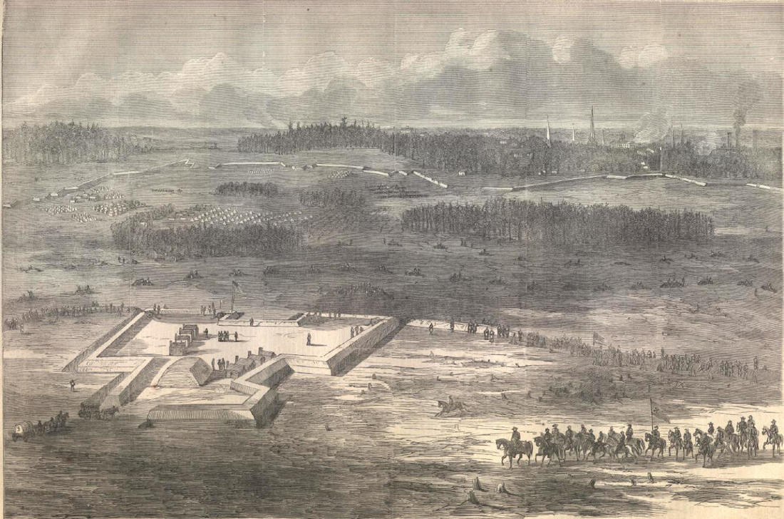 Harper's Weekly, March 11, 1865, sketch by Horace Heath.
|
Imagine hauling a Civil War era camera and glass negative(s) to the top of the signal tower! The result is the view below, looking to the northeast of the Union line, and capturing deserted camps, picket posts and Fort Conahey. It is not known who took this photograph,which seems to have been taken after the city fell and the armies moved west.
|
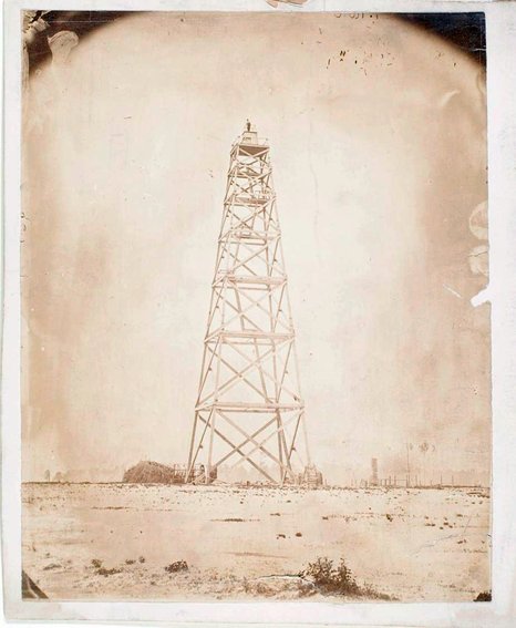
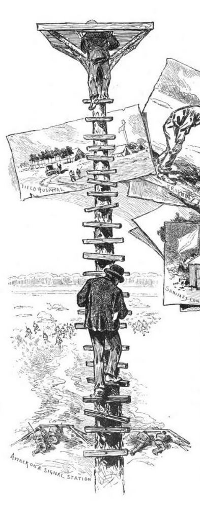
Dec. 20th, 1864. "Hine is very friendly to me again, having got over his pet. He begins work today on a Signal Tower 140ft. high and 40 x 40 at the base. Builds of hewn timber secured with screw and bolts and braces. This is a very disagreeable task to be done at this season when cold winds are so frequent. From the top of this tower, which is to be placed upon an eminence near our camp, the Signal officer expects to overlook the whole Rebel left and all the roads leading out of Petersburg. By means of the tower, we shall be kept informed of all movements of troops on the part of the enemy." --William Watts Folwell Diary, 50th New York Engineers |
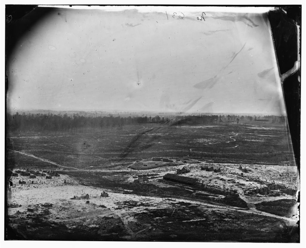 LC 04090. View from the Peebles Farm signal tower looking north by northwest. Fort Conahey with its casemated guns is at the middle of the image. Surrounding camps appear to have been abandoned. Confederate lines were inside the distant tree line.
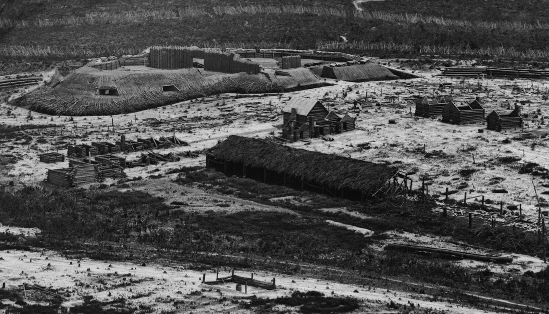
LC 04090 detail. Fort Conahey and surrounding deserted camps as viewed from the Peebles Farm signal tower.
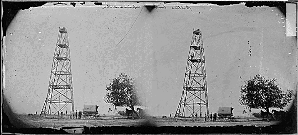
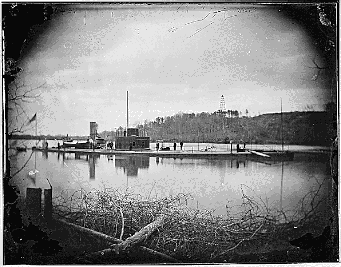
Ben Butler's Signal Station at Point of Rocks on the Appomattox River
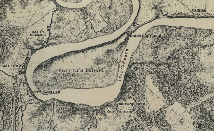
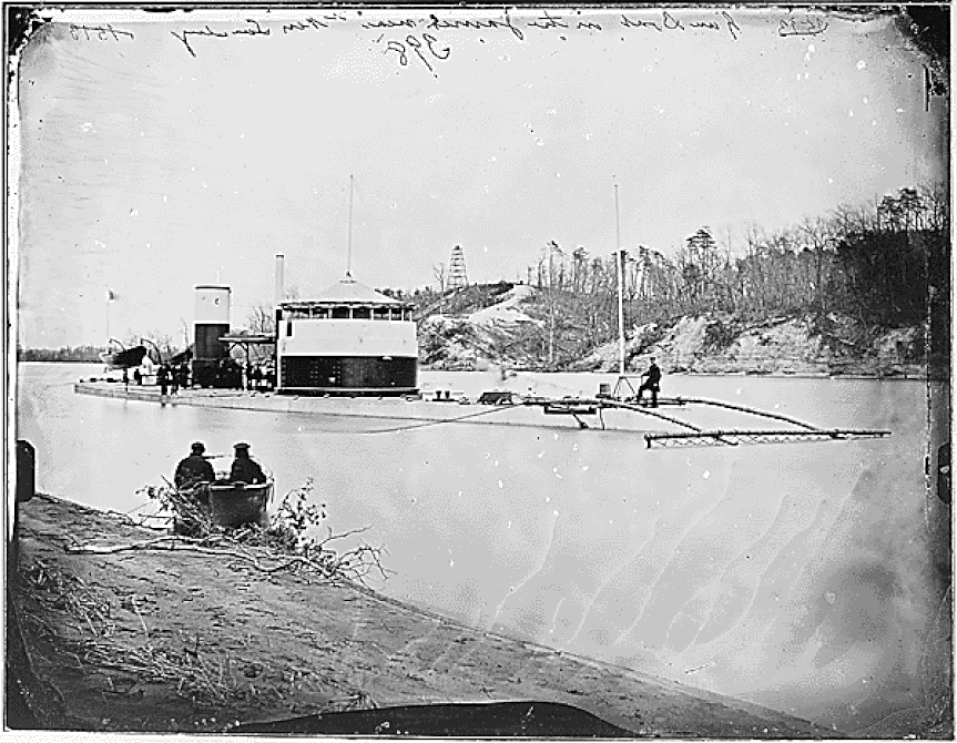
Beginning in May 1864, he Army of the James occupied Bermuda Hundred, the neck of land between the Appomattox and James Rivers and entrenched a strong line of works consisting of six forts and nine connected batteries. Engineers constructed two signal towers, one at each end of the line. Cobb's Hill signal tower above Point of Rocks on the left of the line overlooked the Appomattox River; Crow's Nest signal tower overlooked James River. The Cobb's Hill signal tower could communicate directly with a signal station at Grant's Headquarters at City Point.
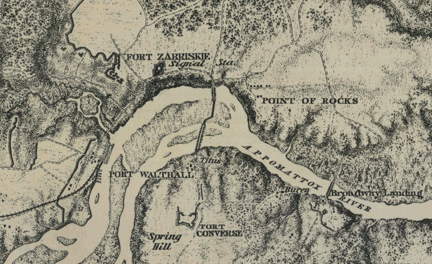
LC cw0525b20, detail. "Bermuda Hundred." Michler. The signal tower was built on Cobb's Hill on the north bank of the Appomattox River adjacent to Fort Zabriskie.
"A signal tower 120 feet high was built at Point of Rocks, from the top of which could be seen the Richmond and Petersburg Railroad and turnpike. This gave us the means of obtaining a great deal of information, and must have impressed the enemy with this idea, for they established a casemated battery of three Whitworth rifled field <ar126_184> guns for the special purpose of firing at this tower. But one shot of all fired at it struck it, and that only splintered one of the posts without damaging the tower itself." -- Report of P. S. Michie, chief engineer, Army of the James, Oct. 10, 1865. O.R. series iii, vol. 5, 183-184
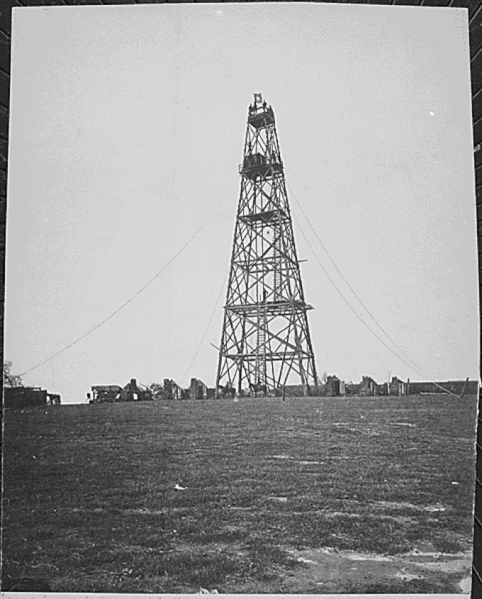
.LC01958. "[Bermuda Hundred, Va. Butler's signal tower; another view]." Left half of stereo view. Unattributed.
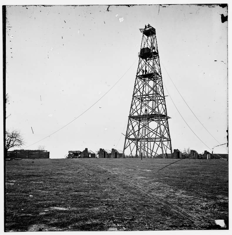
NARA. "Cobb's Hill signal tower".
LC00491. "Bermuda Hundred, Virginia. Lookout tower on left of Bermuda Hundred line." Right half of unattributed stereo view (damaged). This image appears to have been taken after the tower was abandoned. The canvas roofs of the huts have been removed, and the camp is in disarray.
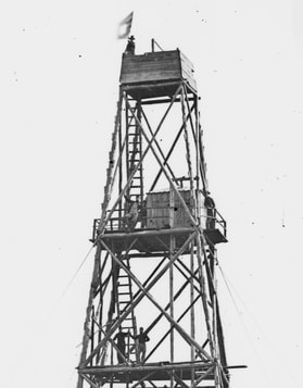
NARA. Point of Rocks signal tower.
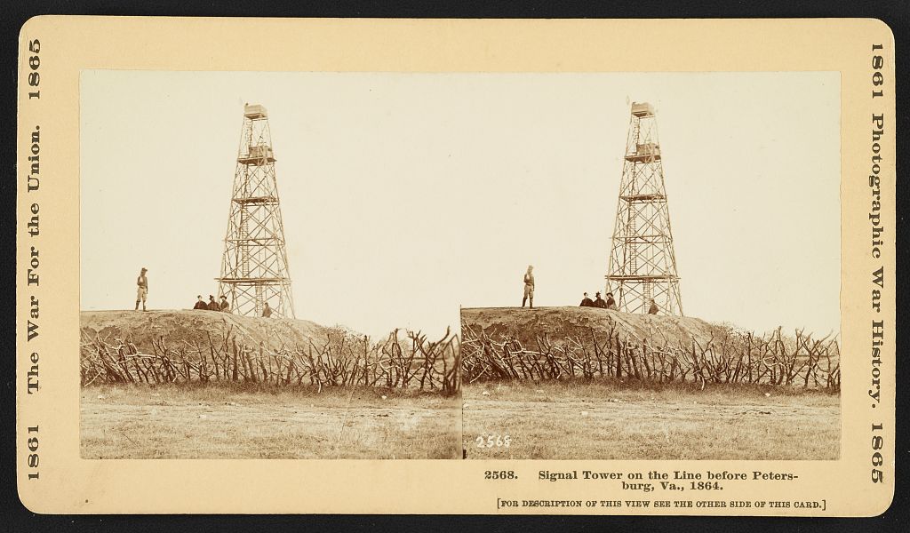
LC 1s02750. "Signal tower on the line before Petersburg, Va., 1864, showing a group of men standing near the signal tower on a hill outside of the fortifications in the vicinity of Point of Rocks, Virginia." Soldier stands atop the parapet of Fort Zabriskie.
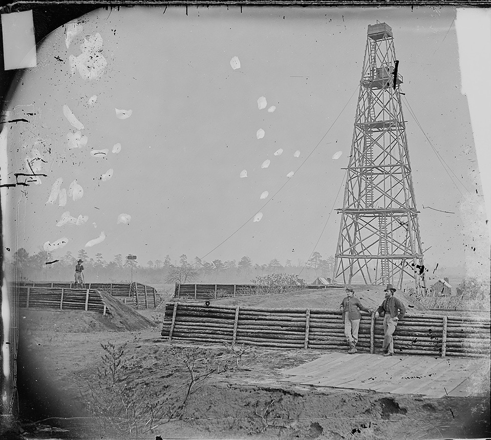
NARA 525042. "Lookout Tower on Petersburg Lines." Photo of Butler's tower on Cobb's Hill, taken from within Fort Zabriskie.
LC 01829. "[Bermuda Hundred, Va. Photographer at Butler's signal tower]" Photographer with his wagon on right.
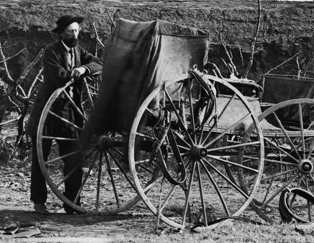
LC 01829 detail. Camera wagon and photographer. Is this John Reekie?
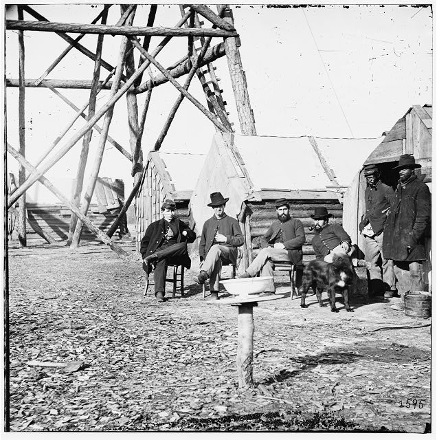
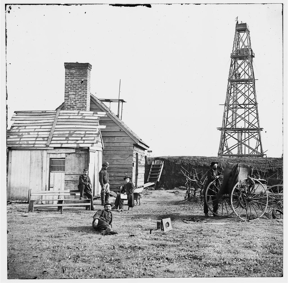
LC 02006. "Bermuda Hundred, Va. Officers by their quarters near the signal tower."
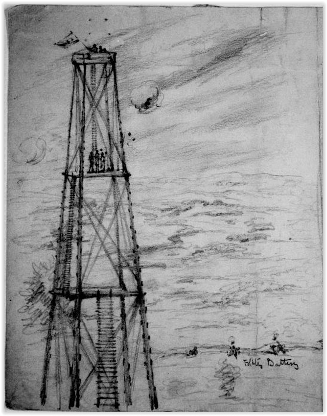
Signal Station Near Pont of Rocks, Fired at by the Rebels, while Gen. Butler was in the Station tearing away a portion of one of the main supports. Unnamed artist, the Becker collection, Boston College.
|
LC 02819 detail. Soldiers posed atop the signal tower.
|
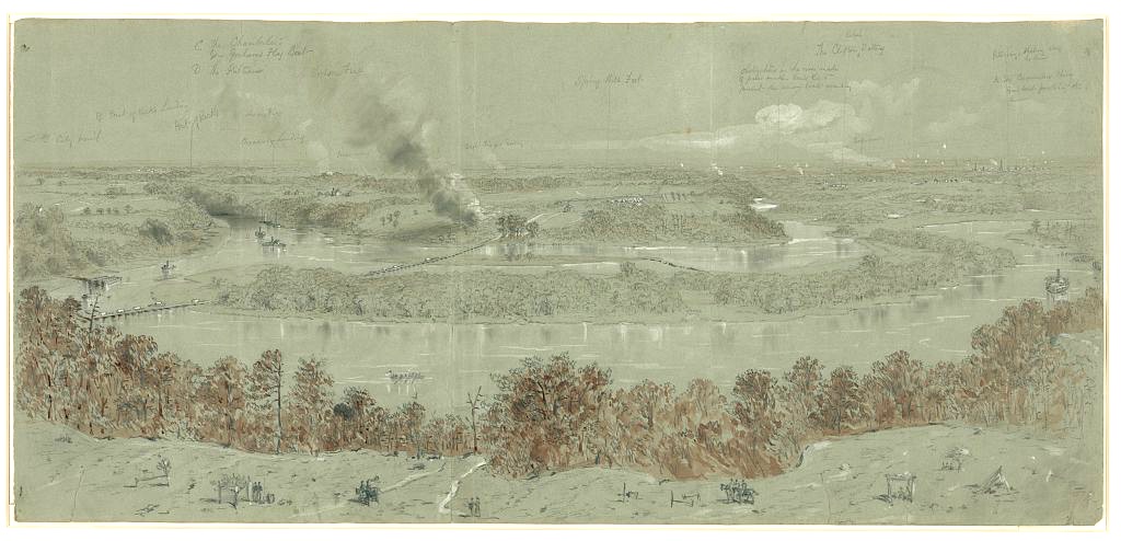
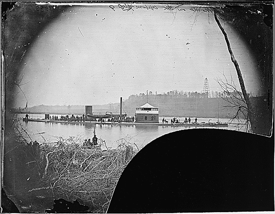
LC 22507. William Waud. View from Weitzels lookout & sig[nal] tower; Bermuda hundred looking south
Inscribed after title: shewing [sic] the Pontoon Bridge, Spring Hill Fort, the course of the Appomattox River & position of Gun Boats, Fort Clifton (rebel), Petersburg in the distance being shelled from out lines.
Inscribed above image from left to right: City Point; B- Point of Rocks landing; Point of Rocks; C The Chamberlain. Gen Graham's Flag Boat; D The Putnam; Woods on Fire; Broadway Landing; Woods on Fire; Troops moving; Dust - Troops moving; Spring Hill Fort; obstructions in the river made of piles of sunken boats &c to prevent the union boats ascending; The Clifton Rebel Battery; Troops moving; Petersburg, shelling along the lines; A - The Commodore Perry Gun Boat picketing the river.
Published in: Harper's Weekly, July 23, 1864, pp. 472-473.
Signal Tower at Crow's Nest
"A second signal tower 126 feet high, and capable of being made 40 feet higher, was built on the right flank of the line, on the high bluff known as "Crow's Nest," James River, opposite Aiken's. From the top of this could be seen the Richmond and Petersburg turnpike and the cross-roads connecting the main roads which ran to Richmond on the north side of the James River. A lookout constantly stationed here gave information of the enemy's movements." -- Report of P. S. Michie, chief engineer, Army of the James, Oct. 10, 1865. O.R. series iii, vol. 5, 183-184.
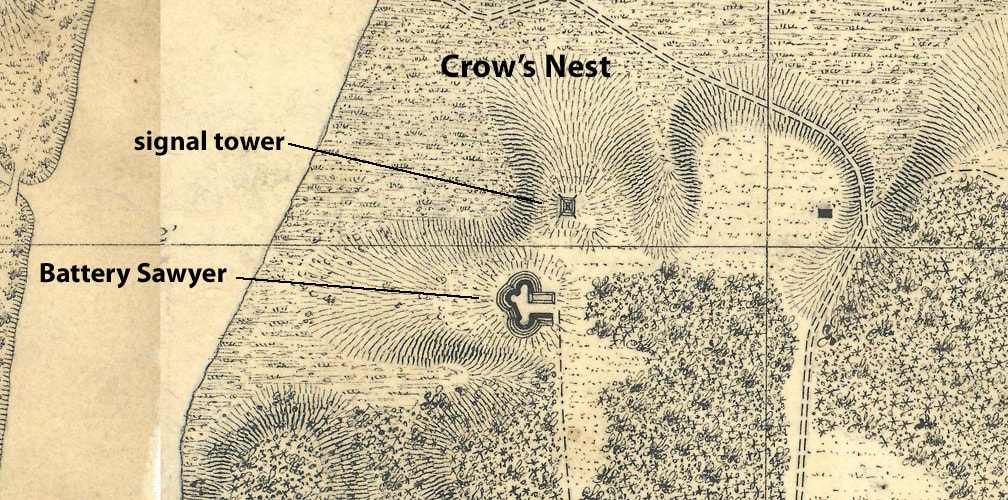
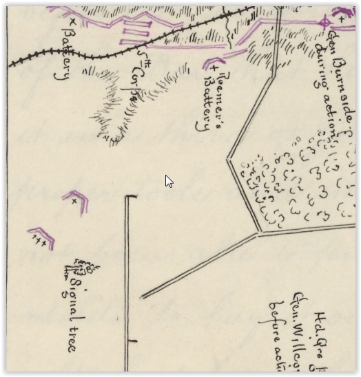
Detail of Crow's Nest and Location of the Signal Tower from Michler 8" = 1 mi. series, Map 12, RG77 G204-44. Features were unlabeled on the original and are annotated.
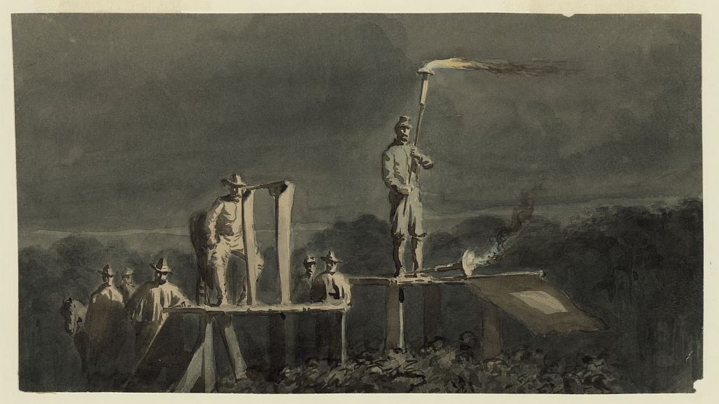
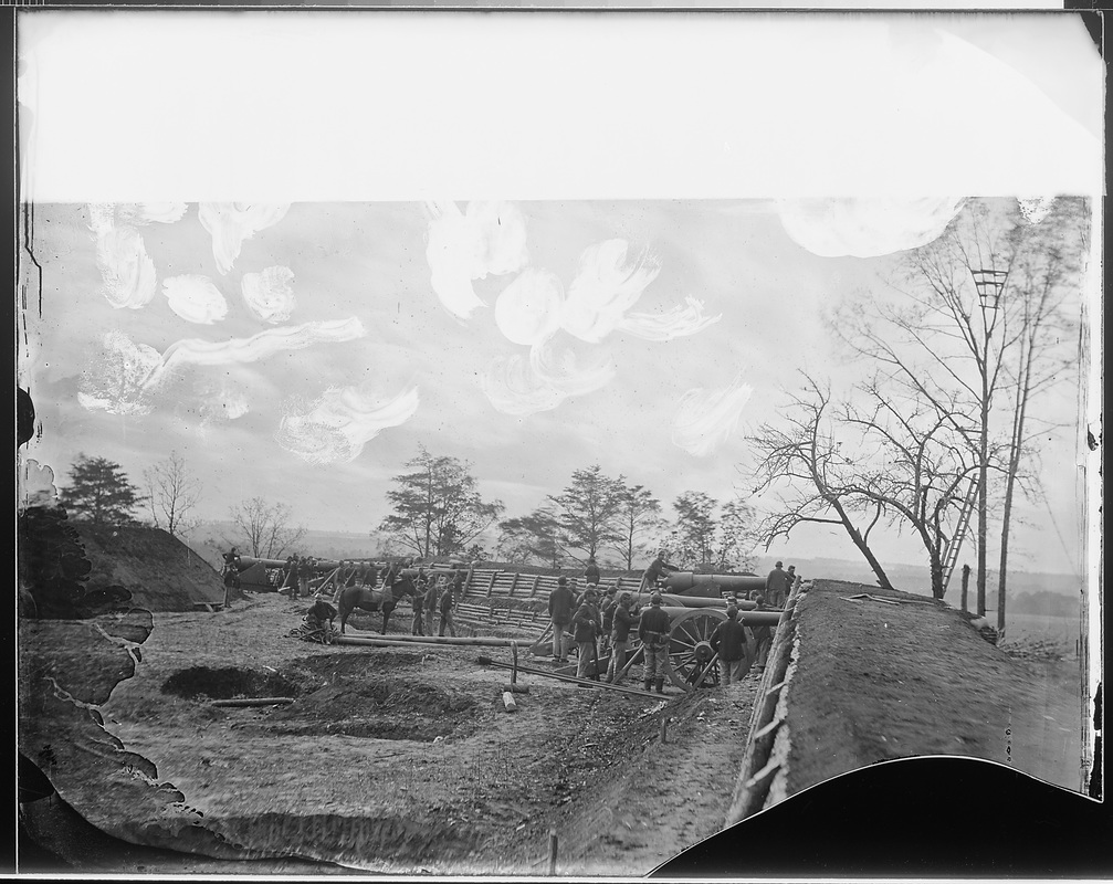
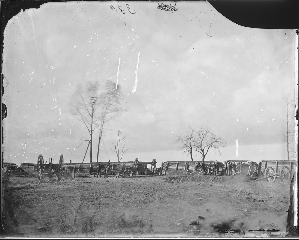
Before the construction of the signal tower, the Signal Corps relied on more primitive means. The image below was likely taken at the Crow's Nest Battery overlooking James River. The battery was designed for three guns -- a 24-pounder Sawyer rifle that exploded after firing ten rounds, and two 10-inch mortars, which are shown here ready to mount. According to reports, this would have been about the first week in July 1864. "The two mortars are ready for mounting in Crow's Nest Battery." -- Col. Henry L. Abbot, July 5, 1864, OR vol. 40, 3, 24.
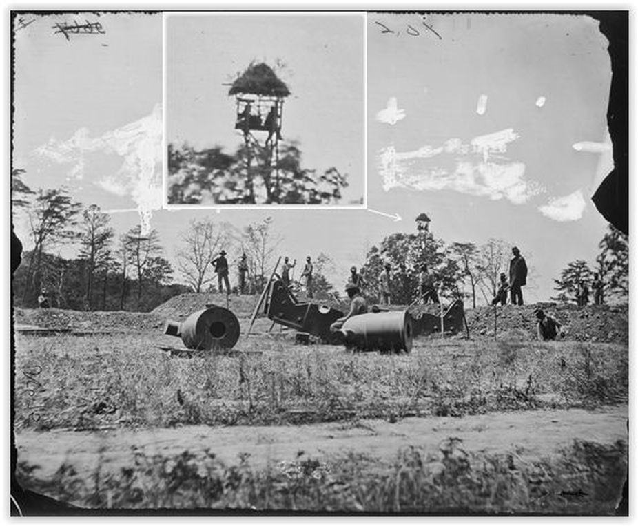
NARA 111-B-106 with inset detail of signal tree. "Mounting Mortars, Butler's lines, near Petersburg." Photo from July 1864, taken at Crow's Nest Battery, unattributed. Behind the battery, two observers monitor the confederate lines from a perch above the tree canopy.
|
(Becker)CW-EM-VA-NDb.
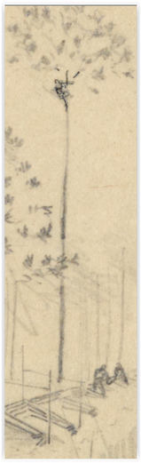
The Crows Nest. Signal Station on the James River Opposite Dutch Gap. "The Crows Nest // Signal Station for the James River. Oppisite [sic] 'Dutch Gap' // [signed] Ed F Mullen." Drawing is likely the same tree as shown in the image to the left.
|
"On the 2d [August] General Birney's signal officer commenced the building of a tower near the Sawyer Battery, on the James River from which, when finished, it is thought will be obtained a view of the Petersburg & Richmond Railroad and turnpike opposite our right, Drewry's Bluff and the pontoon bridge near it, and other points of importance." Report of Capt. Lemuel B. Norton, Signal Corps. OR vol. 42, 1, pg. 650. The tower, as completed, is shown in the image below.
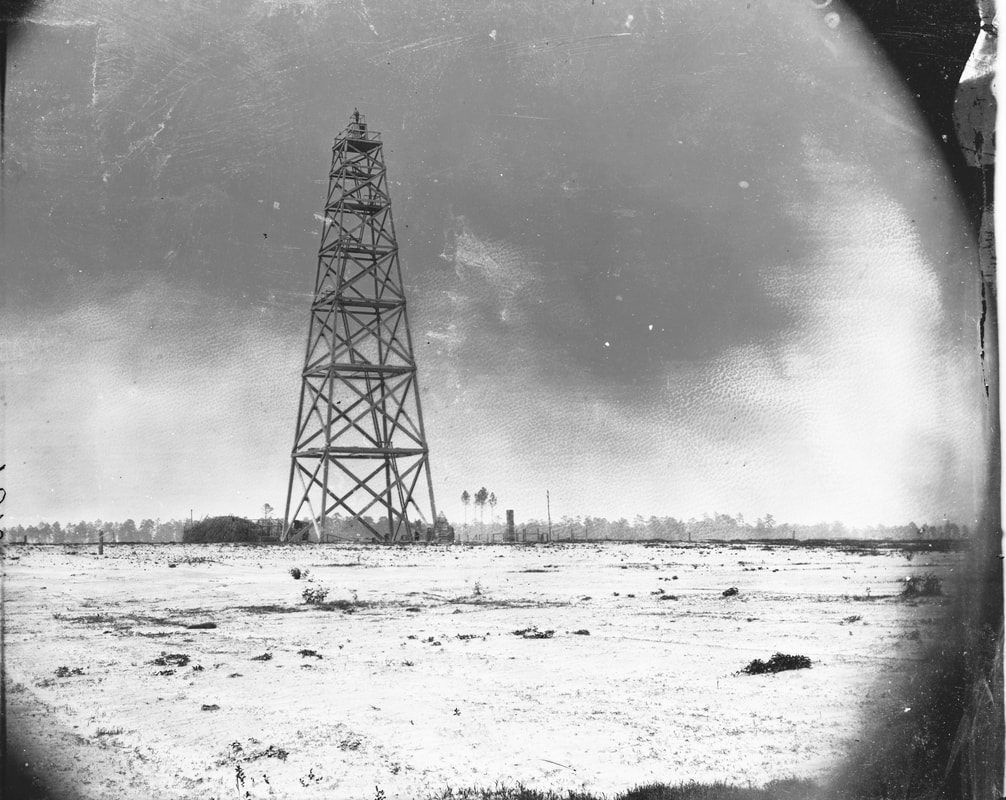
LC33161. "Army of the James, signal tower on left of Bermuda Hundred lines." Albumen print, unattributed. The image is miscaptioned. The signal tower at Crow's Nest on the right of Butler's line was ultimately about 160 feet high, built in nine tiers. The Crow's Nest tower was said to be the tallest signal tower on the Richmond-Petersburg front.
NARA 111-B-398 "Monitor Saugus at Aiken's Landing." Crow's Nest Signal Tower in distance.
NARA 111-B-80. "Monitors in Trent's Reach, James River." This appears to be the Saugus as identified in the previous image. Crow's Nest tower on the bluff in the distance.
 NARA 111-B-409. "Monitor 'Mahopac"'on the Appomattox River, 1864." Photo is taken from Aiken's Landing on James River. Crow's Nest signal tower in the background.
NARA 111-B-652. "Monitor 'Lehigh,' James River." Crow's Nest Signal Tower in background.
LC 23180. William Waud. Night signalling. Signalling by torches across the James River, October 1864.
Signal Towers on the U.S. Military Railroad
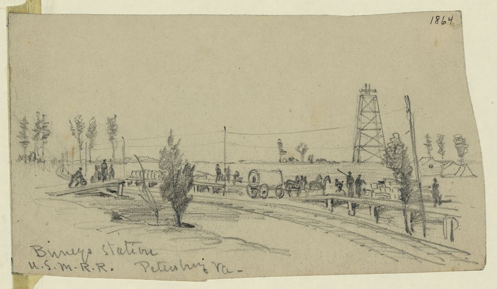
"Birneys Station. U.S.M.R.R. Petersburg Va.," drawing by A. R. Waud [DRWG/US - Waud, no. 441 (A size)] Located halfway between Pitkin's and Meade's Stations. Signal Tower in right rear.
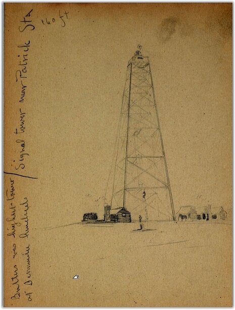
Charles Wellington Reed, Manuscript Division, LC. Inscriptions says, "Signal Tower near Patrick Sta. 160 ft. Butlers was highest tower at Bermuda Hundred".
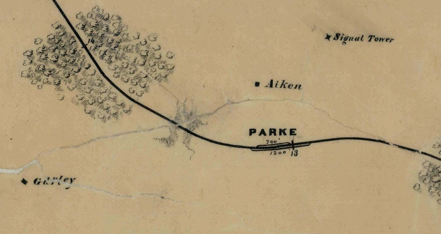
Detail of Parke's Station from NARA "Map of the City Point & Army Line." Signal Tower in upper right corner.
Another Signal Tree, two views
NARA 111-B-117. "Battery in front of Petersburg." Note the ladder up to the signal tree on the parapet to the right.
NARA 3996076924_a135824616_o. A different view of the same battery with signal tree.
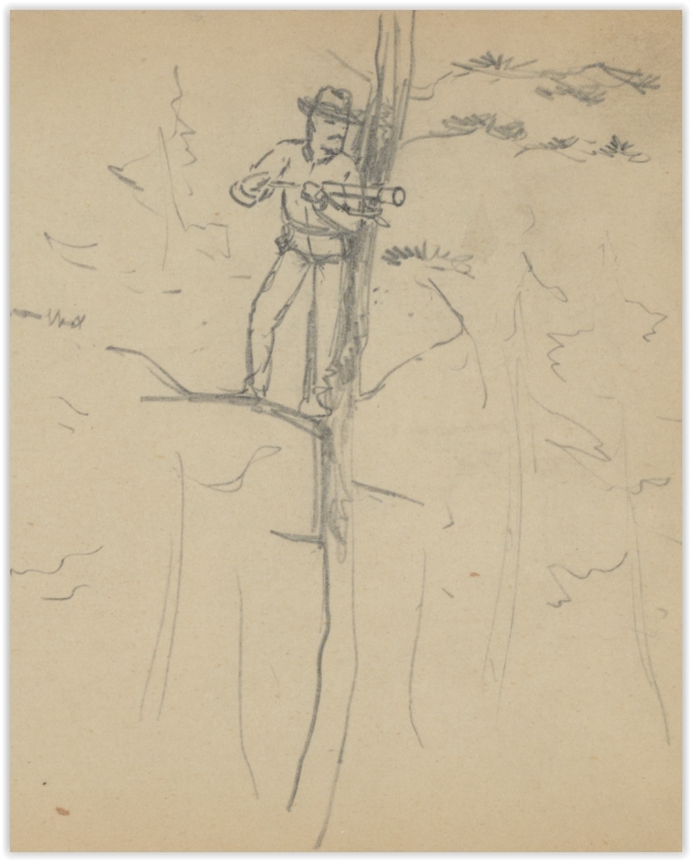
Detail from drawing by Charles Wellington Reed, Reed papers, Manuscript Division, Library of Congress. Caption on drawing is "Signal officer Strap't to a tree in case of getting shot".
|
“On the edge of the lines, not far from the headquarters of General Warren, stood a tall tree. It had been stripped of its boughs, and where the topmost limbs branched a crow’s nest of planks had been built for observatory purposes. The Confederate sharpshooters used this as a target. It was ninety feet from the ground, and its little telescope gave an admirable view of Petersburg and its defenses. The ascent was most uncertain. Rude cleats had been nailed on by a single spike, and these slipped and slanted most distressingly under the feet. In a moment of friskiness, soon regretted, I asked the signal officer in charge of this observatory if I might climb to the top and make a bird’s-eye sketch. He said I might if my courage held out. This was insulting, but turned out to be prophetic. He went up ahead and reached the top a dozen cleats ahead of me. He took one look, and then yelled: “Look out! They’re going to make a charge!” Sure enough they were. The rifles in the breastworks that protected the signal station began to crack. I craned my neck around the tree and saw a straggling lot of rebel skirmishers scampering across the fields toward the tree. Bullets whizzed by. The rickety cleats were gone in places, and others were so loose that they turned unless both feet met on them at once. The agony of that descent was indescribable. With the lieutenant treading on my fingers from above, the chance of being shot in midair or captured at the bottom of the ladder filled me with nervous terror. At last I sank exhausted into a rifle pit near the foot of the tree, completely unnerved. I was quite ill for three days as the result of this adventure. The Confederates were driven back. On the second day they renewed the attack and captured the tree. On the third day it was retaken. This struck me as useless trouble. They could have kept if for all I cared. I did not want it.”
--Joseph Becker, The American Magazine, vol. 37 (1894): 746-748. |
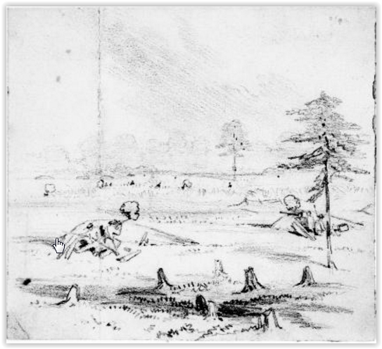
Joseph Becker, Becker collection, Boston College Library. September? 1864. "Our pickets repulsing rebel pickets. They frequently tried to capture the signal station where I drew this picture."
Frances W. Knowles Papers, East Carolina University Library. Detail of a schematic map showing Union troop locations at the Battle of the Crater. Signal tree is located south of Baxter Road and north of the Avery house.
|
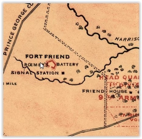
LC cw0607000. Detail of schematic map by Andrew McCallum depicting Federal regimental locations on April 2, 1865. Note the signal station near Fort Friend.
|
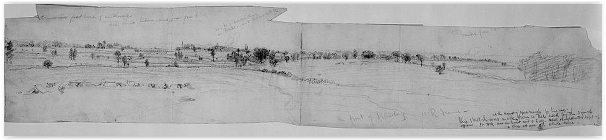
LC 3c36820. A.R. Waud. In front of Petersburg. Inscribed upper left: enemies first line of earthworks our lines below and in front. Inscribed above image: Smoke of locomotive on Petersburg and Richmond RR. Inscribed lower left: This sketch was made at the request of Genl. Meade, for his use, from a tree used by the signal officers. It took over an hour and a half rebel sharpshooters kept up a fire at me the whole time. Inscribed upper right: Smou[ldering? ...]
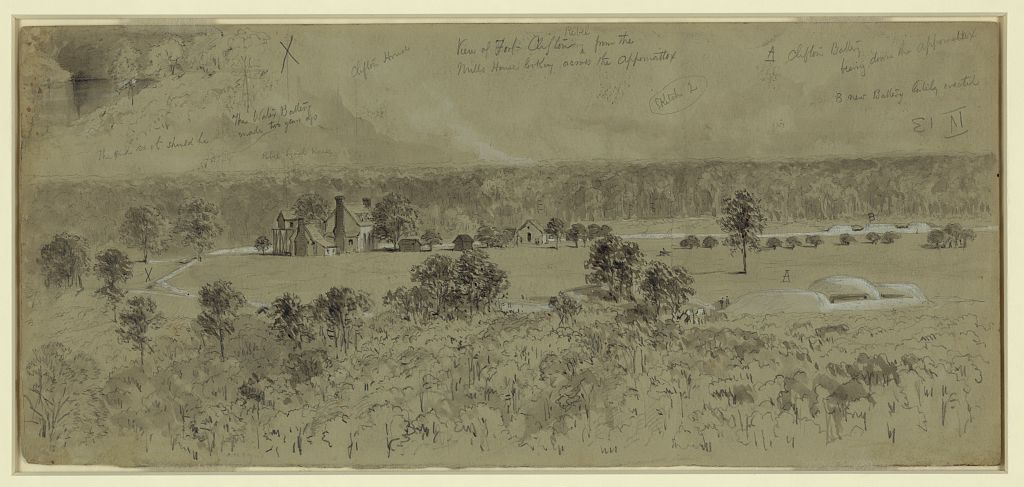
LC 21700. William Waud. View of Fort Clifton Rebel from the Mills House looking across the Appomattox. The end as it should be; The Water Battery made two years ago; Rebel signal house; Clifton House; (Sketch 2); A Clifton Battery bearing down the Appomattox; B new Battery lately erected.
LC 21767. "Fort Clifton within the Appomattox sketched from the Signal Tower," drawing by William Waud.
|
Signal/Observation tree in front of Fort Davis. Detail from a Charles Wellington Reed drawing of Fatiigue Duty at Fort Davis. Libarary of Congress Manuscript Division, Charles Wellington Reed papers.
|
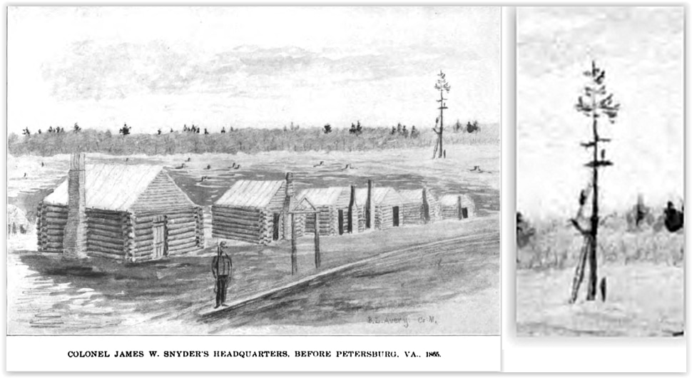
Drawing of winter quarters of 9th New York Heavy Artillery at Petersburg- with signal tree in the background. Drawn by private Benjamin L. Avery. Thanks to Edward Alexander for sharing this drawing! The Ninth New York Heavy Artillery, a History of its Organization.... Alfred Seelye Roe, 1899: after page 216.
Misidentified Signal Tower -- NOT at Petersburg. This photograph was taken at the Minor House in Arlington County in January 1862
John Cummings' blog located the tower shown below and unlocked several related photos.
LC 01566 Petersburg, Va. Signal tower at 14th New York Heavy Artillery headquarters. This tower was misidentified first in Miller's Photographic History and later incorporated into the Library of Congress metadata.
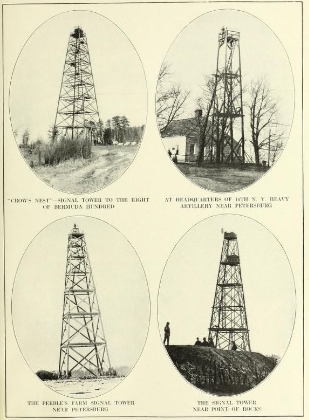
Signal Towers. Miller, Photographic History, vol. 8: 331. The tower at top right was not at Petersburg but at the Minor House, Fairfax County, 1862, Source of some of the later misidentifications.
