
Warren Map, September 30, 1864
Work on this map began shortly shortly before and after the Federal offensives leading to the Battles of Peebles' and Pegram's Farms, September 30-October 2, 1864, likely produced to illustrate Maj. Gen. G. K. Warren's report of the operation. It looks like the work of Warren's engineer, Washington Roebling. The Confederate lines are shown in blue, Federal lines in red.
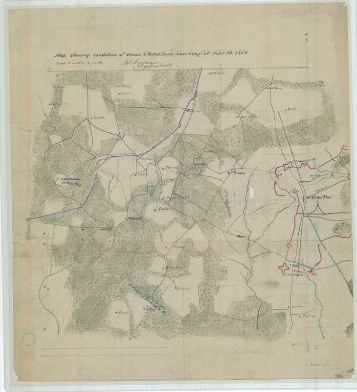
NARA 139309146. "Map showing condition of Union and Rebel lines morning of September 30, 1864."
