
Appomattox Mill Photographs -- Timothy O'Sullivan with William Redish Pywell
Photographer Timothy O'Sullivan and his future brother-in-law and fellow photographer William Pywell spent several days in April 1865 photographing Petersburg and the mills along the Appomattox River. The mills were the lifeblood of Petersburg's economy, and most escaped without damage after the surrender of the city on April 3, 1865. After the war, floods, fires, and economic depressions took their toll of these architectural features, leaving little evidence of their existence today. Maps show us where the buildings stood and we hope to identify the many distinct boulders along the river banks and match up some of the historic images with the modern river. For the moment, we await the coming of winter and defoliation of riverbank vegetation. Some of these photos are exquisitely framed and display the artistic skills of O'Sullivan's and Pywell's collaboration.
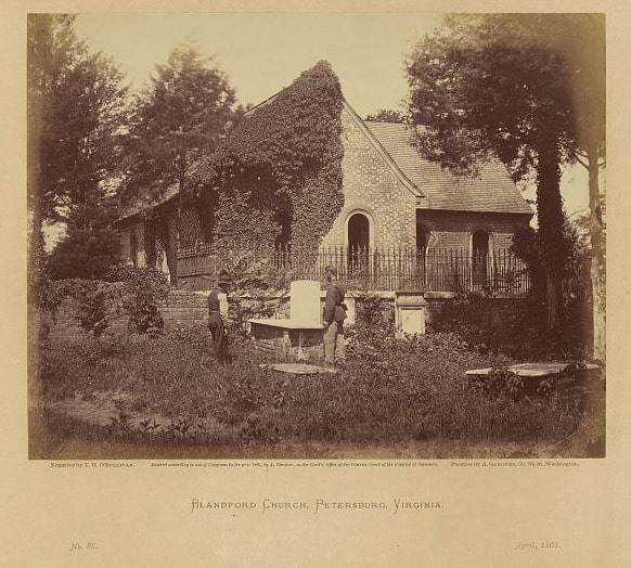
LC12606. "Blandford Church, Petersburg, Virginia / negative by T.H. O'Sullivan, positive by A. Gardner." Printed from the negative below?
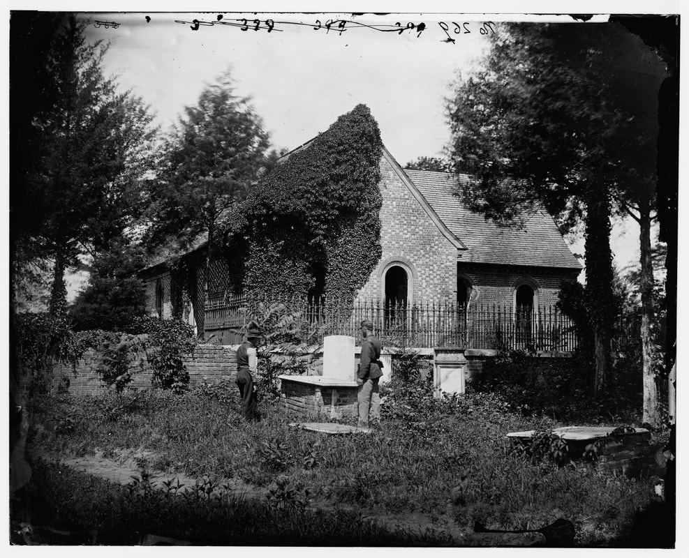
LC03937 (neg num 399). "Petersburg, Virginia. Blandford church," attributed to O'Sullivan. Pywell is posed by grave with a soldier.
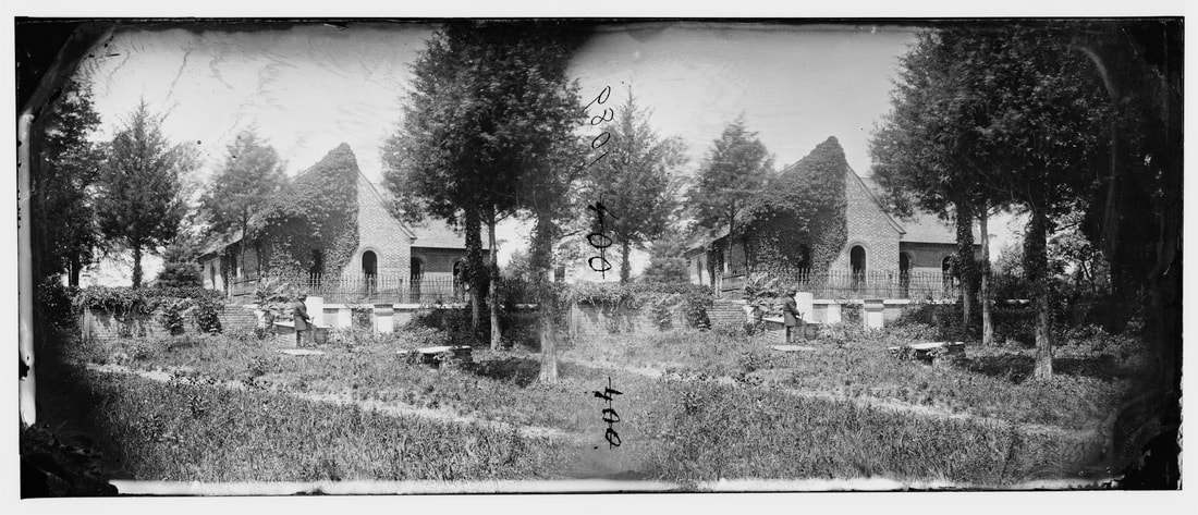
LC00543 (neg num 400). "Petersburg, Virginia. Blandford church and graveyard," stereo view attributed to O'Sullivan.
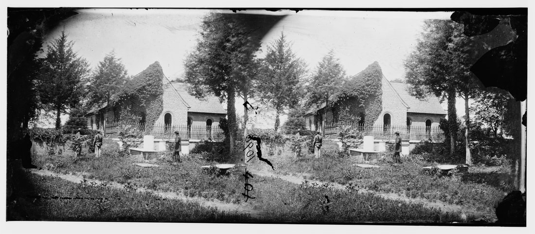
LC00544 (neg num 401). "[Petersburg, Va. Blandford Church and graveyard]," attributed to O'Sullivan.
LC 01336-01337 composite (Neg num 402 x'ed out, 403). "Petersburg, Virginia (vicinity). Ruins of locomotive and railroad bridge across the Appomattox River," unattributed. This is part of the O'Sullivan series. Wm. Pywell is posed in the left foreground.
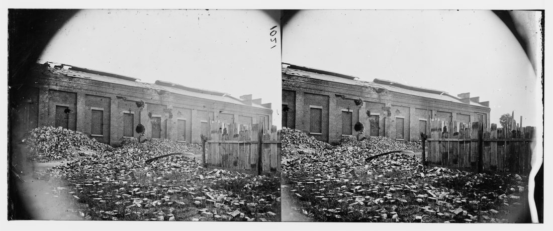
LC00495 (no neg num). "Petersburg, Virginia. Gas works showing the effect of bombardment," unattributed. O'Sullivan.
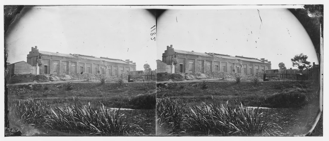
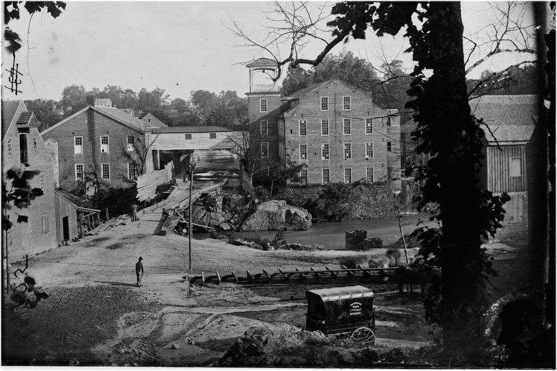
LC 00666 (no neg num). "Petersburg, Virginia. View of gas works. (Photographic wagon, Engineer Department shown)," attributed to O'Sullivan.

LC12602. "View of the Petersburg Gas Works / negative by T.H. O'Sullivan, positive by A. Gardner." No. 81 in Photographic Sketch Book, dated May 1865. Photographic Wagon Engineer Department parked on right.
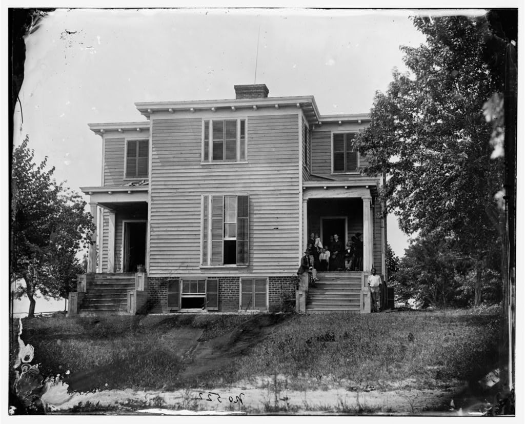
LC04020. "Petersburg, Virginia (vicinity). Bryant house," large format attributed to O'Sullivan.
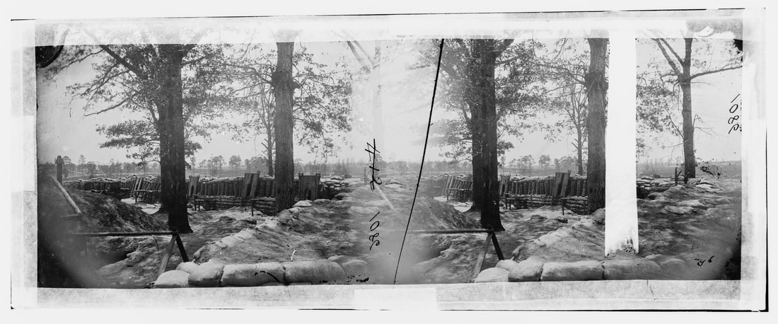
LC00540 (neg num 412). "Petersburg, Virginia. Fort Stedman in front of Petersburg," stereo view attributed to O'Sullivan.
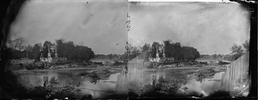
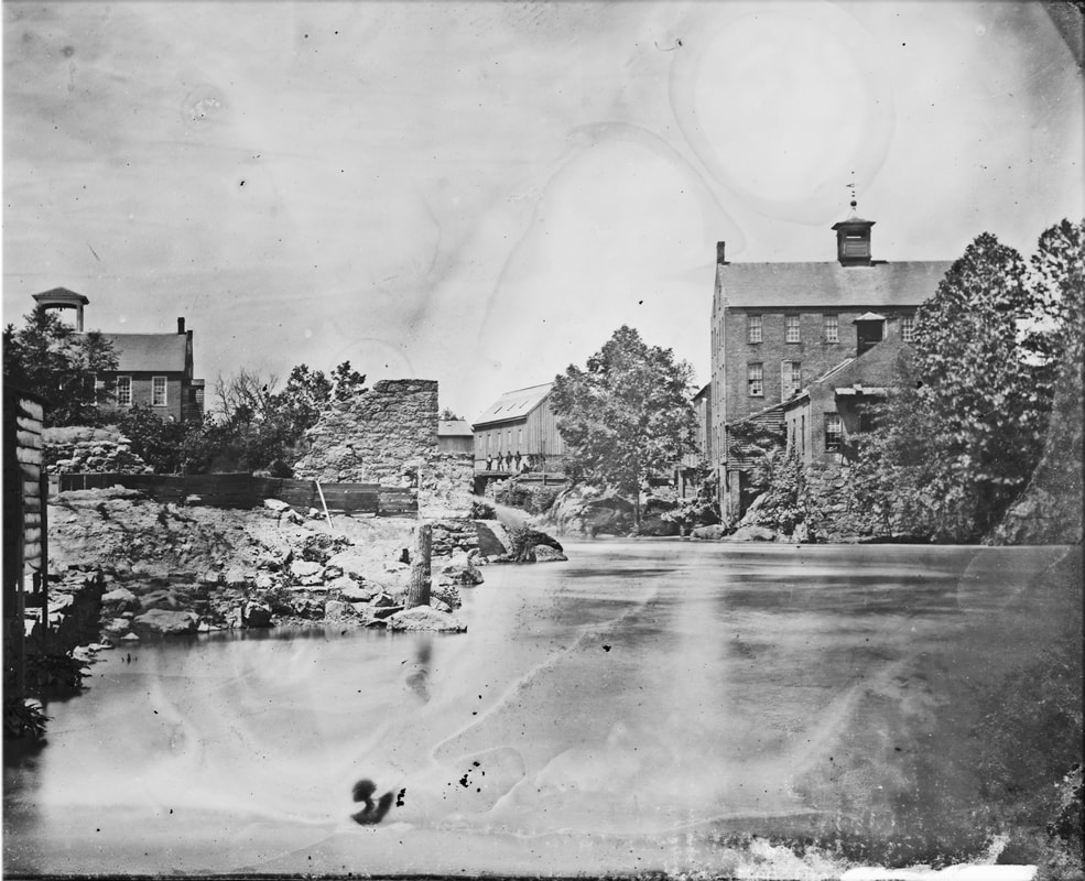
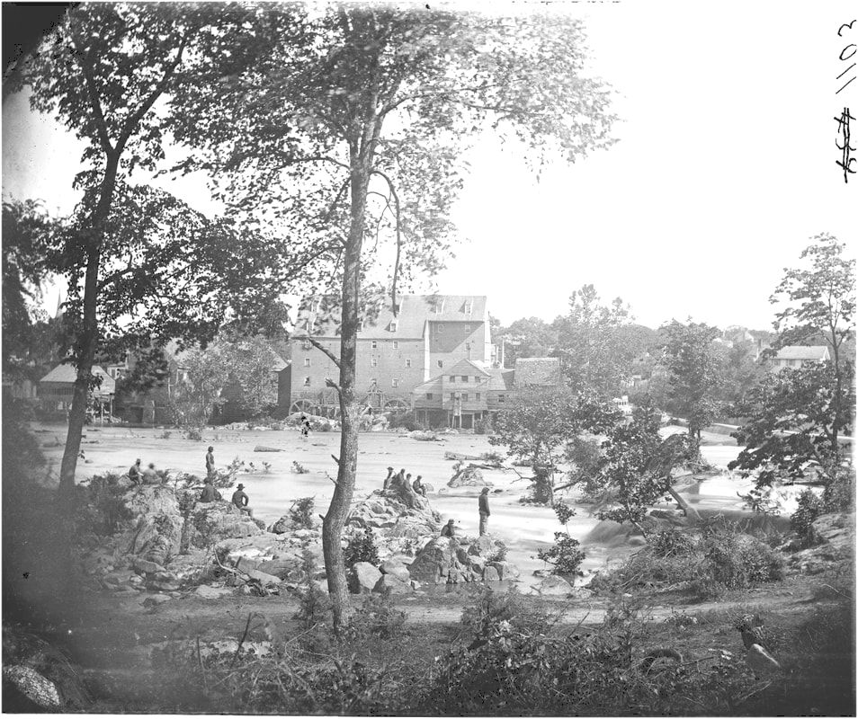
LC03864 (neg num 415?)."[Petersburg, Va., vicinity. Johnson's Mill on the Appomattox below Campbell's Bridge; soldiers standing on rocks in the stream]." Extremely clear large format photograph taken from the north bank showing Johnson's Mill with seven soldiers posed on rocks. Mill dam is at right of photo.
LC 03714 (neg num 417). "
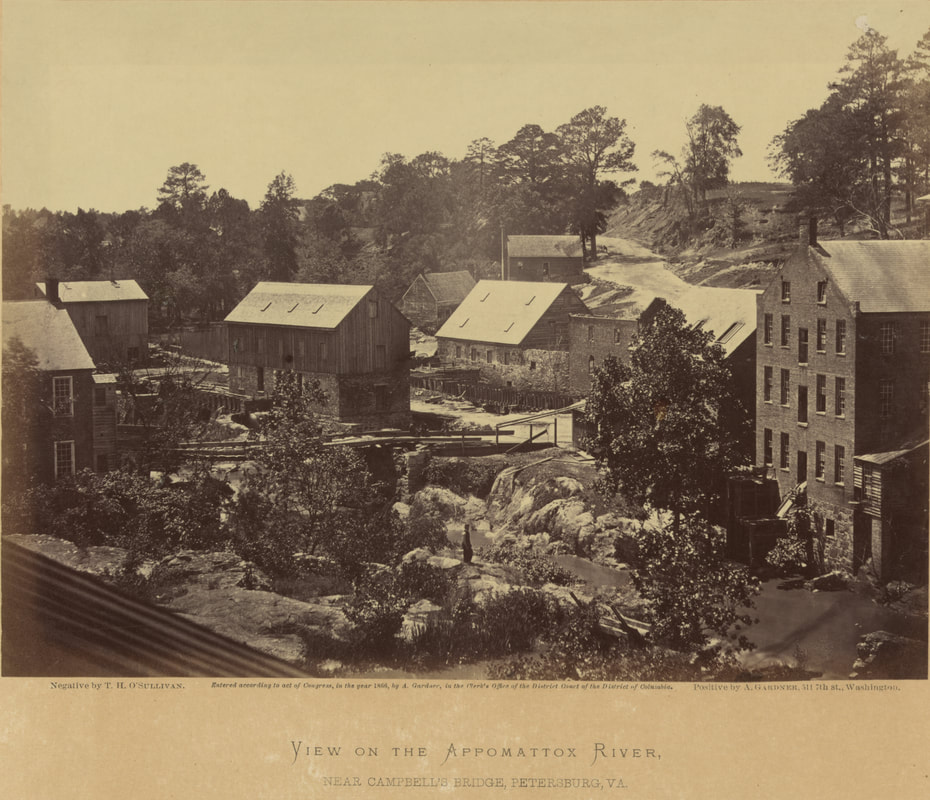
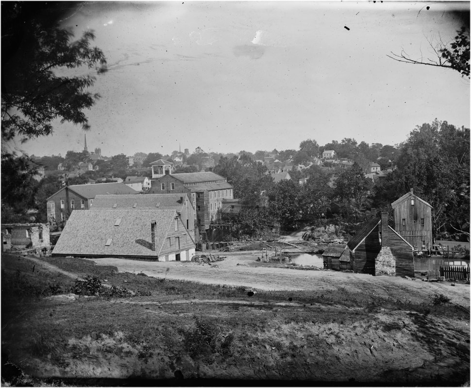
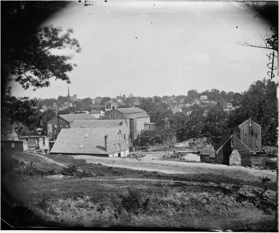
[Petersburg, Va. Mills on the Appomattox River near Campbell's Bridge]." Larger format plate by O'Sullivan from same location as the previous views. Two seated men and horse cart at the bridge. This is an exceptionally clear image that was included in Gardner's Photographic Sketch Book, vol. 2, plate 82, where the mill on the far right is identified as The Merchant Manufacturing Company Cotton Mill.
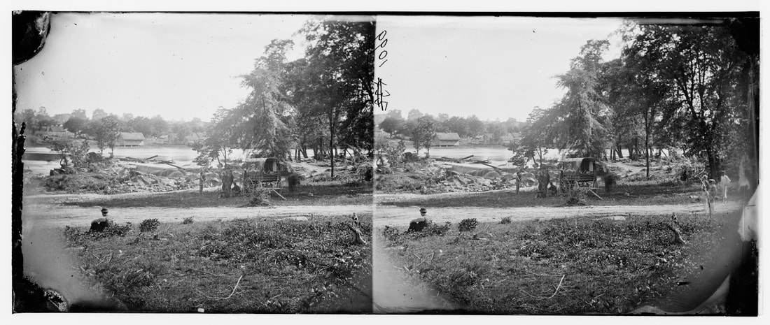
LC00541 (neg num 418). "Petersburg, Virginia, Mills," right half of stereo view by O'Sullivan and Pywell. Pywell poses in the mid-ground on the road that leads from Campbell's Bridge back up to Ettrick. The view is from the north side of the Appomattox looking back toward the Gorge and mill buildings. The steeples of the Grace Episcopal and Washington Street Baptist Church steeples can be glimpsed in the distance at the far left of the photo.
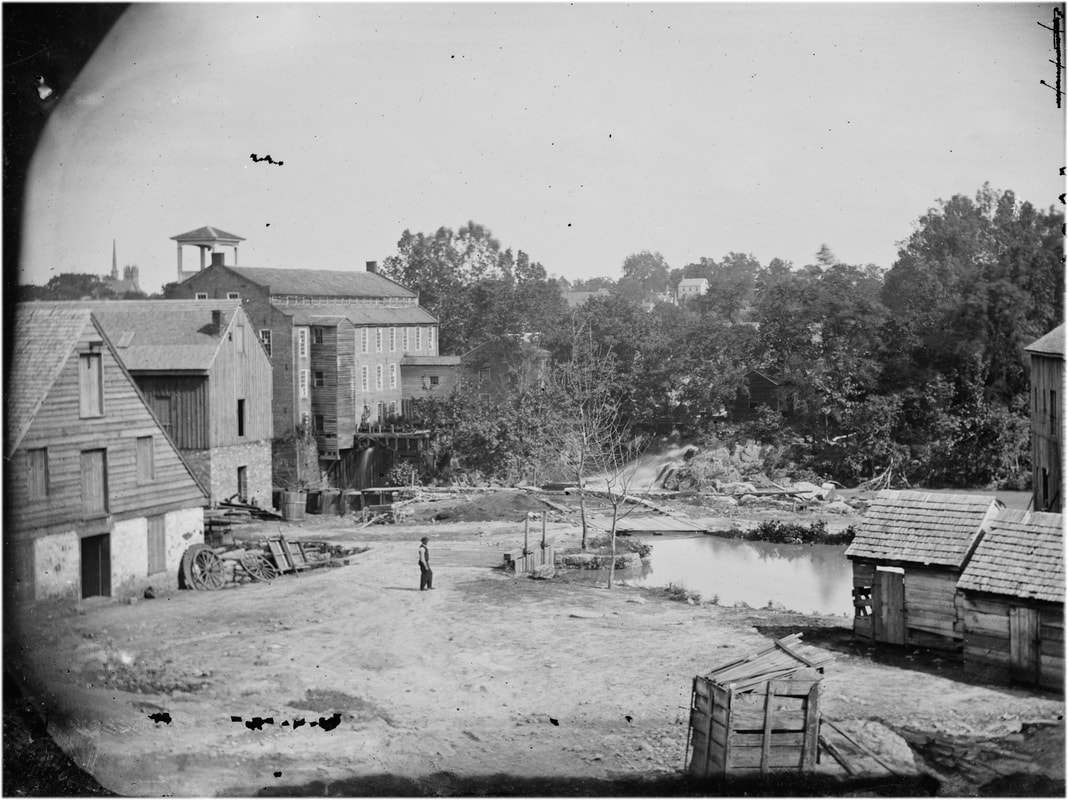
LC00542 (neg num 419). "Petersburg, Virginia, Mills," left half of stereo view by O'Sullivan and Pywell. Pywell has shifted his position somewhat from the above photo. View from north bank of the Appomattox, church steeples in rear.
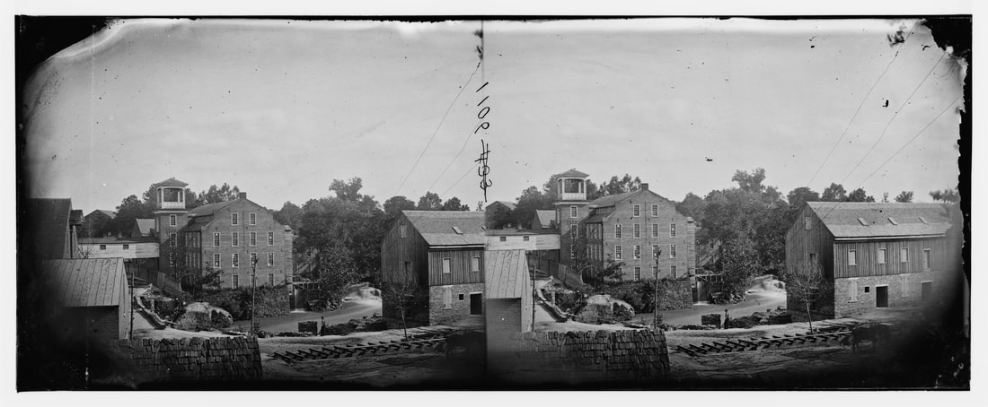
LC 00621 (neg num 420). "Petersburg, Virginia. View of mills'" stereo view attributed to Timothy O'Sullivan.
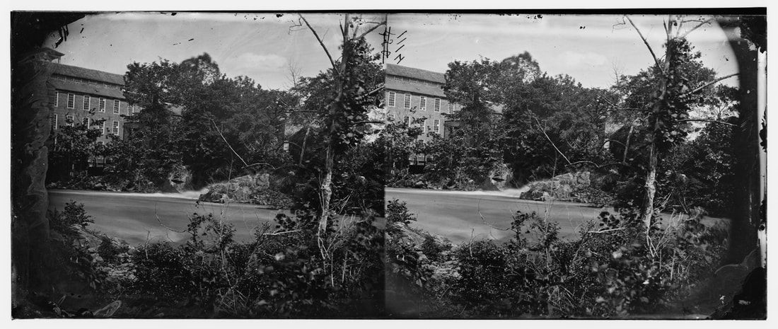
LC00615 (neg num 421). "Petersburg, View of Mills," right half of stereograph by Timothy O'Sullivan. View on the Appomattox River looks upstream at The Gorge and mills at Campbell's Bridge. Ruined stone wall on the left shows up in the above photos. Scratched out plate number 427.
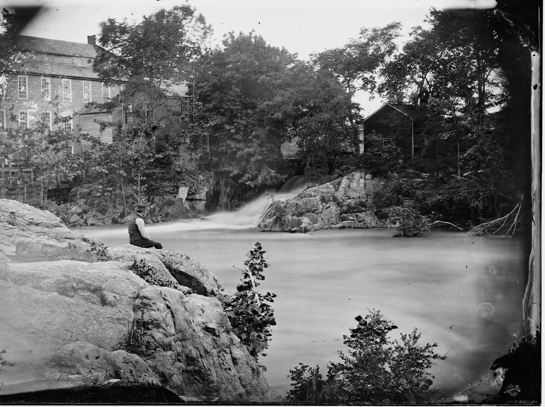
LC00536 (neg num 422). "Petersburg, Virginia, Mills." Right half of stereo view by Timothy O'Sullivan, fellow photographer William Pywell is seated atop a boulder overlooking the Appomattox River. This scene is near Campbell's Bridge. A large mill tail race gushes on the far bank. This is a beautifully composed photograph; one can hear the roaring of the water. Pywell is apparently seated on the protruding boulder seen in the previous photos on the south bank.
LC00616 (no neg num) 423?). "Petersburg, Virginia. View of mills," right half of stereograph by O'Sullivan and Pywell. Looking upstream toward the Gorge and Campbell's Bridge. The photographers have attracted viewers from the previous photo, soldiers in the distance posed in front of a mill building. Distinctive large bell tower from mill at the bridge on the left. Ruined stone wall is at left center.
 LC 01301 (neg num 424). "Richmond, Virginia (vicinity). Mill on James River and Kanawah Canal above Richmond, attributed to John Reekie." We think his is misidentified. This stereo view appears to belong in the O'Sullivan-Pywell series as detailed above. It was likely taken from near the "Hope Flour Mill. The key is the ruined stone wall that appears in the other photos from different angles. The scratched out negative number is 424. First identified here by the Petersburg Project.
|
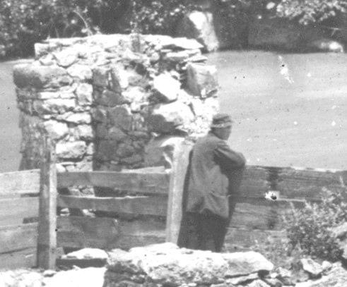
The figure in the far background of the above photo LC01301-1302 leaning against the fence is almost certainly William Pywell, indicated by posture, profile, and tell-tale hat. On the right is Pywell posed in the distance of stereo view LC 00541 (scratched out plate number 418), attributed to O'Sullivan. |
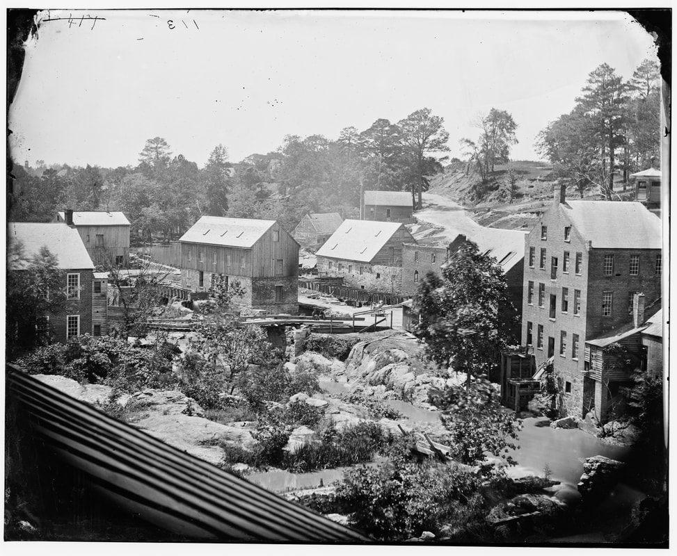
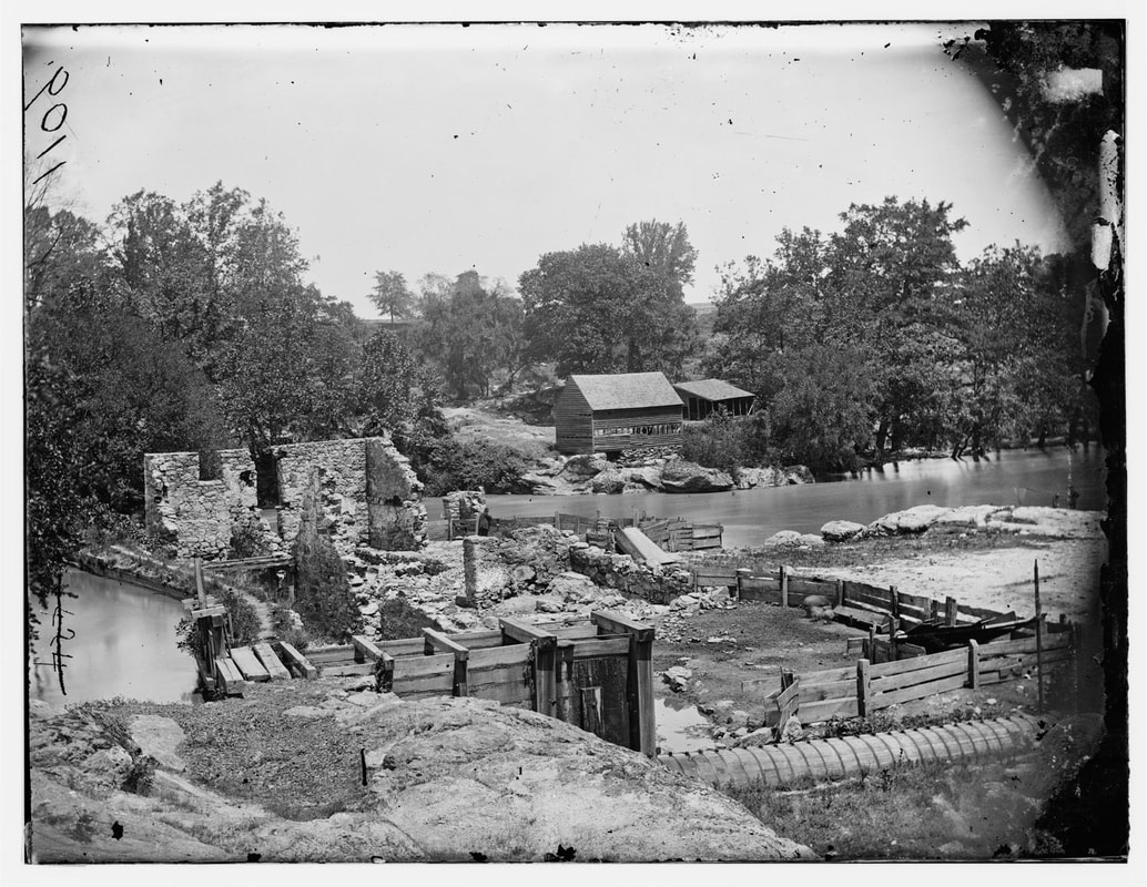
 LC 12603. "View on the Appomattox River Near Campbell's Bridge." Large format plate exposed by Timothy O'Sullivan, published in Gardner's Sketch Book, vol. 2, plate 82. Two men sitting on the bridge, William Pywell posed in the middle foreground. O'Sullivan and Pywell made at least four other images from the same elevated camera position..
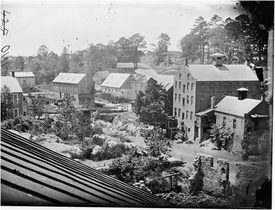
LC 00617 (neg num 425). "Petersburg, Virginia, Mills." Right half of stereo view by Timothy O'Sullivan and William Pywell. View from upper story looking upstream on the Appomattox toward The Gorge and Campbell's Bridge. This appears to be a series of stereo views by scratched out plate numbers 425, 426, and 427, followed by a larger format plate. The road climbing the bluff in the distance leads to the mill village of Ettrick, home to more than 800 mill workers. A single man, probably a soldier, sits on the bridge. The ruined stone wall at bottom right shows up in several other views, including one from the opposite bank of the river.
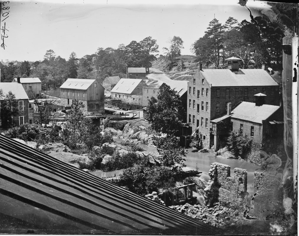
LC 00538 (neg num 426). "Petersburg, Virginia, Mills." Right half of stereograph by Timothy O'Sullivan, overlooking Campbell's Bridge and The Gorge from upper floor downstream. Similar to above photo.
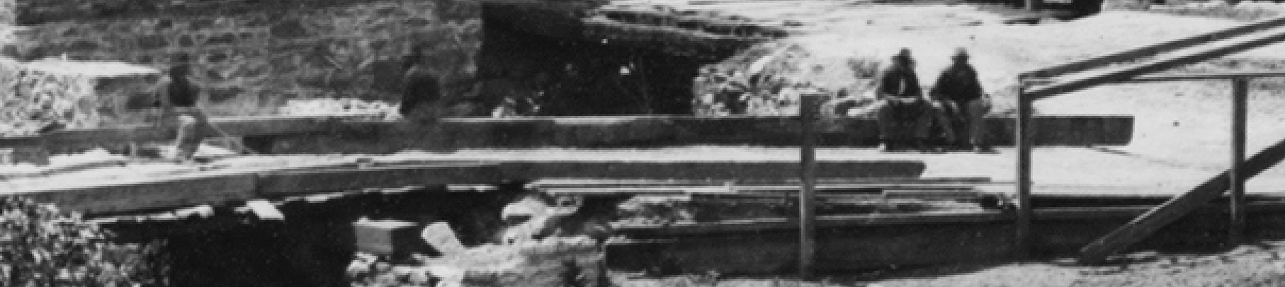
LC 00538 detail. Same camera position as 00537, Four men now seated on the bridge.

LC 00537 (neg num 527). "Petersburg, Virginia, Mills." Right half of stereograph by Timothy O'Sullivan, one of a series. Overview of Campbell's Bridge and The Gorge from a building on the south bank. Two men "ghosting" on the bridge. The road up the bluff leads to the mill village of Ettrick. Ruined stone wall in the right foreground.
LC00619 (neg num 428). Left half of stereo view by Timothy O'Sullivan, titled "Petersburg, Virginia. View of mills." View is from south bank. These are the mill buildings directly to the right of Campbell's Bridge. Note the distinctive wind vane atop the cupola of the larger building. In the distance on the hillside is a military camp.
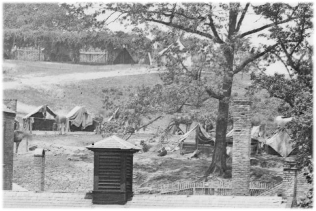
LC00619 detail. Military camp on the hillside.
LC00620 (neg num 429). Left half of stereo view, labeled "Petersburg, Virginia. View of mills." Image by O'Sullivan. Campbell's Bridge mills (Merchant Mills) from bluff overlooking the river, steeples of Petersburg beyond..
LC00609 (neg num 430) Left half of stereograph titled "[Petersburg, Va. General view]"
by Timothy O'Sullivan. Nearly identical exposure to LC00620, taken perhaps 10 minutes apart estimated from shadows.
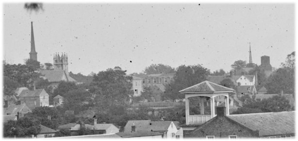
LC00609 detail. Petersburg steeples from L to R -- Washington Street New Baptist, Grace Episcopal, 3, Old Presbyterian Church converted to Shot Tower.
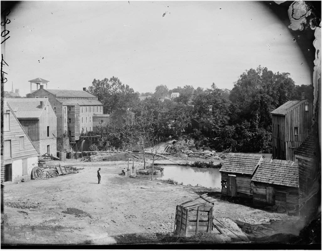
LC00613 (neg num 431). "[Petersburg, Va. Mills; photographic wagon of Engineer Dept. in foreground]," right half of stereo view by O'Sullivan and Pywell. View from the north bank approaching Campbell's Bridge and the Gorge. The two main Merchant's Mill buildings on the south bank are connected by a "sky" bridge. The right building features a large bell tower which shows up in other photos. A soldier poses in the mid-ground, while others lounge on the bridge, possibly the same men from the previous series of photos. The photographers' wagon is parked in the foreground, labelled "Photographic Wagon Engineer Department."
LC00607 (neg num 432). "Petersburg, Virginia. Ruins of woolen mill." Left half of stereo view by O'Sullivan and Pywell from north bank of Appomattox River, showing ruined stone wall from previous images. Copious flow from tail trace.
LC 00614 (neg num 433)."Petersburg, Virginia. View of mills," attributed to Timothy O'Sullivan, taken from north bank looking south to Marchant Mills and Campbell's Bridge on left. Wm. Pywell is posed on the road in the distance.
LC 00612 (neg num 434). "Planing Mill showing effect of bombardment, Petersburg, Va.", unattributed stereo view.
LC00608 (neg num 435). "[Petersburg, Virginia (vicinity)]. View of James river and photographic wagon of Engineer Corps," stereo view attributed to O'Sullivan, miscaptioned. This is the dam on the Appomattox at Johnson's Mill. Pywell is posed on left with back to camera. Photographic Wagon Engineer Department parked on right.
missing negs 436-437
LC00610 (neg num 438). "Petersburg, Virginia. View of mills." Left half of stereo view by O'Sullivan. This is a view of Johnson's Mill complex from the north bank of the Appomattox with soldiers lounging on the rocks in the mid-ground.
Steeple of Grace Episcopal Church is visible in the right distance.
LC00611 (neg num 439). "Petersburg, Virginia, View of Mills,'" left half of stereo view by O'Sullivan. Johnson's Mill with twelve soldiers lounging on the rocks of the north bank.. The camera position has shifted closer to the river.
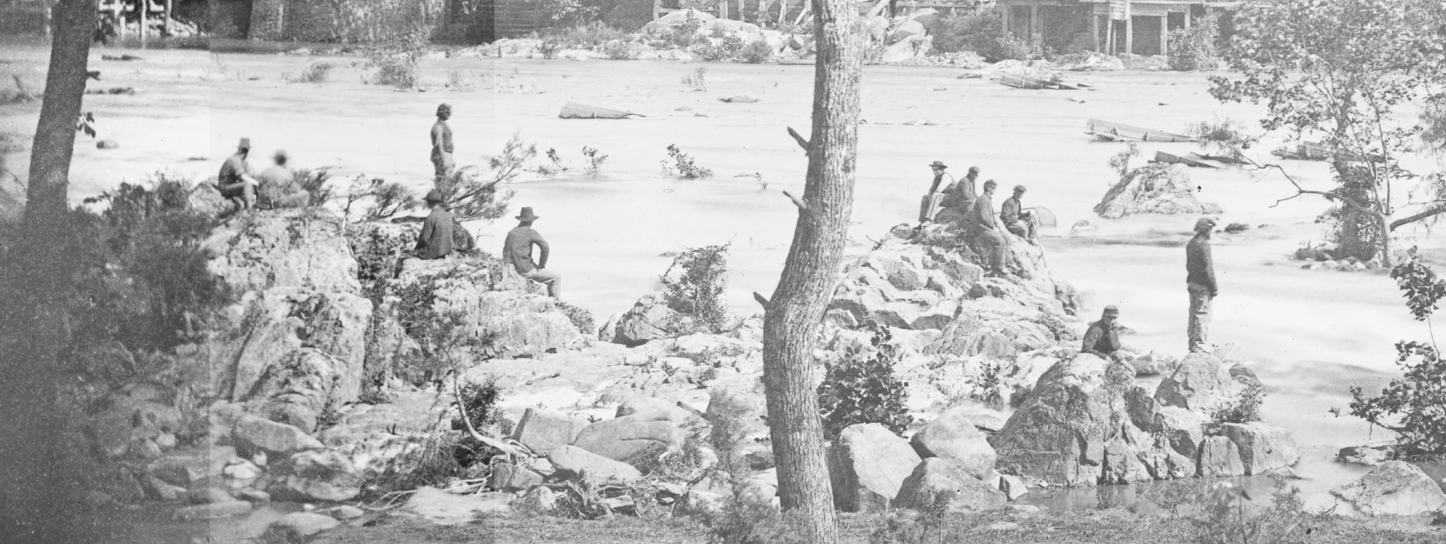
LC00611 detail. Soldiers atop a distinctive rock pile across the river from Johnson's Mill.
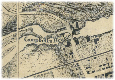
Area of Campbell's Bridge, Appomattox River. Detail, NARA RG77 / G204-37-38.
Campbell's Bridge Photographs
These five images were taken from the upper floors of what is labeled the "Hope Flour Mill" on the later Sunburn Insurance maps, about 100 Yards downstream from Campbell's Bridge.

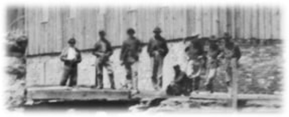
LC00616 detail. Eight soldiers posed for the camera on Campbell's Bridge.
Sanborn Fire Insurance Maps of Petersburg, 1885. Area of Campbell's Bridge
Johnson's Mill Photographs

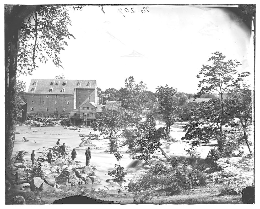
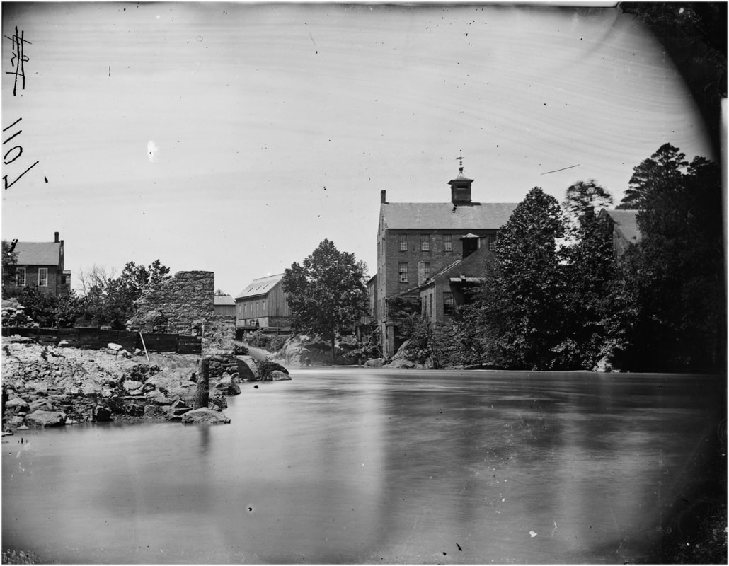
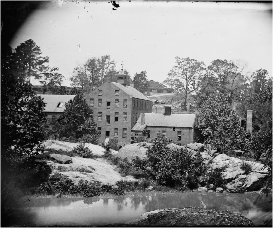
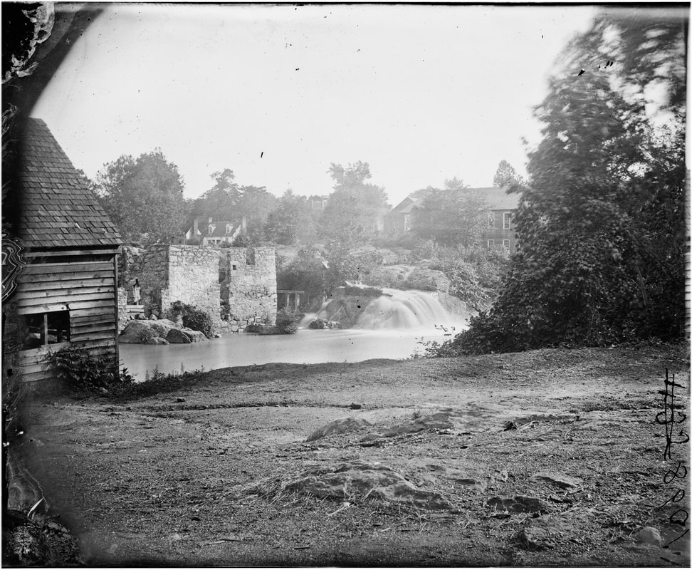
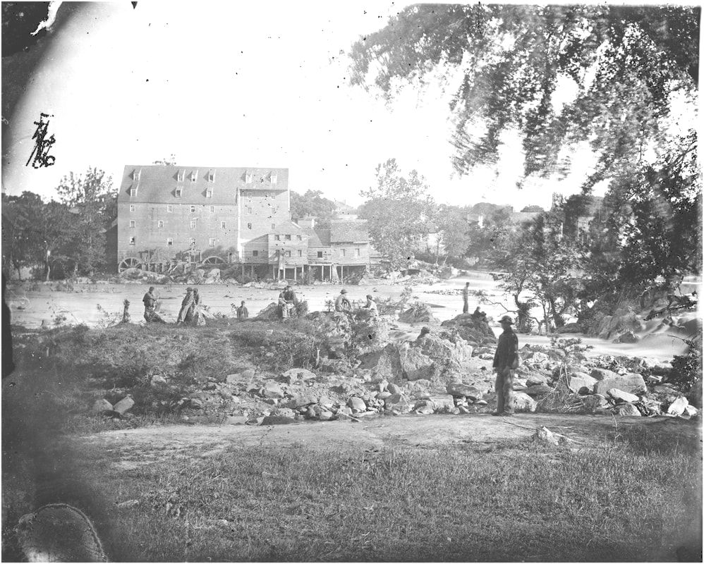
LC12601. "Johnson's Mill" (on left) was a quarter mile downstream from Campbells's Bridge on the main dam that was known by various names. This large format plate (above), negative by O'Sullivan, positive by Gardner, was featured in Gardner's Photographic Sketch Book of the Civil War, vol. 2, plate 80, taken in early May 1865. Taken from the north bank looking south, the town of Petersburg can be glimpsed behind the mill. To the right is the mill dam. Numerous soldiers are posed, some precariously, on the rocks along the river. This image is featured in Davis, Image of War, vol. 4, pg. 778, as an example of O'Sullivan's artistic composition.
Last updated 04/28/2023
