
Battle for the Weldon Railroad, August 18-21, 1864
The lithograph below, entitled Battle of the Weldon Railroad, August 21, 1864, made from a sketch by Richard Holland was published by John Henry Bufford's Lithography and Publishers of Boston. Richard Holland was enlisted in the 9th Massachusetts Battery. The lithograph courtesy of the Huntington Library Collection shows positions (L to R) for Battery H, 1st N.Y.; Battery B, 1st N.Y.; Battery D, 5th U.S.; 5th N.Y. Regt.; 9th Mass. Battery; and 16th Maine Regt. Research by Jerry Netherland and Philip Shiman identifies the house on the far left as the Blick house, next is Halifax Road and the railroad marked by the line of telegraph poles. The view is looking northerly from the vicinity of the Dunlop house. The Dunlop barn is in the far right distance as shown on the Warren map beneath. Attacking Confederates can be seen through the powder smoke in the distant tree line. Insets at the top of the page show actions on the 18th and 19th in which Holland participated. As might be expected, the 9th Massachusetts Battery is featured prominently.
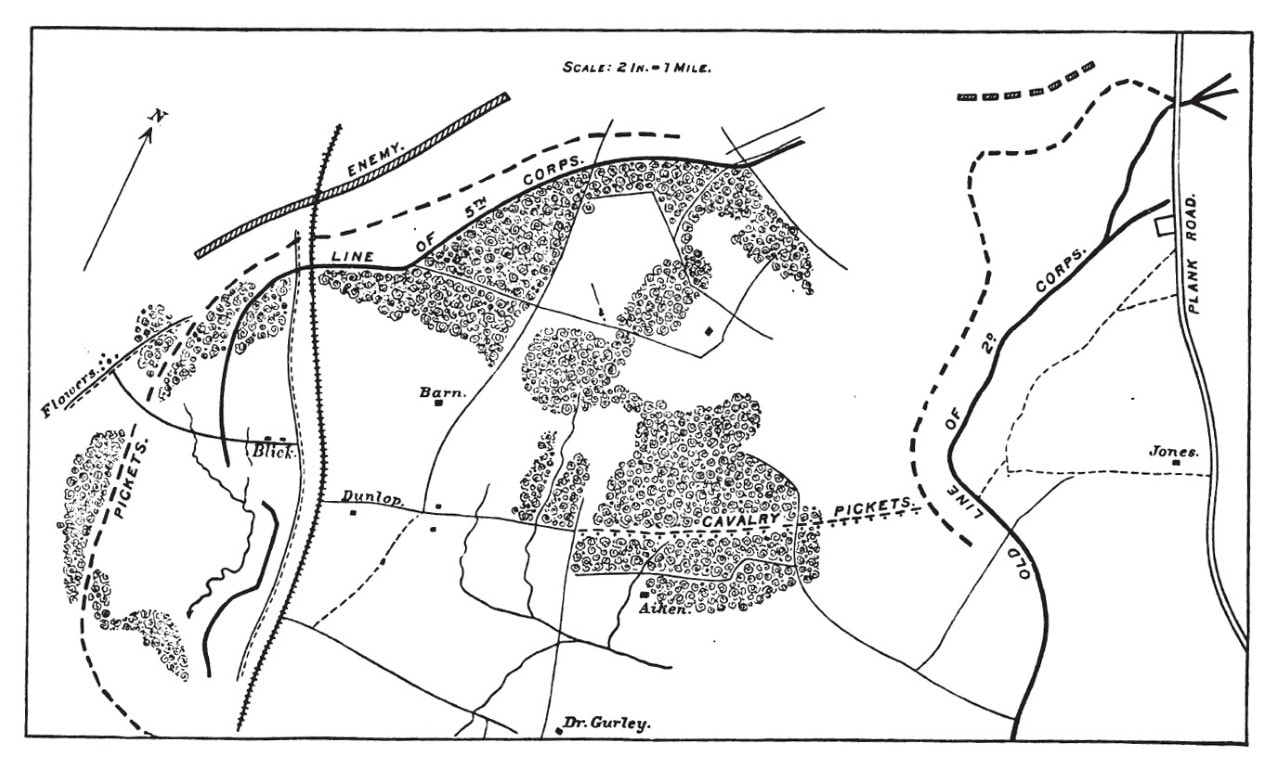
Map to accompany Maj. Gen. Gouverneur K. Warren's report on the battle of August 19-21, 1864. Official Records, Armies, vol. 42, pt. 1, 433.
Report of Brig. Gen. John F. Hartranft, U. S. Army, commanding First Brigade, of operations August 19-21. OR 42, pt 1, 594.
"At 5 o'clock on the morning of [August] 21st I moved my brigade, with exception of the Fifty-first and Twenty-seventh Michigan, which remained on the skirmish line, to a position on the left and in front of the Blick house, my right resting on the Ninth Massachusetts Battery and my left extending across railroad (two regiments being on left of the railroad) and resting on ____* Battery. Here I threw up a line of intrenchments, which was almost completed at 9.15 a.m., when the enemy attacked on the left of the Fifth Corps. When this attack was made one of General Ayres' brigades, of the Fifth Corps, moved up to my line of works. At 10.30 the enemy attacked on my immediate front; the artillery opened upon him with full force. There was no infantry fire from my line except by a few sharpshooters on the right. The enemy was soon compelled to retire, owing to the murderous fire of our artillery, and about 25 or 30 prisoners came in on my front. The regiments on the line of skirmishers were obliged to retire with some loss."
* possibly Battery H, 1st New York Artillery, as depicted by Holland in the lithograph above.
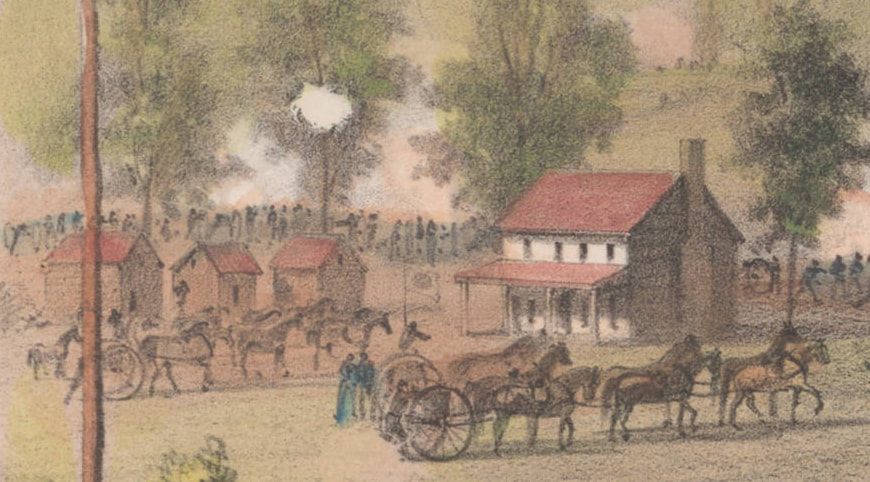
Blick house, as depicted by Holland in the lithograph "Battle of the Weldon Railroad."
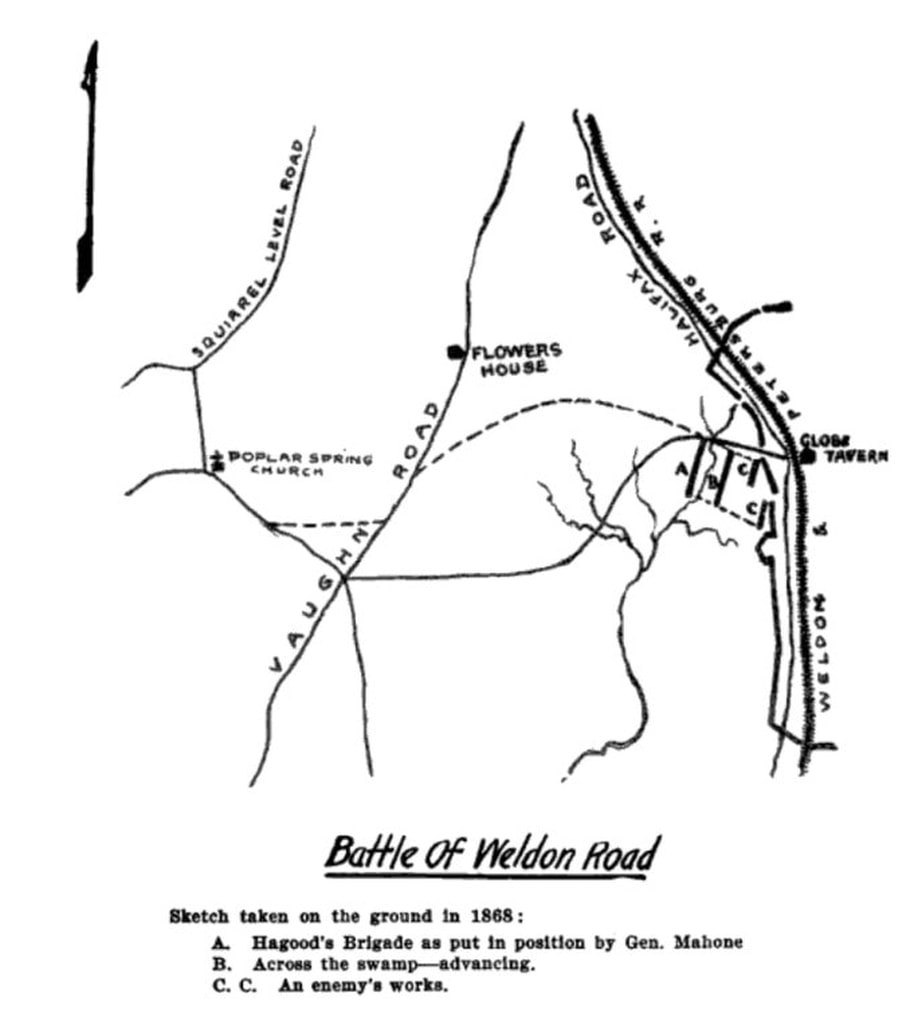
Johnson Hagood, Memoirs of the war of secession, Columbia, S.C., The State Company, 1910.
The caption reads: Sketch taken on the ground in 1866.
A. Hagood's Brigade as got in position by General Mahone.
B. Across the swamp--advancing.
C. C. At enemy's works.
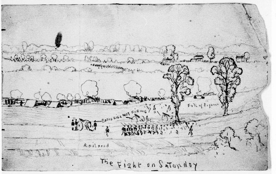
Becker, Joseph, 1841-1910, “The Fight on Saturday (Siege of Petersburg),” The Becker Collection, accessed April 1, 2021, https://beckercollection.bc.edu/items/show/2971
The Fight on Saturday (Siege of Petersburg) Panel 1
Fragment of a larger sheet; in Frank Leslie's illustrated newspaper 9/17/1864, p. 413.
Becker, Joseph, 1841-1910
Date: August 20, 1864
Transcription:
Recto: Panel 1: "The fight on Saturday 20 Aug. on the left of the Union line // Weldon Railroad // Full of Light Artillery not firing." Panel 2: "The Fight on Saturday // Batteries not firing // Full of Figures."
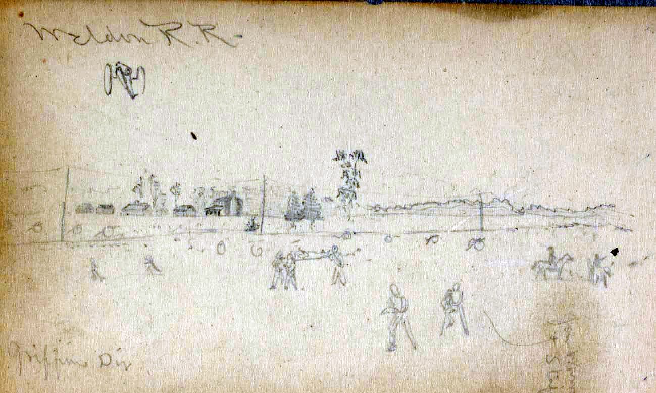
Library of Congress , Charles Wellington Reed Papers, Mss collection. Weldon R. R. Griffin's Division.
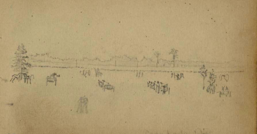
Library of Congress , Charles Wellington Reed Papers, Mss collection. Drawing is labeled "Crawford's Div".
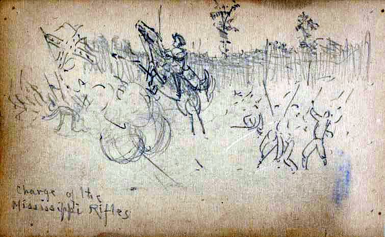
Library of Congress , Charles Wellington Reed Papers, Mss collection.
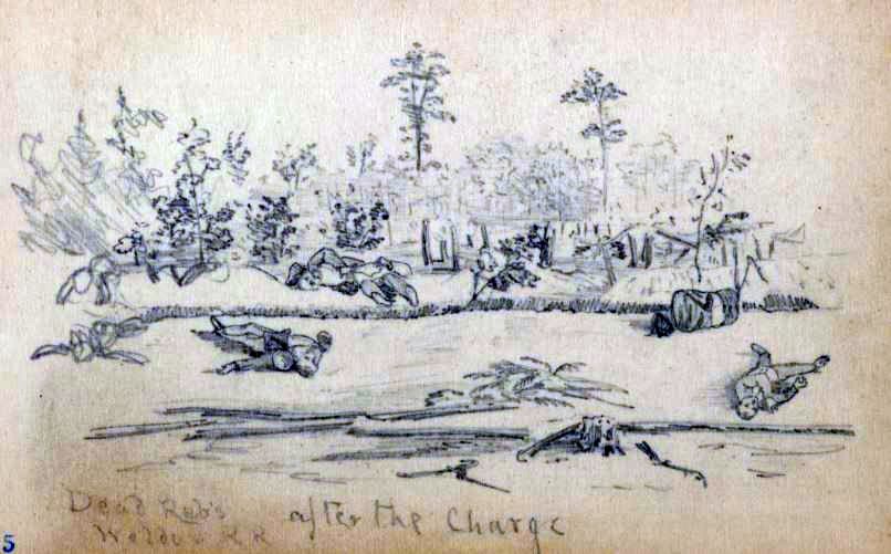
Library of Congress , Charles Wellington Reed Papers, Mss collection. Labeled "Dead Reb's. After the charge. Weldon R.R.
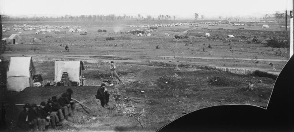
NARA 524537, with excess sky cropped out. This photograph is taken from the vicinity of Vaughn Road looking east with Fort Wadsworth in the background and encompasses much of the Weldon Railroad battlefield. Fort Wadsworth was built in the vicinity of the Blick house. There are many great details in this photograph that can best be seen by looking at it on the National Archives website:
https://catalog.archives.gov/OpaAPI/media/524537/content/arcmedia/stillpix/111-b/524537a.jpg
